
Hsinchu, Taiwan

Hsinchu, Taiwan

Hsinchu, Taiwan Terrain Database Information

  • Imagery: 50 cm
  • Elevation: SRTM 30m
  • Terrain Drive: Asia & Middle East
  • Cultural Features: Apron or Ramp Areas, CityEngine/Geotypical Buildings, Control Tower, Custom Models (Geospecific Buildings), Fences or Walls, Hangars, Lighting for Non-Runway Areas (Streetlights), Military Specific Elements (Shelters, Bunkers, Watchtowers, etc.), Roads, Runway, Runway Lights, Taxiways and Associated Markings, Trees, Utilities (Poles, Powerlines or Transmission Lines), Water Features (Lakes, Rivers, etc), Windsocks
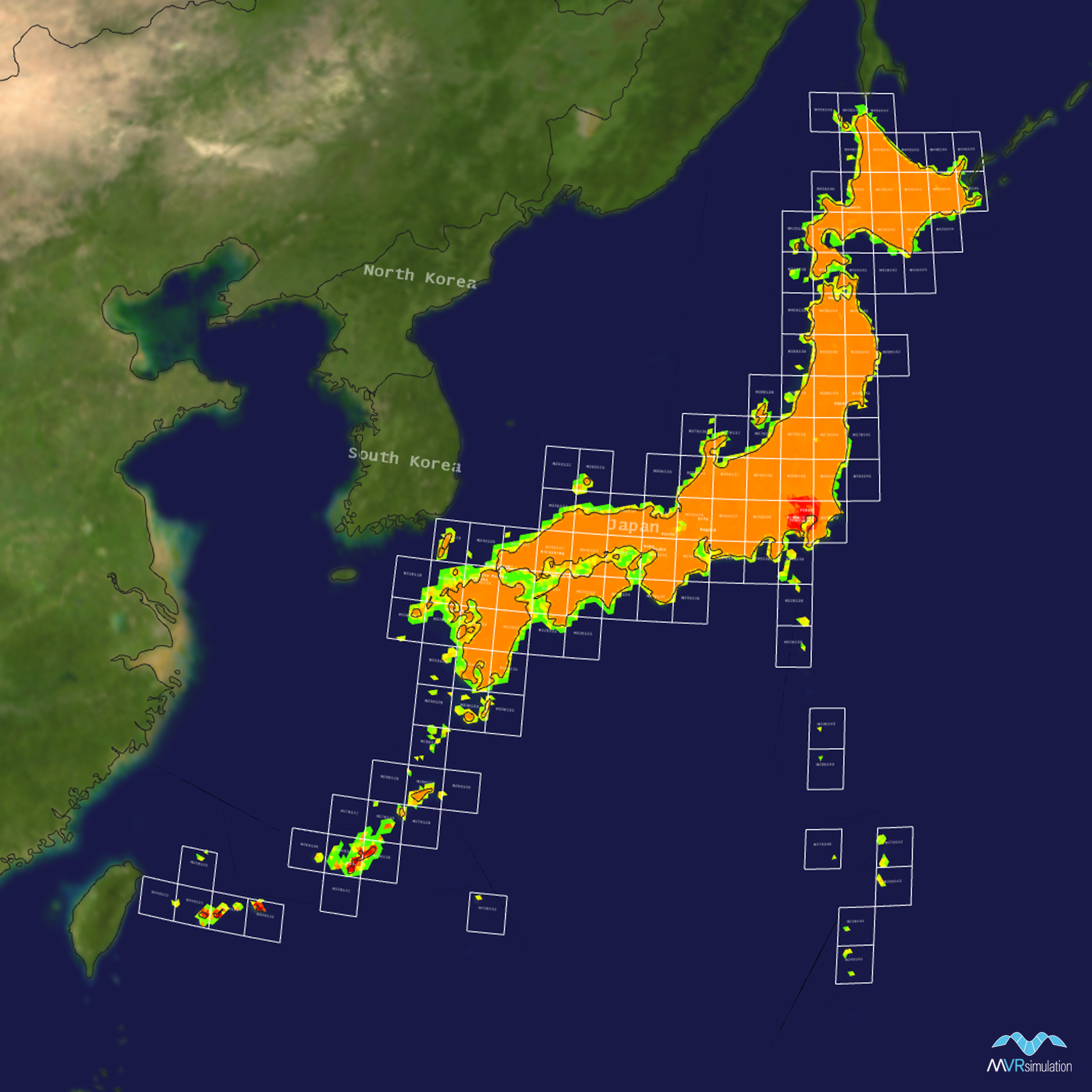
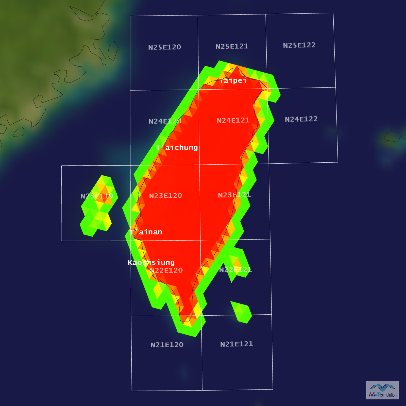
Tile Coverage Map

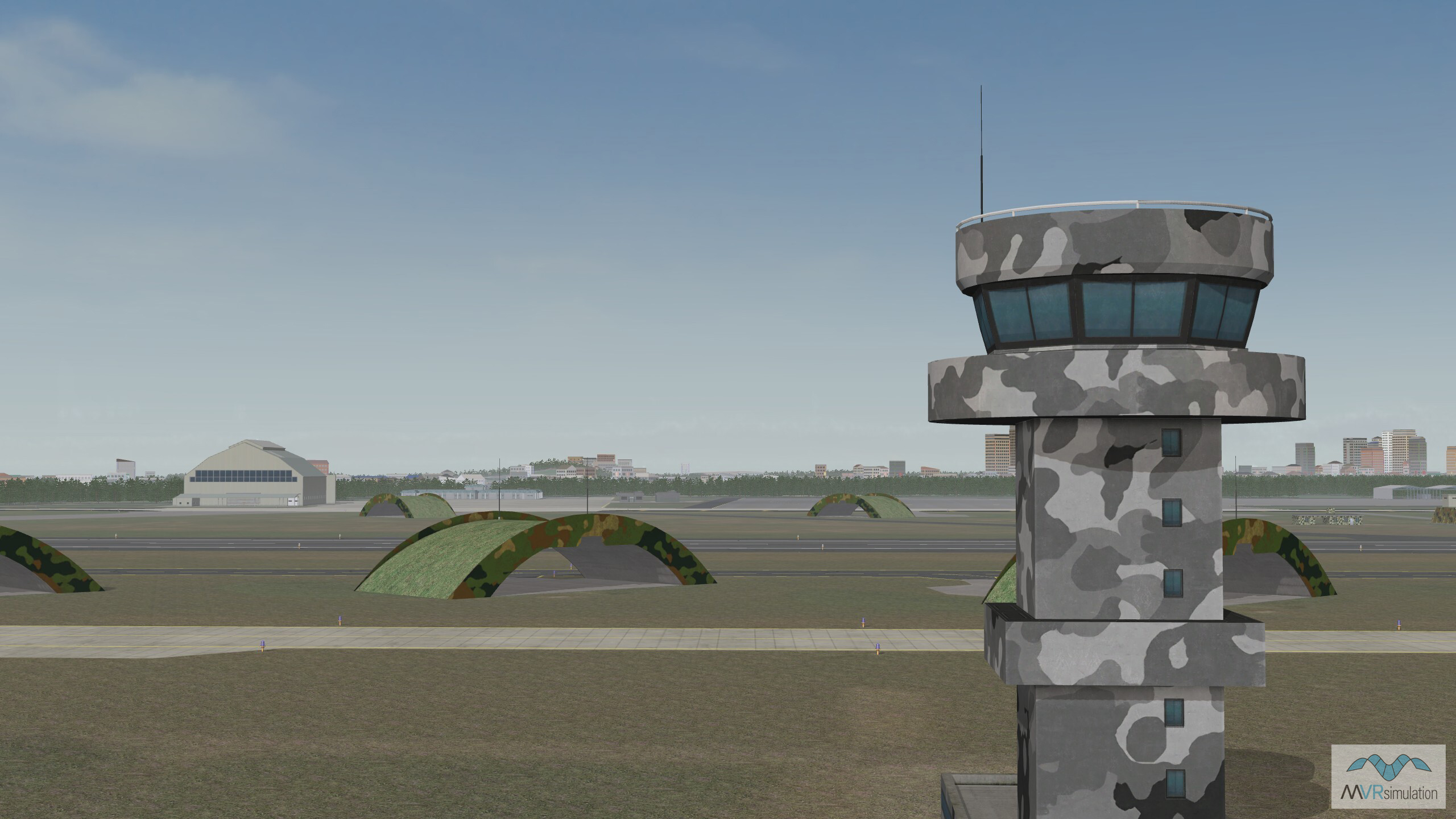
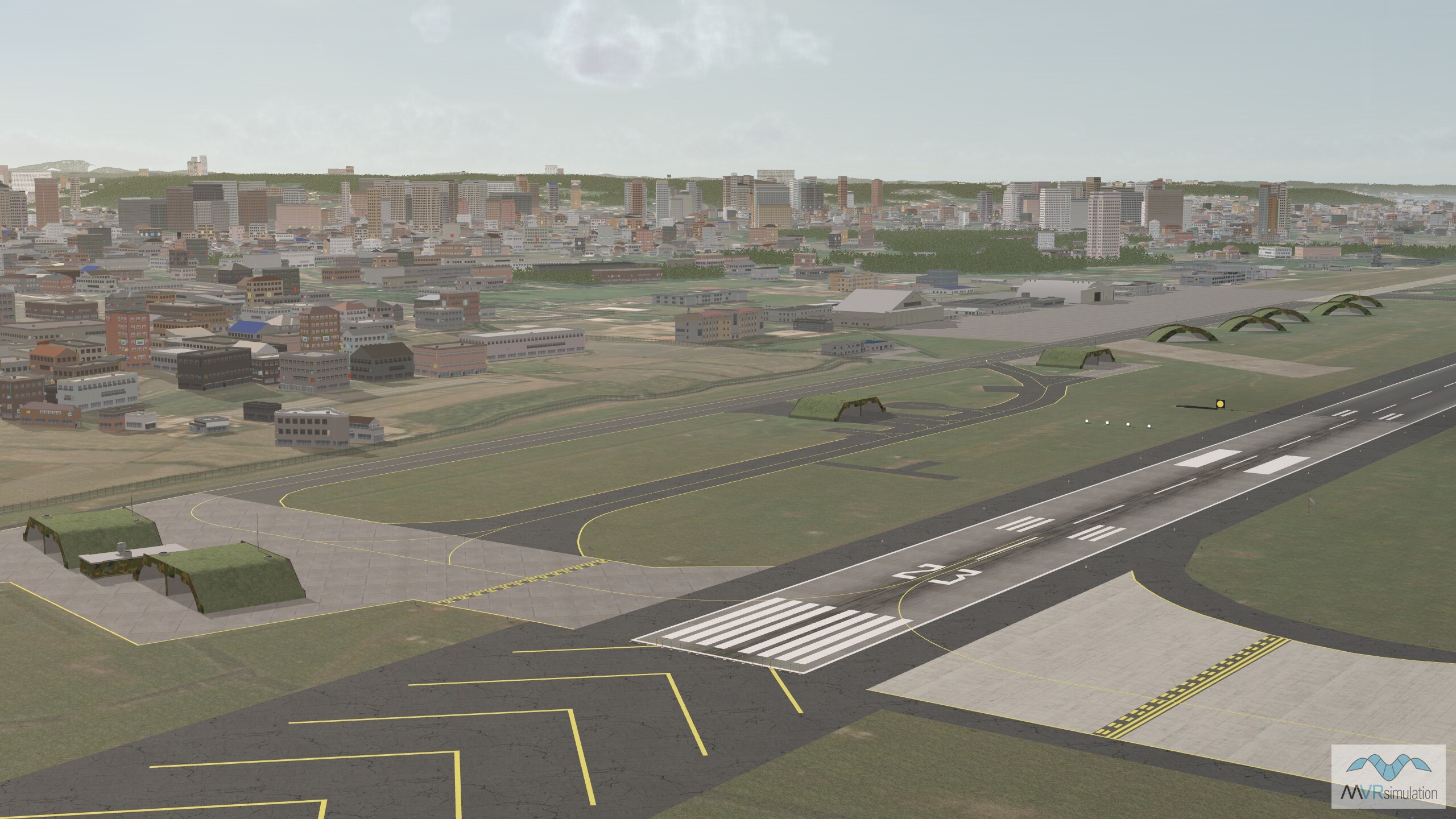
Geospecific control tower located at Hsinchu Air Base in Hsinchu, Tawain as part of the MVRsimulation Asia & Middle East terrain database.

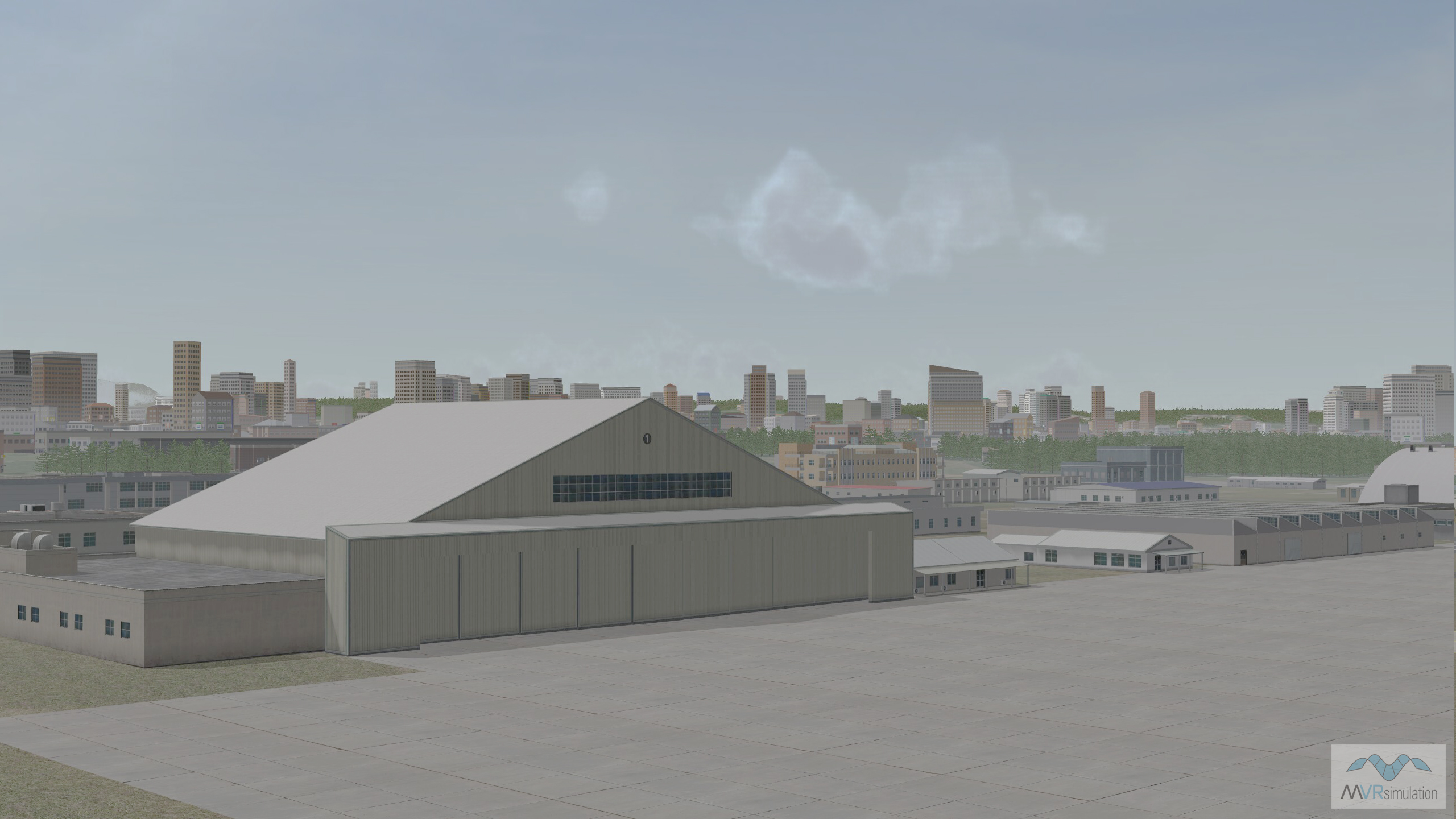
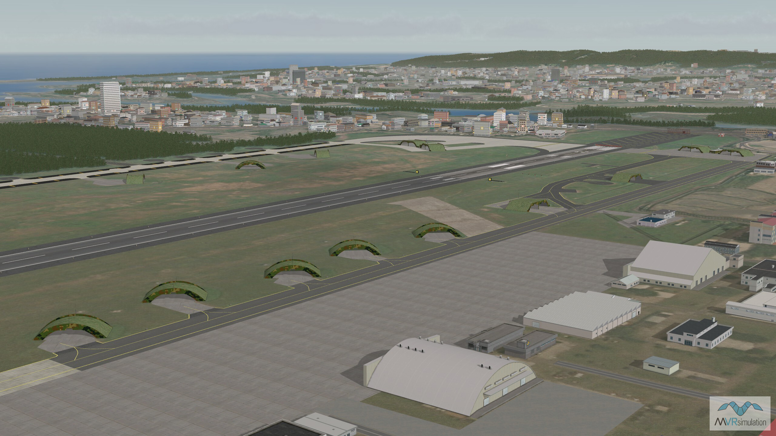
The MVRsimulation Hsinchu, Taiwan terrain database includes geospecific hangars and military specific elements.

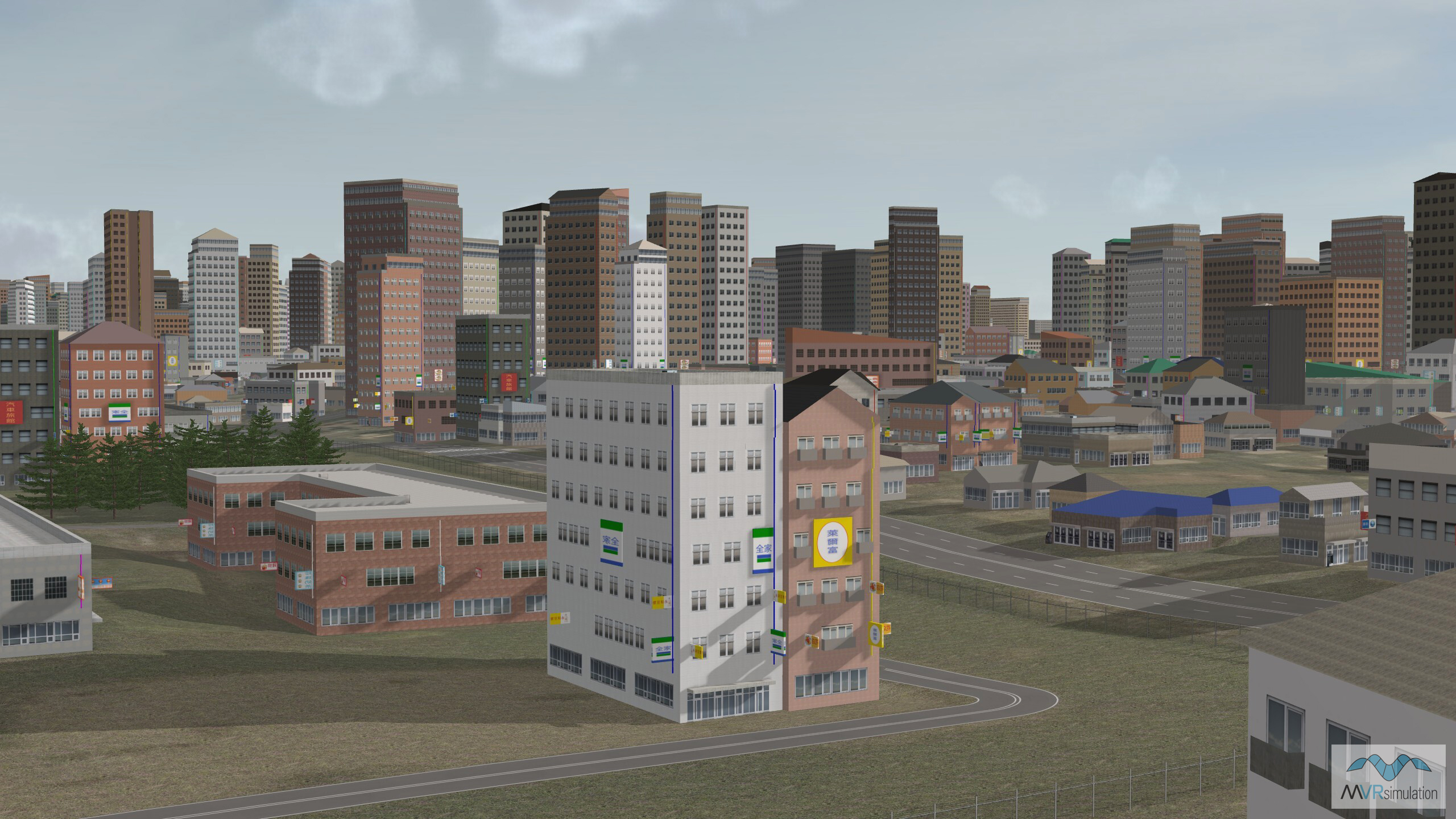
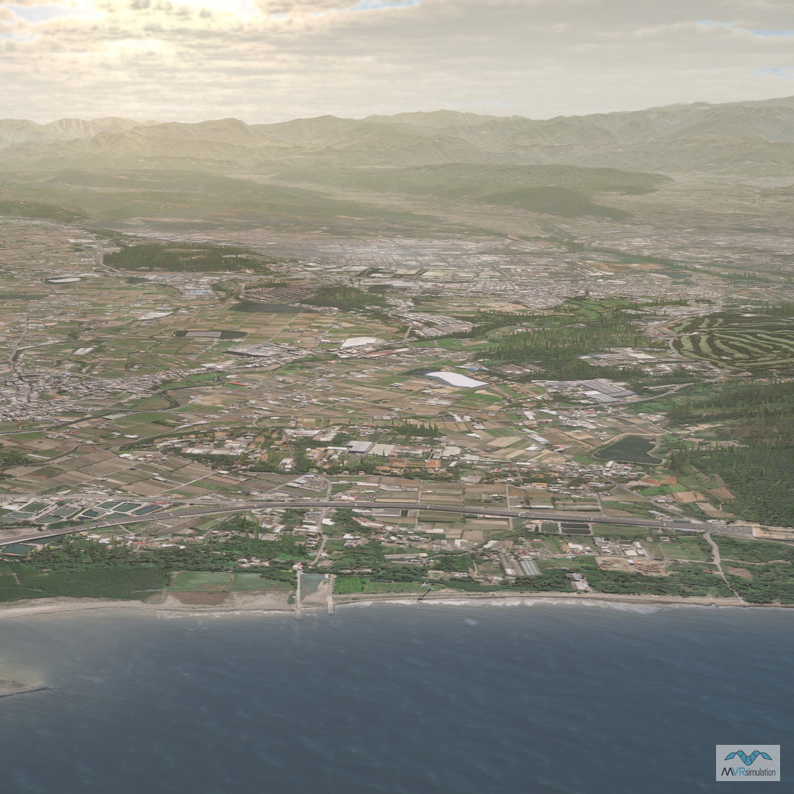
Geoptypical CityEngine buildings, roads and fences surrounding the Hsinchu Air Base.

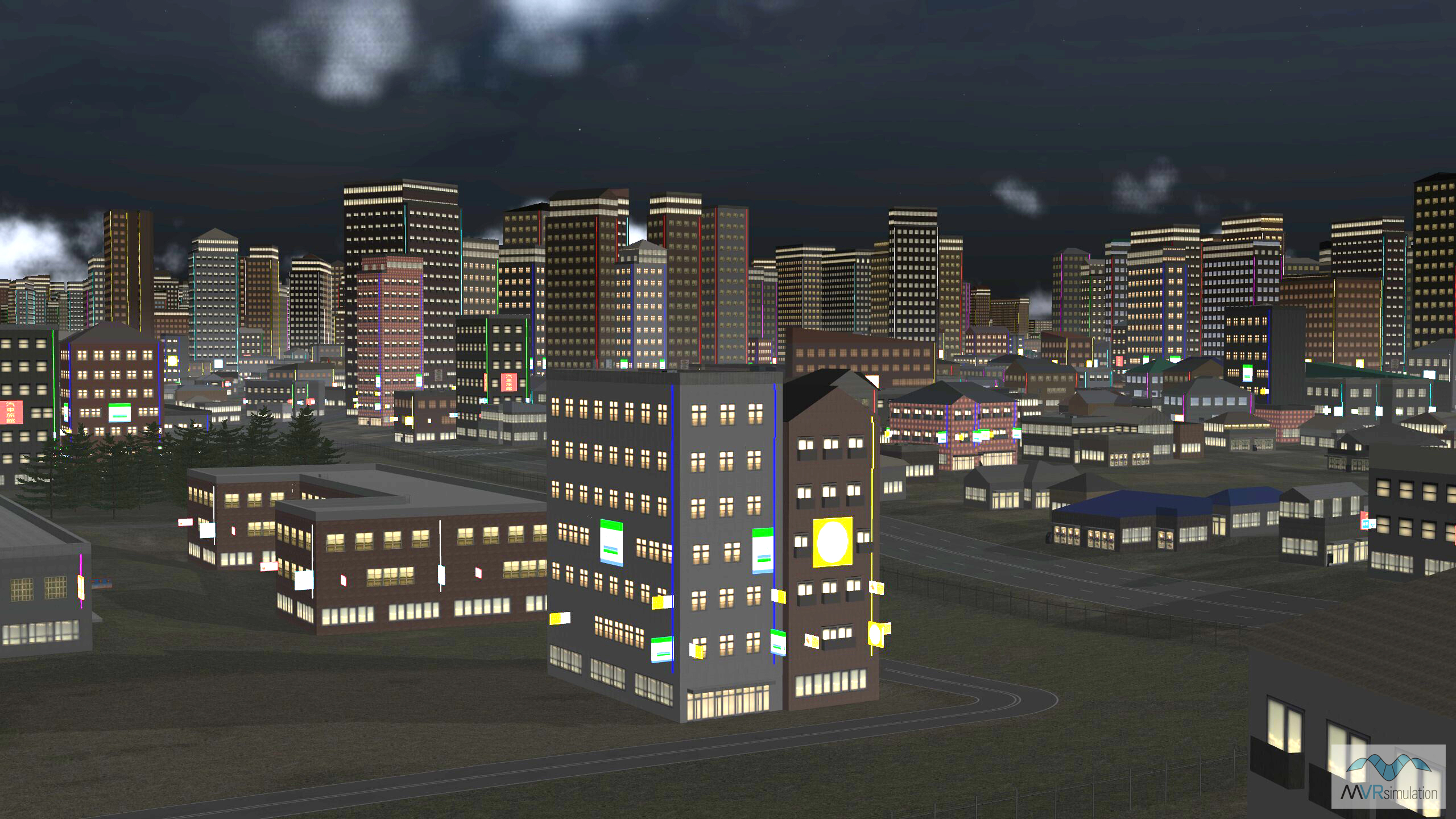
Real-time VRSG scene with light lobes and building lighting including neon lights from commercial signage.

Related Terrain

EXTEND YOUR TERRAIN DATABASE


MVRsimulation Downloads Server

  • Explore and implement terrain updates
  • Download and use new 3D models
  • Stay up-to-date with VRSG features
  • Discover utilies for expanding VRSG
    Filler for Spacing

Request Account

MVRsimulation Regional Terrain Drives

  • External hard drive - regional terrian
  • Network attached storage device - whole-world terrain
  • Ready for plug and play
  • Available to customers on active maintenance
    Filler for Spacing

Request Drive

MVRsimulation Produced Custom Terrain

  • Custom terrain created by MVRsimulation's terrain team
  • Specify your desired area of interest
  • Indentify needed terrain features
  • Use your own or commercially available imagery
    Filler for Spacing

Request Quote

Create Terrain with Terrain Tools

  • Build real-time 3D terrain for VRSG using GIS technology with ArcGIS Pro
  • Designed to be user-friendly for users with basic ArcGIS knowledge
  • Use imagery, elevation, and optional vector data to create terrain
  • Compile buildings from 2D polygon footprint features using a CityEngine rule package
    Filler for Spacing

Terrain Tools