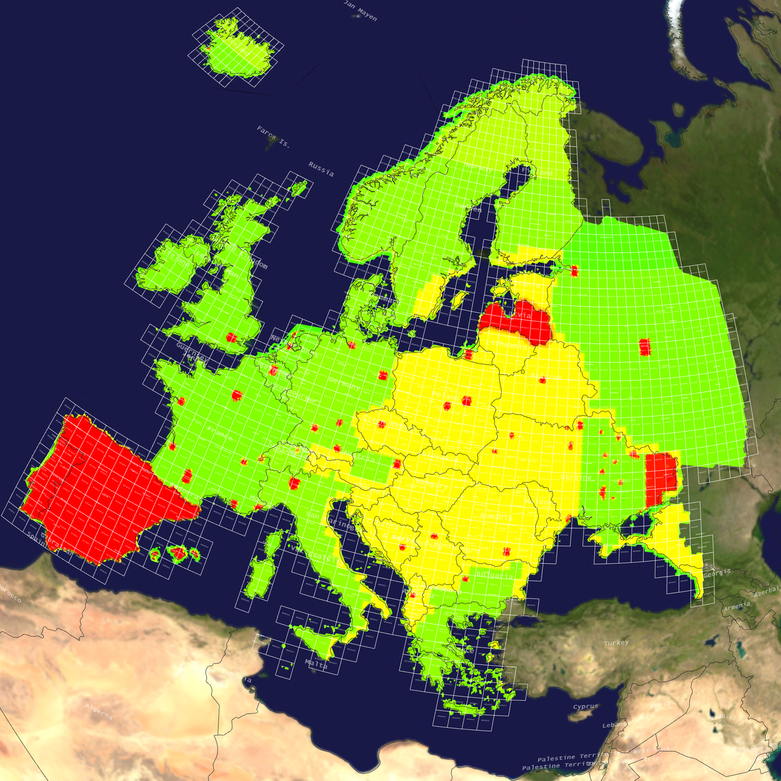
Tile Coverage Map
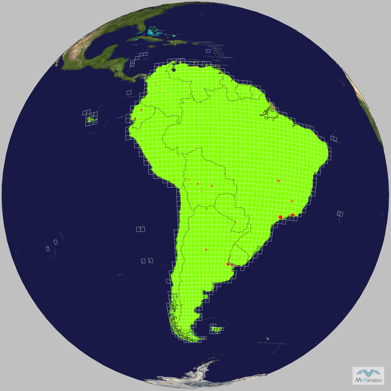
Terrain Database Information
- Imagery: 15mpp base imagery with higher resolution insets
- Elevation: SRTM 3 arc-second (=90m) elevation data with higher resolution insets
- Terrain Drive: South America
Natural color high-resolution insets with 60cm imagery
Buenos Aires and Cordoba, Argentina; Cochabamba, La Paz, and Santa Cruz, and Sucre, Bolivia; Belo Horisonte, Brasilia, Fortaleza, Rio de Janeiro, and Sao Paulo, Brazil; Barranquilla, Bogota, and Medellin, Columbia; Guayaquil and Quito, Ecuador; Cayenne, French Guyana; Asuncion, Paraguay; Arequipa and Lima, Peru; Paramaribo, Suriname; Montevideo, Uraguay; Caracas and Maracaibo, Venezuela
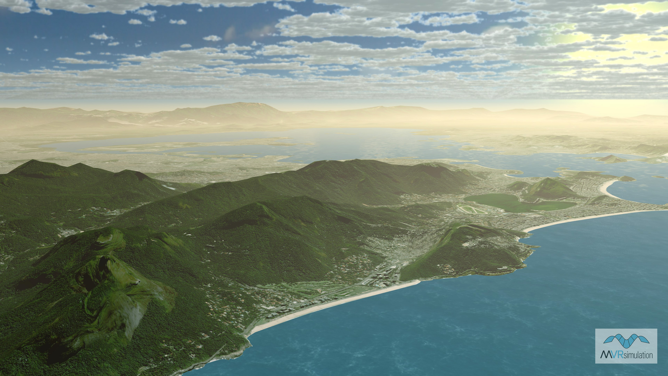
MVRsimulation VRSG real-time scene of virtual Rio de Janeiro, Brazil.
MVRsimulation VRSG real-time scene of virtual Medellin, Colombia.
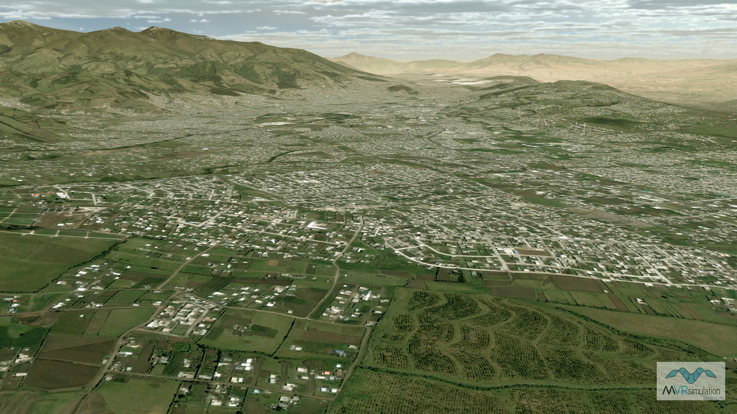
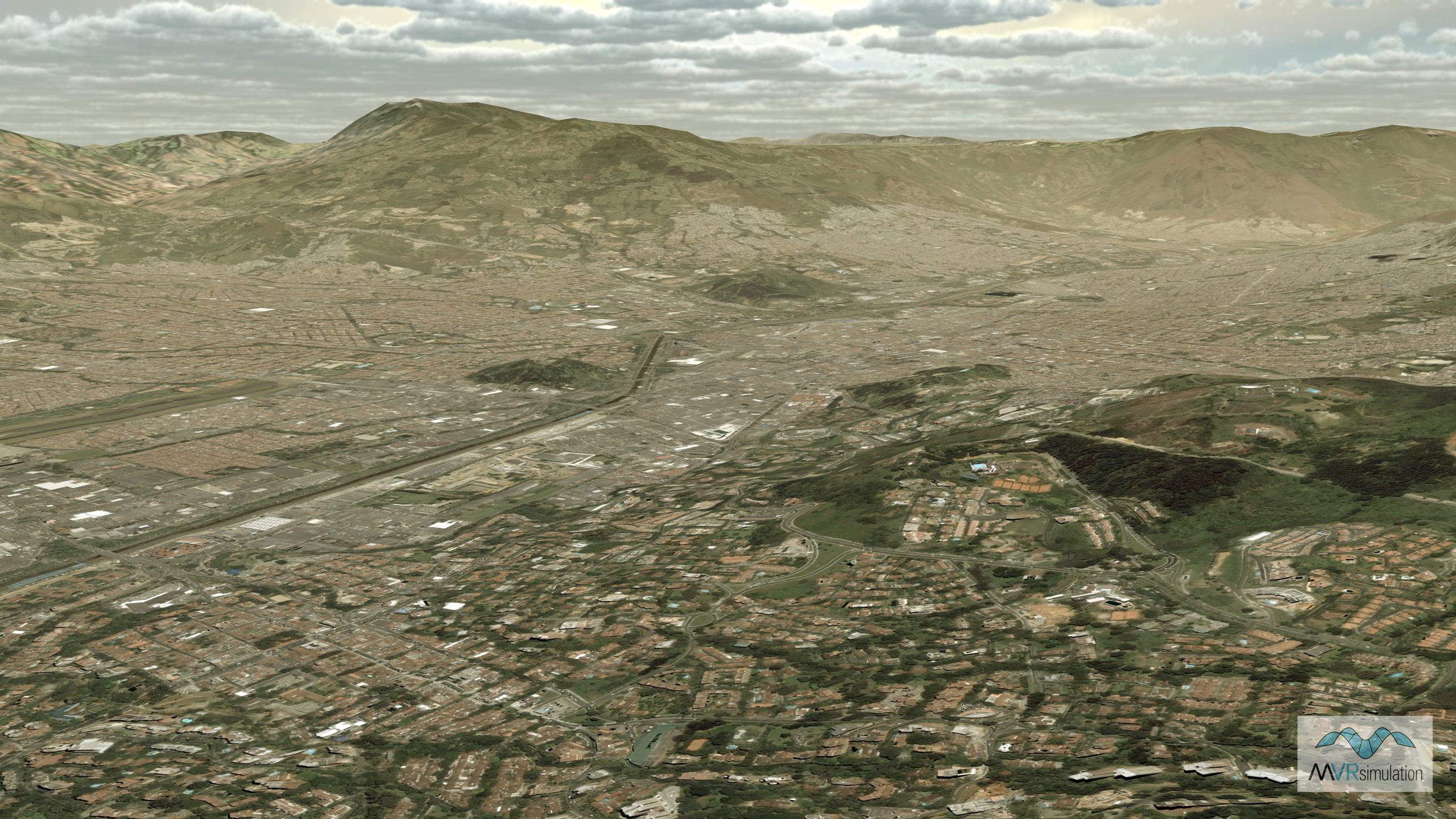
MVRsimulation VRSG real-time scene of virtual Quito, Ecuador.
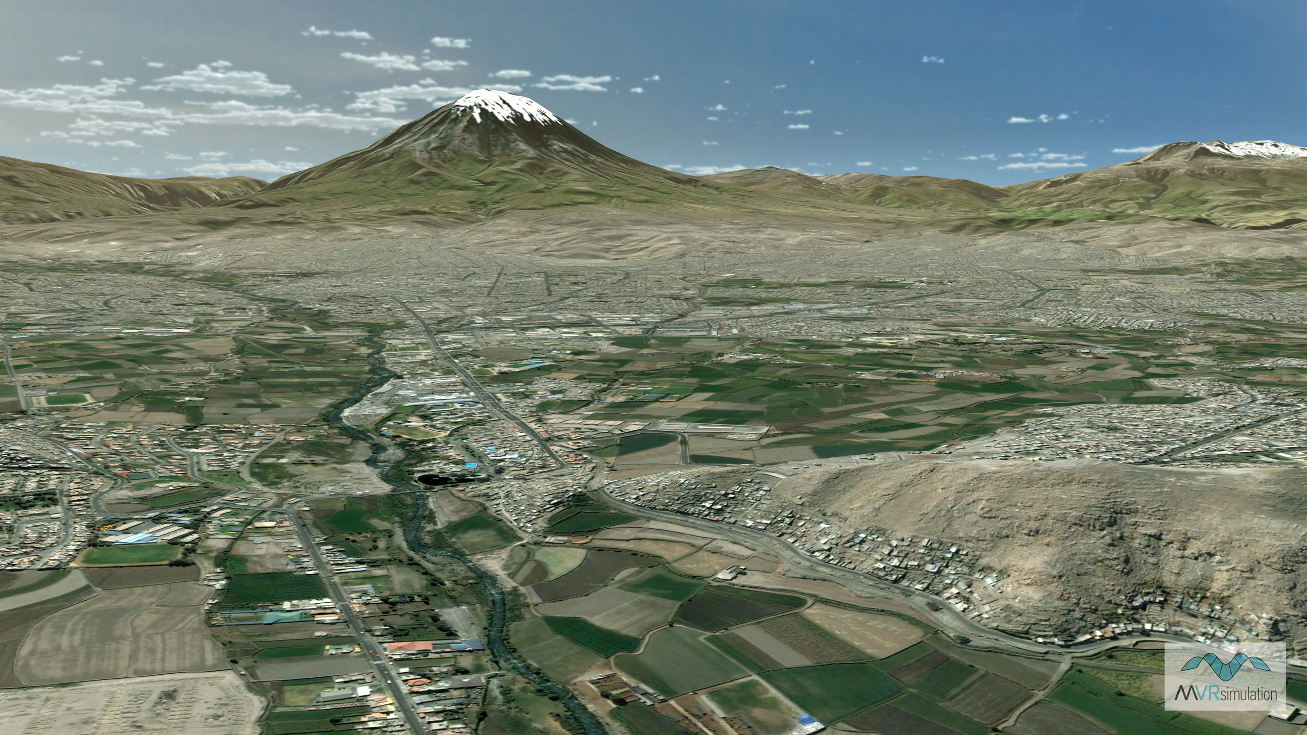
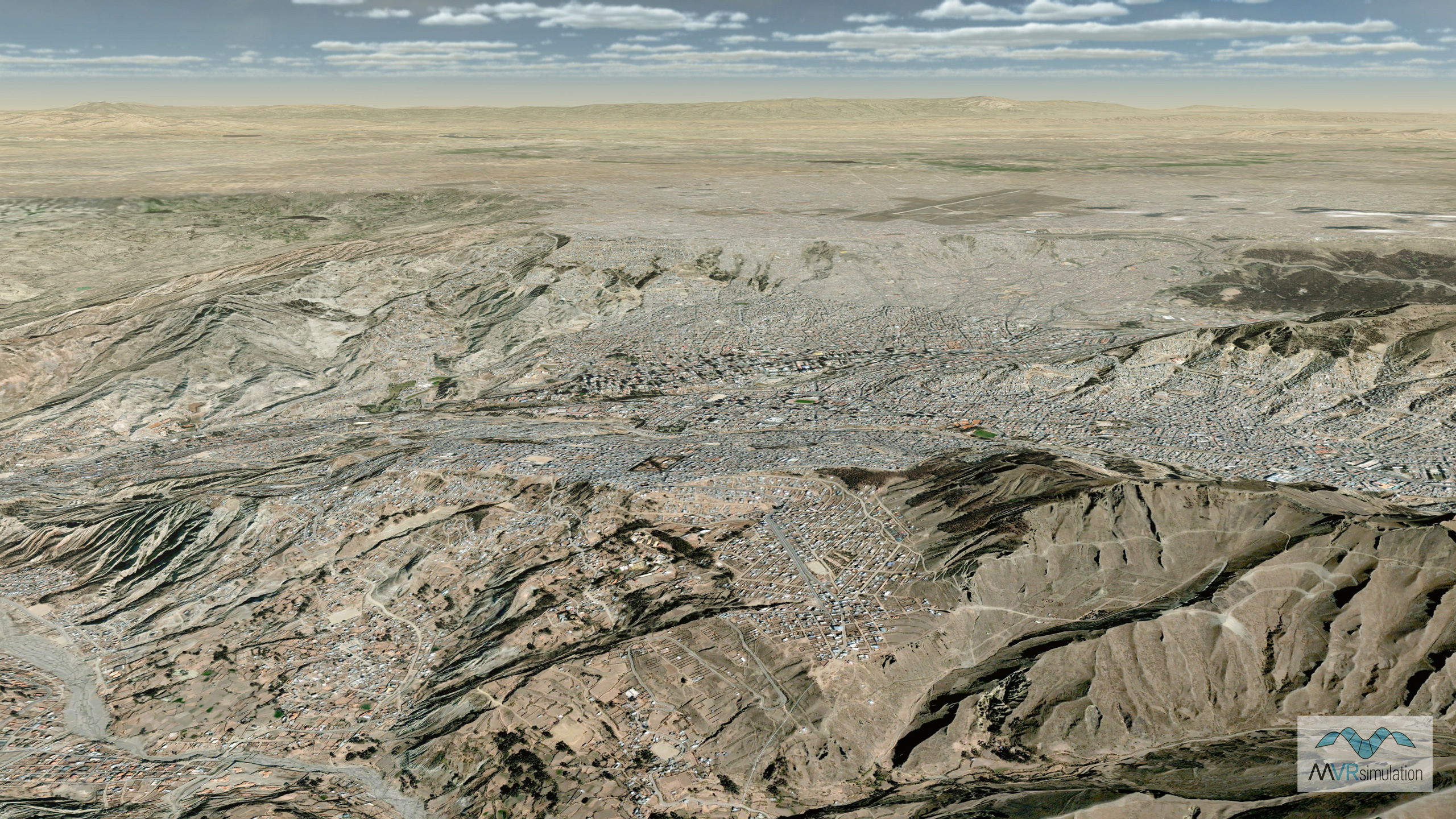
MVRsimulation VRSG real-time scene of virtual Arequipa, Peru.
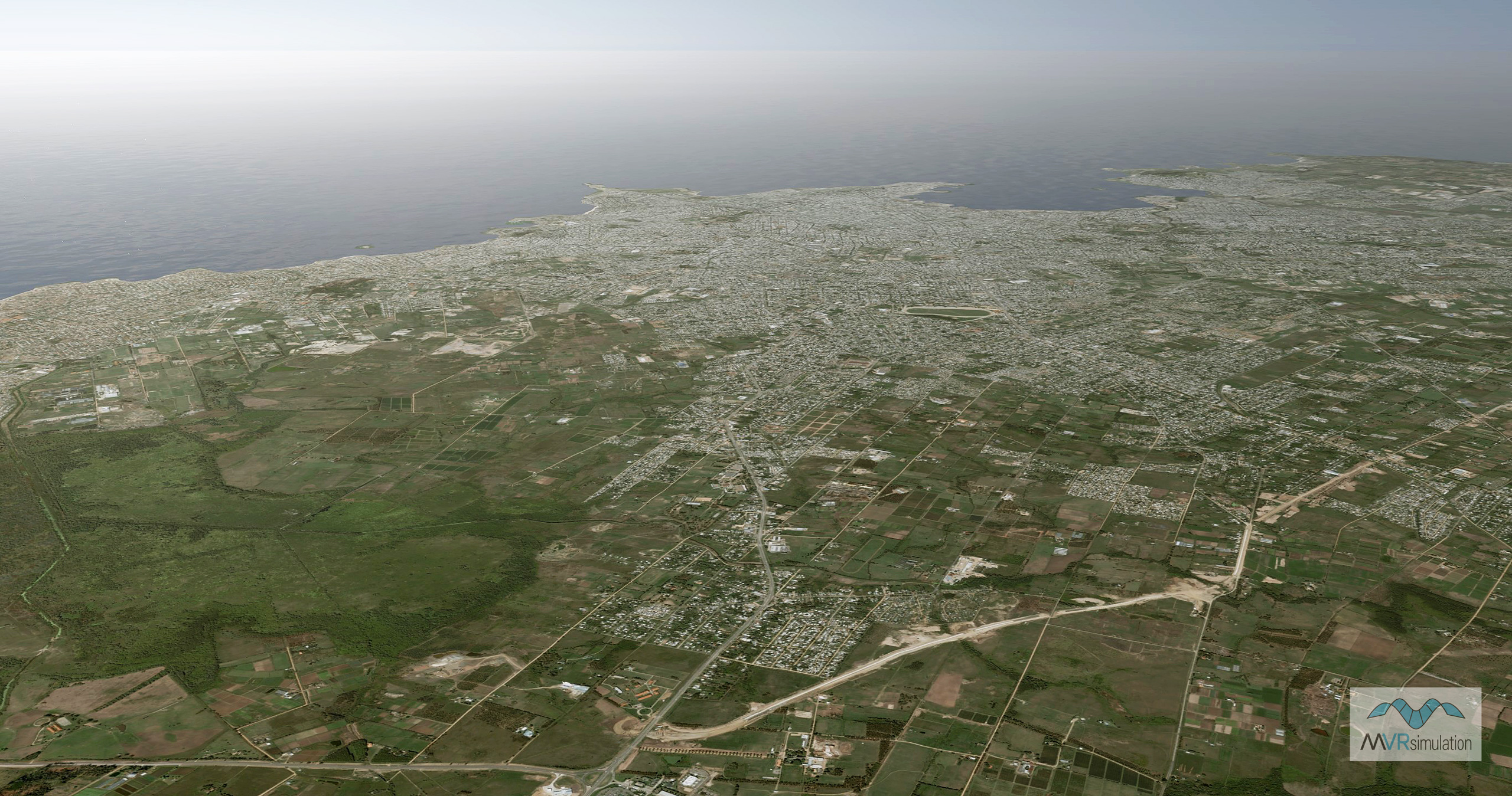
MVRsimulation VRSG real-time scene of virtual Montevideo, Uruguay.
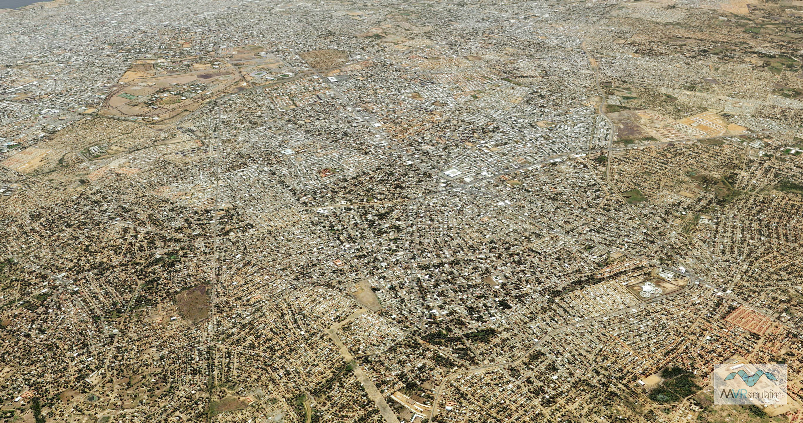
MVRsimulation VRSG real-time scene of virtual Maracaibo, Venezuela.
MVRsimulation VRSG real-time scene of virtual La Paz, Bolivia.