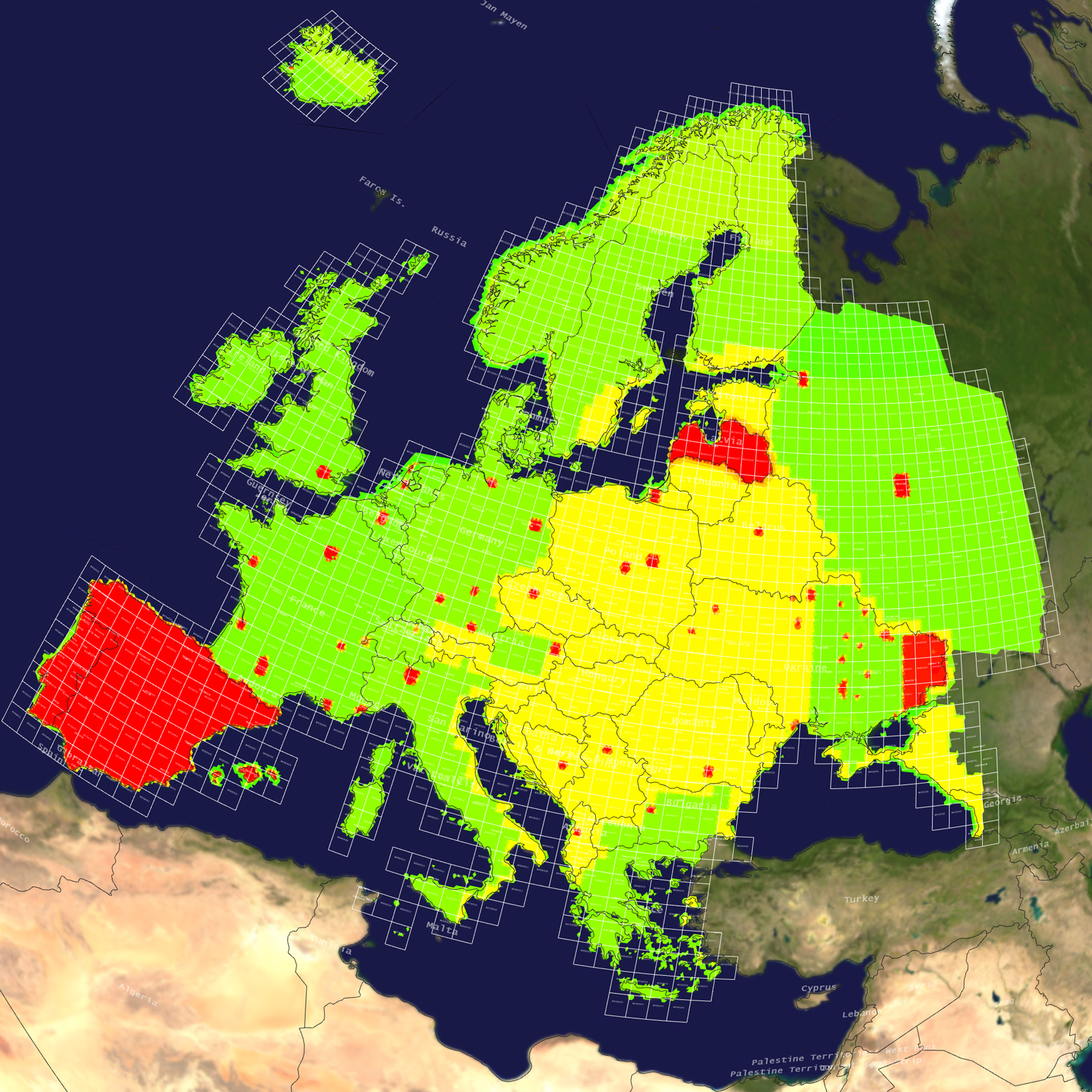
Africa 3D Terrain

Africa Terrain

Tile Coverage Map

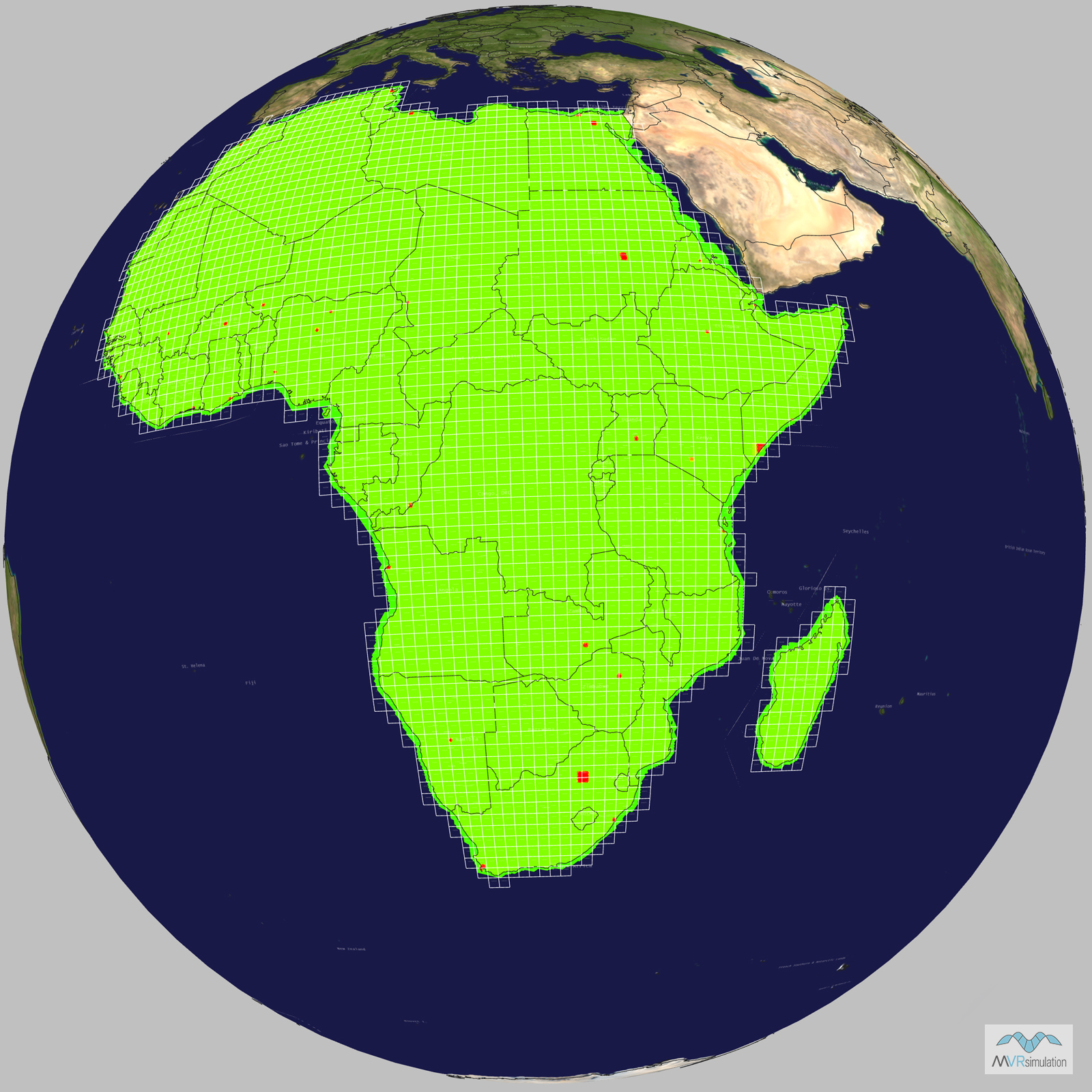
Terrain Database Information

  • Imagery: 15mpp base imagery with higher resolution insets
  • Elevation: SRTM 3 arc-second (=90m) elevation data with higher resolution insets
  • Terrain Drive: Africa

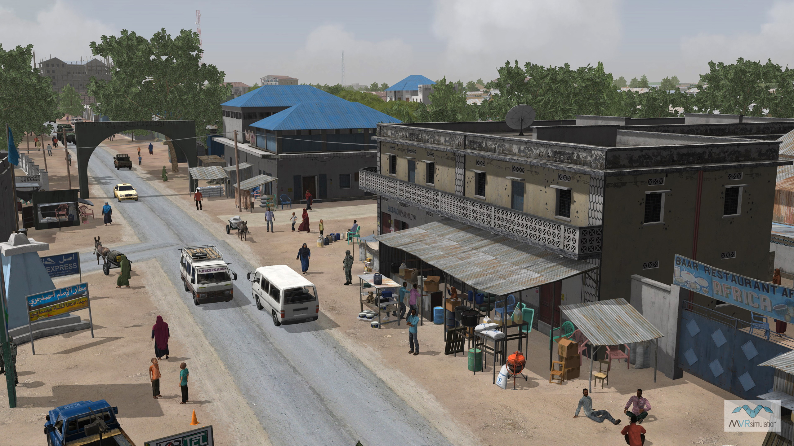
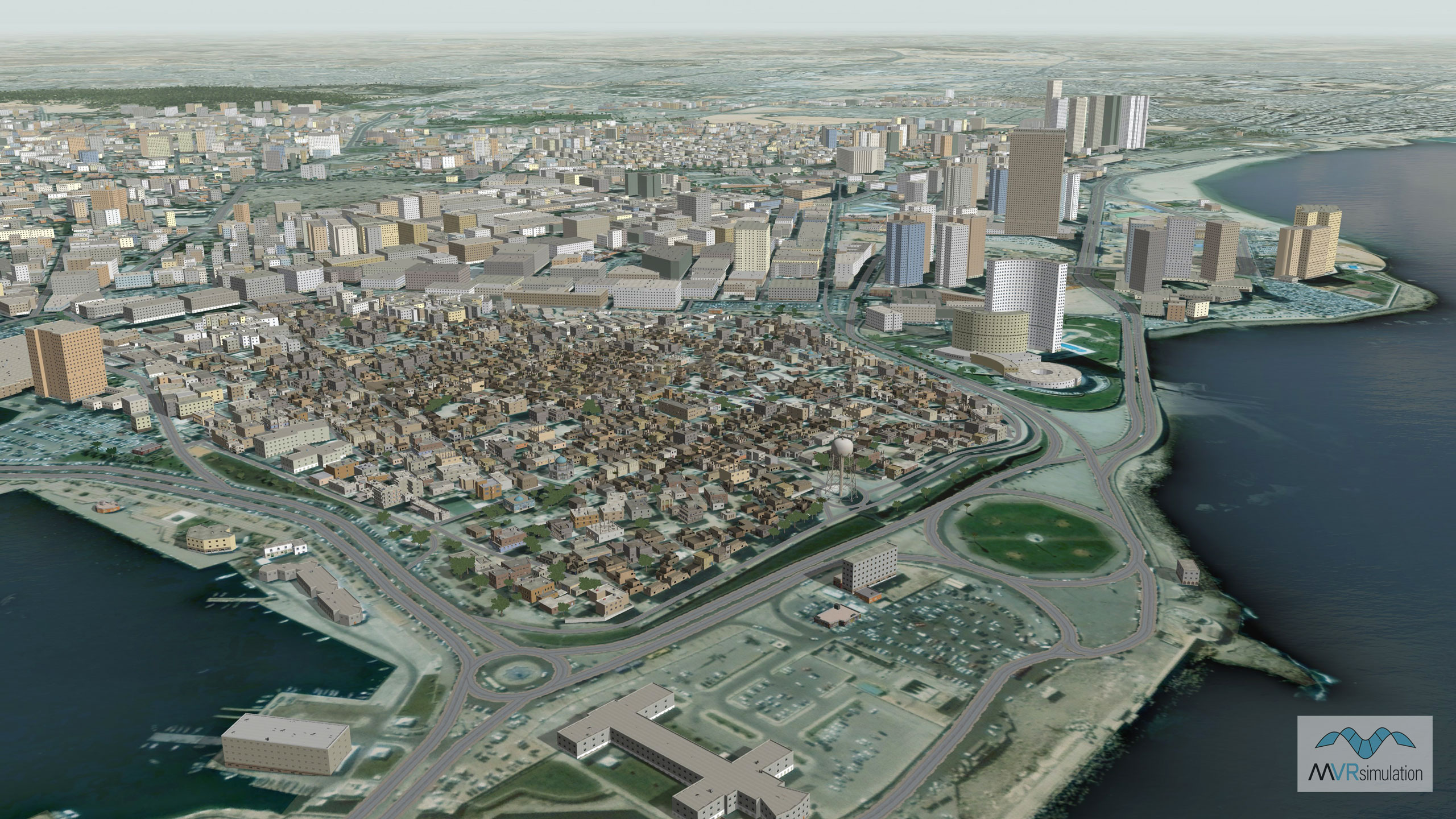
Natural color high-resolution insets with 60cm imagery

Algiers, Algeria; Luanda, Angola; Ouagadougou, Burkino Faso; Ndjamena, Chad; Abidjan, Cote d'Ivoire; Kinshasa, Democratic Rep. of Congo; Djibouti City, Djibouti; Alexandria, Egypt; Cairo, Egypt; Asmara, Eritrea; Addis Ababa, Ethiopia; Accra, Ghana; Conakry, Guinea; Nairobi, Kenya; Bamako, Mali; Nouakchott, Mauritania; Casablanca, Morocco; Rabat, Morocco; Windhoek, Namibia; Niamey, Niger; Ibadan, Nigeria; Kano, Nigeria; Kaduna, Nigeria; Dakar, Senegal; Freetown, Sierra Leone; Mogadishu, Somalia; Johannesburg, South Africa; Cape Town, South Africa; Durban, South Africa; Khartoum, Sudan; Dar es Salaam, Tanzania; Tunis, Tunisia; Kampala, Uganda; Lusaka, Zambia; Harare, Zimbabwe.

3D Modeled Areas of Interest

Related Terrain

EXTEND YOUR TERRAIN DATABASE

MVRsimulation Downloads Server

  • Explore and implement terrain updates
  • Download and use new 3D models
  • Stay up-to-date with VRSG features
  • Discover utilies for expanding VRSG
    Filler for Spacing

Request Account

MVRsimulation Regional Terrain Drives

  • External hard drive - regional terrian
  • Network attached storage device - whole-world terrain
  • Ready for plug and play
  • Available to customers on active maintenance
    Filler for Spacing

Request Drive

MVRsimulation Produced Custom Terrain

  • Custom terrain created by MVRsimulation's terrain team
  • Specify your desired area of interest
  • Indentify needed terrain features.
  • Use your own or commercially available imagery
    Filler for Spacing

Request Quote

Create Terrain with Terrain Tools

  • Build real-time 3D terrain for VRSG using GIS technology with ArcGIS Pro
  • Designed to be user-friendly for users with basic ArcGIS knowledge
  • Use imagery, elevation, and optional vector data to create terrain
  • Compile buildings from 2D polygon footprint features using a CityEngine rule package
    Filler for Spacing

Terrain Tools