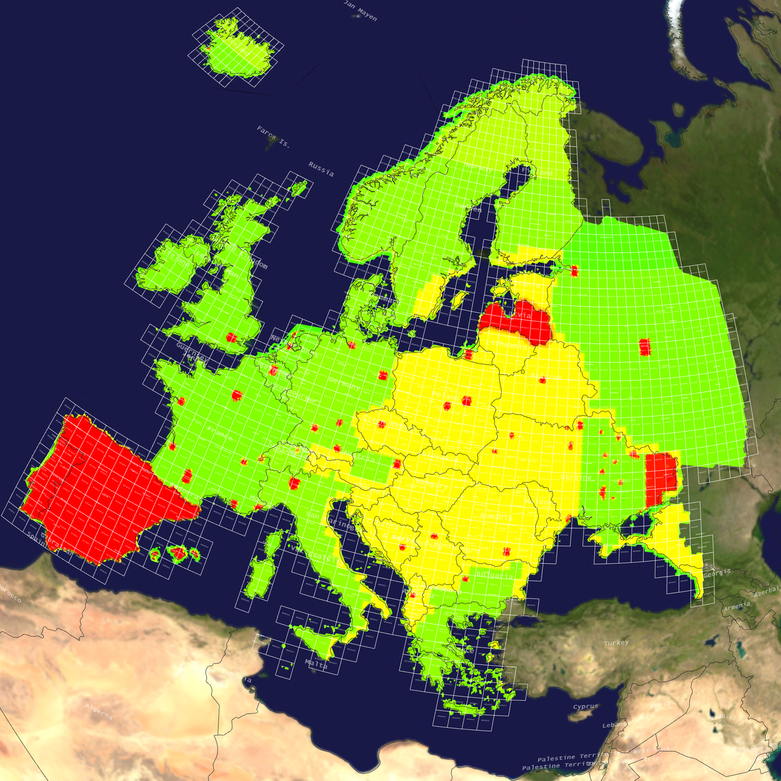
Australia & Oceania

Australia & Oceania Terrain

Tile Coverage Map

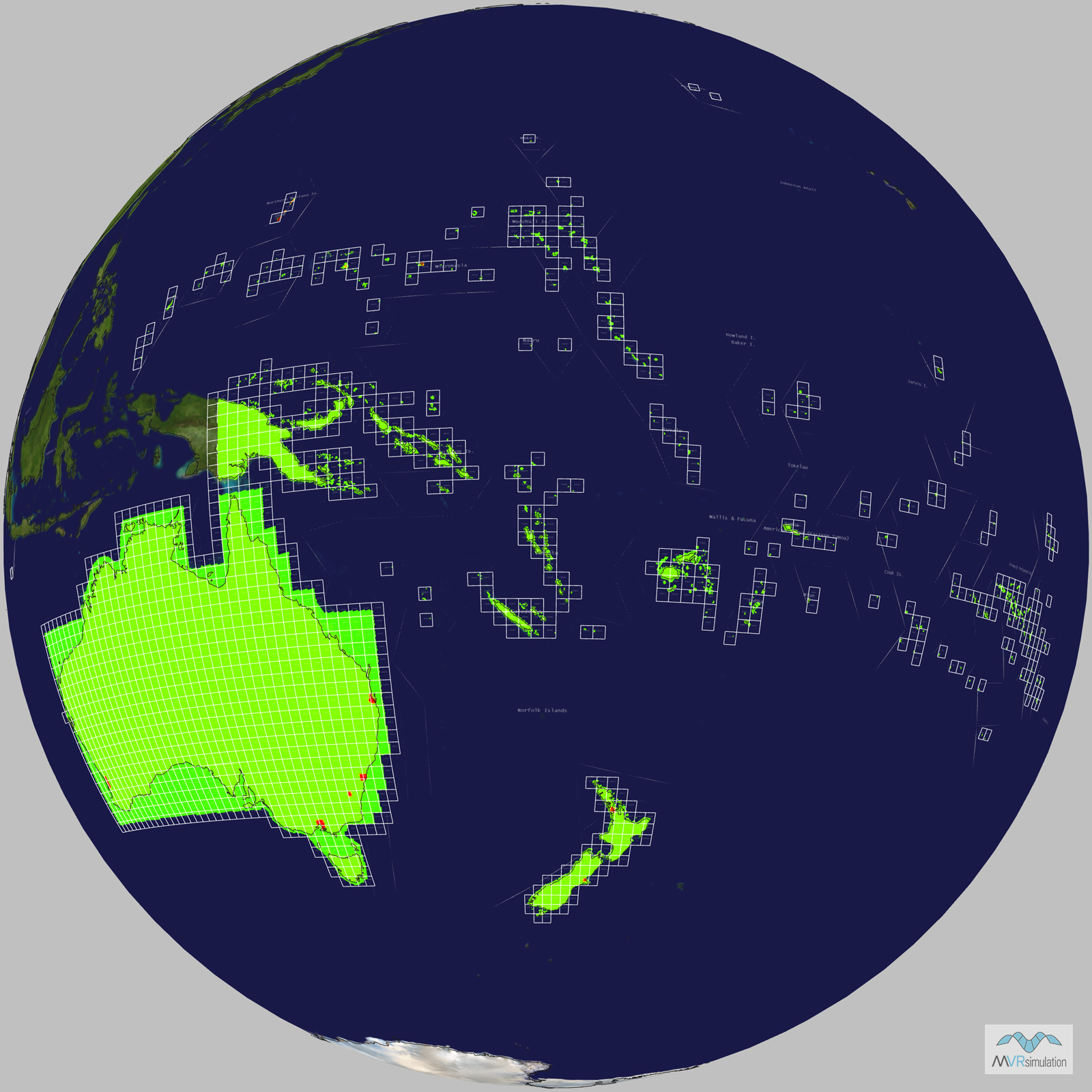
Terrain Database Information

  • Imagery: 15mpp base imagery with higher resolution insets
  • Elevation: SRTM 3 arc-second (=90m) elevation data with higher resolution insets
  • Terrain Drive: Australia & Oceania

Natural color high-resolution insets with 60cm imagery

The Australia virtual terrain includes insets of several areas of interest: Sydney, Perth, Canberra, Melbourne, and Brisbane.

The Oceania virtual terrain includes insets of Pohnpei and Weno Islands, Federated States of Micronesia; Auckland and Christchurch, New Zealand; Rota Island and Tinian & Saipan Islands of the Northern Mariana Islands. The terrain also includes 30cm per pixel inset of Guam.

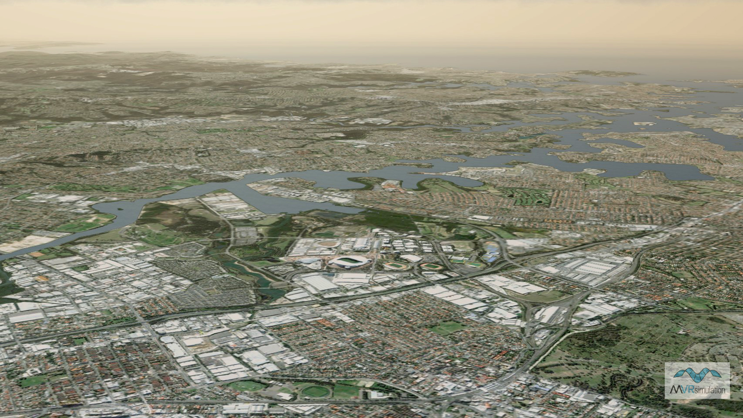
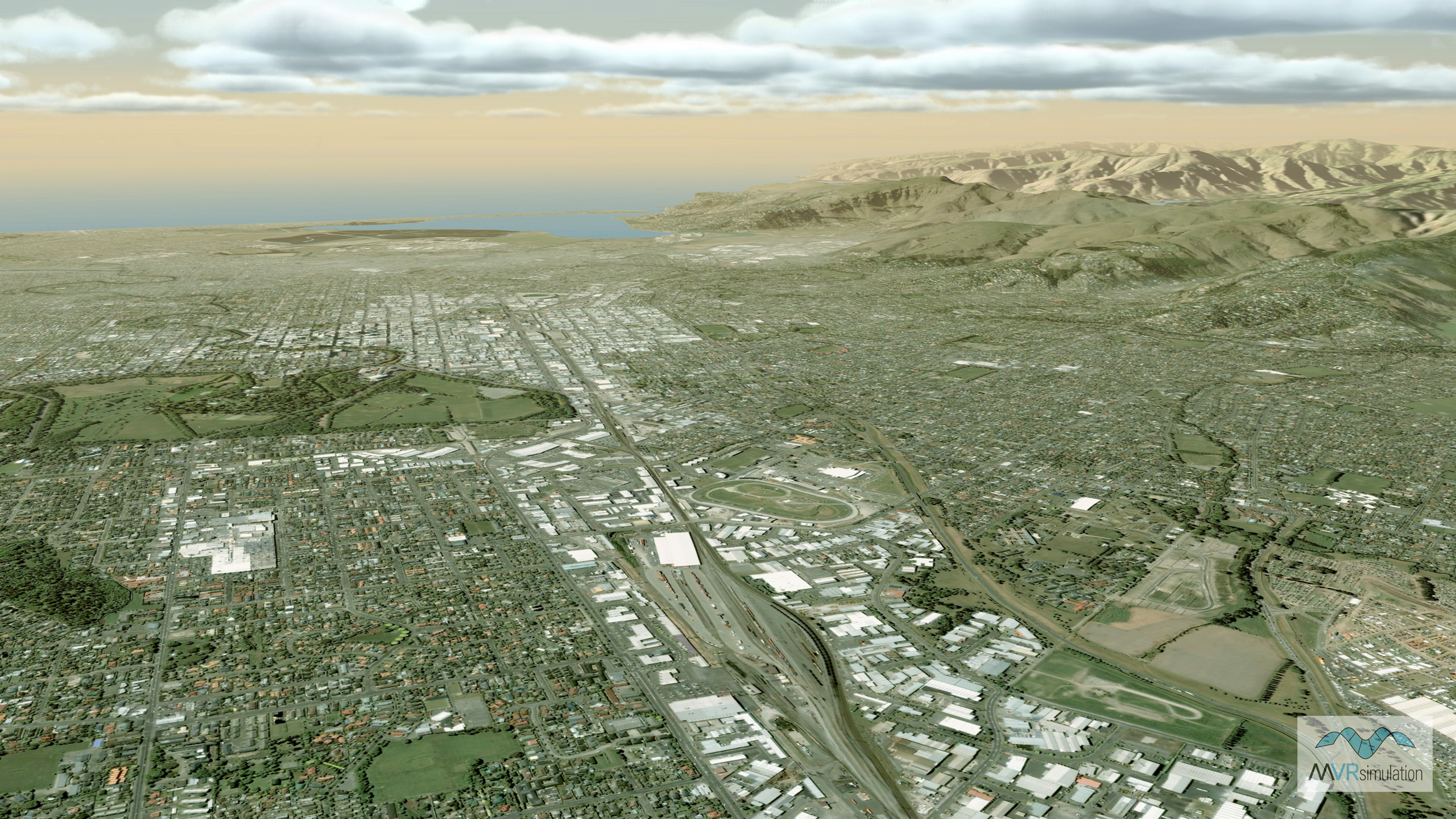
MVRsimulation VRSG real-time scene of virtual Sydney, Australia.

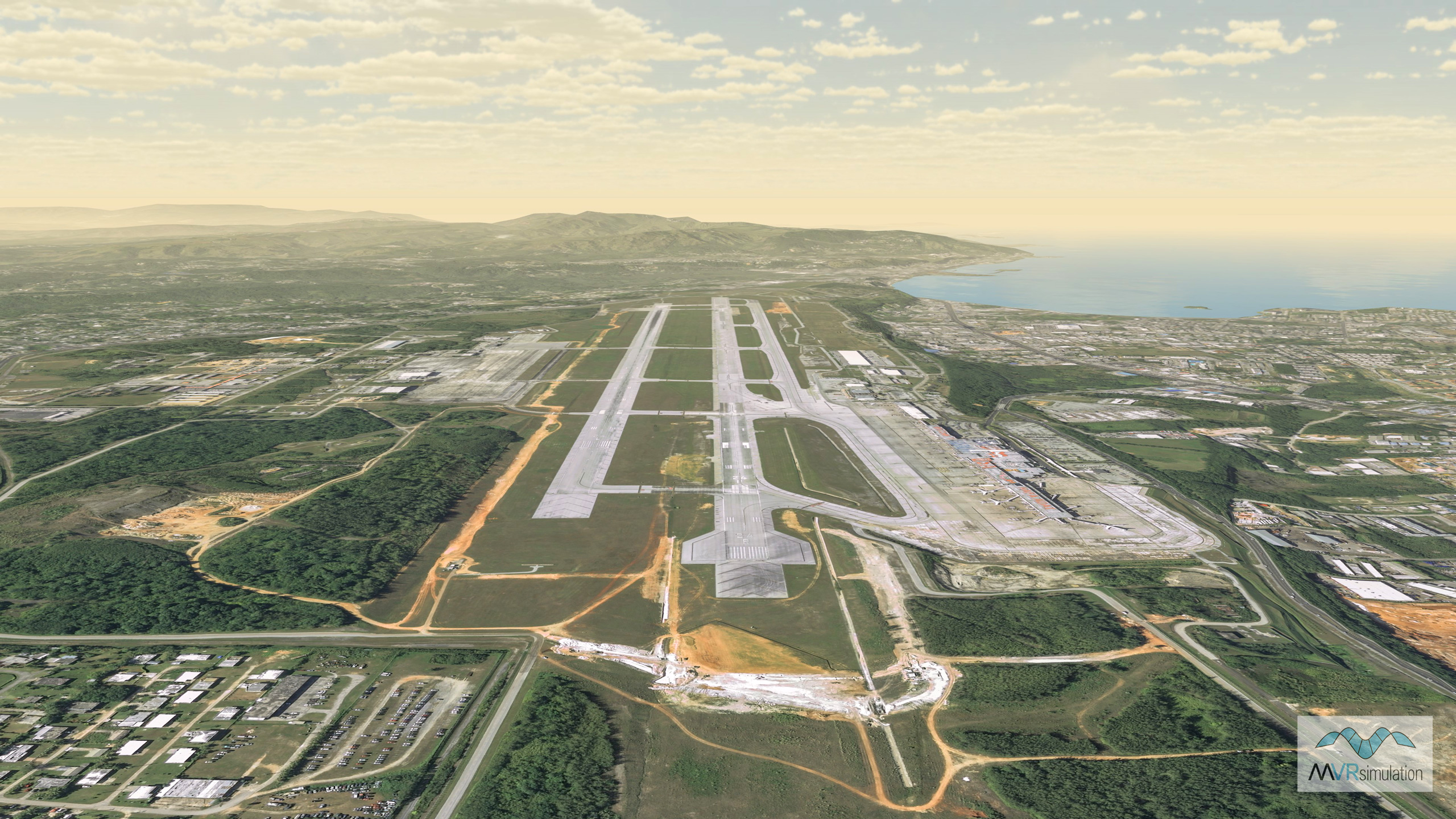
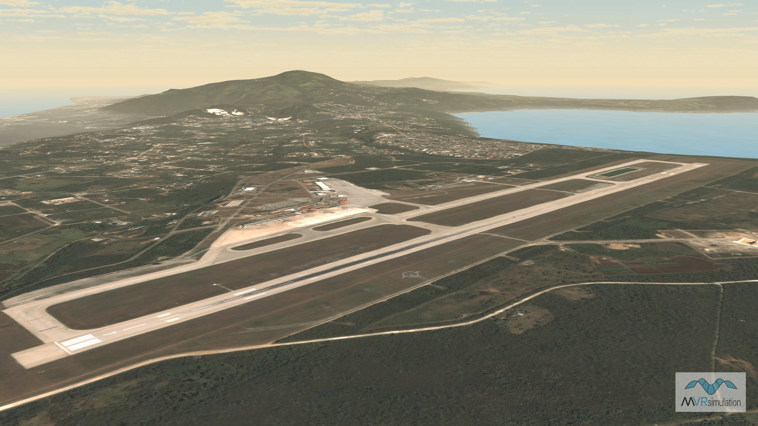
MVRsimulation VRSG real-time scene of virtual Won Pat International Airport, Guam.

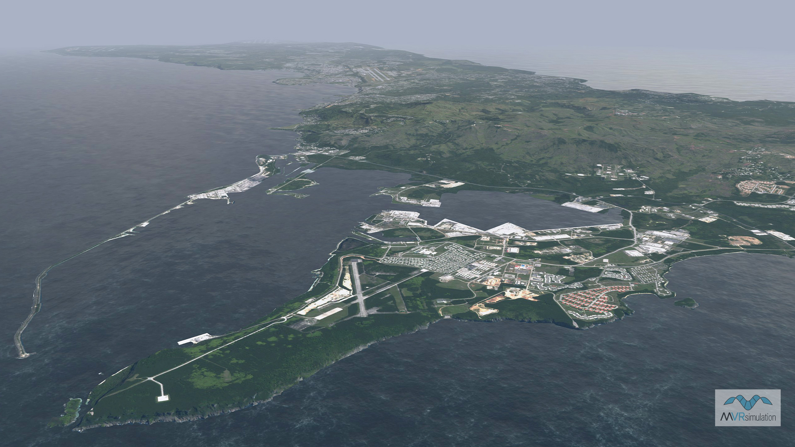
MVRsimulation VRSG real-time scene of virtual Naval Base Guam.

MVRsimulation VRSG real-time scene of virtual Christchurch, New Zealand.

MVRsimulation VRSG real-time scene of virtual Saipan, Northern Mariana Islands.

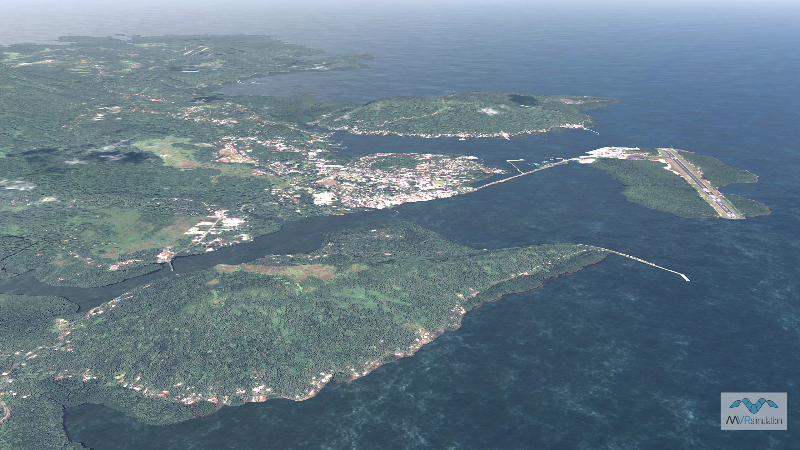
MVRsimulation VRSG real-time scene of virtual Pohnpei International Airport, Micronesia.

Related Terrain

EXTEND YOUR TERRAIN DATABASE

MVRsimulation Downloads Server

  • Explore and implement terrain updates
  • Download and use new 3D models
  • Stay up-to-date with VRSG features
  • Discover utilies for expanding VRSG
    Filler for Spacing

Request Account

MVRsimulation Regional Terrain Drives

  • External hard drive - regional terrian
  • Network attached storage device - whole-world terrain
  • Ready for plug and play
  • Available to customers on active maintenance
    Filler for Spacing

Request Drive

MVRsimulation Produced Custom Terrain

  • Custom terrain created by MVRsimulation's terrain team
  • Specify your desired area of interest
  • Indentify needed terrain features.
  • Use your own or commercially available imagery
    Filler for Spacing

Request Quote

Create Terrain with Terrain Tools

  • Build real-time 3D terrain for VRSG using GIS technology with ArcGIS Pro
  • Designed to be user-friendly for users with basic ArcGIS knowledge
  • Use imagery, elevation, and optional vector data to create terrain
  • Compile buildings from 2D polygon footprint features using a CityEngine rule package
    Filler for Spacing

Terrain Tools