Baghdad, Iraq Terrain Database Information
- Imagery: 60cm Digital Globe Citysphere imagery surrounded by 1m black and white color-fused with 15mpp LANDSAT-based color imagery
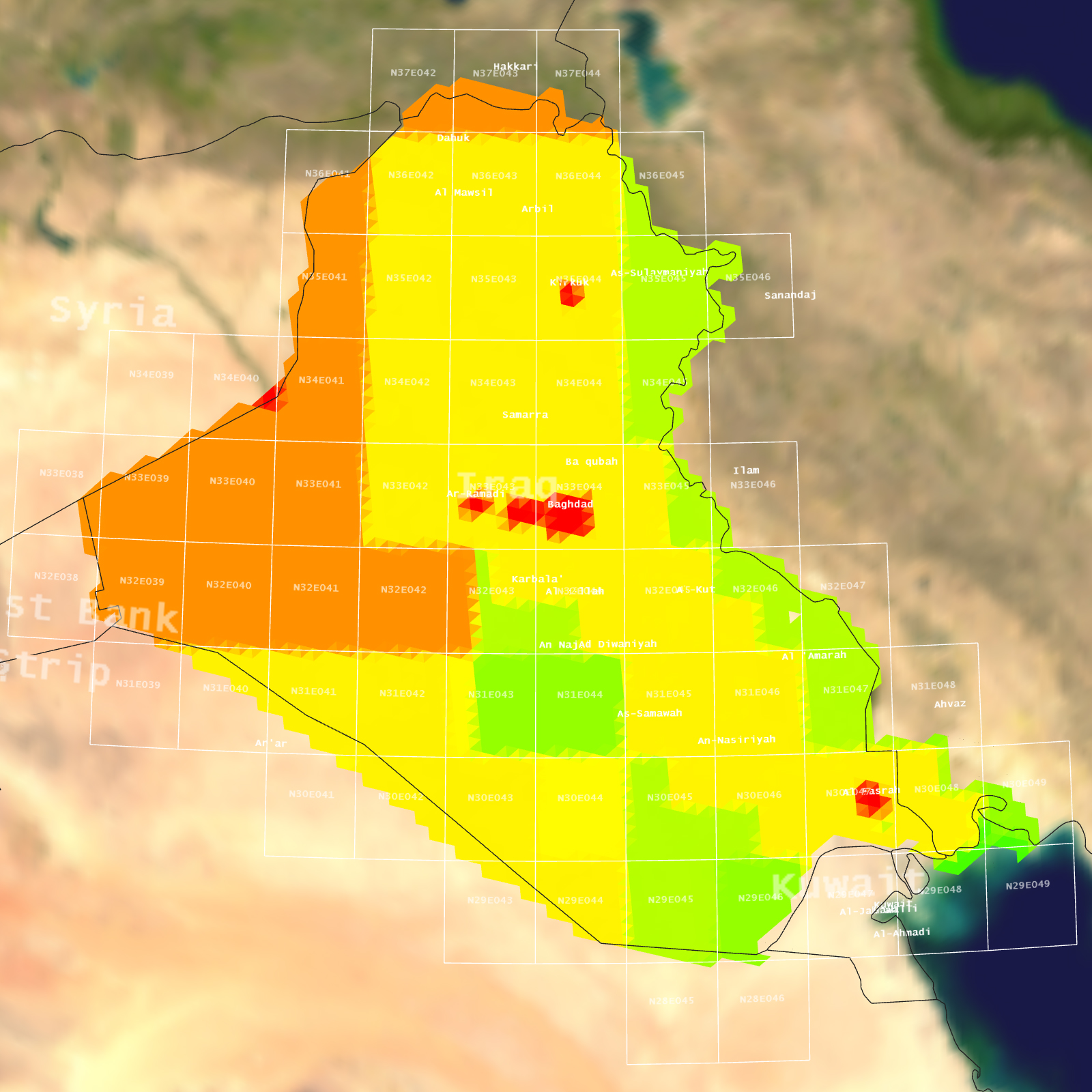
- Elevation: DTED 2: ~30km
- Terrain Drive: Asia & Middle East
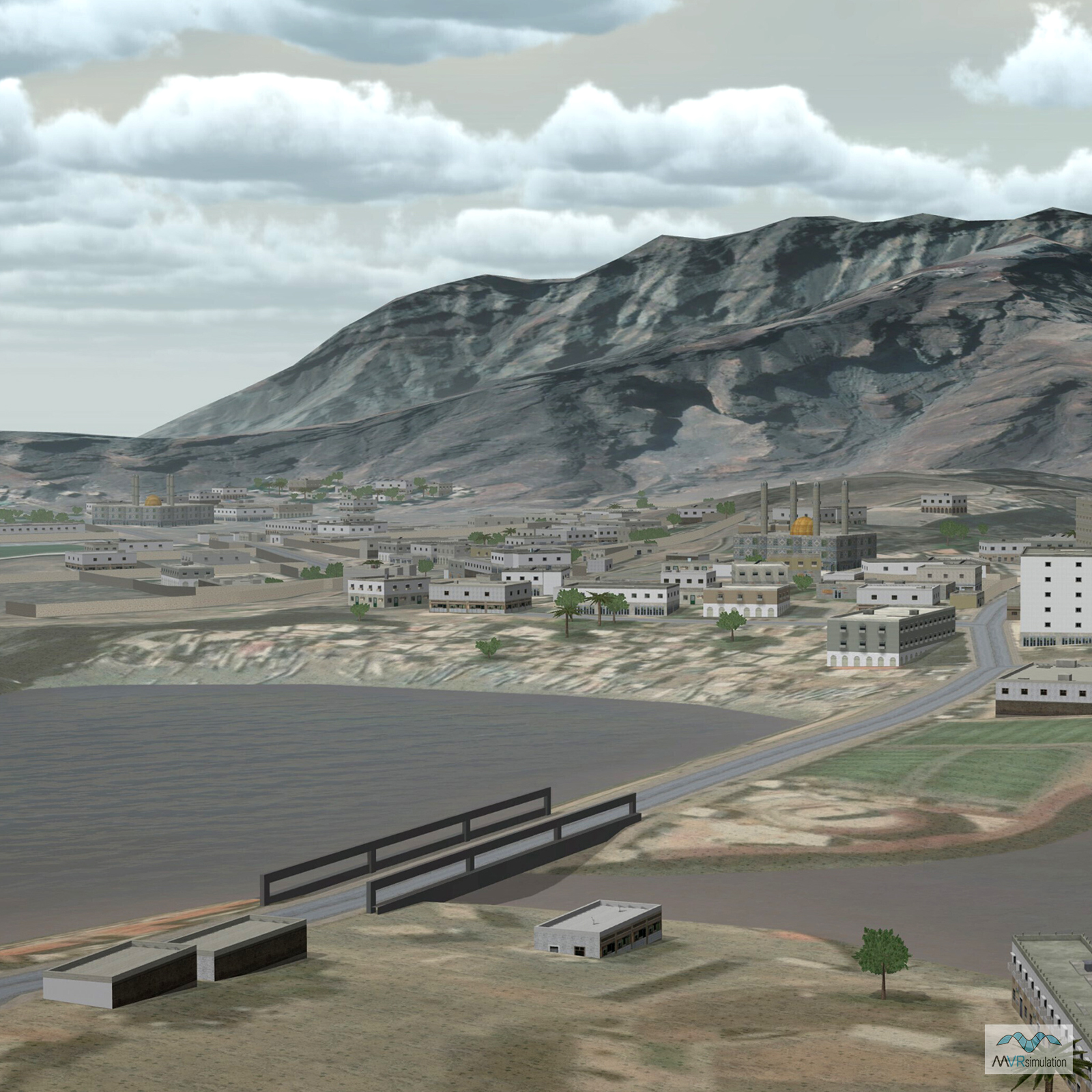
- Artist modeled neighborhood next to the Green Zone
- Photo-realistic buildings and cultural elements
- Cultural Features: Building Interiors, Control Tower, Custom Models (Geospecific Buildings), Fences or Walls, Landscape Features (Shrubs, Grass, Paved Medians, etc.), Light Poles, Lighting for Non-Runway Areas (Streetlights), Roads, Signs, Trees, Urban Furniture (Benches, Trash Bins, etc), Utilities (Poles, Powerlines or Transmission Lines), Water Tanks/Towers
Tile Coverage Map
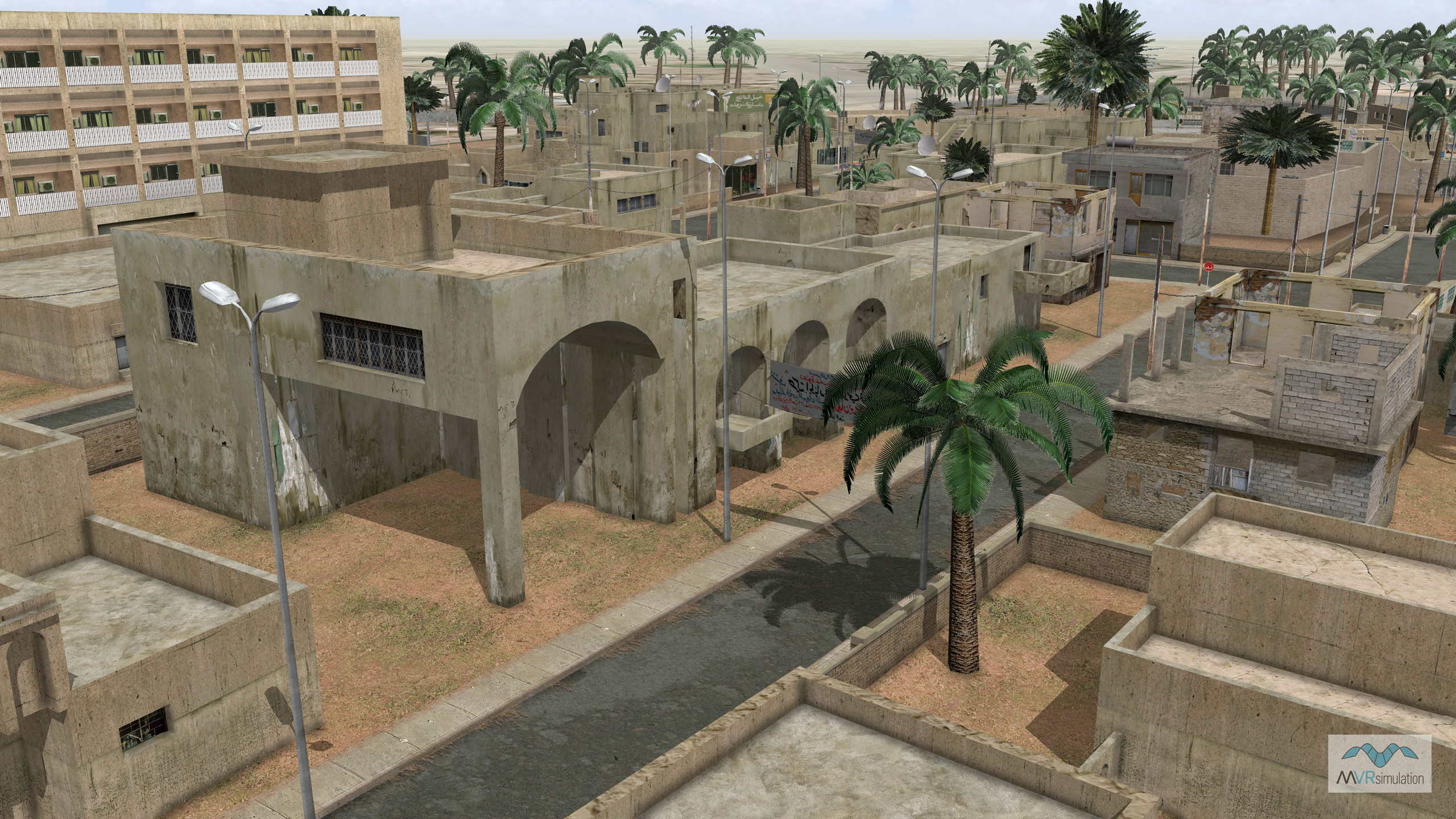
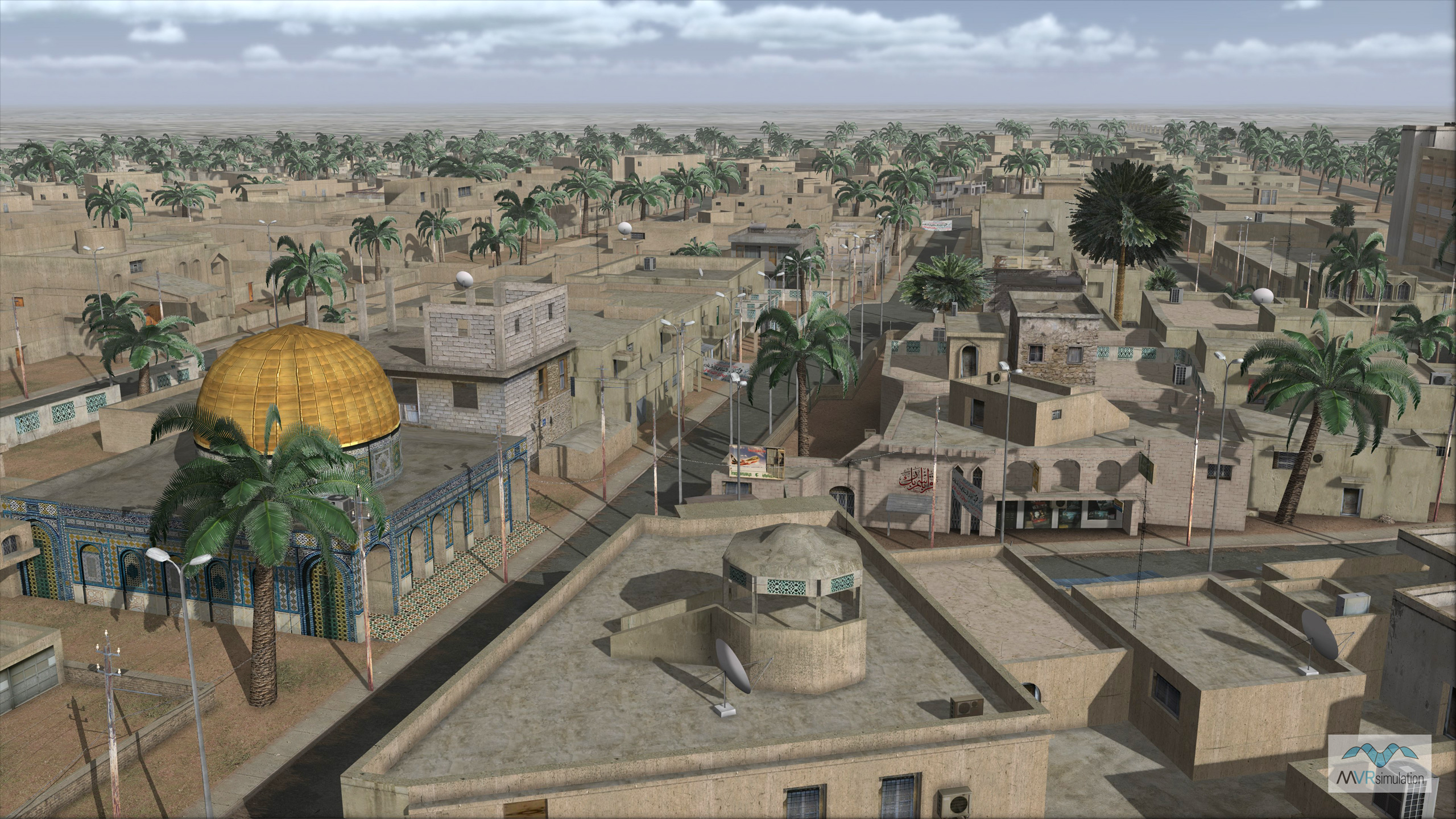
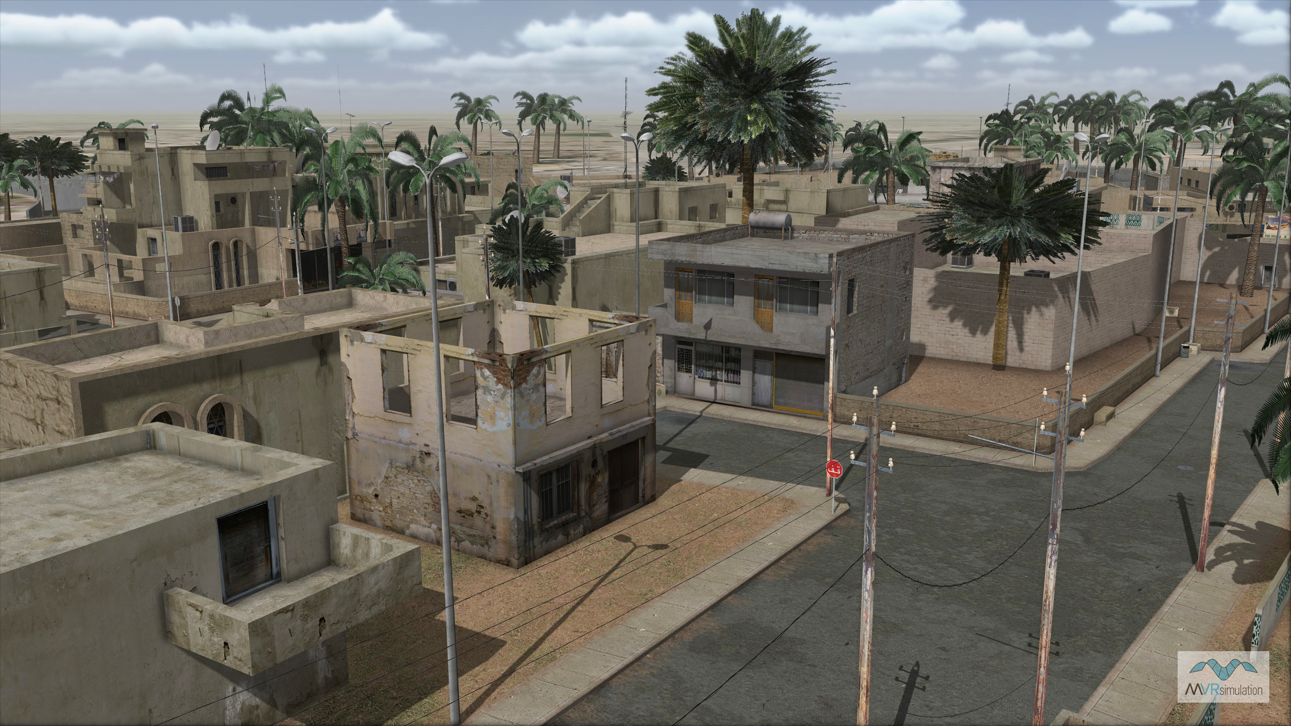
Custom 3D building models as part of the Baghdad, Iraq, terrain database.
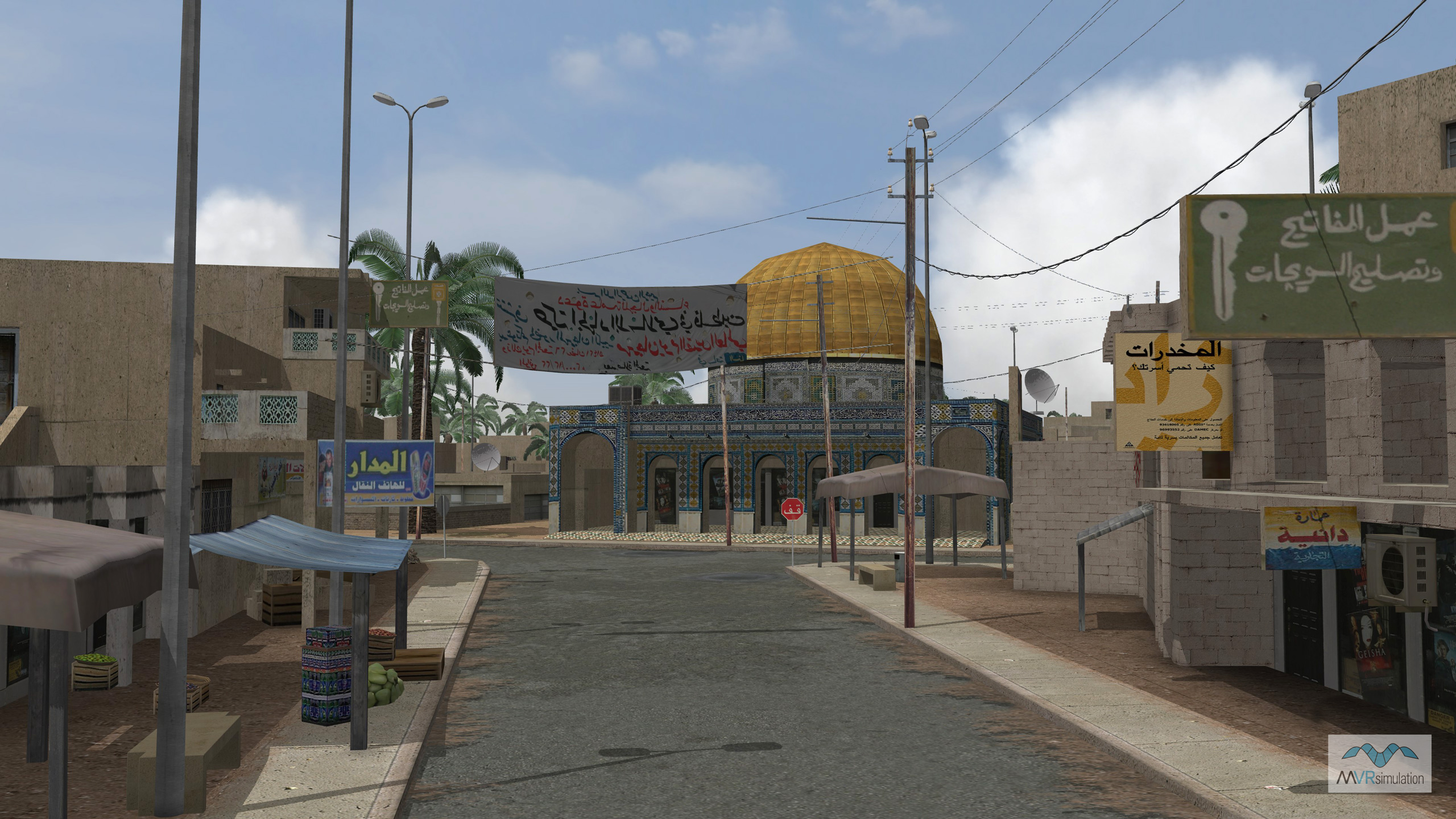
VRSG scene of virtual Baghdad with power lines and custom geospecific signs and culture.
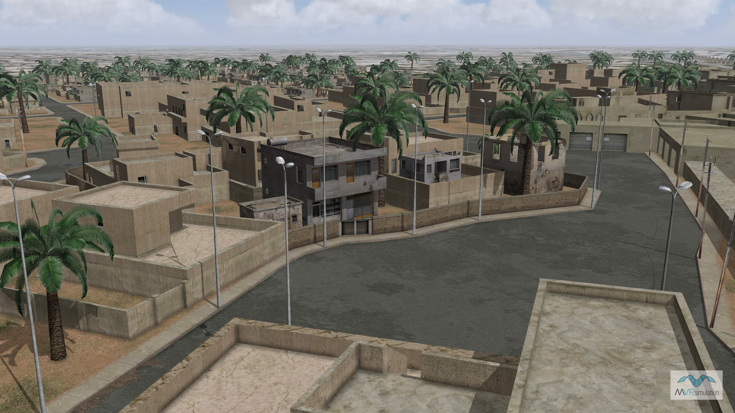
3D modeled Baghdad, Iraq, with geospecific urban features including walls, roads, light poles and vegetation.
Region specific model textures for buildings and other cultural 3D models.
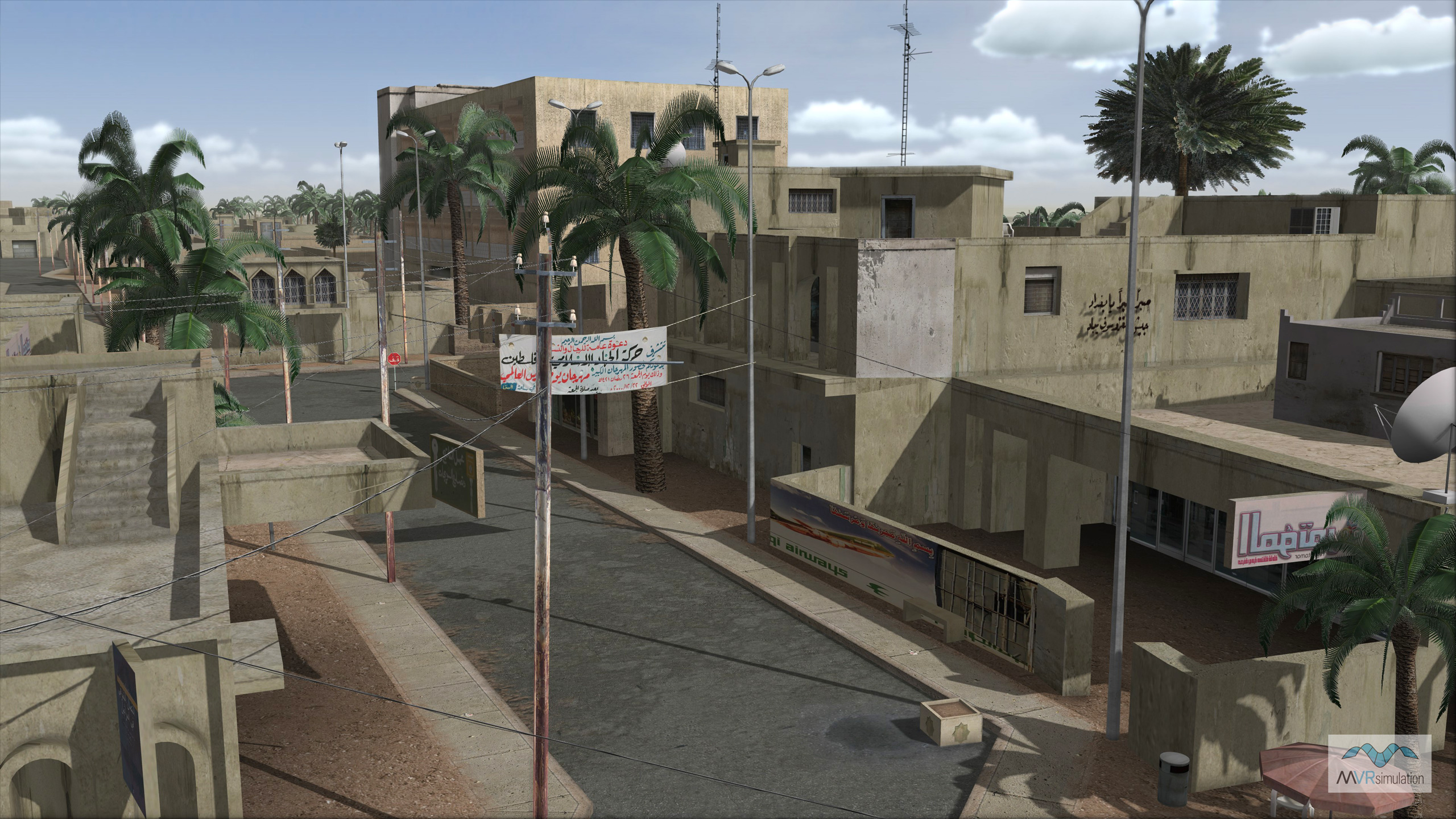
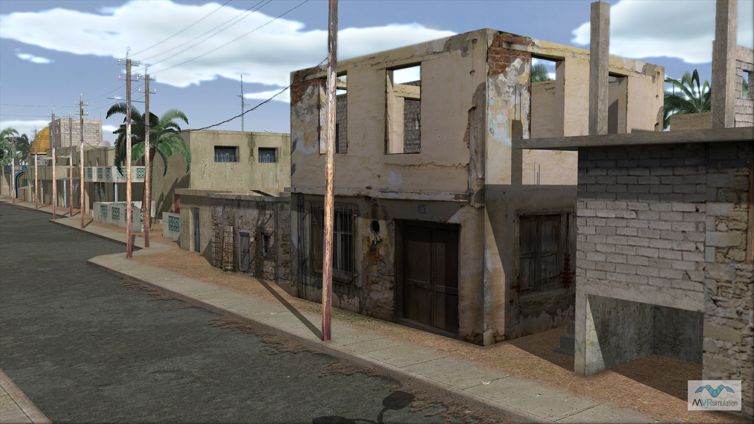
Study of building and urban cultural model shadowing and self-shadows.
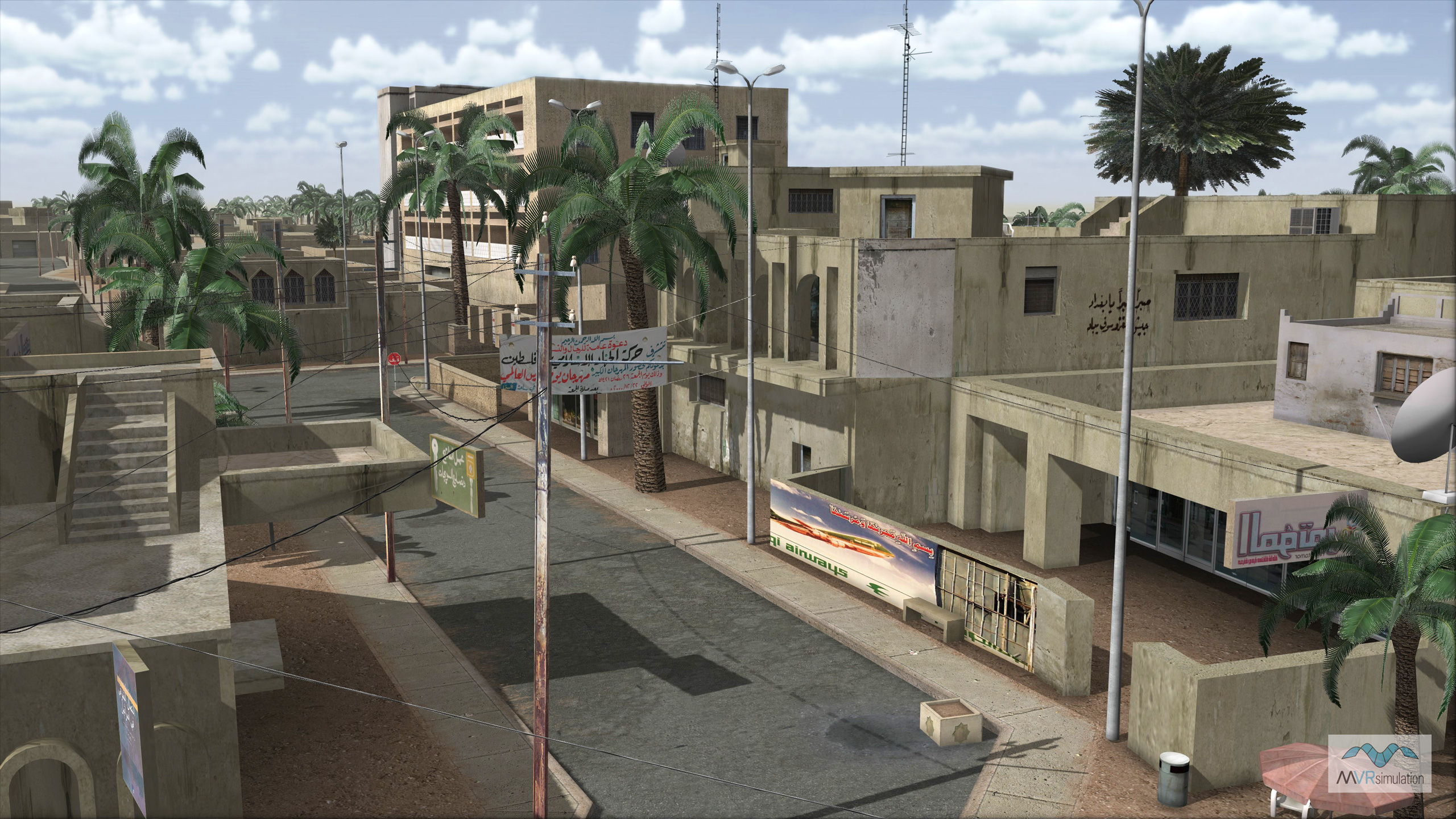
Study of building and urban cultural model shadowing and self-shadows.