Kabul, Afghanistan Terrain Database Information
- Imagery: 60cm and 2.5m surrounding; very high detailed village inset
- Elevation: SRTM 90m
- Terrain Drive: Asia & Middle East
- Complex terrain with varying elevations and sub-terrain tunnels with simulated below-ground entrances
- Cultural Features: Building Interiors, Custom Models (Geospecific Buildings), Destructible Buildings, Fences or Walls, Geospecific Bridge, Landscape Features (Shrubs, Grass, Paved Medians, etc.), Roads, Signs, Trees, Tunnels, Urban Furniture (Benches, Trash Bins, etc), Utilities (Poles, Powerlines or Transmission Lines), Water Features (Lakes, Rivers, etc), Water Tanks/Towers
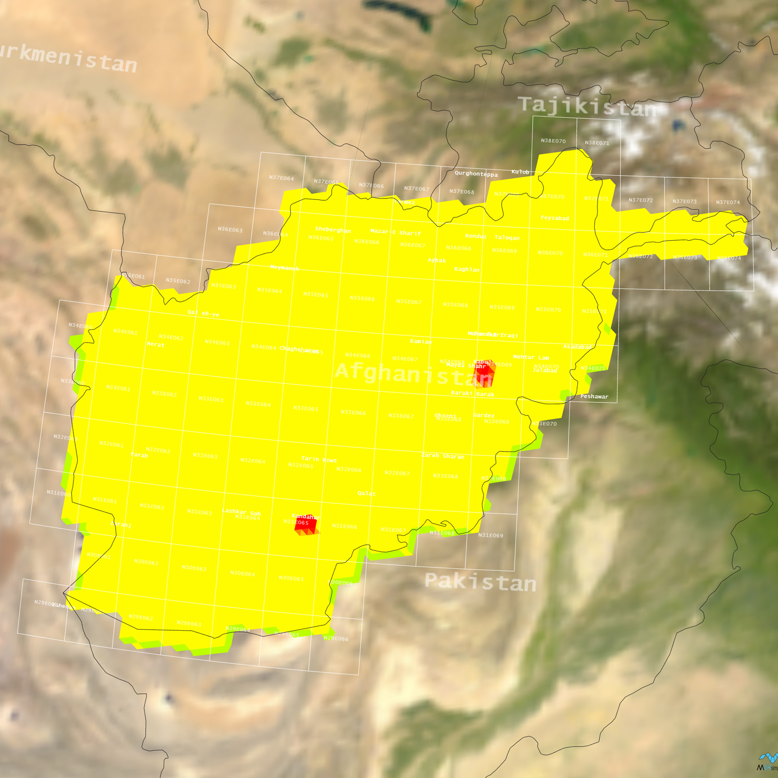
Tile Coverage Map
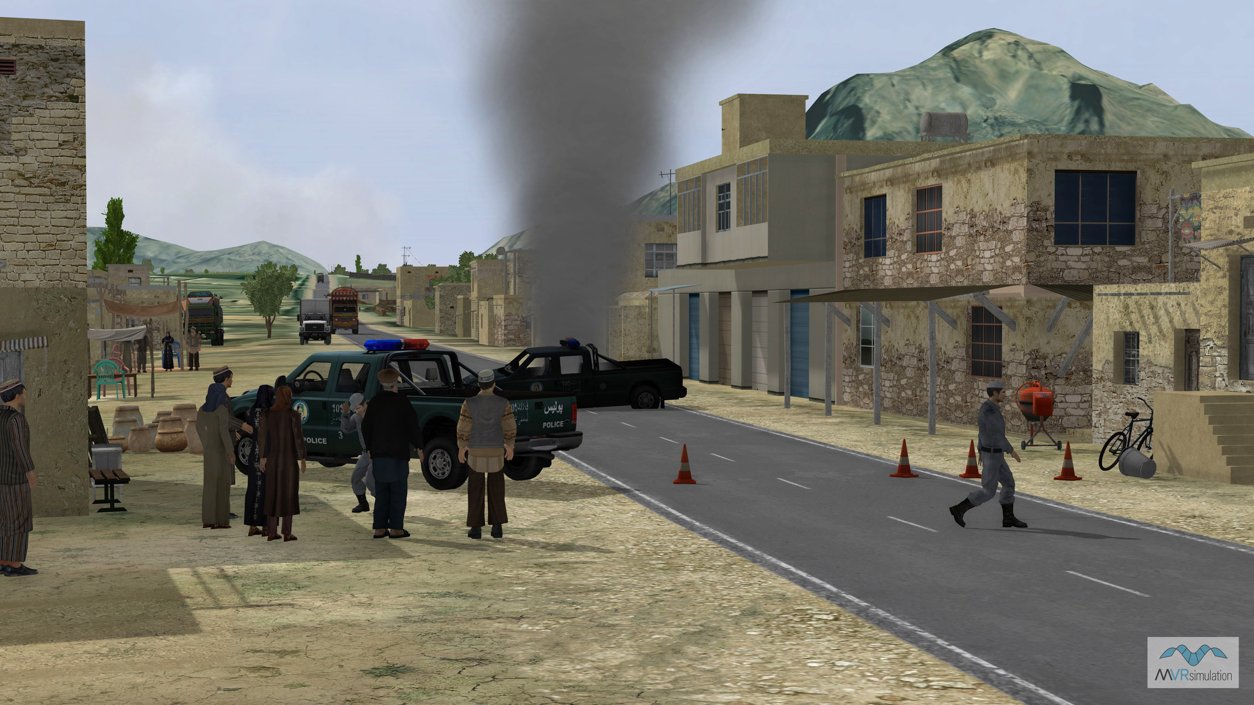
VRSG scene showing the aftermath of an Improvised Explosive Device (IED) explosion causing vehicle damage.
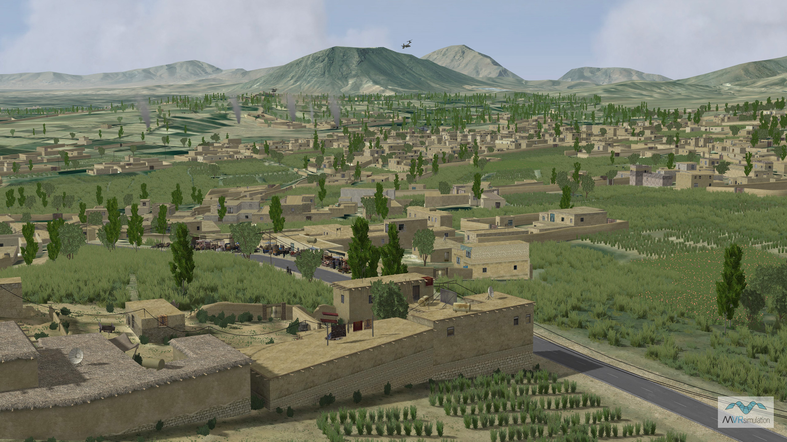
Geospecific cultural vegetation including poppies with burning fires and mountainous terrain in the distance.
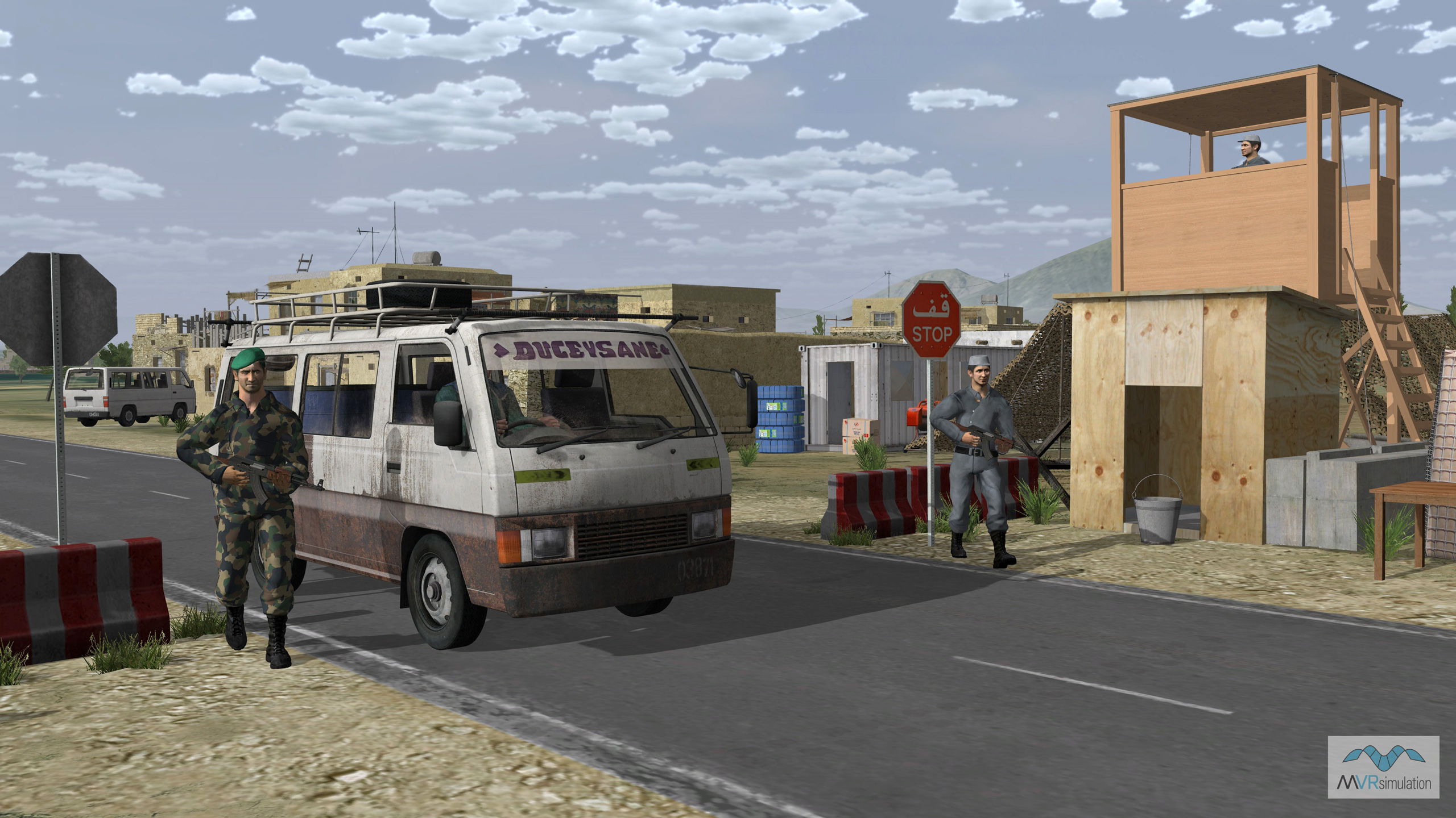
Insurgent checkpoint at the entrance of MVRsimulation's high-resolution village in Kabul Province, Afghanistan.
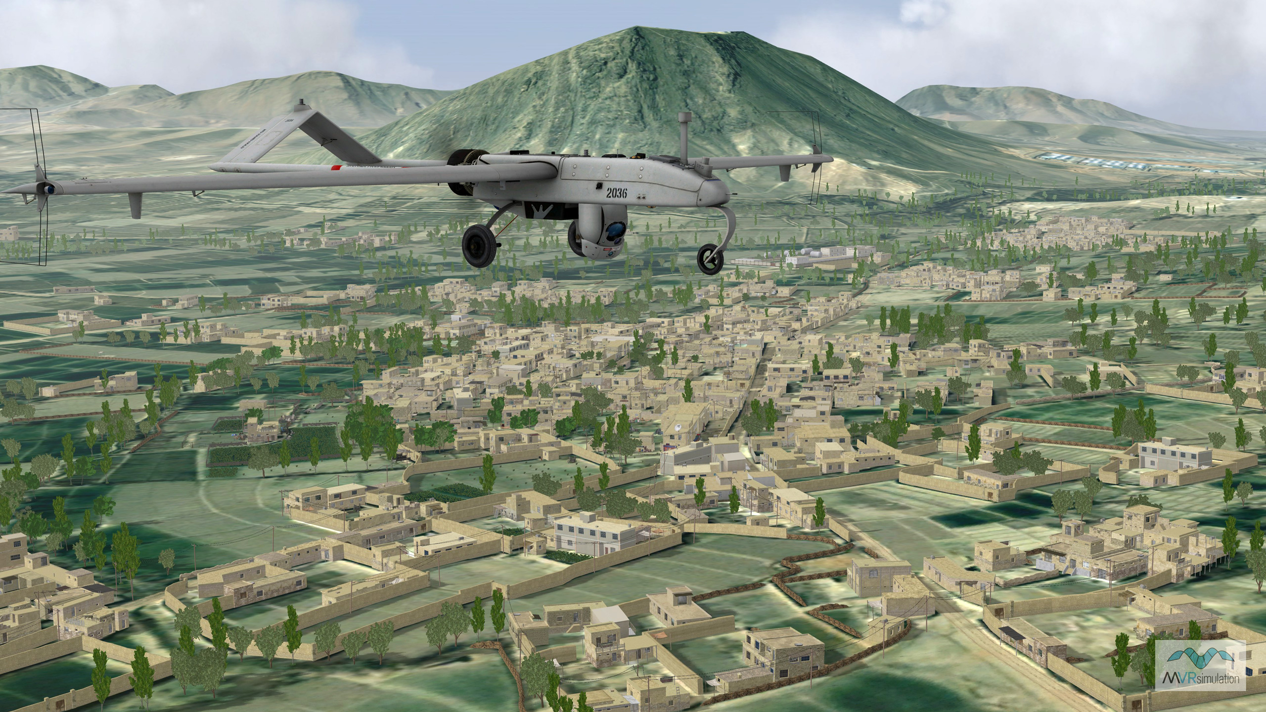
An RQ-7B shadow UAS in flight over a 3D urban area including buildings, walls, and vegetation.
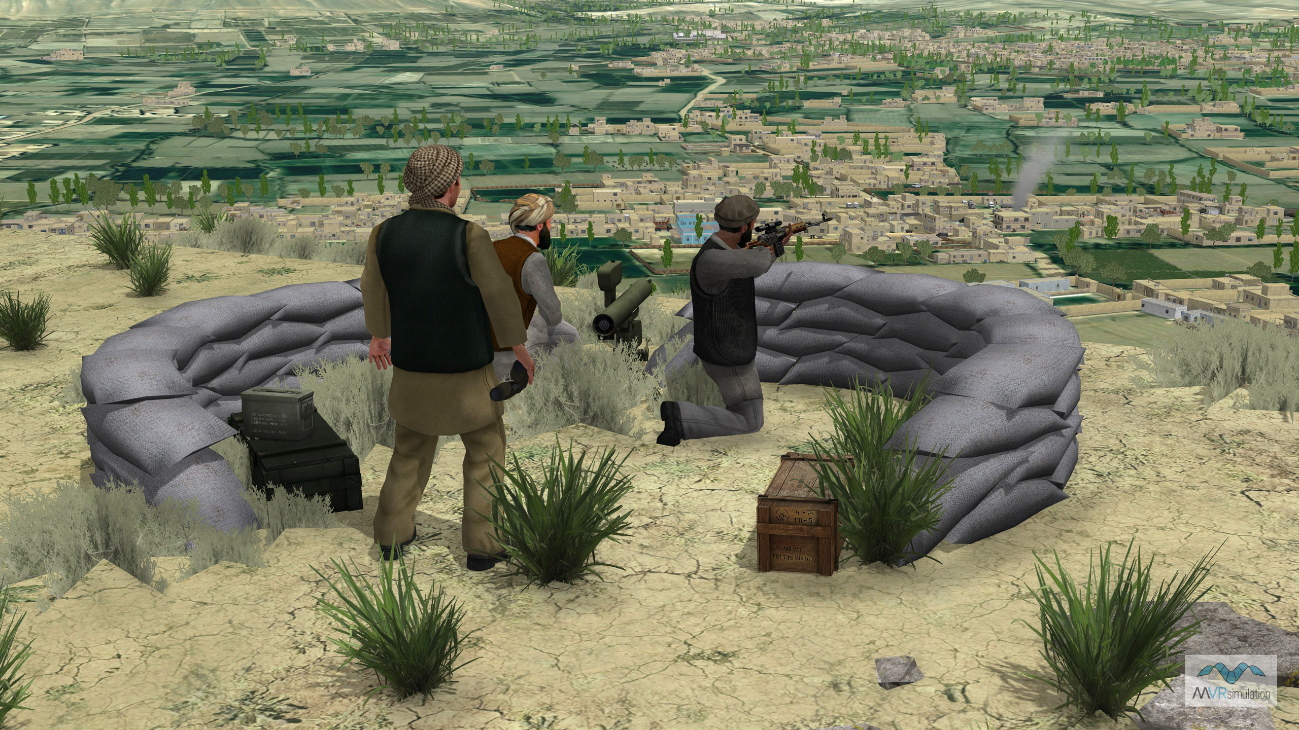
Insurgent charaters overlooking the geospecific terrain of Afghanistan.
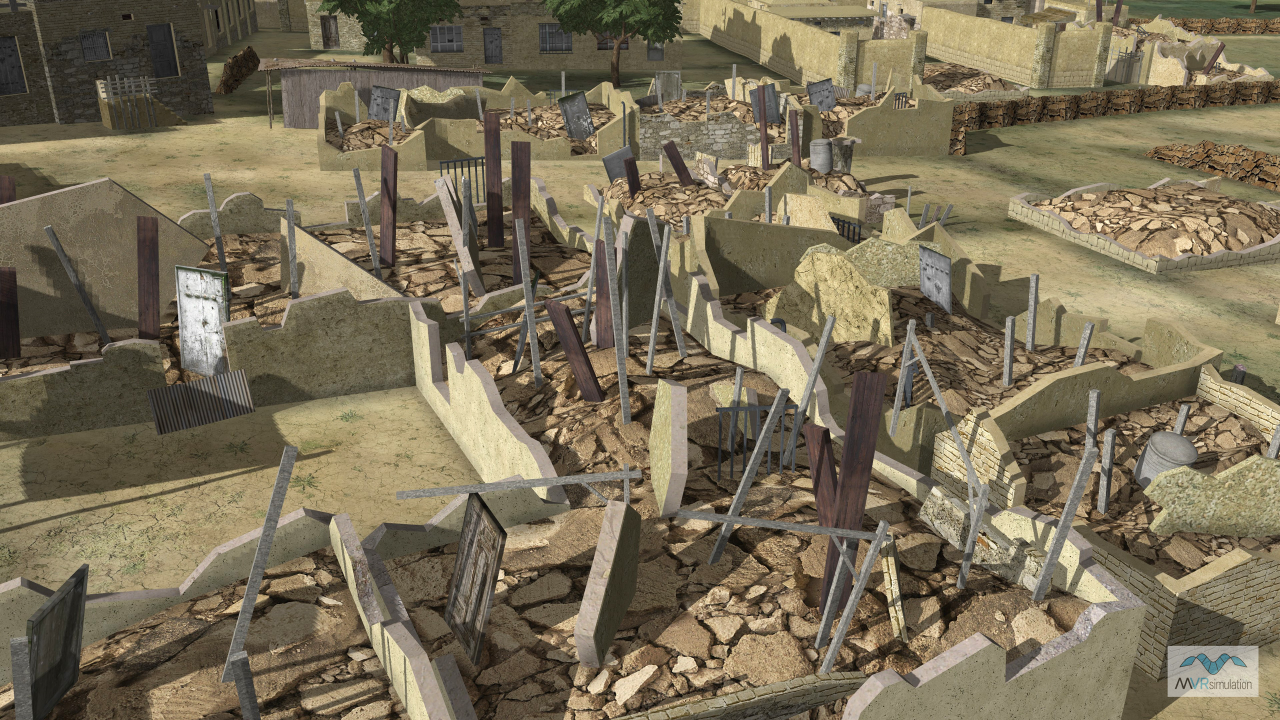
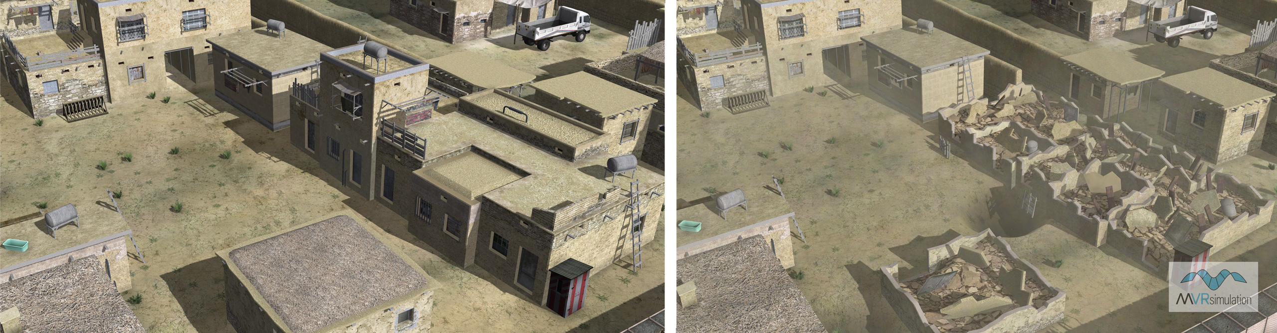
Geospecific building models with multiple damage state afters an explosion on a series of buildings in the village.
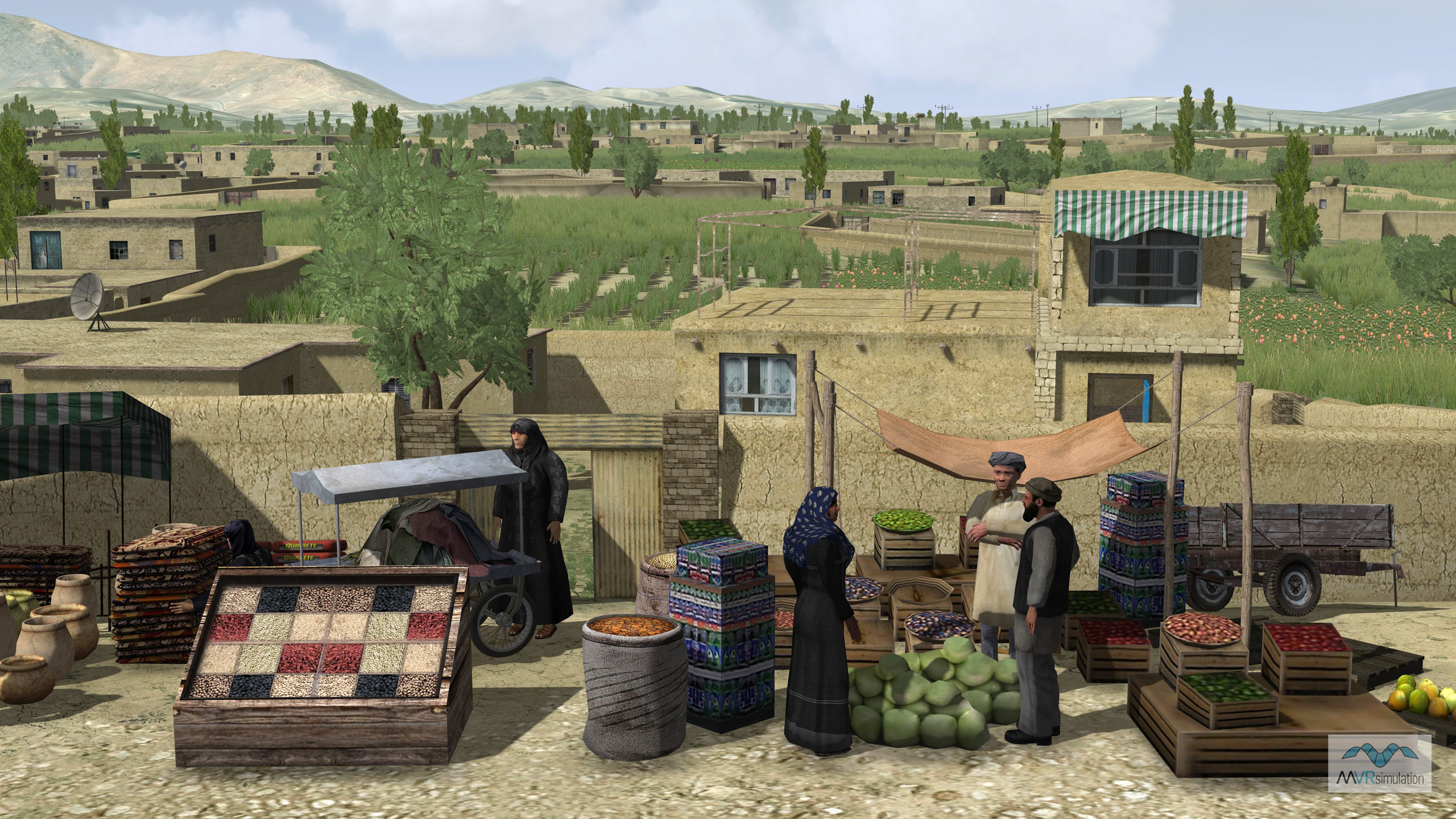
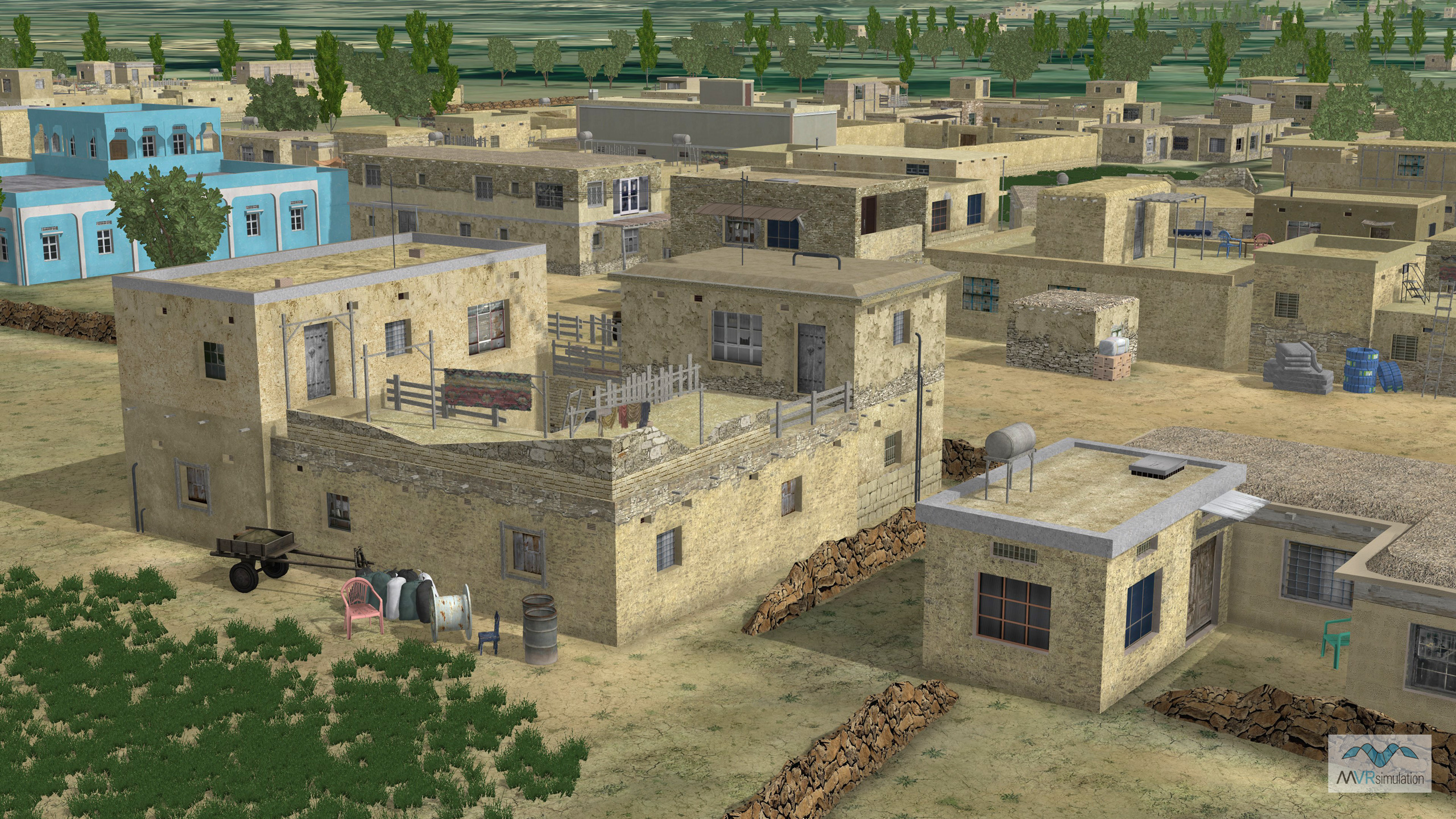
High-definition 3D Modeled Village
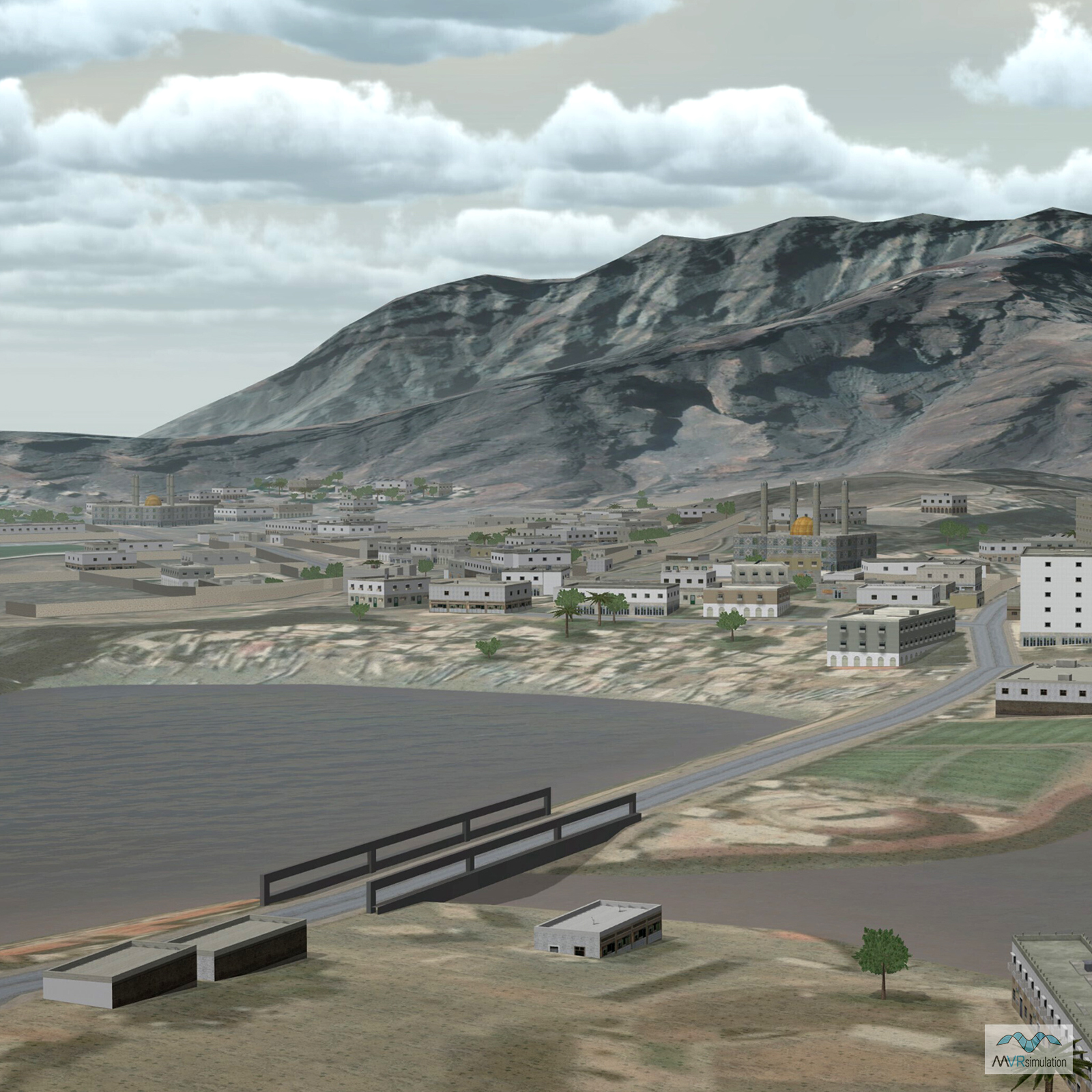
MVRsimulation built 3D geospecific terrain of the entire country of Afghanistan featuring a high-resolution virtual village with over 650 buildings in the province of Kabul. The 3D modeled village is based on the village of Khairabad in the southern part of the Kabul province, and includes neighborhoods along the Kabul-Gardez highway. Situated at an altitude of 1,843 meters, Khairabad is located approximately 10-15 kilometers south of Kabul city center, next to Qalai Naeem in the Char Asiab district.
As a significant percentage of Afghanistan's population lives in mountainous terrain, training warfighters in a simulated environment that accurately represents mountainous regions with small population centers is critical. MVRsimulation’s high-resolution Afghan village is set within mountains and complex terrain of varying elevation with cave networks, enabling realistic training scenarios for mission planning and rehearsal of operations in mountainous villages.
The virtual terrain of this area of Afghanistan was built from geospecific high-resolution elevation and imagery source data; it was augmented with finer level terrain details derived from the imagery to add to the realism near ground level. This virtual terrain was built with a particular emphasis on identifying and defeating IEDs using resources from combined military branches and nations. Among the village’s 650 models of buildings and other structures are 150 models which have multiple damage states.
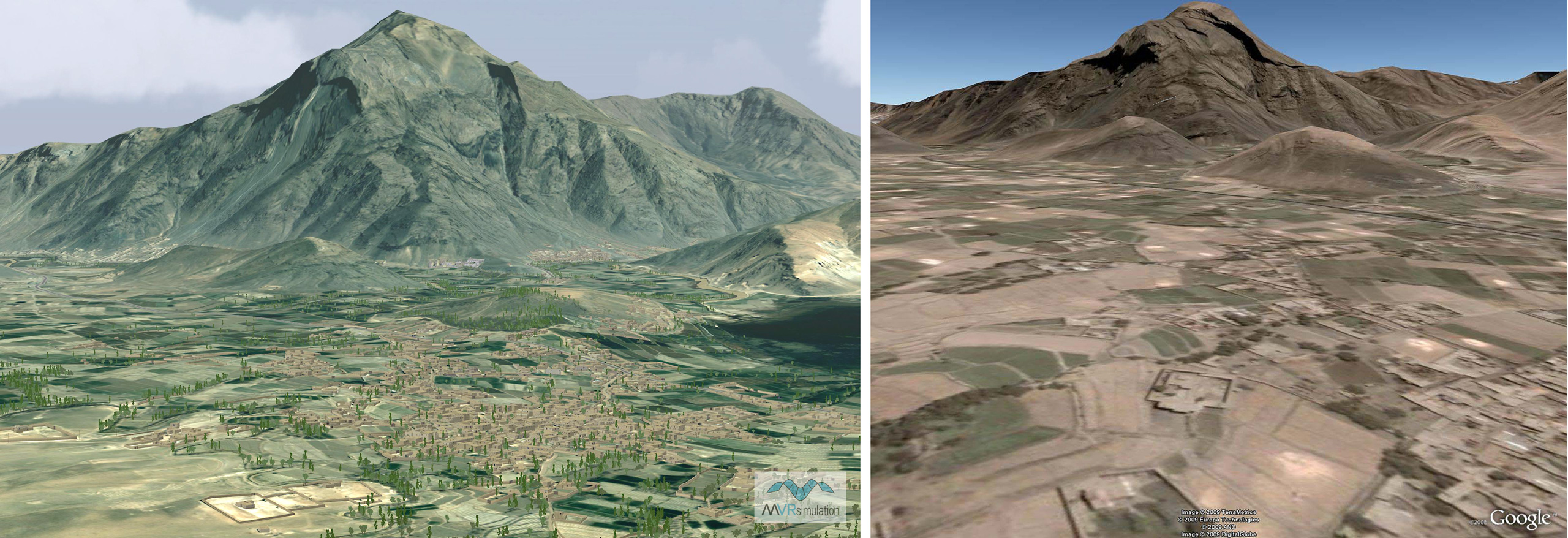
VRSG Comparison to Google Earth
Enhancing the overall SRTM 90 elevation data are higher resolution areas of the village. These high-resolution areas define features such as berms, ditches, and an underground tunnel network. The village area has approximately 520 custom-built 3D structures that match the building footprints visible on the source imagery. Many of the buildings are multi-level, contain modeled interiors, and include damage states. Open doorways, translucent windows, and stairways, contribute to making the structures within the virtual village suitable for tactical scenarios. The textures of many cultural features are derived from publicly available photographs found on the Internet.
This virtual village and its surrounding mountainous terrain is optimized for conducting ground combat simulations, such as sniper, IED detection, and forward air controller or JTAC exercises such as those undertaken by A-10 missions, with a high degree of realism. For example, the high-resolution terrain and models appear accurately in simulated magnified view scopes and laser designators. Geospecific agricultural fields are also modeled and can be tailored to represent various crop types over different seasons.
Below-surface Tunnels
The Afghan village provides the opportunity for users to conduct challenging exercises within its underground tunnel and cave network. Accurately simulating typical below-ground entrances is another important part of preparing soldiers for Afghanistan and other mountainous regions. The tunnel and cave complex has an entry point in one of the buildings that is linked to a cave and tunnel position in the courtyard, which could be used as a mortar position. The tunnel exits some distance away in a heavily wooded area behind the building complex and courtyard. The tunnel network is modeled with geometry and textures much like the above-ground terrain. It can support the underground traversal of small entities such as small unmanned ground vehicles (SUGVs) or characters.