
Latvia Terrain

Latvia

Latvia Terrain Database Information

  • Imagery: 25cm open-source imager
  • Elevation:digital terrain model compiled at 10m
  • Terrain Drive: Europe
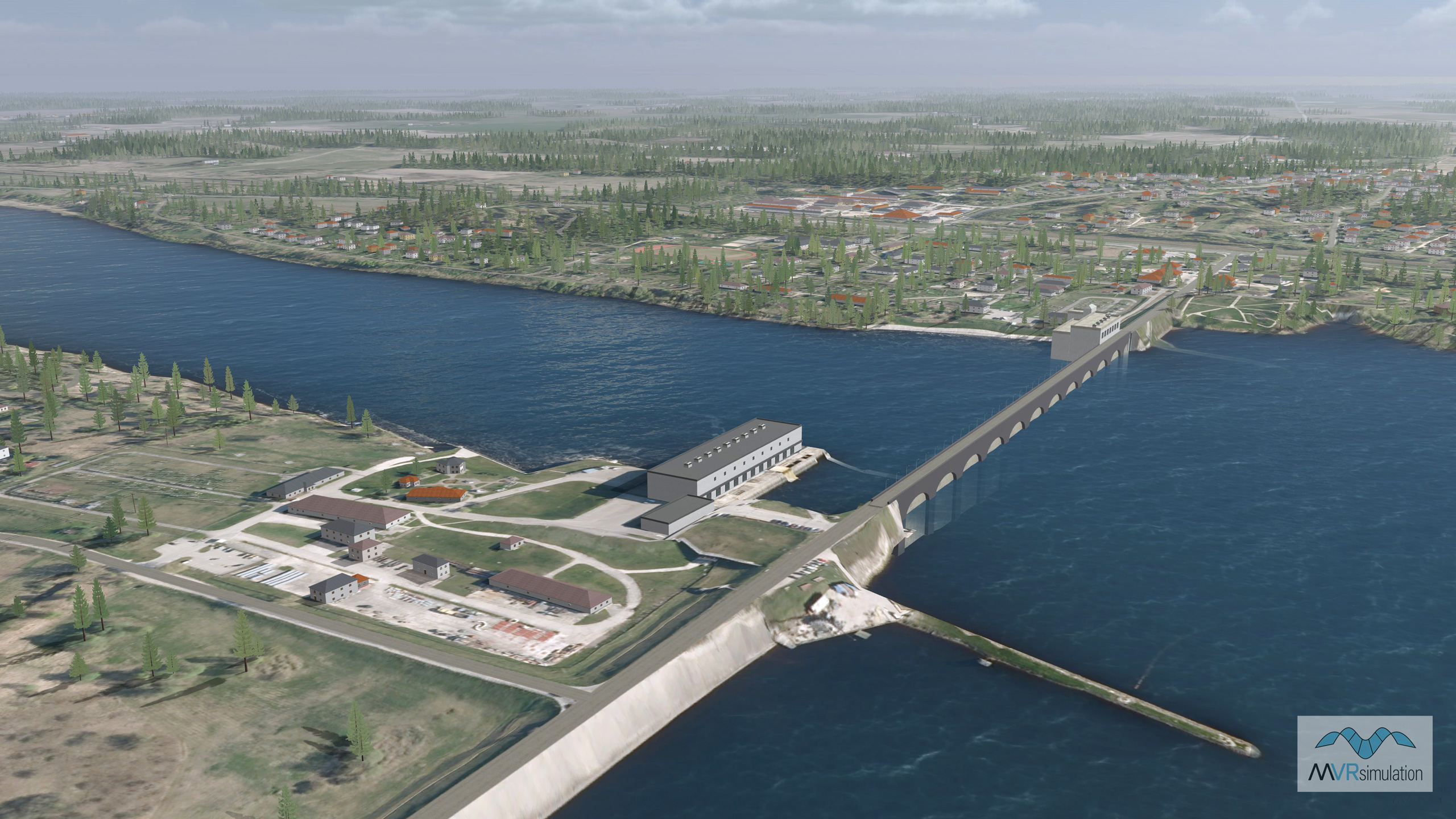
  • Kegums hydroelectric power station geolocated on the Daugava river.
  • This Latvia terrain dataset was delivered to the Latvian Ministry of Defence for use in joint terminal attack controller (JTAC) training. The Latvian JTAC training site at the Adazi Military Base uses seven VRSG licenses in its dome-based Advanced JTAC Training System (AJTS).
  • Cultural Features: CityEngine (Geotypical) Buildings, Custom Models, Roads, Trees, Utilities (Poles, Powerlines or Transmission Lines)
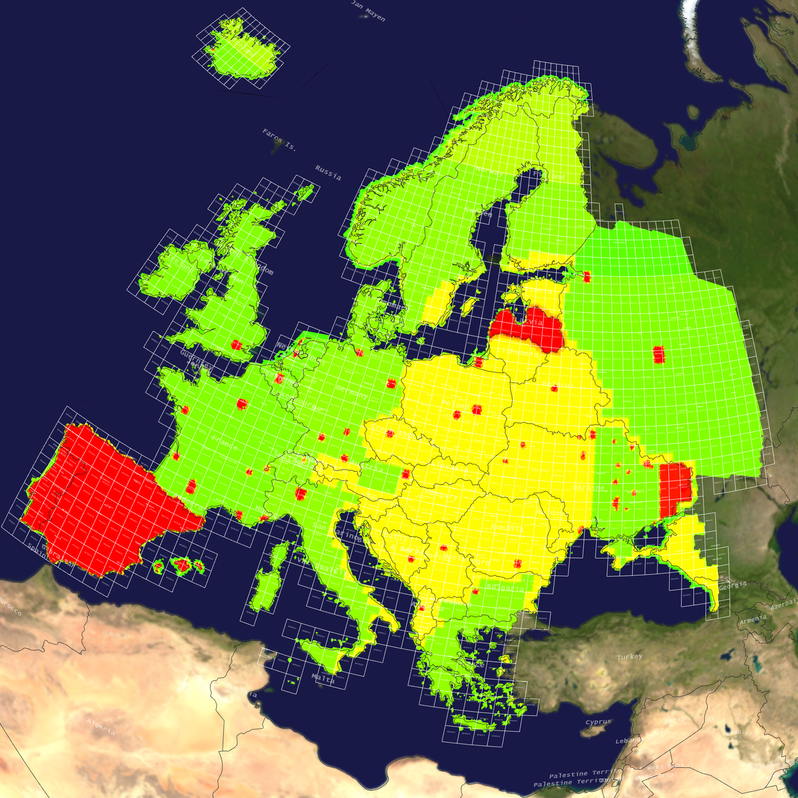
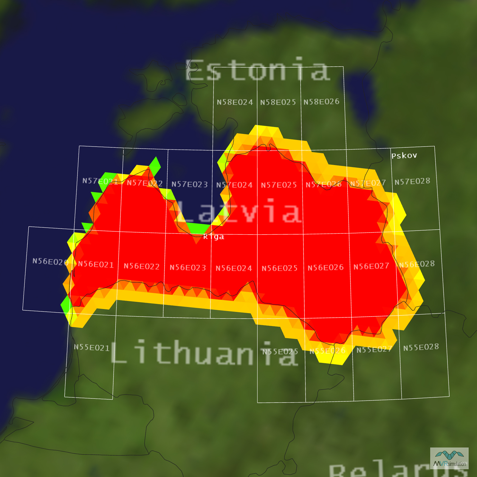
Tile Coverage Map

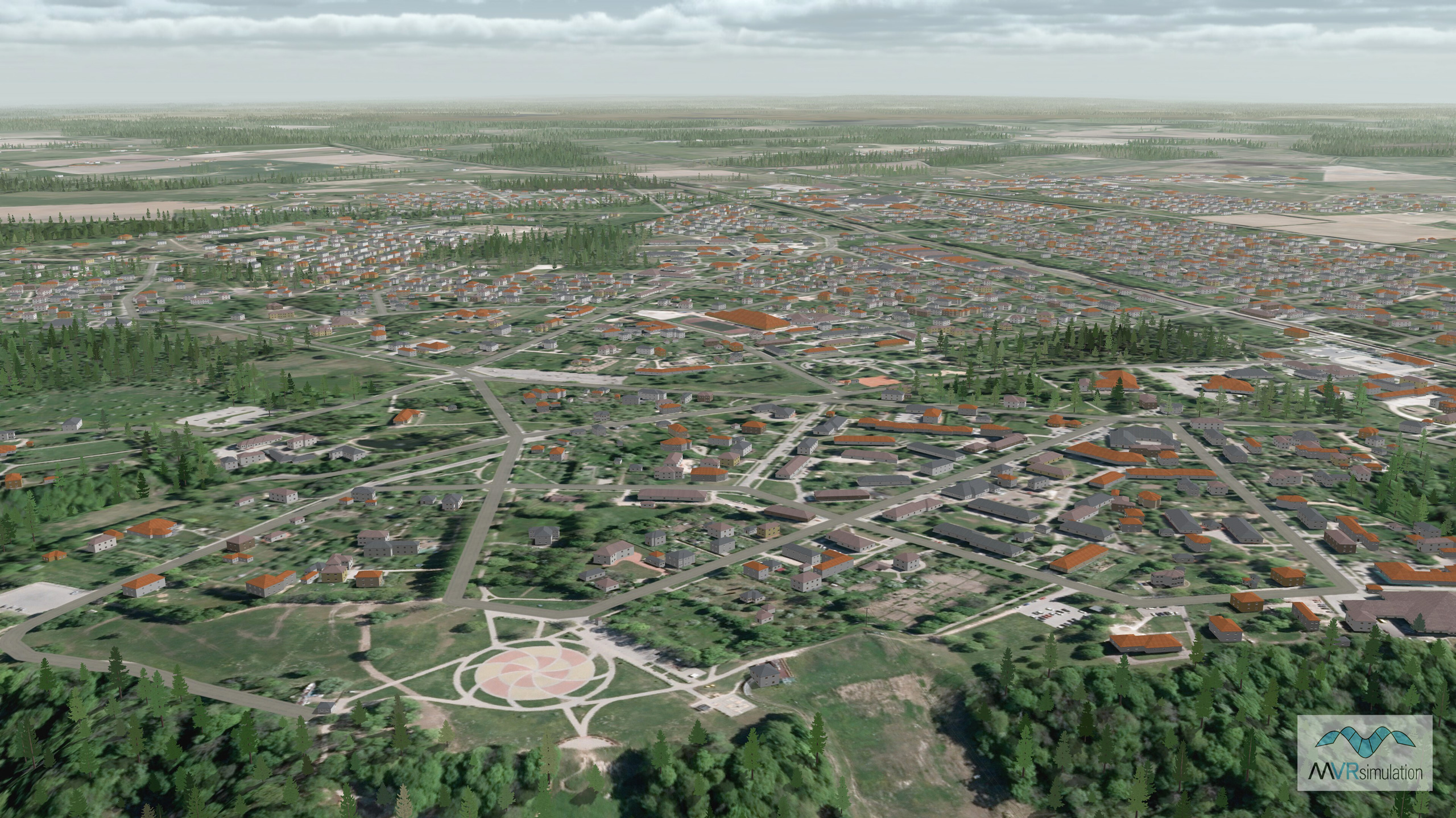
MVRsimulation VRSG real-time scene featuring the 3D virtual terrain of Senite, Latvia.

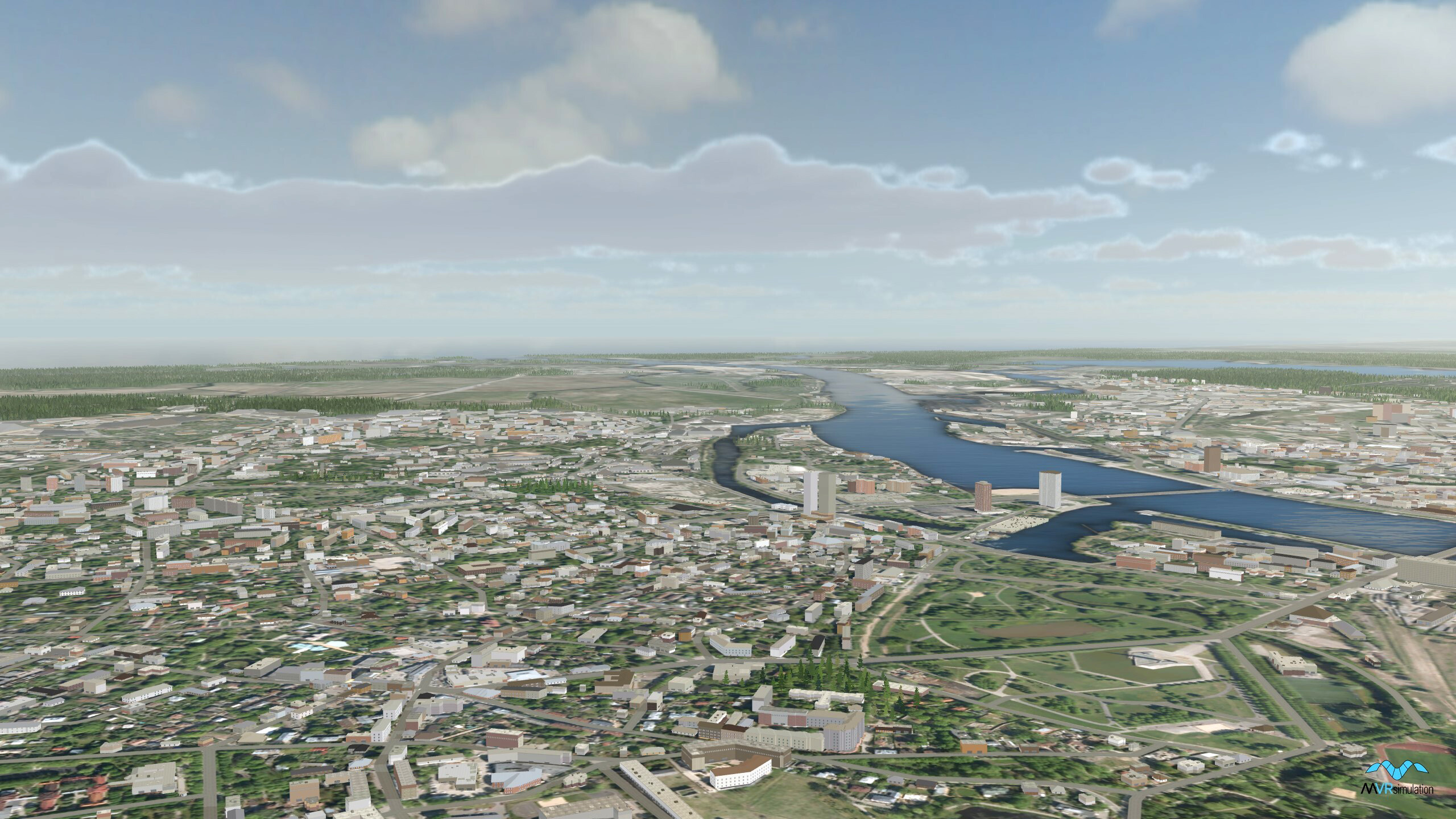
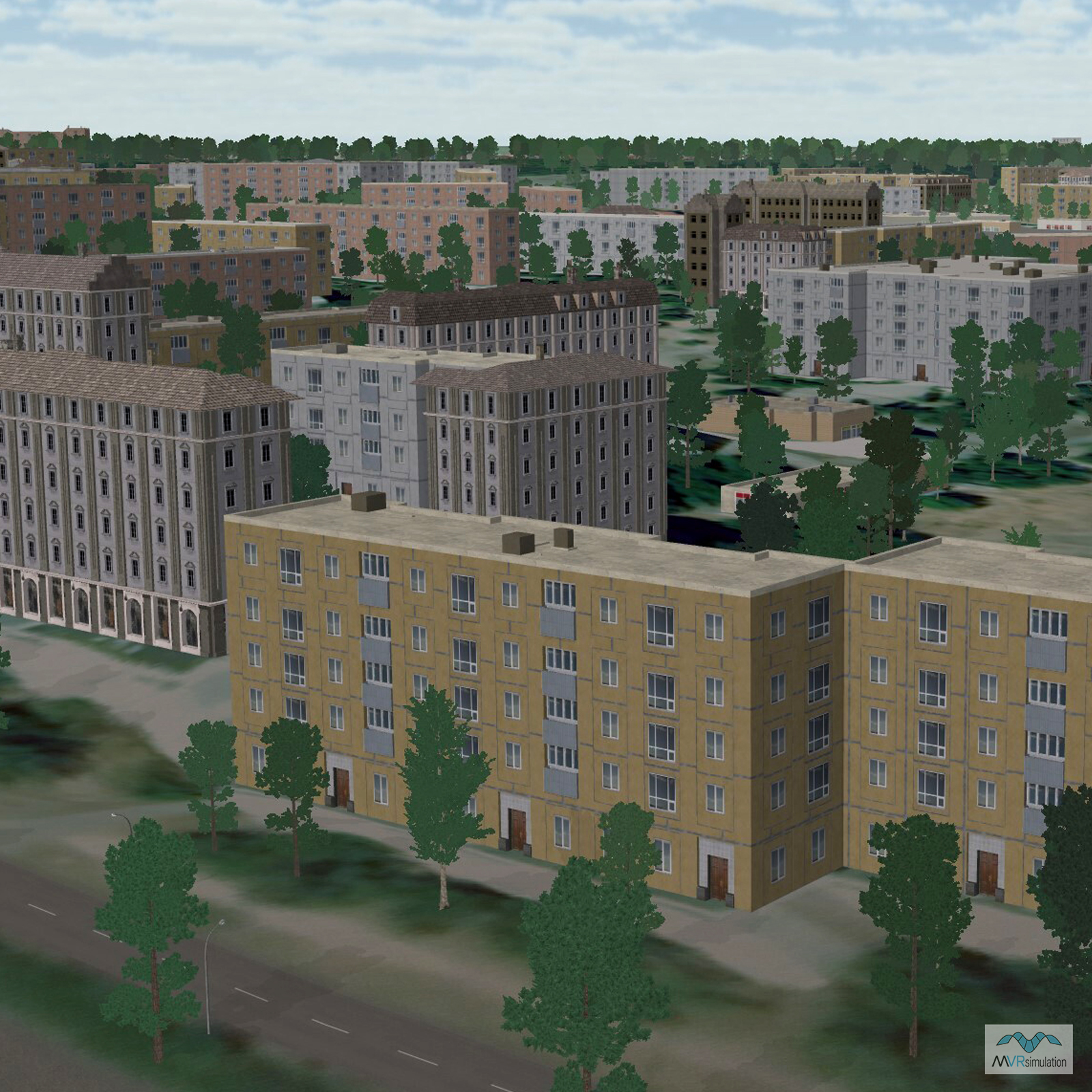
MVRsimulation VRSG real-time scene featuring the 3D virtual terrain of Riga, Latvia.

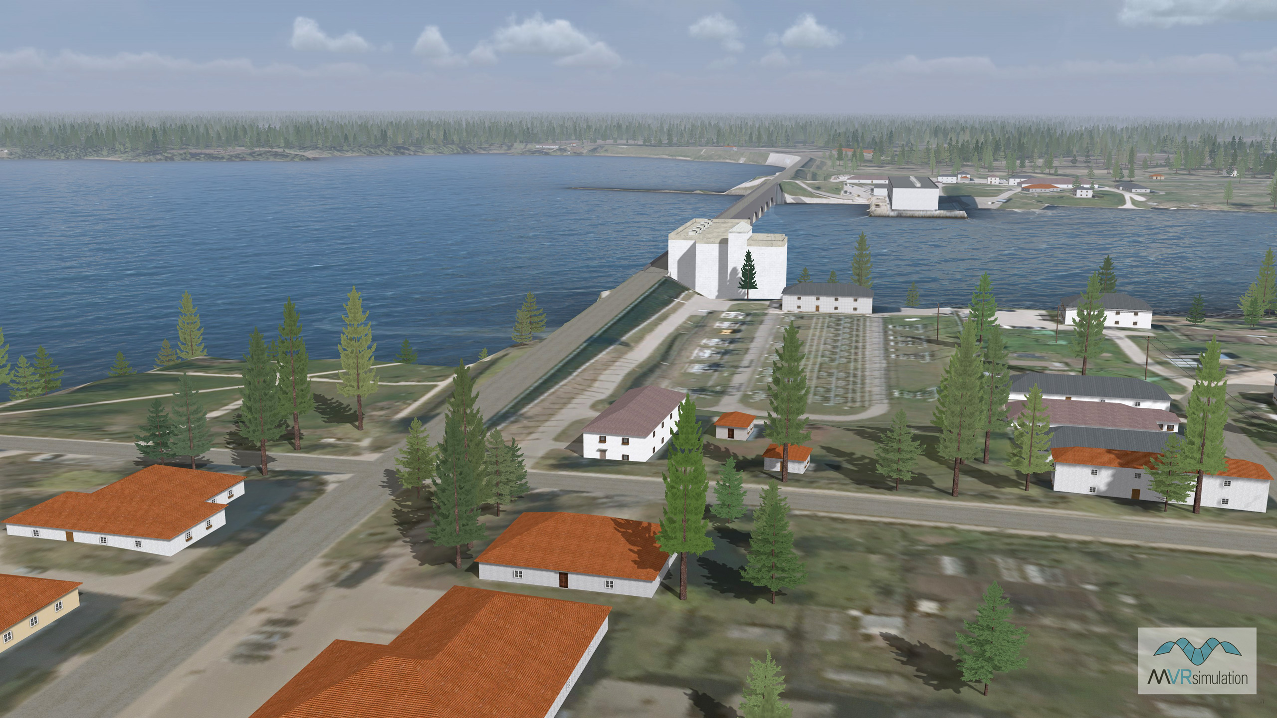
MVRsimulation VRSG real-time scene of the 3D virtual terrain of Keguma, Latvia, featuring a model of the city’s hydroelectric power station geolocated on the Daugava River.

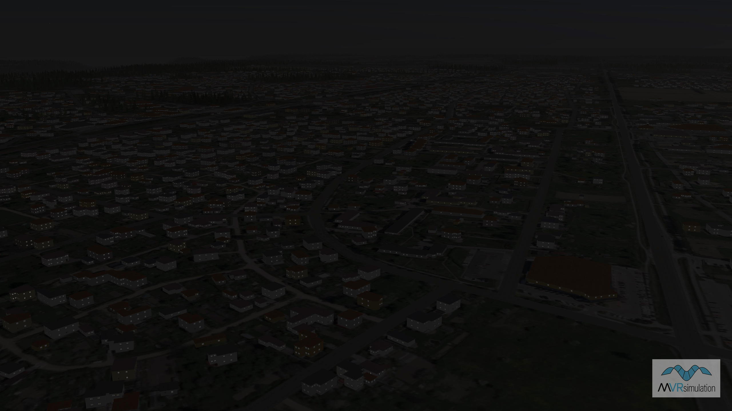
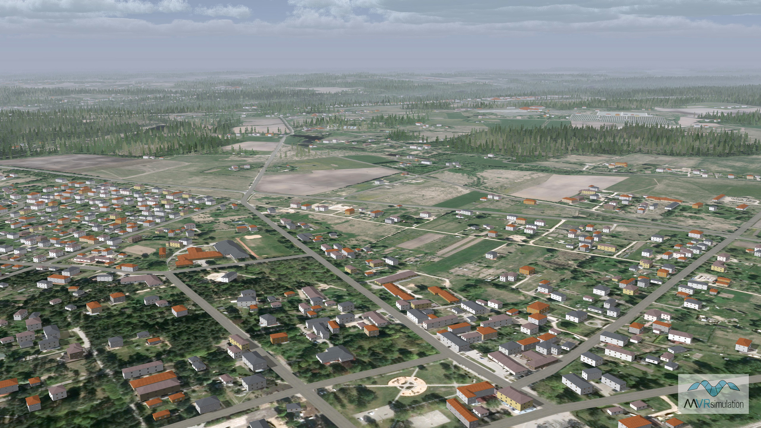
MVRsimulation VRSG real-time night scene featuring the 3D virtual terrain of Segulda, Latvia. For nighttime viewing, building models contain emissive light-map textures.

Related Terrain

EXTEND YOUR TERRAIN DATABASE

MVRsimulation Downloads Server

  • Explore and implement terrain updates
  • Download and use new 3D models
  • Stay up-to-date with VRSG features
  • Discover utilies for expanding VRSG
    Filler for Spacing

Request Account

MVRsimulation Regional Terrain Drives

  • External hard drive - regional terrian
  • Network attached storage device - whole-world terrain
  • Ready for plug and play
  • Available to customers on active maintenance
    Filler for Spacing

Request Drive

MVRsimulation Produced Custom Terrain

  • Custom terrain created by MVRsimulation's terrain team
  • Specify your desired area of interest
  • Indentify needed terrain features.
  • Use your own or commercially available imagery
    Filler for Spacing

Request Quote

Create Terrain with Terrain Tools

  • Build real-time 3D terrain for VRSG using GIS technology with ArcGIS Pro
  • Designed to be user-friendly for users with basic ArcGIS knowledge
  • Use imagery, elevation, and optional vector data to create terrain
  • Compile buildings from 2D polygon footprint features using a CityEngine rule package
    Filler for Spacing

Terrain Tools