MVRsimulation News Issue 70
FPV UAV Simulator: Capability Updates
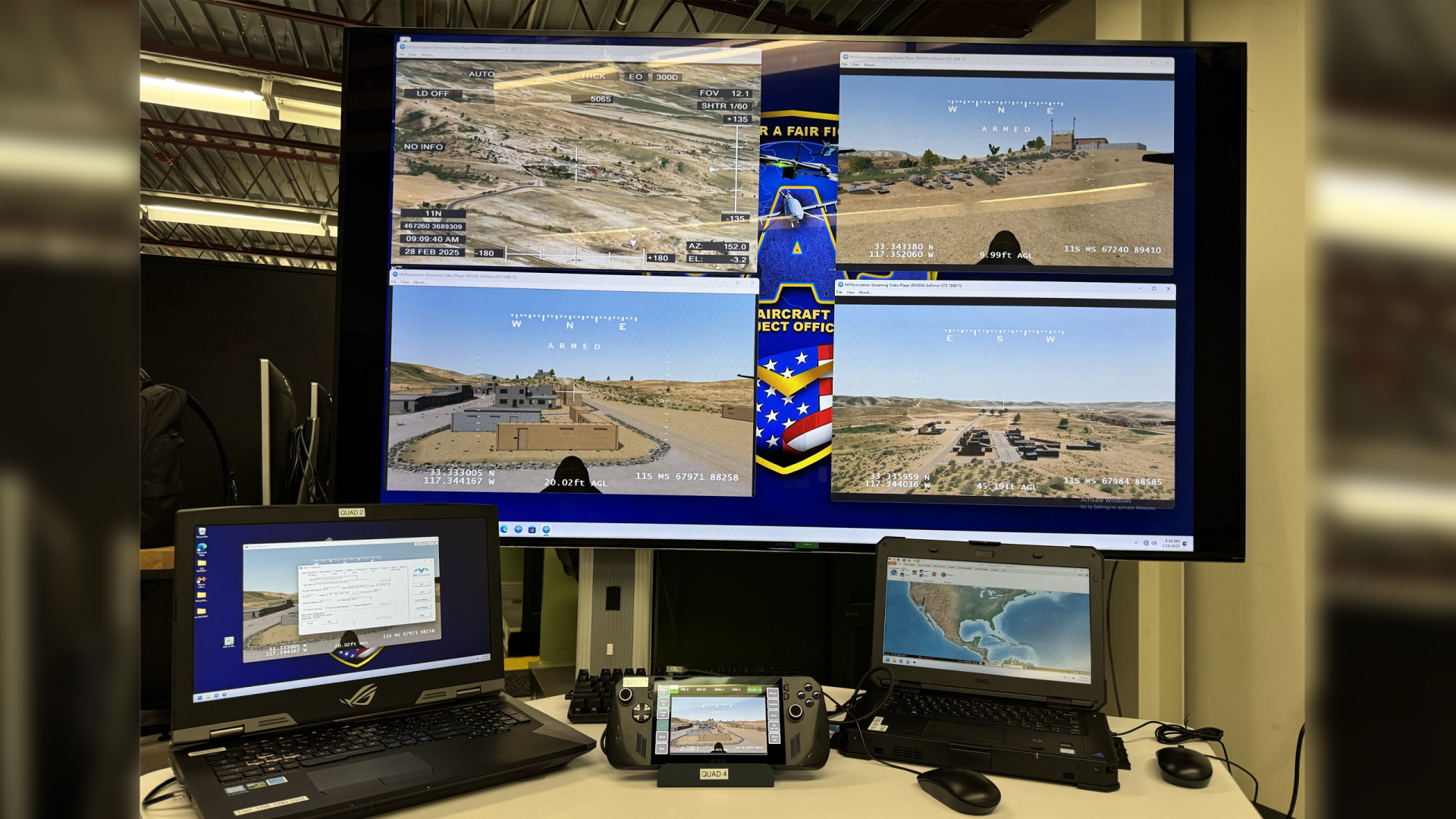
Since launching the FPV UAV Simulator at the end of 2024, we have continued to expand the system's capabilities in line with feedback from the simulator's first customer, the U.S. Army Joint Services Integration Lab (JSIL), which ordered six systems in January 2025.
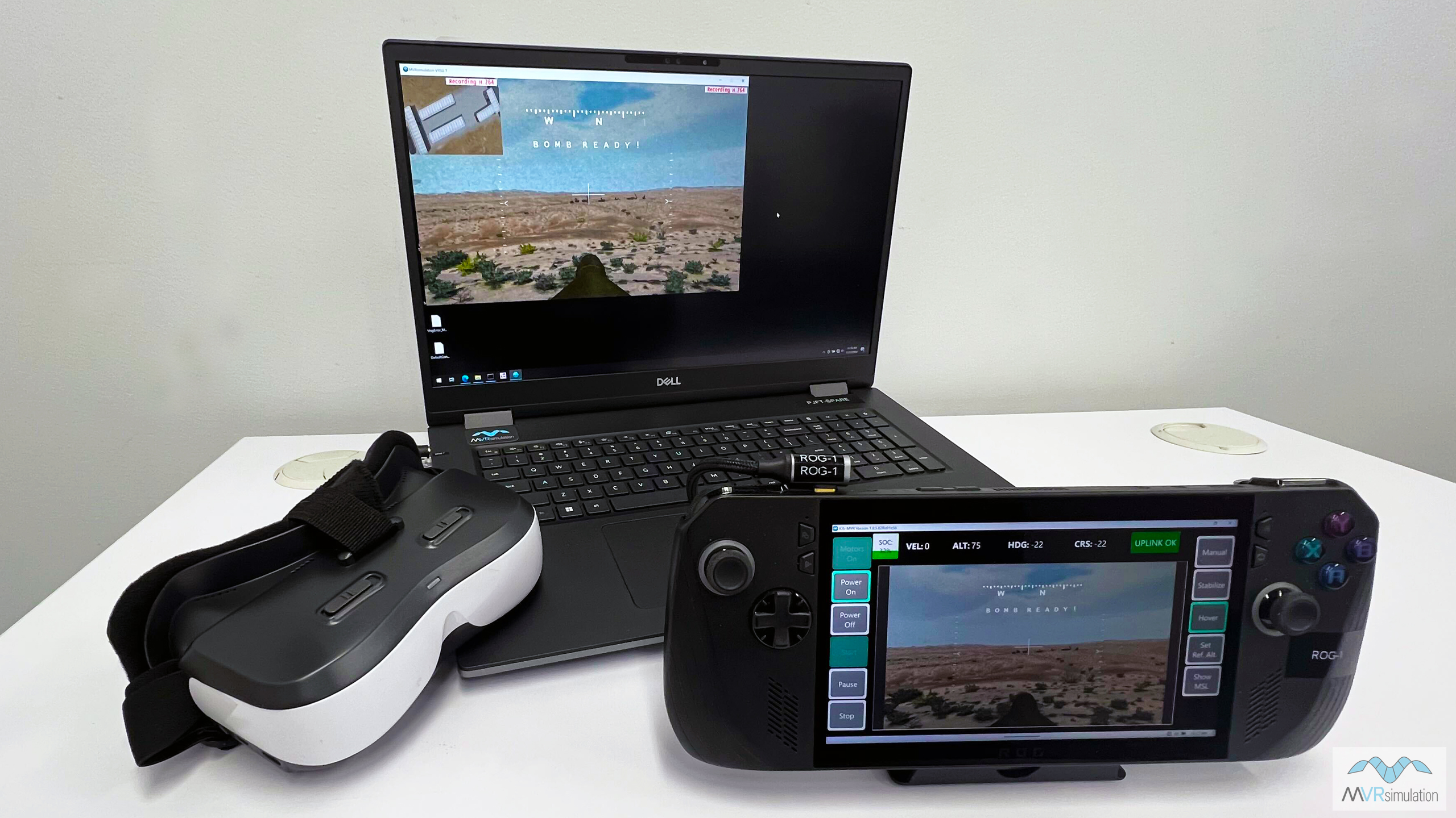
Designed to provide a highly-realistic training solution for the operation of racing-style quadcopter sUAS on the contested battlefield, the internally-developed FPV UAV Simulator combines MVRsimulation’s VRSG with a reconfigurable high-fidelity flight model from Bihrle Applied Research, to replicate the tactile, visual and cognitive demands of operating agile UAVs in combat to successfully defeat enemy targets.
The FPV UAV Simulator can be used as an ultra-low footprint stand-alone training device for tactical operations, or networked with other fielded air and ground simulators that operate on the VRSG infrastructure, enabling Large Scale Combat Operations (LSCO) training exercises.
What's new?
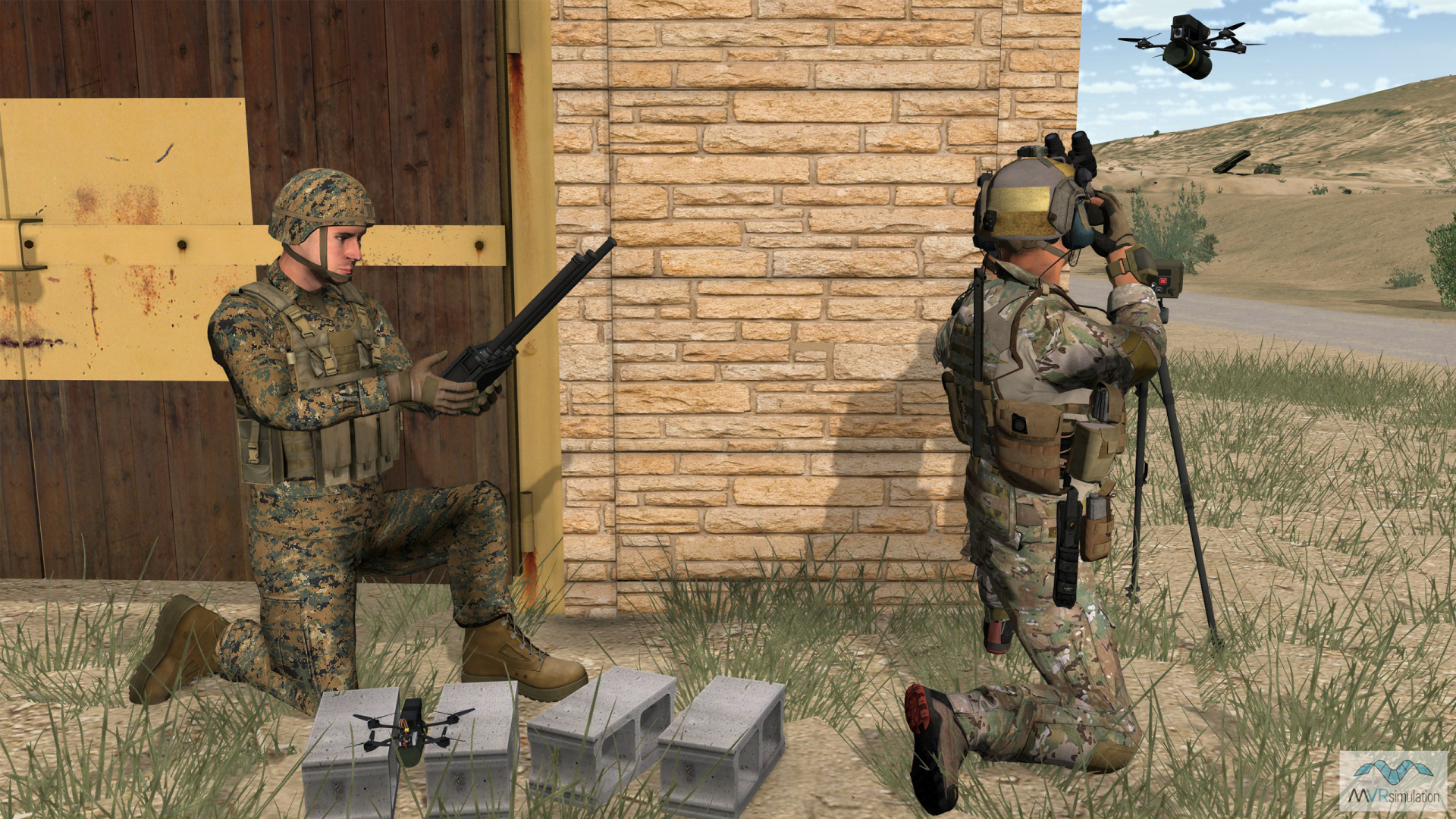
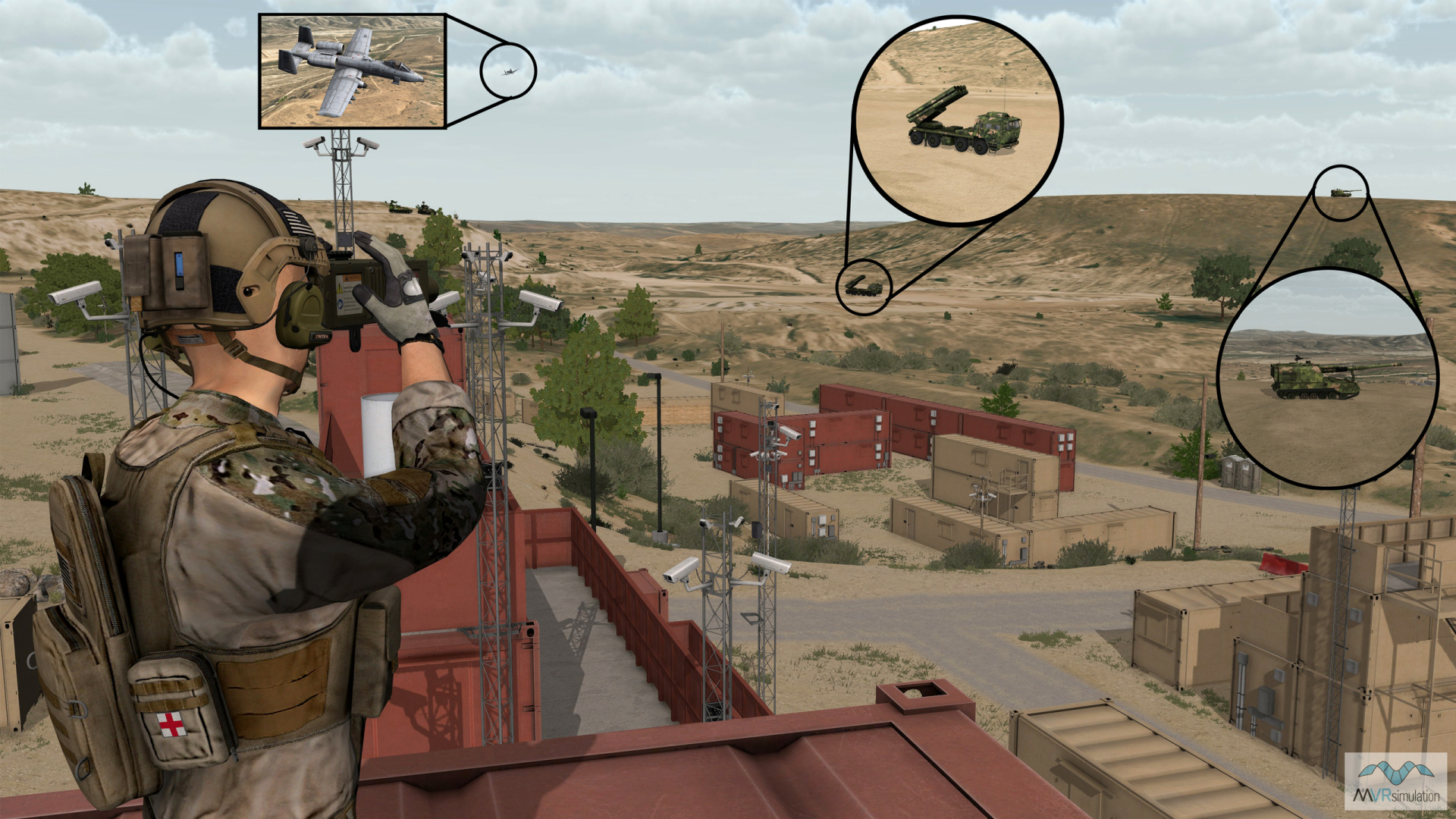
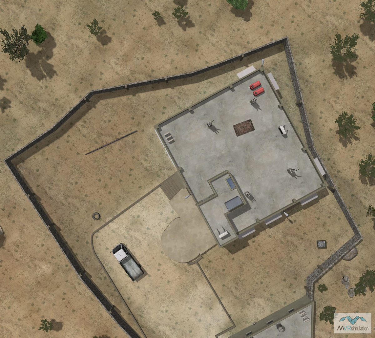
- Tactical ISR: Train to carry out ISR using flight model configured as RQ-28A quadcopter drone with user-controllable pan-tilt-zoom (PTZ) camera, including the ability to land/power-down for perch-and-stare on rooftops
- Inside/outside missions: Train to carry out ISR inside and outside buildings, maneuvering drone flight model through doorways and windows
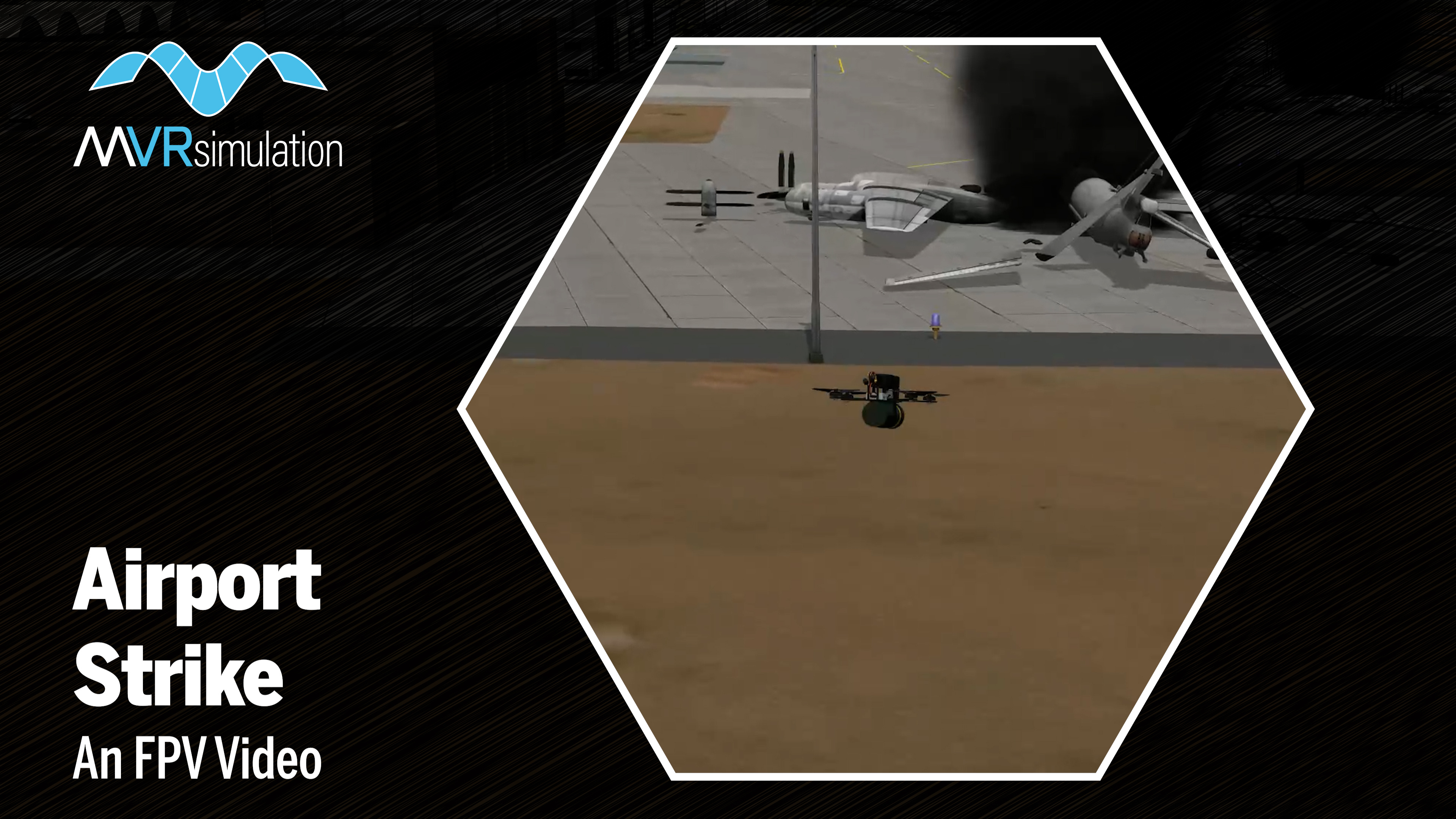
- Door breaching: Train to deliver munitions to strike targets in the battlefield, including door breaching operations
- Field-deployable drone operator console: Train on the simulator using an integrated custom-built Durabook Americas MIL-STD controller, then transition to real-world drone flight operations using the same controller
- Drone swarm operations: Control an sUAS swarm offensive attack integrating multiple FPV UAV operators carrying out strikes against multiple virtual targets in a single networked mission
- Counter-drone tactics: Train in techniques to achieve FPV UAV missions in denied or hostile Electronic Warfare environments
- Scalable combat management: Network in battlefield controllers and JTACs using the Deployable Joint Fires Trainer (DJFT) to coordinate and oversee missions in real-time as they are undertaken by a single or multiple FPV UAV Simulator operator(s)
- Smoke screen: Simulate sUAS-deployed smoke screens to obscure enemy observation of sensitive friendly assets in the battlefield, including the location of Combat Controllers and JTACs
- Train in emerging tactics: Conduct collective mission planning and rehearsal of agile sUAS swarms against 3D model targets that accurately reflect currently-deployed military platforms. See a recent example of how the FPV UAV Simulator and VRSG support emerging tactics training that mirror real-world events in the video below.
Introducing: VRSG Raytracing Terrain Shadows
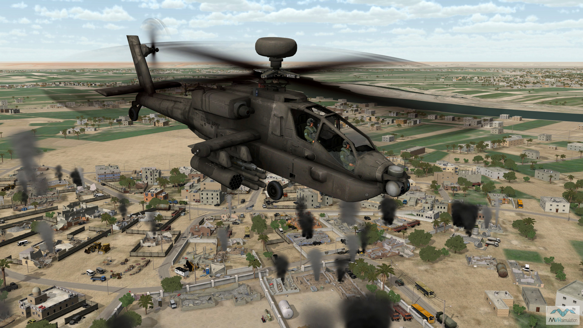
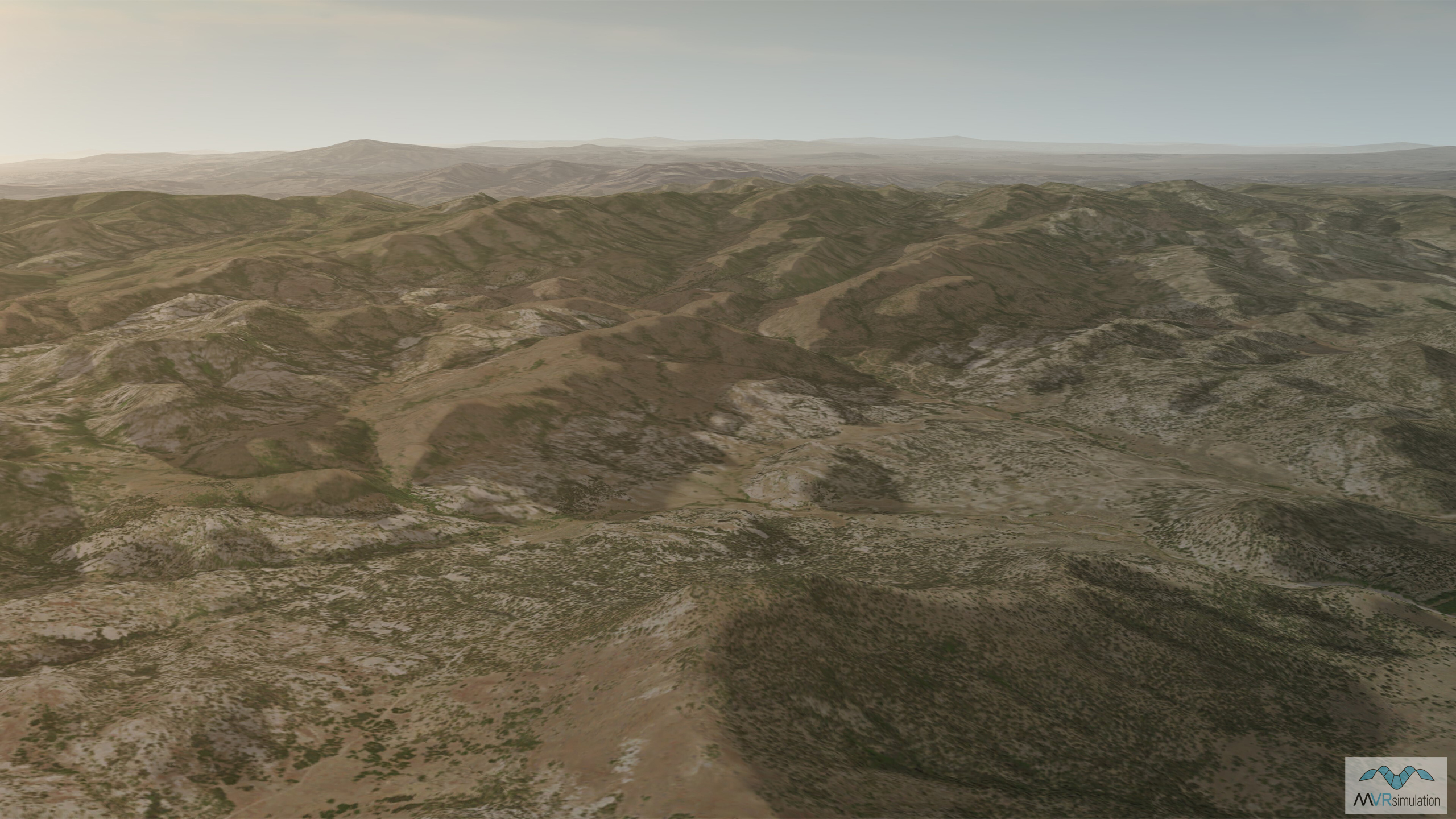
This spring we introduced a new shadow feature for VRSG that uses hardware-based raytracing to allow terrain to cast shadows. Allowing terrain features to cast shadows onto culture as well as other terrain significantly enhances the visual realism of training scenarios. This is particularly important when training scenarios take place at sunrise or sunset, when the sun is at a low elevation and terrain shadows are most prominent.
VRSG’s terrain shadows harness the vast power of massively parallel raytracing cores available on modern GPU hardware. VRSG traces millions of rays - one from each pixel on screen - toward the sun. If a ray intersects terrain before reaching the sun, VRSG will darken the pixel at the ray’s origin, resulting in the shadow effect. When all rays work in parallel, this yields large, consistent, and accurate shadows on hillsides and in valleys.
As for performance, the raycasting hardware that produces VRSG’s raytraced terrain shadows operates in parallel to the hardware supporting the more traditional rasterization techniques. As a result, the powerful new terrain shadow capability has only minimal impact on overall performance while improving visual fidelity.
Recent Sales
Joint Services Integration Lab
In January, the U.S. Army's Joint Services Integration Lab (JSIL) purchased six First Person View (FPV) UAV Simulators and VRSG software licenses for integration into its Reconfigurable Academics Aviation Digital (RAAD) training environment.
US Air Force JTC TRS
VRSG software maintenance renewals received for more than 480 VRSG licenses for the JTC TRS program, ensuring continued training with VRSG’s geospecific high-resolution terrain, real-time models and culture for this critical JTAC training program.
Air National Guard F-16 MTTs
Two new 15x channel Air National Guard F-16 Mission Tactics Trainer (MTT) simulators equipped with VRSG have been delivered to Andrews Air Force Base, MD. In total, more than 300 VRSG licenses are now in use across the ANG’s F-16 MTT program.
U.S. Army IEWTPT program
79x VRSG licenses renewed, five new licenses purchased, and a Terrain Tools license renewed in support of the U.S. Army’s Intelligence and Electronic Warfare Tactical Proficiency Trainer (IEWTPT) program for training military intelligence analysts.
New & Updated Terrain
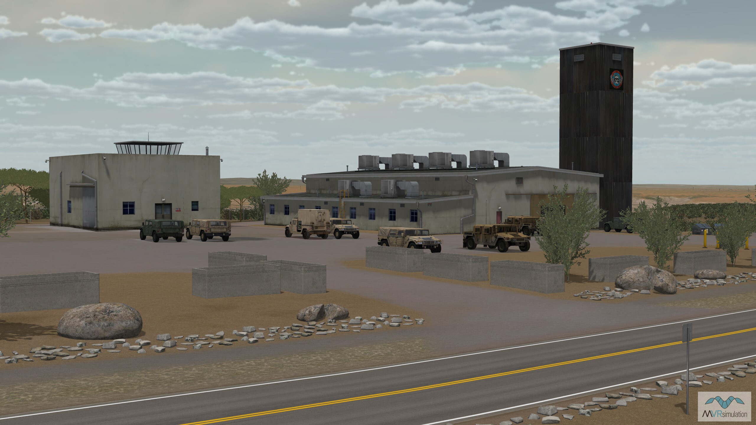
Fort Huachuca & Sierra Vista
VRSG's new Fort Huachuca terrain dataset includes detailed 3D model of Fort Huachuca, Sierra Vista Airport/Libby Army Airfield (KFHU), the U.S. Army's Black Tower UAS operations site, and surrounding area of Sierra Vista, Arizona.
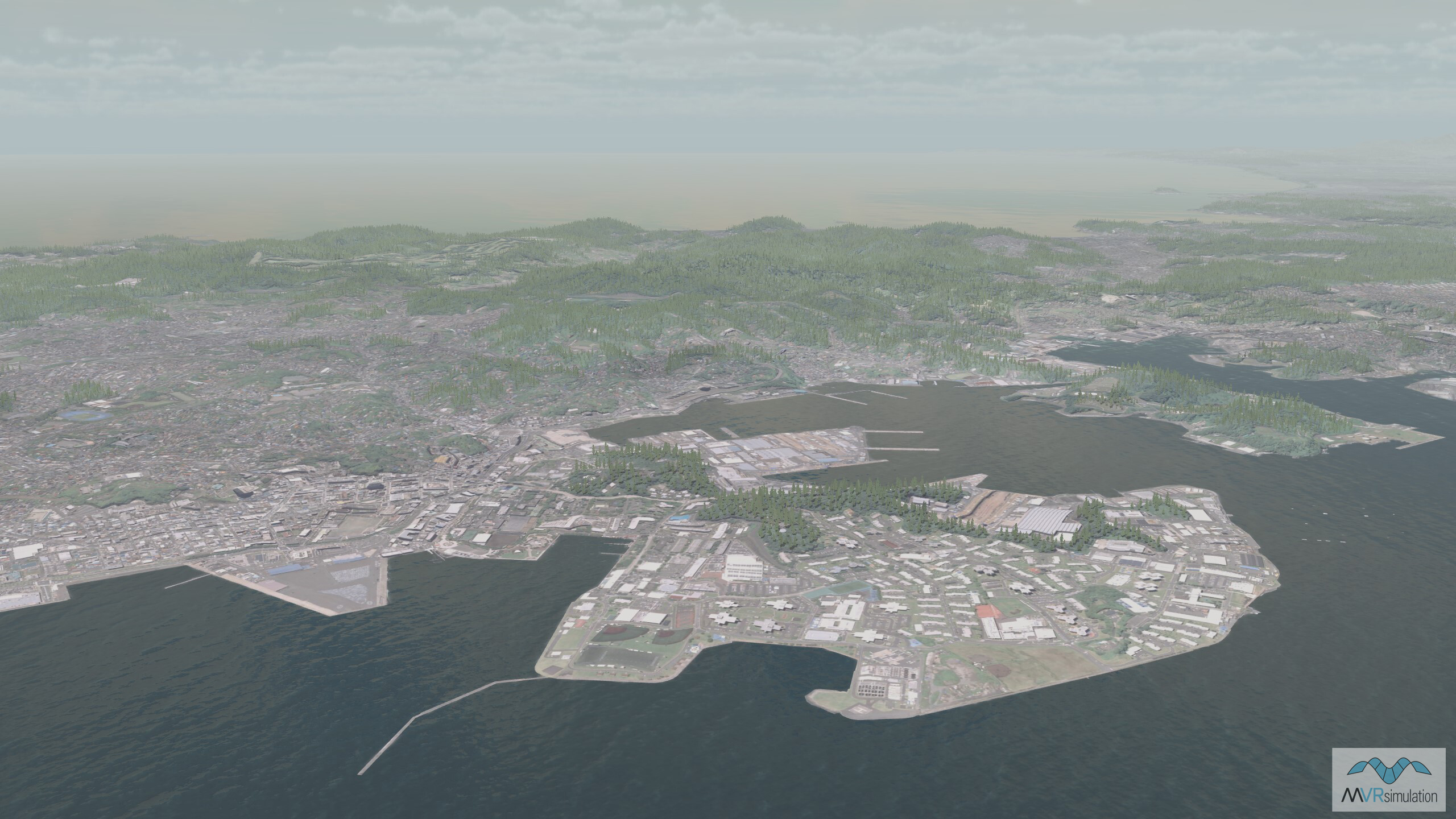
Japan terrain updated
VRSG's Japan terrain has been rebuilt with 1-meter imagery (provided by the Geospatial Information Authority of Japan) blended with 30-meter elevation data, to support VRSG users’ evolving training requirements in the region.
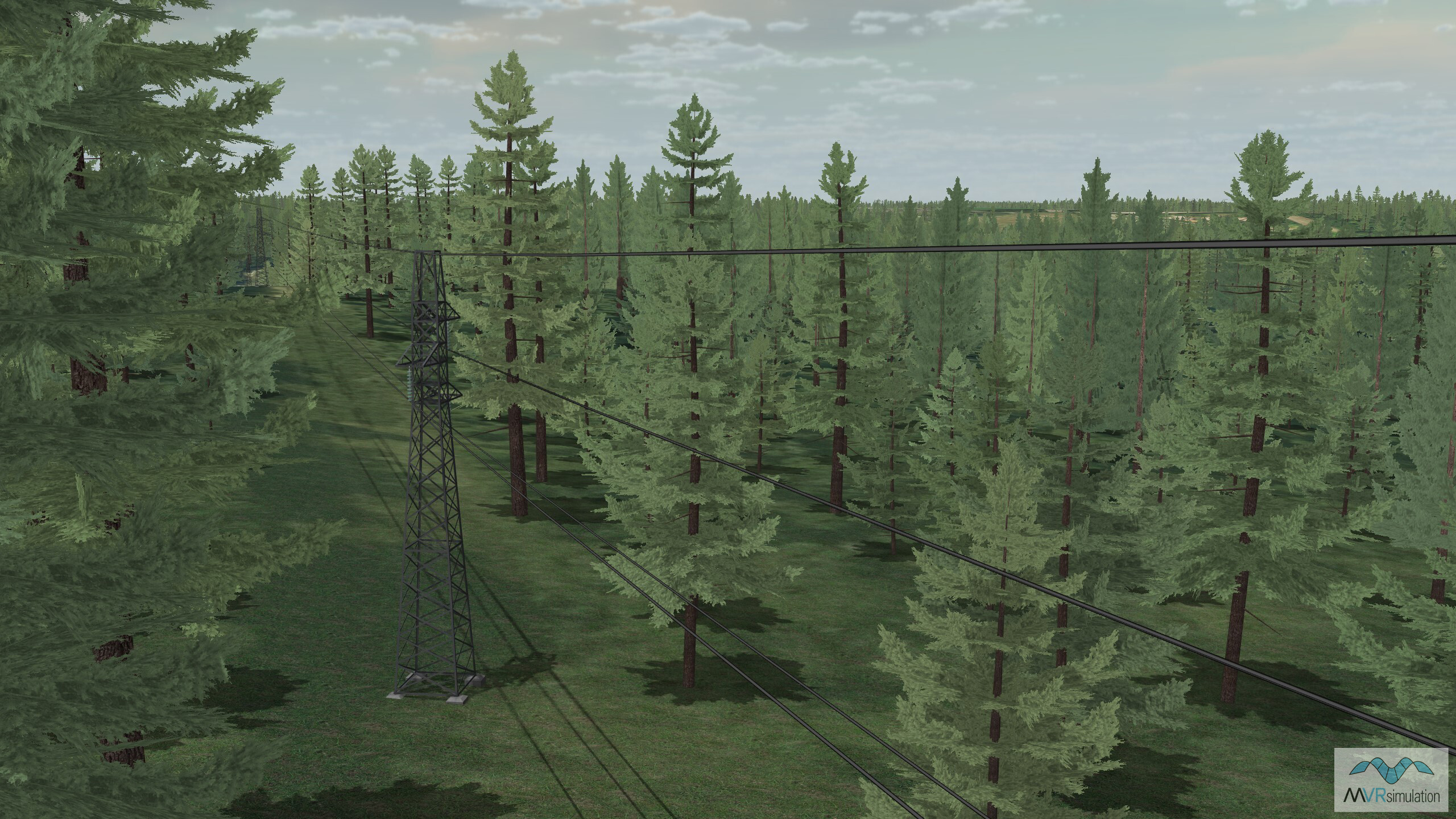
Fort Rucker Cairns Airfield (KOZR)
VRSG's 1 meter per-pixel Fort Rucker Cairns Airfield (KOZR) dataset has been enhanced to include geolocated 3D powerline models surrounding Fort Rucker airport, and to increase texture resolution of the airfield.
Let's Talk!
We are changing the way we communicate with our users.
We have recently introduced a new monthly Models newsletter, which will be sent out to all VRSG users with active downloads accounts, to share the newest 3D models that have been added to the library each month. We work hard to keep our 3D model library updated with the latest military equipment fielded worldwide so that our users can train with relevant, accurate 3D entities in their VRSG scenarios. You can also complete a download account request form for assistance on accessing new and updated VRSG content, if you don't already have one.
We will also be sending email communications that are more targeted to those who need them, on the topics of terrain, and new simulator features updates. To manage which communications you receive, please visit the Newsletter Subscription Preferences page to opt in or out of the newsletters you would like to receive. This will ensure you receive the most relevant information and enable your organization to leverage our latest developments as they become available.
As always, we welcome your feedback and requests for new VRSG terrain and models, and have recently updated our online meeting software to enhance our virtual demo experience - so you can experience our sims and tech wherever in the world you are located. For those a little more local, we can load our simulators into our Mobile Classroom Trailer and bring them to your facility to allow your whole team to get hands-on with the tech.
The easiest way to keep up with our latest developments on all topics is by following our company LinkedIn page.
For demonstrations of our VRSG or Terrain Tools software, extensive 3D model library, new VRSG terrain, or one of our simulators, please email us at demos@mvrsimulation.com. To discuss your terrain requirements, just email us at terrain@mvrsimulation.com; and for anything else please get in touch at sales@mvrsimulation.com.