
MVRsimulation News Issue 68
Introducing the Portable Joint Fires Trainer:
Taking JTAC training to the tactical edge
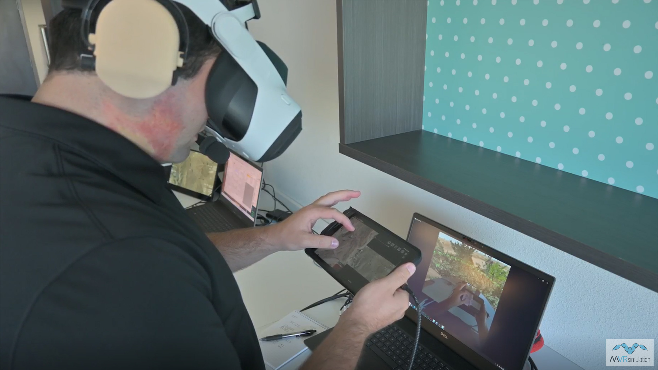
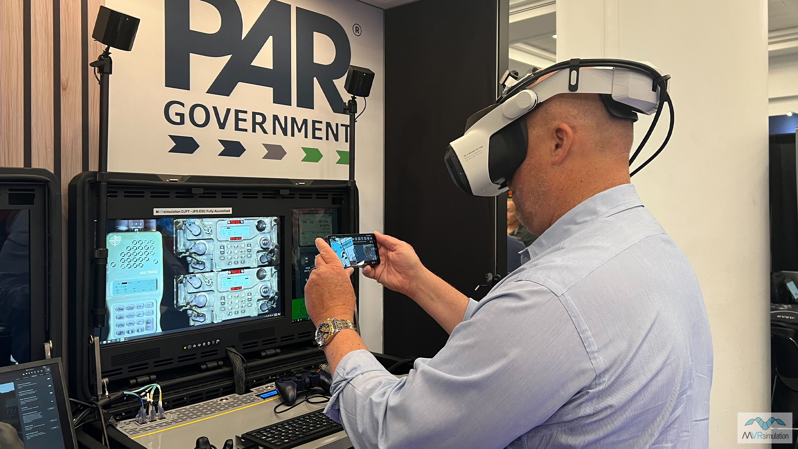
MVRsimulation extends mixed-reality Joint Fires training to the tactical edge with the introduction of the new Portable Joint Fires Trainer (PJFT).
The internally-developed PJFT allows users to train at the point of need using real-world Android Team Awareness Kit (ATAK) end user devices, MVRsimulation’s Virtual Reality Scene Generator (VRSG), Battlespace Simulation’s MACE, and the Varjo XR-4 mixed-reality headset.
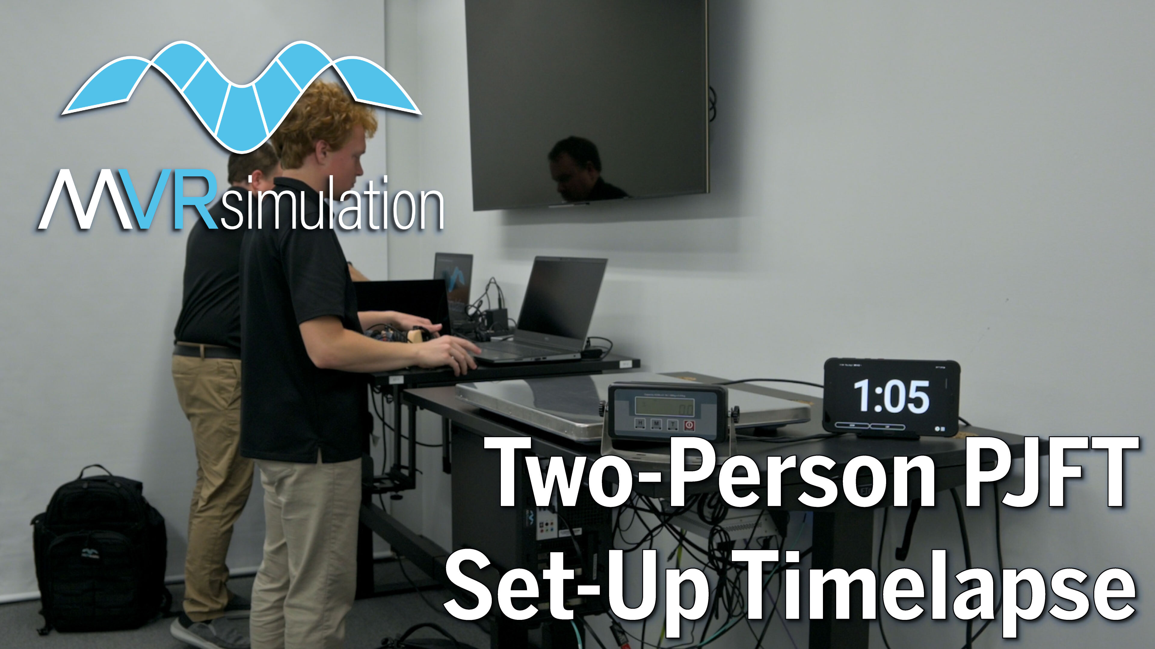
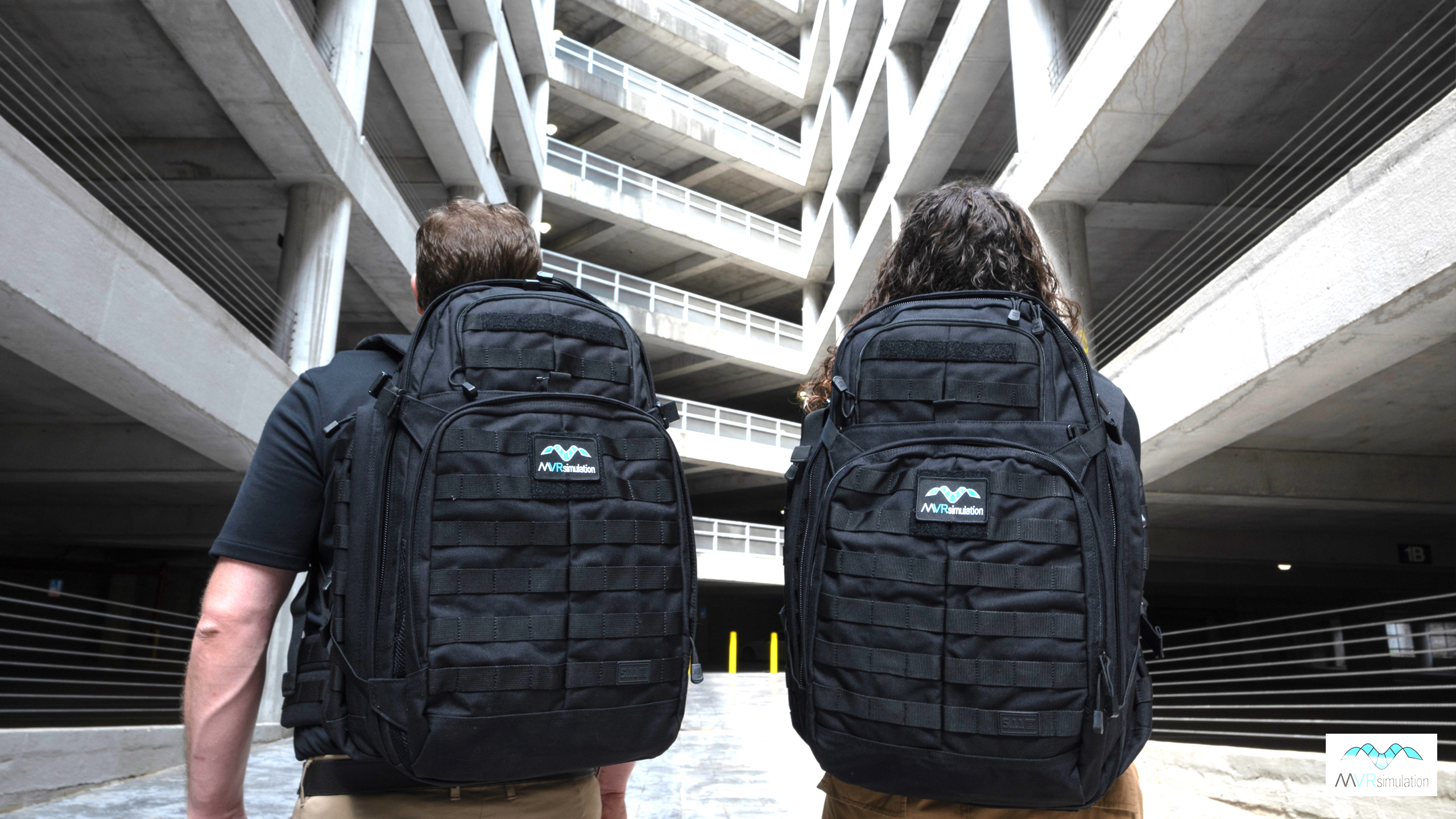
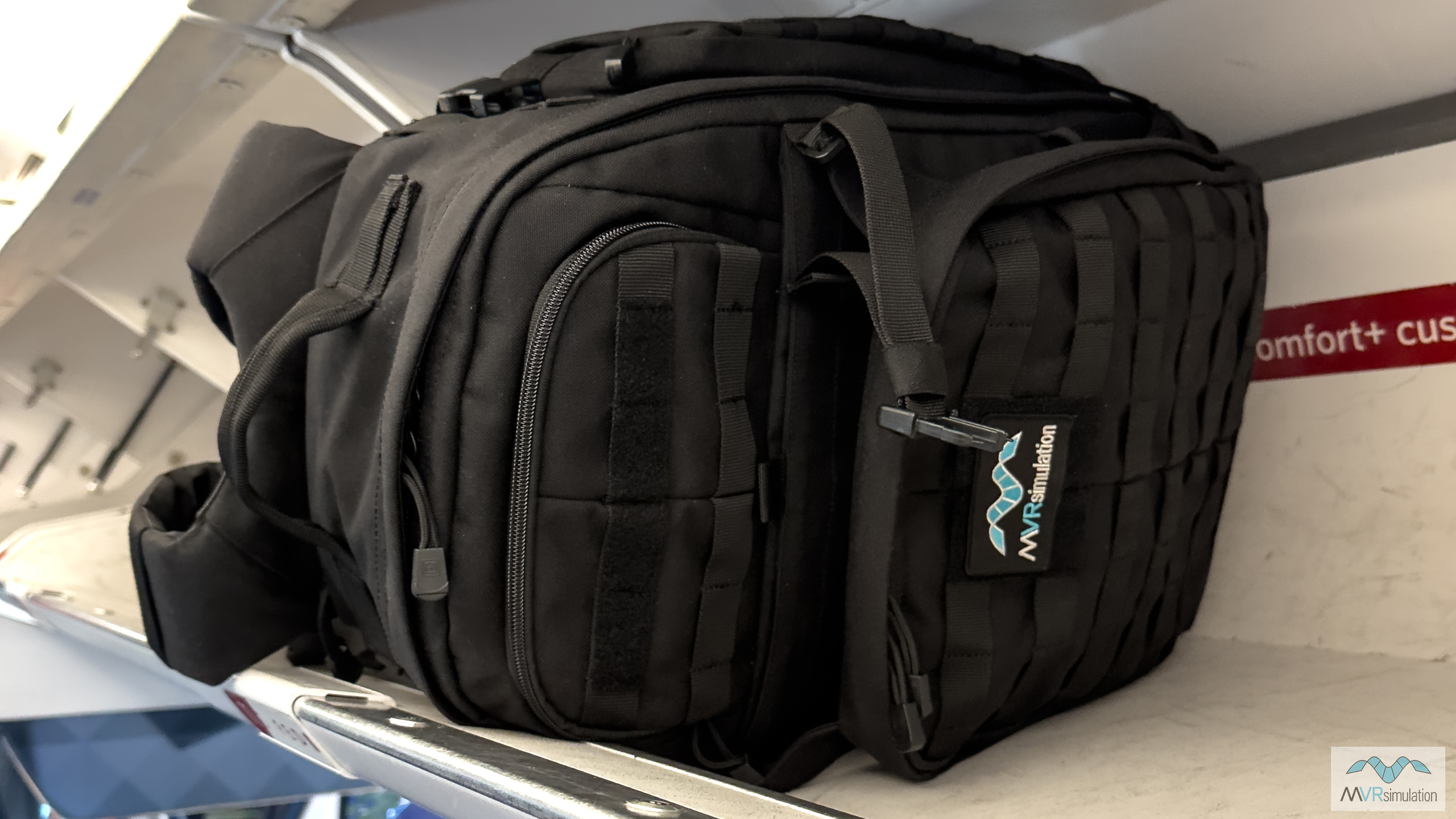
A complete PJFT system consists of two portable training stations, each fully contained in a commercial airline carry-on backpack and weighing less than 50 lbs combined: one Instructor Operator Station (IOS) and one JTAC Backpack (OBS).
The PJFT includes all software and simulated devices to complete Type 1, 2, and 3 Terminal Attack Control (TAC), Bomb on Coordinate (BOC), Fixed-Wing (FW), Rotary-Wing (RW), Remote Observer (RO), Video Down-Link (VDL), Suppression of Enemy Air Defenses (SEAD), Urban, Forward Air Controller (Airborne) (FAC (A)), Night, IR, and Laser controls.
The PJFT provides full spectrum mission training either as a stand-alone capability, or as a portable component of the fully-accredited Deployable Joint Fires Trainer (DJFT). Systems can also be configured with multiple IOS or JTAC backpacks to match specific training goals.
This expanded JTAC training ecosystem allows units to run the DJFT and PJFT at deployed locations and take the PJFT while on temporary duty assignment (TDY) training exercises. Training scenarios can be replicated between the DJFT and PJFT. Missions run on the PJFT can be assessed for after action review on the DJFT, giving a fully flexible training capability wherever and whenever required. Additionally, the PJFT can be added to the DJFT to support additional role players for training efforts where more participants are desired.
The entire PJFT system can be up and running training scenarios in under five minutes from system boot-up.
The PJFT is also directly interoperable with the current U.S. Air Force JTAC training program of record system, the Joint Terminal Control Training and Rehearsal System (JTC TRS). This includes the ability to re-use existing missions, scenarios, content, and terrain currently provided by VRSG and MACE.
Experience the PJFT for yourself!
Our team is attending the Joint Close Air Support (JCAS) Curriculum Review in Virginia Beach, 17-19th September, 2024, where we will be running full demonstrations of the PJFT and DJFT throughout the event. Let us know you will be there and we will secure your demo time slot.
For those not attending the conference, we can arrange an in-person demo at our site in Sudbury, MA; or a remote demonstration of any of our simulators. We can even arrange to bring our simulators to your site for a whole unit demo. To arrange any of these options, or discuss specific requirements, please email us at demos@mvrsimulation.com.
New VRSG terrain
The VRSG 3D terrain library has grown in recent months with a number of new high-resolution datasets now available to download in support of customer training requirements around the world:
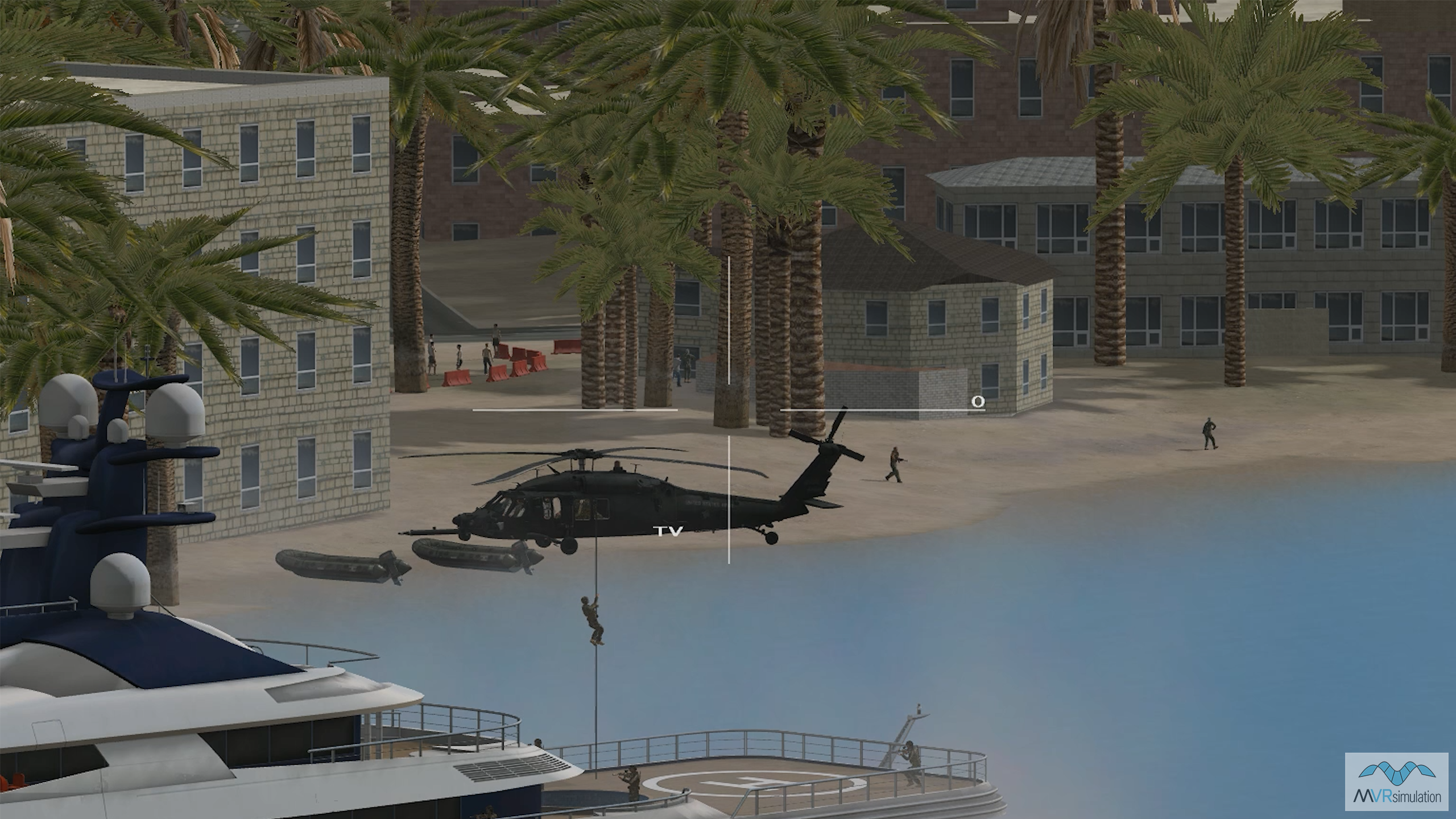
- Tampa Bay, Florida: Built to support a Special Forces Operations demonstration at SOF Week 2024, our virtual Tampa Bay showcases our ability to rapidly create medium fidelity terrain for mission rehearsal. The terrain was built using CyberCity 3D's high-resolution model, and textured using CityEngine. 3D city models were compiled into the existing VRSG Tampa terrain dataset, which is part of VRSG's Southeast CONUS NAIP terrain drive. This dataset includes 1-meter NAIP imagery and elevation data compiled from 10-meter NED, ensuring comprehensive coverage of the region.
- VRSG's Japan terrain has been expanded to include 3D terrain of the islands of Miyako and Ishigaki in Okinawa prefecture, built with 50cm Maxar imagery with 30 meter SRTM elevation data. The terrain includes a high-resolution geospecific model inset of Yashima Jinko Island, the Southern Gate Bridge, and a handmade geospecific inset of Ishigaki Port, more than 70 unique geospecific buildings, lighthouses, breakwaters, and yacht piers; and hundreds of boats, containers, vegetation, and poles.
- We've added two new airfield datasets to VRSG's CONUS-NAIP terrain drives: Holloman Air Force Base (KHMN) to the CONUS Southwest drive; and Mayport Naval Station (KNRB) to the CONUS Southeast drive. VRSG now includes more than 30 critical virtual North American airfields and airport datasets, all with 1 meter per-pixel (mpp) or better resolution - some as high as 0.15 mpp.
Don't forget: our 3D artists build new terrain and models continuously, and as soon as new terrain and models are added to the VRSG library, they can be downloaded and used at no charge by users on active software maintenance. Please get in touch with our team if you would like to discuss your terrain and 3D model requirements - just send us an email at support@mvrsimulation.com.
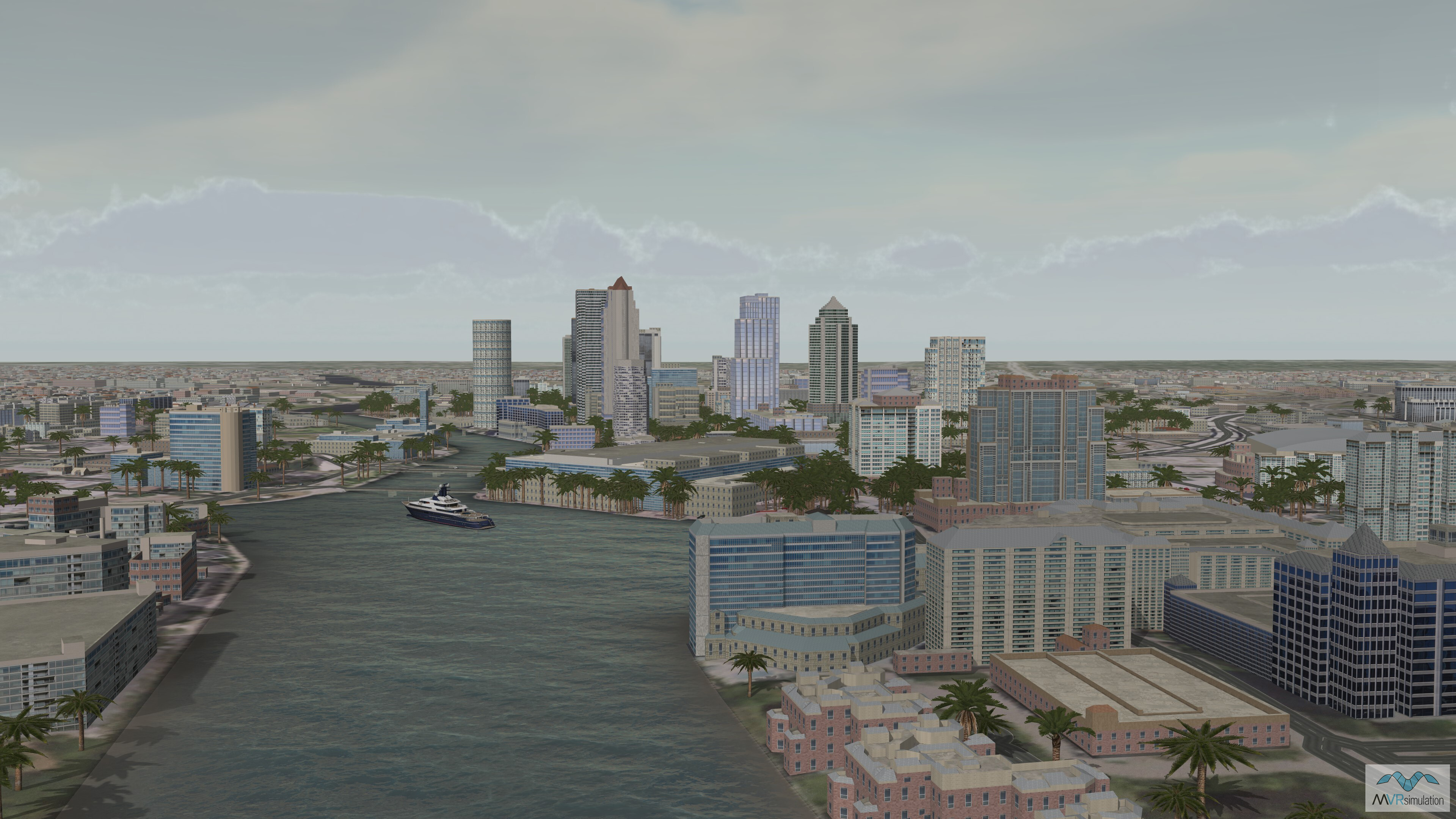
Tampa Bay, downtown Tampa, Florida
Medium-res fast-build terrain for mission rehearsal: new Tampa Bay dataset includes geospecific models of downtown buildings, the Tampa Bay shoreline, and the yacht permanently moored in the bay.
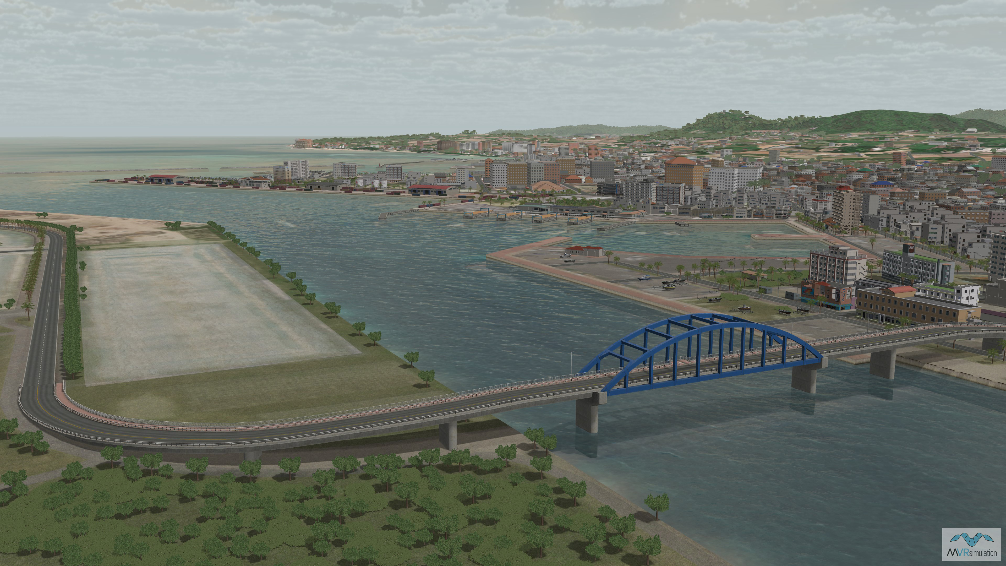
Miyako & Ishigaki Islands, Japan
New 3D dataset of the islands of Miyako and Ishigaki in Okinawa prefecture recently added to VRSG's Japan terrain, built with 50cm Maxar imagery with 30 meter SRTM elevation data.
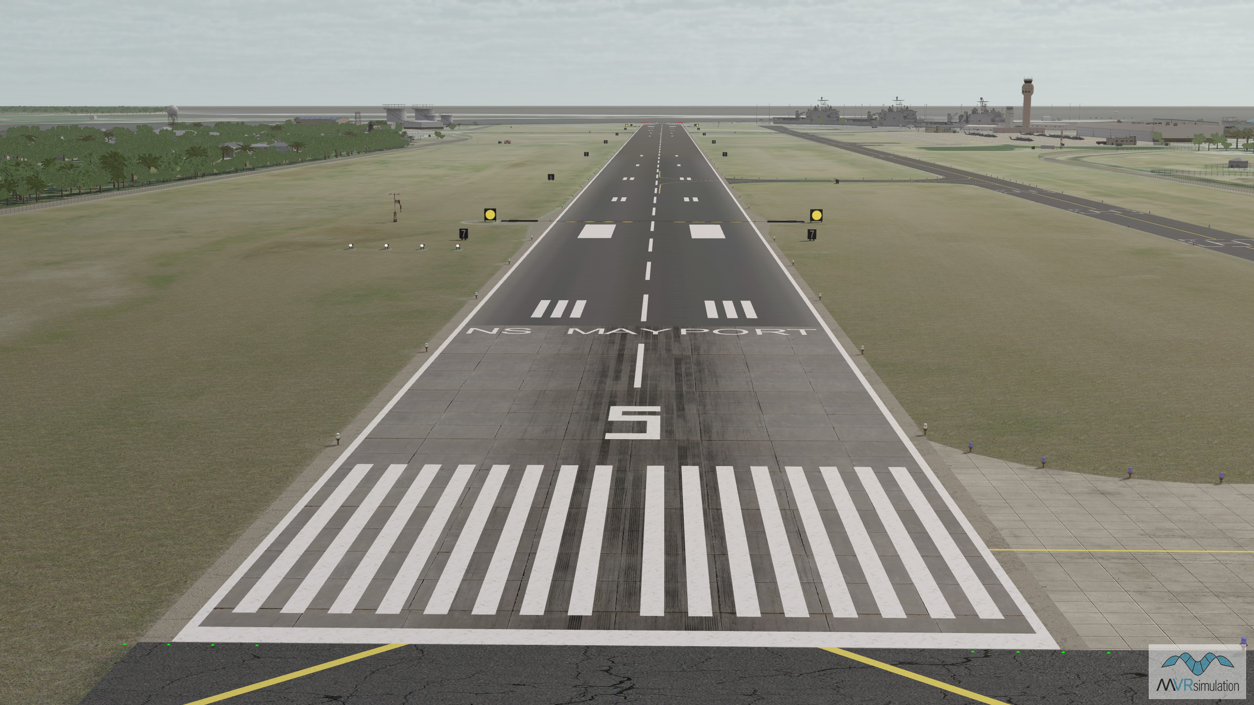
Mayport Naval Station (KNRB)
High-res 30 cm imagery of Mayport Naval Station (KNRB), seamlessly blended with 1-meter resolution NAIP imagery for the surrounding areas, added to VRSG's CONUS Southeast terrain drive.
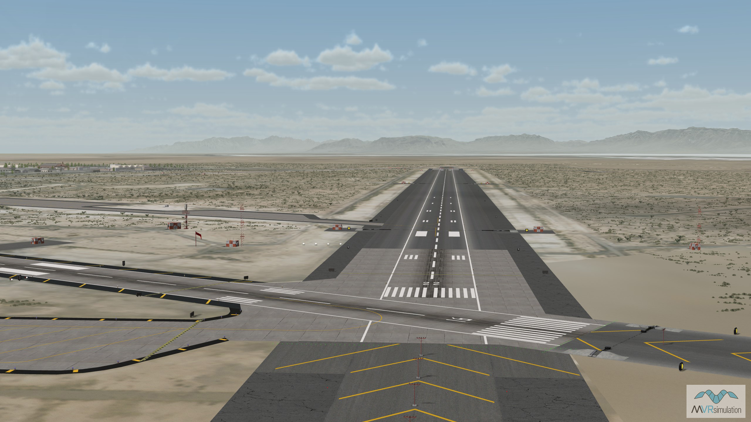
Holloman Air Force Base (KHMN)
New 30 cm imagery of Holloman Air Force Base (KHMN), seamlessly blended with 1-meter resolution NAIP imagery for the surrounding areas, now part of VRSG's CONUS Southwest terrain drive.
VRSG sales
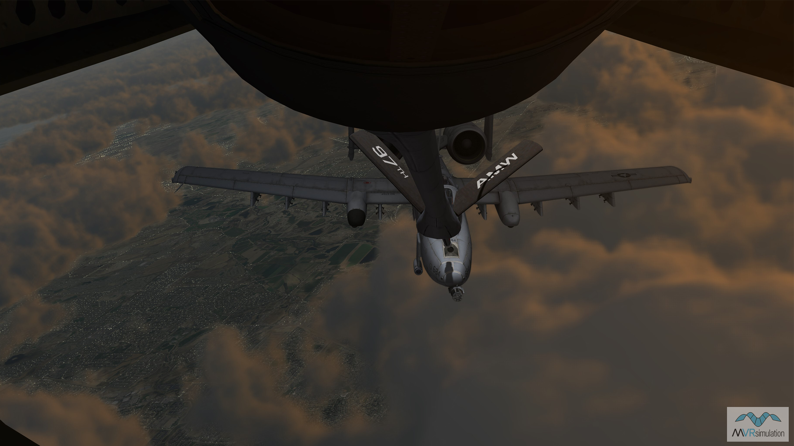
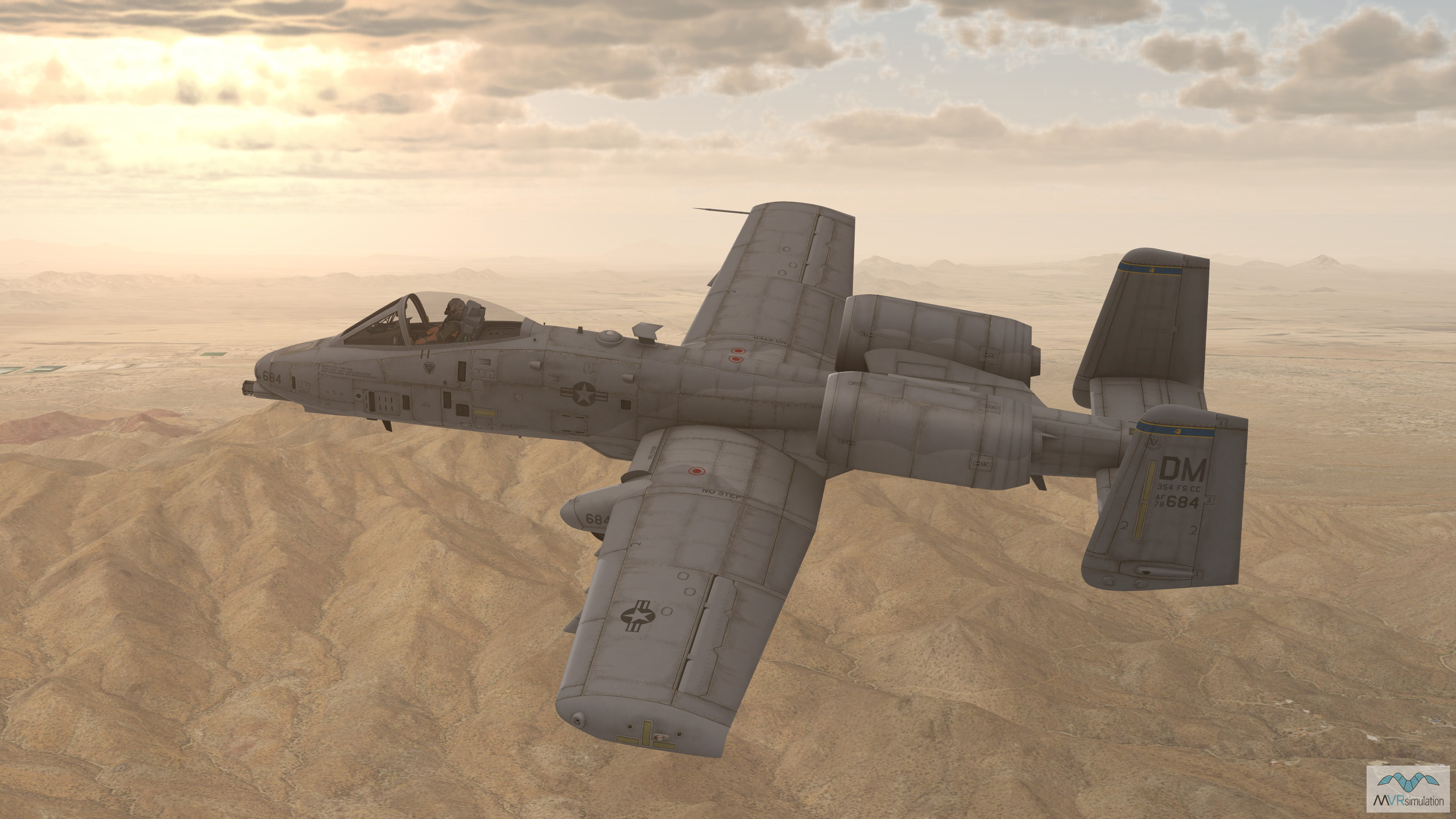
We have received notable sales in the first half of 2024 for VRSG software licenses, both new purchases and renewals, for multiple long-running programs including the U.S. Air Force's Joint Terminal Control Training and Rehearsal System (JTC TRS) and A-10 Full Mission Trainer programs, and the Air National Guard's Boom Operating Simulator System (BOSS) for KC-135R aerial refueling training.
ANG BOSS aerial refueling trainer
The U.S. Air National Guard renewed software maintenance for 88 VRSG licenses in support of its Boom Operating Simulator System (BOSS) for KC-135R aerial refueling training.
U.S. Air Force A-10 Full Mission Trainer
The U.S. Air Force has renewed 387 VRSG licenses and five Terrain Tools licenses for continued use in the A-10 Full Mission Trainer (FMT), a program VRSG has supported since 2001.
U.S. Air Force JTC TRS progam
VRSG will continue supporting the U.S. Air Force JTC TRS program under orders for new and renewed VRSG software maintenance licenses totalling more than 480, received in May.
In other news...
Check out some of our other recent company developments, including work being carried out with industry partners, and an exciting new milestone for the VRSG 3D model library.
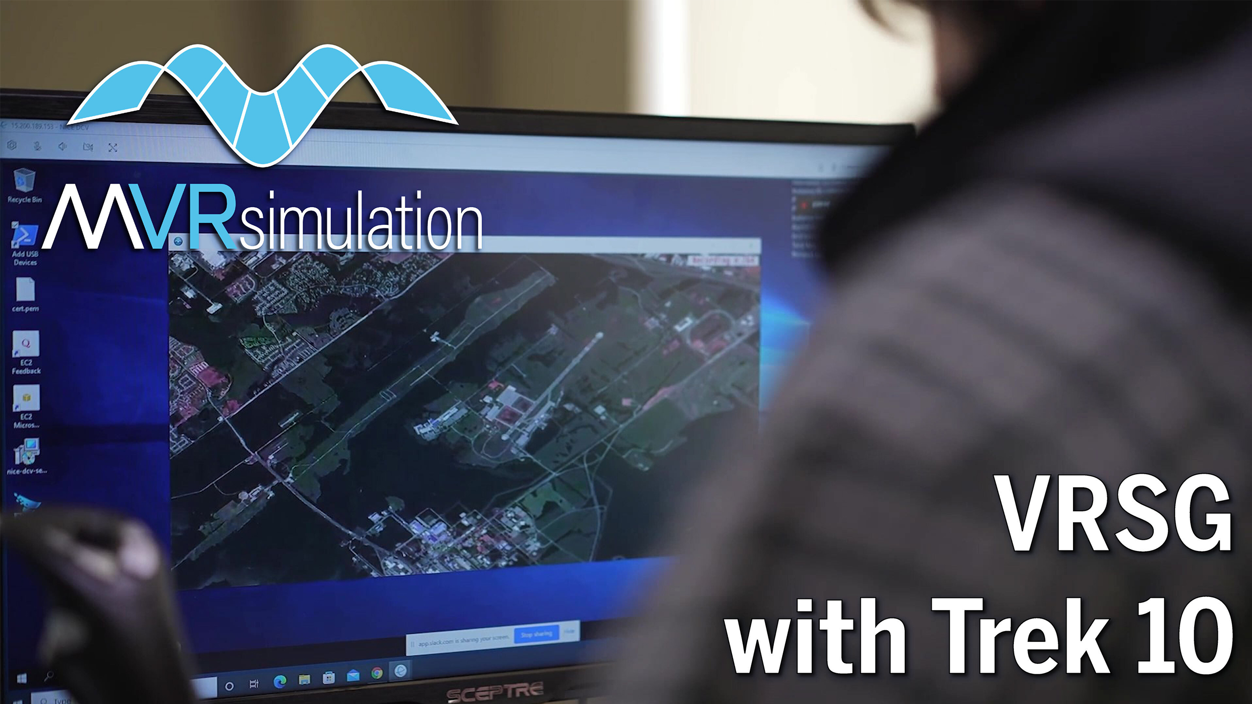
VRSG: Streaming 3D terrain as a service
Read more about how VRSG’s whole world terrain supports “Streaming as a Service” model training for US Department of Defense users of the MUSE/AFSERS system via work being carried out by Trek10.
10,000+ 3D real-time models
The VRSG 3D real-time model library now numbers more than 10,000 aircraft, vehicles, maritime platforms, weapons and munitions, characters, buildings and cultural entities. Search the VRSG database.
Technical report: The last TAK-tical mile
Read the tech report published by Shephard Media: The last TAK-tical mile. An in-depth look at how we are working with innovative partners to enhance realism for military training using operational equipment.
Let's talk!
As always, we welcome your feedback and requests for new VRSG terrain and models, and are always interested in discussing how we can further expand the capabilities of our mixed-reality simulator systems to meet your emerging training requirements. New and existing customers can get in touch at support@mvrsimulation.com, while those looking to arrange a demonstration at our Sudbury, MA site, or virtually via our secure online meeting software can email us at demos@mvrsimulation.com. We can even pack up our simulators into our Mobile Classroom Trailer and bring them to your facility to allow your whole team to get hands-on with the tech.
Looking ahead, we look forward to meeting many of you at I/ITSEC in November! And as always, keep an eye on our LinkedIn page for all the latest developments from the MVRsimulation team.
Copyright © 2024, MVRsimulation Inc.
MVRsimulation Inc.
57 Union Ave.
Sudbury, MA 01776 USA
MVRsimulation, the MVRsimulation logo, and VRSG (Virtual Reality Scene Generator) are registered trademarks, and the phrase "geospecific simulation with game quality graphics" is a trademark of MVRsimulation Inc. MVRsimulation's terrain architecture is protected by US Patent 7,425,952.