
Africa 3D Terrain
MVRsimulation has built 2,750 geocells of 3D terrain covering the continent of Africa, in its round-earth geocentric VRSG format for rendering in Virtual Reality Scene Generator (VRSG).
This terrain was built with MVRsimulation’s Terrain Tools for Esri® ArcGIS® from 15 meter-per-pixel (mpp) NaturalVue imagery and 90 mpp void-filled SRTM (Shuttle Radar Topography Mission) and DTED1 elevation data. In addition, the 3D terrain includes 0.60 mpp high-resolution natural color insets of many African capital cities and others cities of interest. Terrain elevation information was based on 3-arcsecond STRM and DTED level 1 and subsampled to achieve a nominal 60 m post spacing.
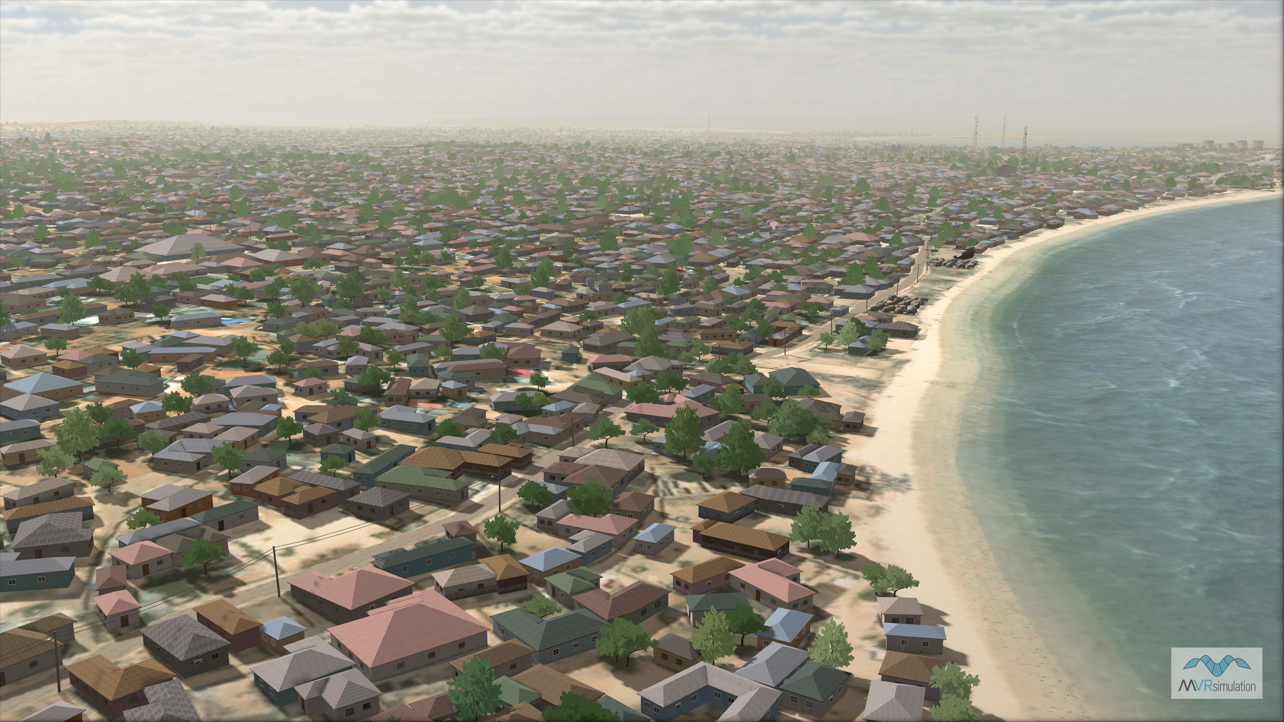
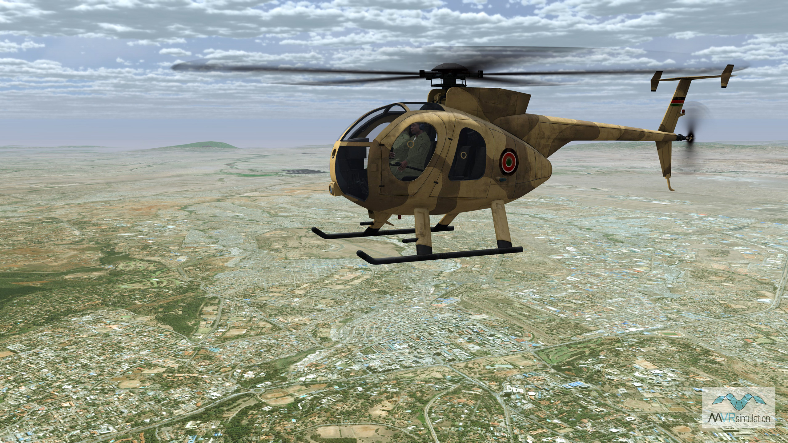
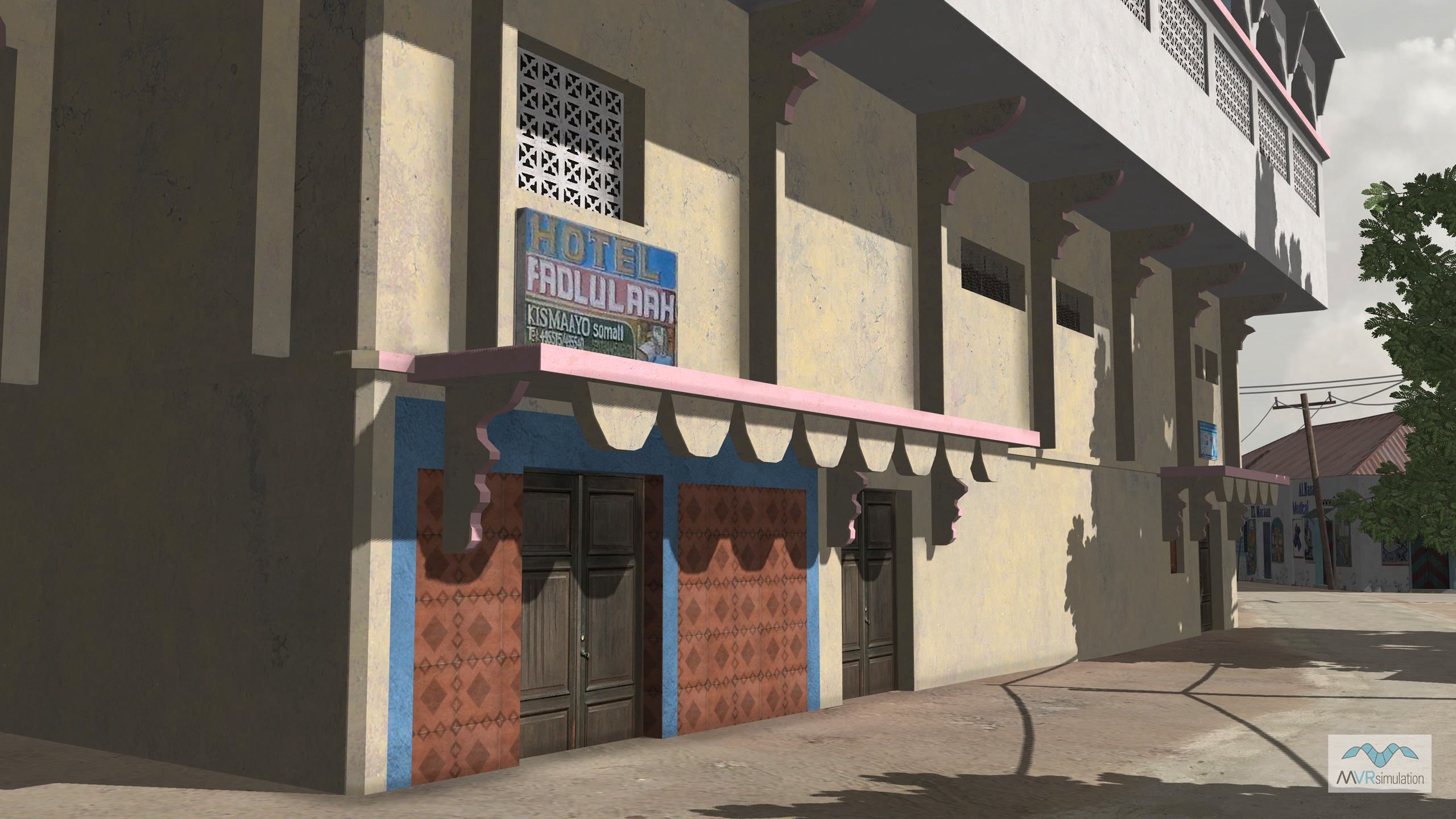
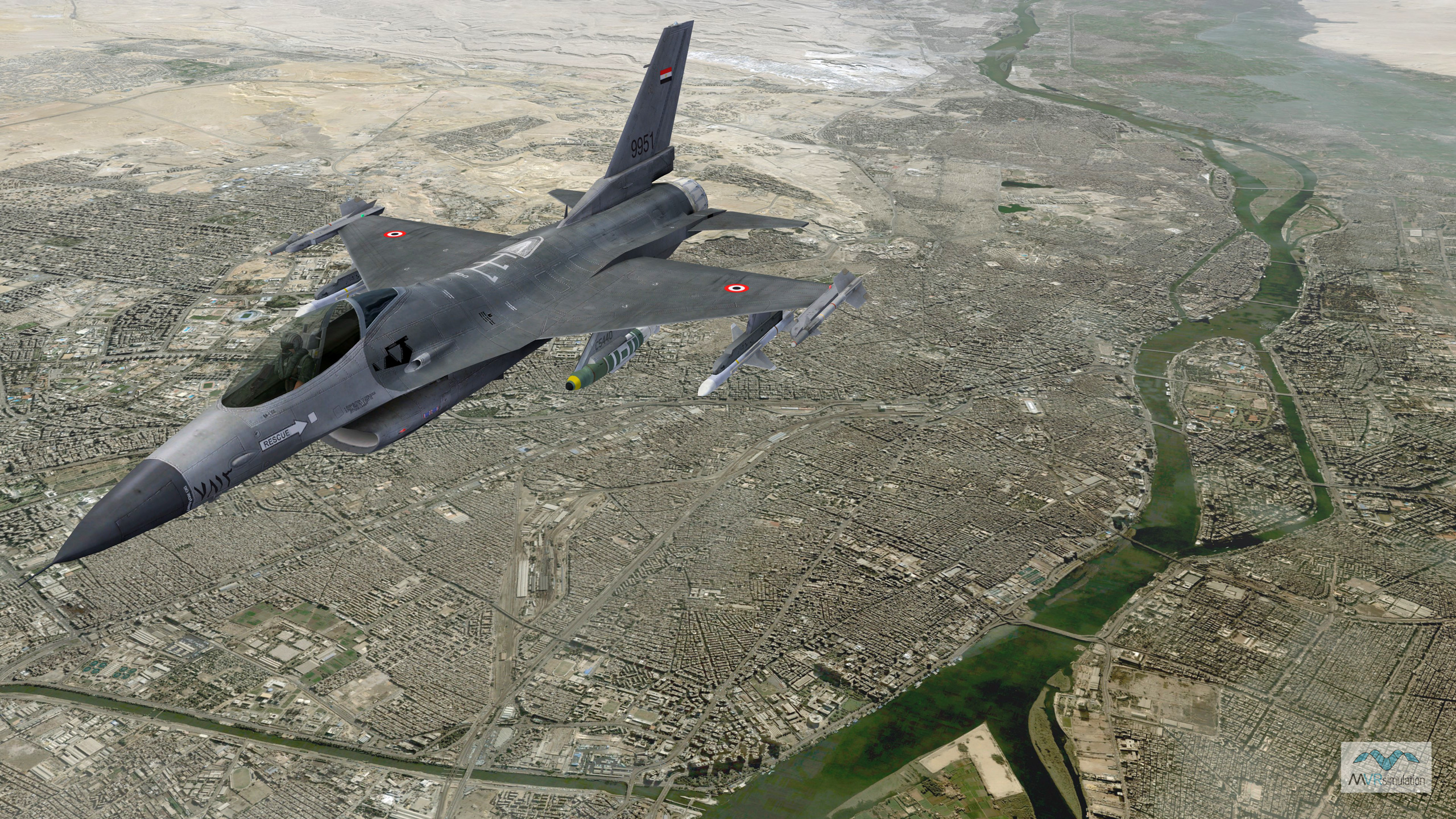
Included in this dataset is the high-resolution 3D terrain of the southern Somalia port city of Kismayo, which is populated with hundreds of geographically specific culture models built from ground-level photographs taken on the streets of Kismayo. In addition to these geolocated and photo-realistic models of buildings and other structures, several hundred other buildings were modeled by matching the structural footprints visible in the imagery as geotypical models with culturally and architecturally accurate details.
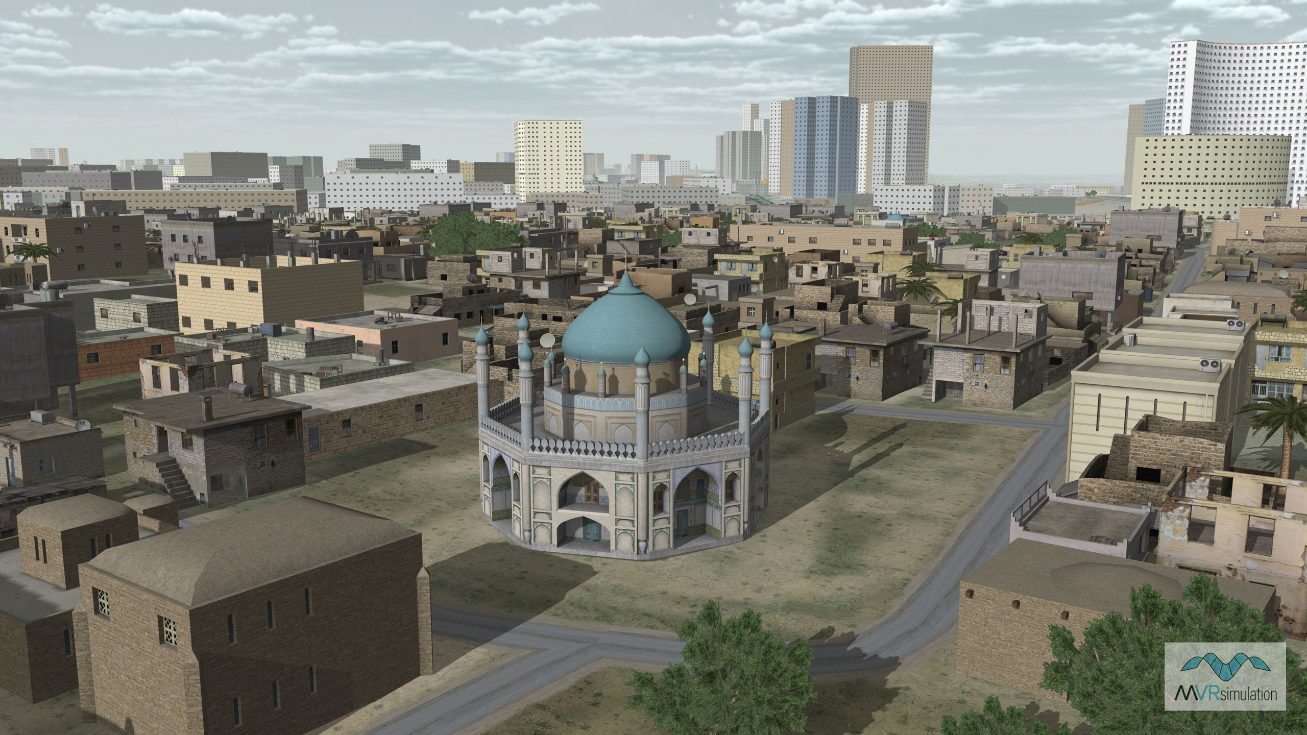
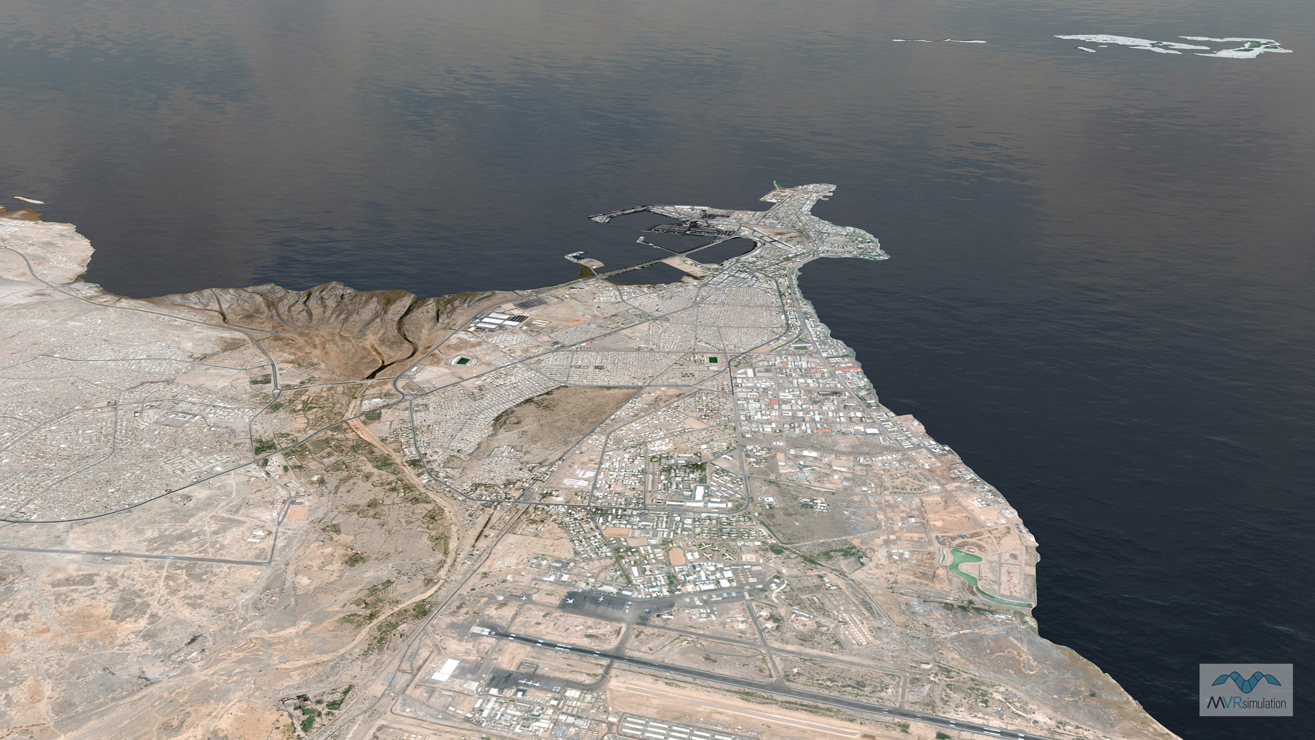
Also included is virtual Tripoli, Libya, built using 0.60 meters per-pixel (mpp) resolution imagery compiled into surrounding 15m Landsat imagery and 90 mpp SRTM elevation data. The terrain features 12,456 building models generated in Esri CityEngine, extruded with height data from OSM building footprints. Where building footprints were lacking or highly inaccurate, geotypical Middle Eastern buildings from VRSG’s culture model libraries were placed on the terrain for a seamless transition to the CityEngine areas. By doing so, this technique enables users to create scenarios in areas where more detail can be seen in the building models while having a city populated with thousands of extruded buildings surrounding them. The terrain’s other cultural features include a road network of Tripoli compiled with OSM data; vegetation, water towers, and vehicles from MVRsimulation's robust 3D model libraries. For nighttime viewing, some building models contain emissive light-map textures; a few contain light lobes.
The Africa 3D terrain is "Additional Materials" and is provided "as is" as described in our license agreement. Although MVRsimulation might modify or enhance the original source imagery, some visual artifacts from the source imagery might remain in the terrain tiles.
Geographic coverage by imagery resolution
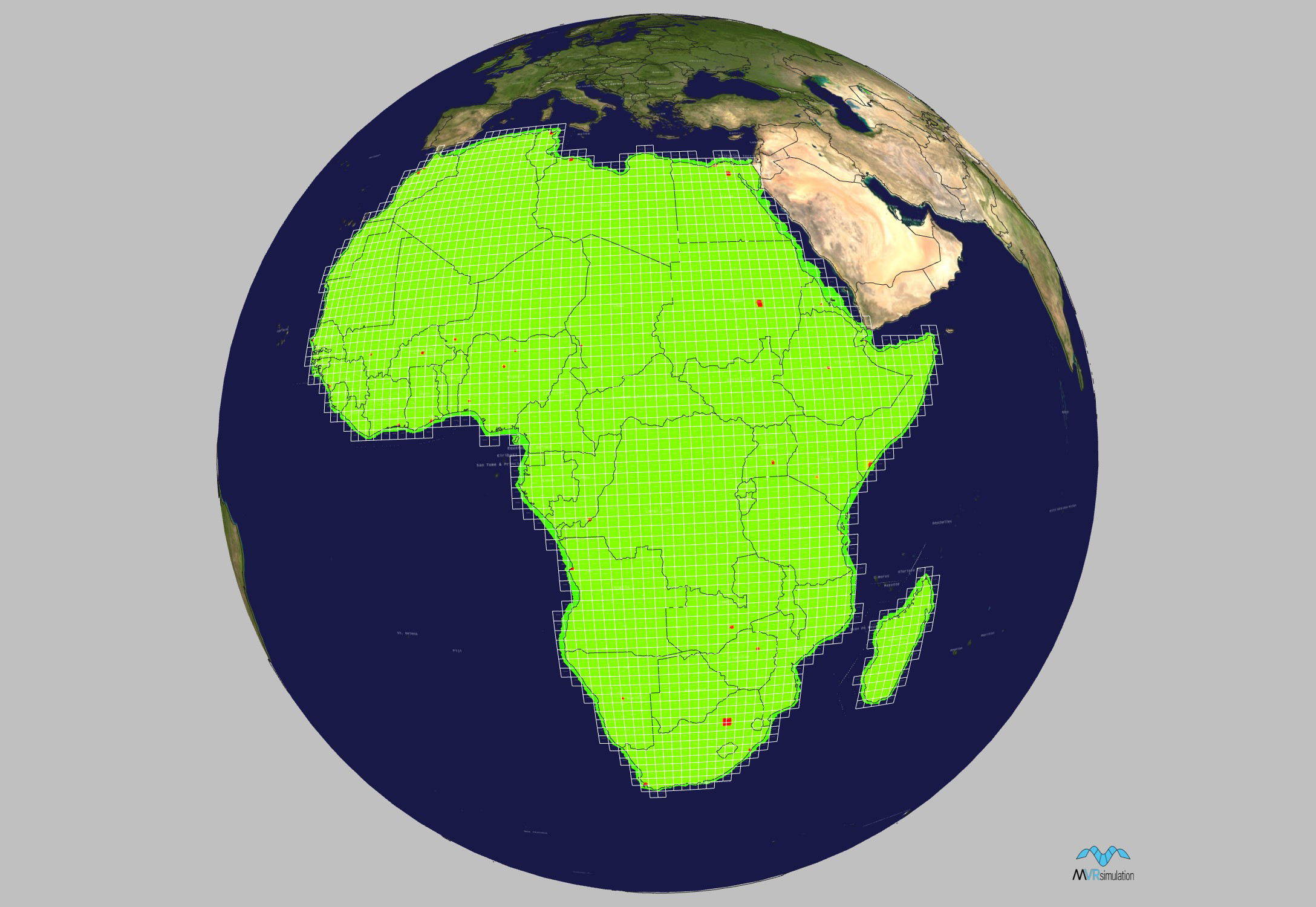
The following symbolic representation shows the geographic coverage of the terrain tiles of Africa. This terrain tile coverage map was generated with MVRsimulation's Model Viewer. The green areas indicate use of 15 mpp imagery and the red areas are the high-resolution insets.
Specifications
Below are specifications for MVRsimulation’s Africa terrain dataset in round-earth VRSG format (MDS).
Dataset size: 2,750 geocells
Size on disk: 1.03 TB (includes culture assets of Kismayo, Somalia and Tripoli, Libya)
Terrain post spacing: 60 meters-per-post (mpp), 30 mpp of Kismayo, Somalia
Elevation source data: 3 arcsecond (90 mpp) SRTM, 3 arcsecond DTED1
Imagery source data: 15 meters-per-pixel (mpp) Natural Vue imagery of the African continent; 0.60 mpp natural color insets of Algiers, Algeria; Luanda, Angola; Ouagadougou, Burkino Faso; Ndjamena, Chad; Abidjan, Cote d'Ivoire; Kinshasa, Democratic Rep. of Congo; Djibouti City, Djibouti; Alexandria, Egypt; Cairo, Egypt; Asmara, Eritrea; Addis Ababa, Ethiopia; Accra, Ghana; Conakry, Guinea; Nairobi, Kenya; Tripoli, Libya; Bamako, Mali; Nouakchott, Mauritania; Casablanca, Morocco; Rabat, Morocco; Windhoek, Namibia; Niamey, Niger; Ibadan, Nigeria; Kano, Nigeria; Kaduna, Nigeria; Dakar, Senegal; Freetown, Sierra Leone; Mogadishu, Somalia; Johannesburg, South Africa; Cape Town, South Africa; Durban, South Africa; Khartoum, Sudan; Dar es Salaam, Tanzania; Tunis, Tunisia; Kampala, Uganda; Lusaka, Zambia; Harare, Zimbabwe; and 0.50 mpp natural color inset of Kismayo, Somalia
Delivery
MVRsimulation’s Africa 3D terrain is delivered on an external hard drive. The terrain is provided in MVRsimulation's round-earth VRSG terrain format and will only run with a valid VRSG version 6 software license with valid software maintenance. A fee covers processing large quantities of data and the hard drive distribution media.
MVRsimulation’s Africa 3D terrain is available for purchase to customers who are US Government agencies or contractors (for official use only). Customers can duplicate the data at their discretion as long as the data is used in conjunction with a valid VRSG license.
You can order this 3D terrain directly from MVRsimulation by consulting the price list and then filling out the quote request form.