Spain 3D Terrain
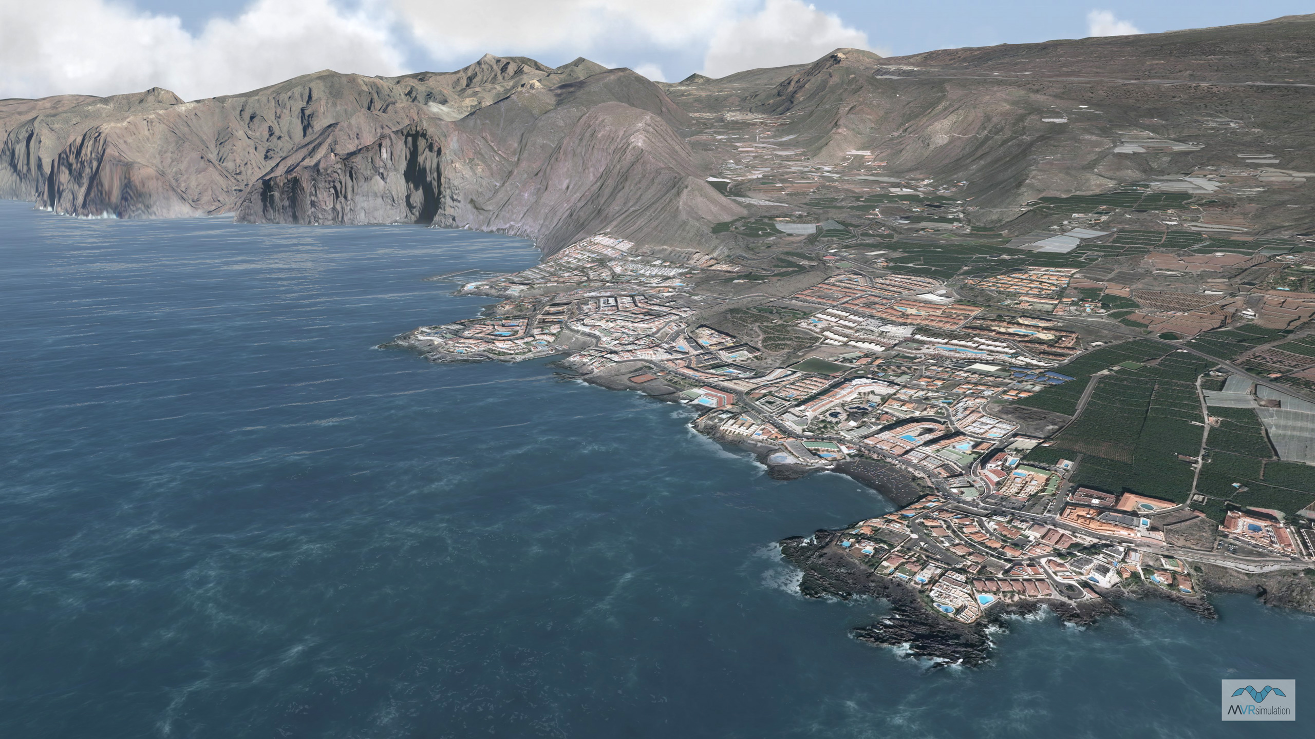
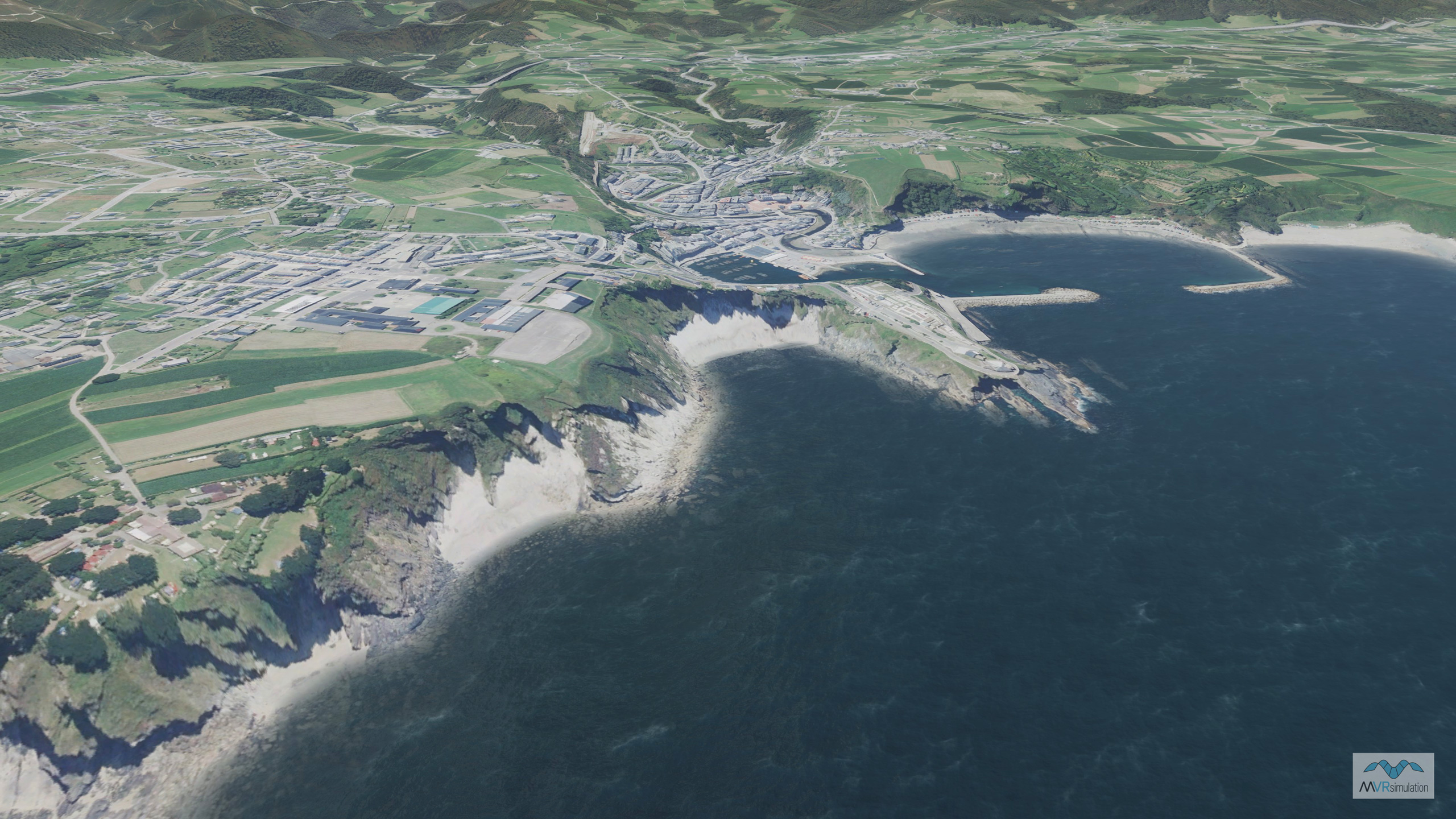
MVRsimulation has built a 3D terrain dataset of Spain, with 0.50 meters per pixel (mpp) resolution source imagery and SRTM1 (30m) elevation source data covering the entire country, including procedural bathymetry of the northern/western Spain coastline. This terrain was built with the newest version of MVRsimulation Terrain Tools for Esri® ArcGIS®.
This terrain includes areas of high-resolution culture insets of:
- Lugo province in the Galicia region of northwest Spain, built with 0.25 mpp imagery and 5 meter elevation source data. The province is populated with over 3 million trees. (A total of over 23 million tree models have been populated throughout Northern Spain covering provinces of Lugo, Asturias, Leon, Orense, Cantabria, and Palencia.) Several roads and highways were populated with OSM road data. Five sets of twin tunnels and 55 bridges were modeled along highway A6 leading to the town of Pedrafita do Cebreiro. Accompanying the structures are streetlights and tunnel lights, illuminated with light lobes for tunnel and nighttime scenes. The outskirts of the town of Pedrafita do Cebreiro is populated mainly with building models generated with Esri CityEngine and compiled into the terrain; these buildings contain emissive light-map textures for nighttime lighting.
- Leon province in northern Spain, built with 0.40 mpp imagery and 30 meter elevation. 3,385 buildings generated with CityEngine were compiled into the terrain in the towns of Fabero, Lilo de Bierzo, Otero de Naraguantes, Fontoria, Sesamo, Vega de Espinareda, La Espino, and Espinareda de Vega. Modeled towns also contain streetlights with light lobes and powerlines. Several roads were populated with OSM road data.
- Los Llanos Albacete Air Base (LEAB) located in Albacete province, in the Castilla-La Mancha region of southeastern Spain. The air base is the home of the NATO Tactical Leadership Programme (TLP). The air base replica was built with 0.40 mpp imagery and 2 meter elevation and includes 80 geospecific building models (control towers, hangars, terminals, administrative buildings) and other structures (windsocks and antennas) placed along the flight-line, illuminated airport guidance signs, taxiway markings, and PAPI and runway lights. The air base models were built from publicly available photos and then geolocated on the terrain in MVRsimulation’s Scenario Editor. Surrounding the air base, building models generated with Esri CityEngine were compiled into the terrain of the city of Albacete; the buildings contain emissive light-map textures for nighttime lighting. The province is populated with over 45,000 trees.
- La Union, Murcia, built with 0.25 mpp imagery and 30 meter elevation. Includes 95 building models; 24 are geospecific and have a destroyable switch and 71 were constructed in Esri CityEngine with CityEngine rule files to show a geotypical representation of the real life location. Roads (including roundabouts, sidewalks, crosswalks, and lane lines) were also created using CityEngine. The AOI is populated with streetlight and tree models from MVRsimulation's culture model libraries.
MVRsimulation’s Terrain Tools extension to Esri ArcGIS above on the left, and real-time aerial views in MVRsimulation VRSG of the resulting 3D terrain on the right. All scenes show the northwest region of MVRsimulation’s geospecific virtual terrain of Spain.
The creation of this terrain benefited from several recent Terrain Tools features and enhancements:
- The forests of over 23 million trees were generated by Terrain Tools' Create Forest Tool, which, in version 1.6, colors the trees during terrain compilation by sampling the terrain imagery, to provide a realistic blend between the forests and the terrain. The heavily forested areas were also built with a new performance enhancement, the ability to compile large areas of instanced tree models in the terrain with level-of-detail (LOD) probability weights described in associated JSON metadata files.
- The northern/western Spain coastline was built with Terrain Tools version 1.6's automatic calculation of a bathymetry surface, where surface depth is computed as a function of the distance to the coastline.
- Buildings generated with Esri CityEngine were compiled into the Pedrafita do Cebreiro area in Lugo province, several towns in Leon province, and into the city of Albacete in Albacete province. Terrain Tools now offers a new CityEngine feature type for compiling extruded building features using a CityEngine rule package (.rpk). This Terrain Tools feature type simplifies the workflow adding large areas of dense culture to 3D terrain quickly and easily. (Many MVRsimulation customers already use CityEngine for generating large urban models to place on their 3D terrain datasets via an external cultural feature file.)
- Instanced light lobes were added to streetlight models and tunnels via positioning attributes specified in a JSON file.
Culture features that were not compiled into the terrain were geolocated on terrain footprints in Scenario Editor.
MVRsimulation delivered this Spain 3D terrain dataset to the NATO Tactical Leadership Programme (TLP) at Los Llanos Air Base, Albacete, Spain, and to Bell Textron for the Bell 360 Invictus prototype submission as part of the U.S. Army’s Future Attack Reconnaissance Aircraft (FARA) program.
This Spain 3D terrain dataset, built with Terrain Tools in MVRsimulation’s round-earth VRSG terrain format, is available as part of MVRsimulation’s Europe terrain drive to all customers who are on active VRSG software maintenance and are US Government agencies or contractors (for official use only). The Europe terrain dataset is delivered on an external hard drive. (A nominal fee covers the processing of large quantities of data in the VRSG terrain format and the hard drive distribution media.) The Spain terrain dataset can be viewed only with a valid VRSG version 6.4 or above software license with valid software maintenance.