Mayport Naval Station (KNRB) Terrain Database Information
- Imagery: 30cm
- Elevation: NED 10
- Terrain Drive: CONUS Southeast
- Cultural Features: CityEngine/Geotypical Buildings, Control Tower, Port/Bathymetric Data, Runway, Runway Lights, Signs, Taxiways and Associated Markings, Trees, Windsocks
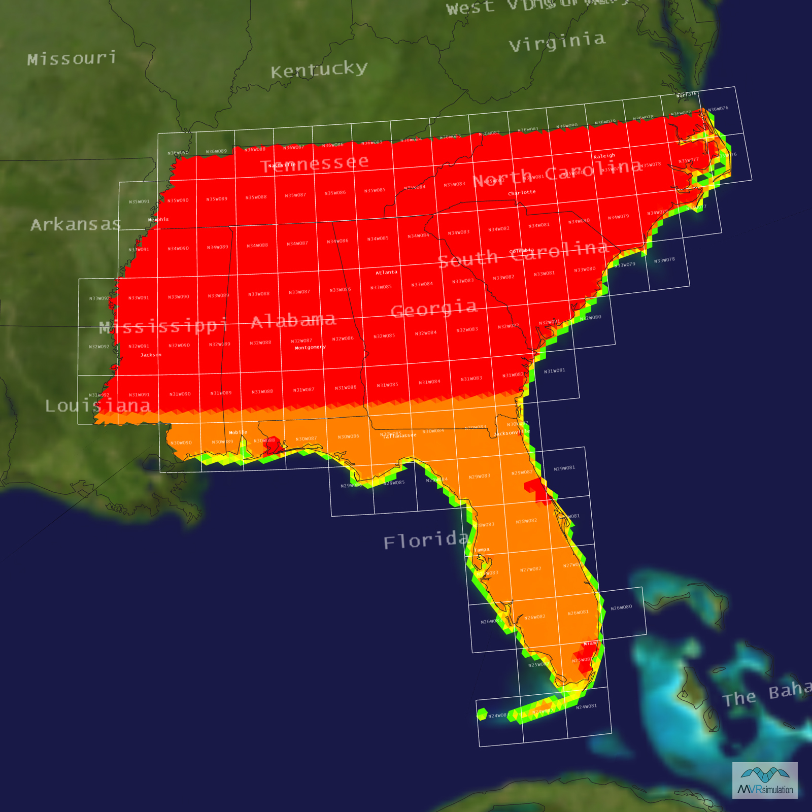
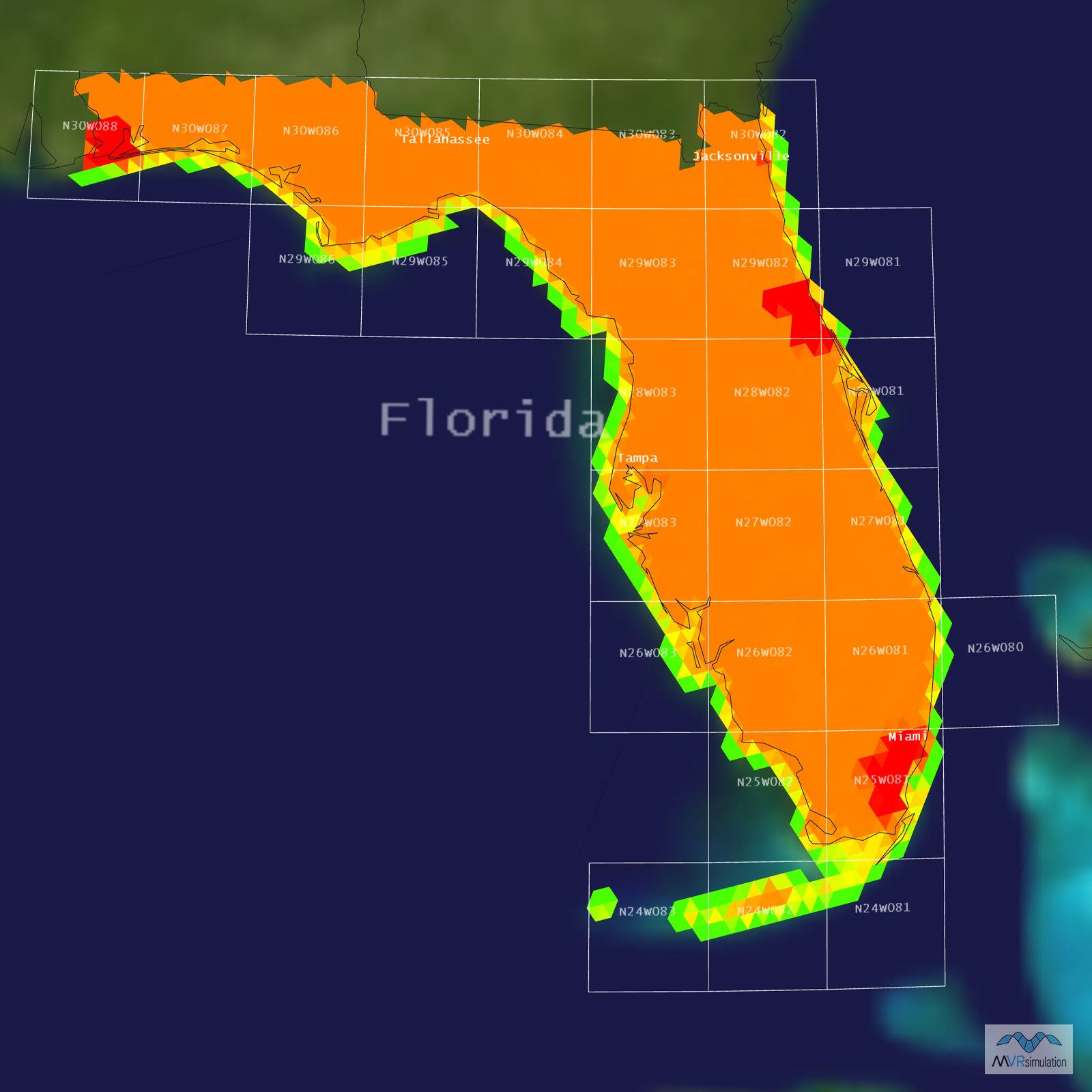
Tile Coverage Map
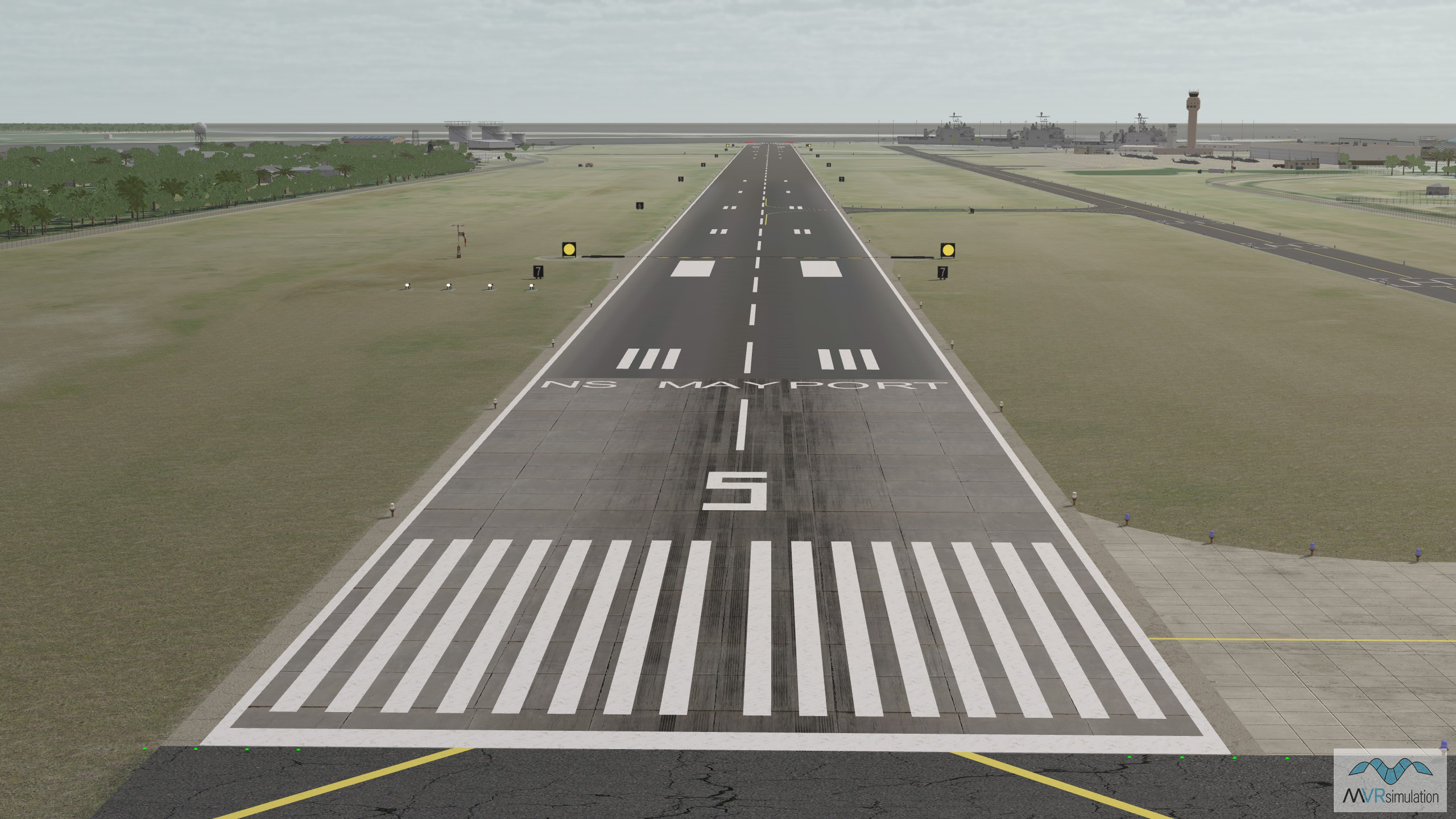
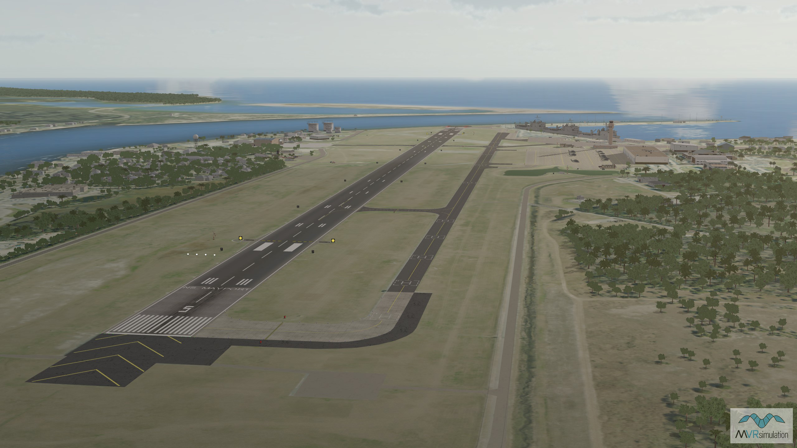
Runway view of VRSG's 3D terrain database of Mayport Naval Station, Florida.
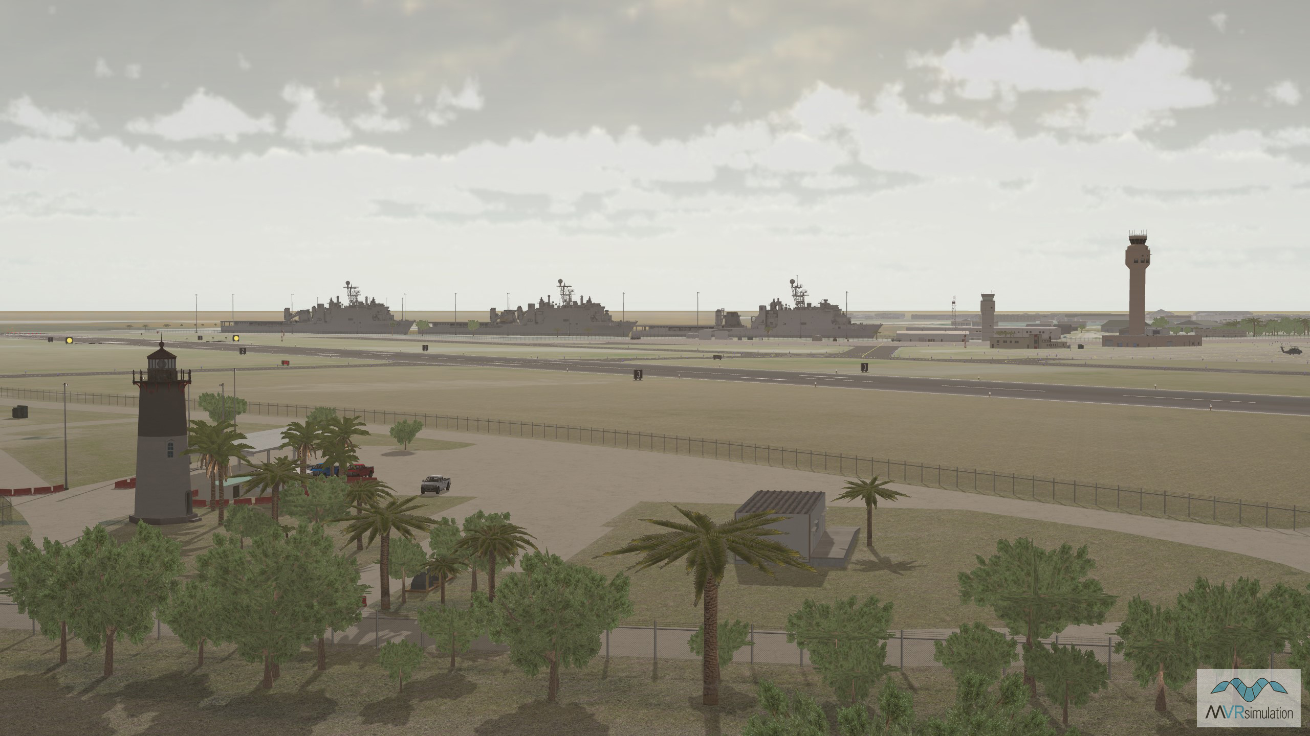
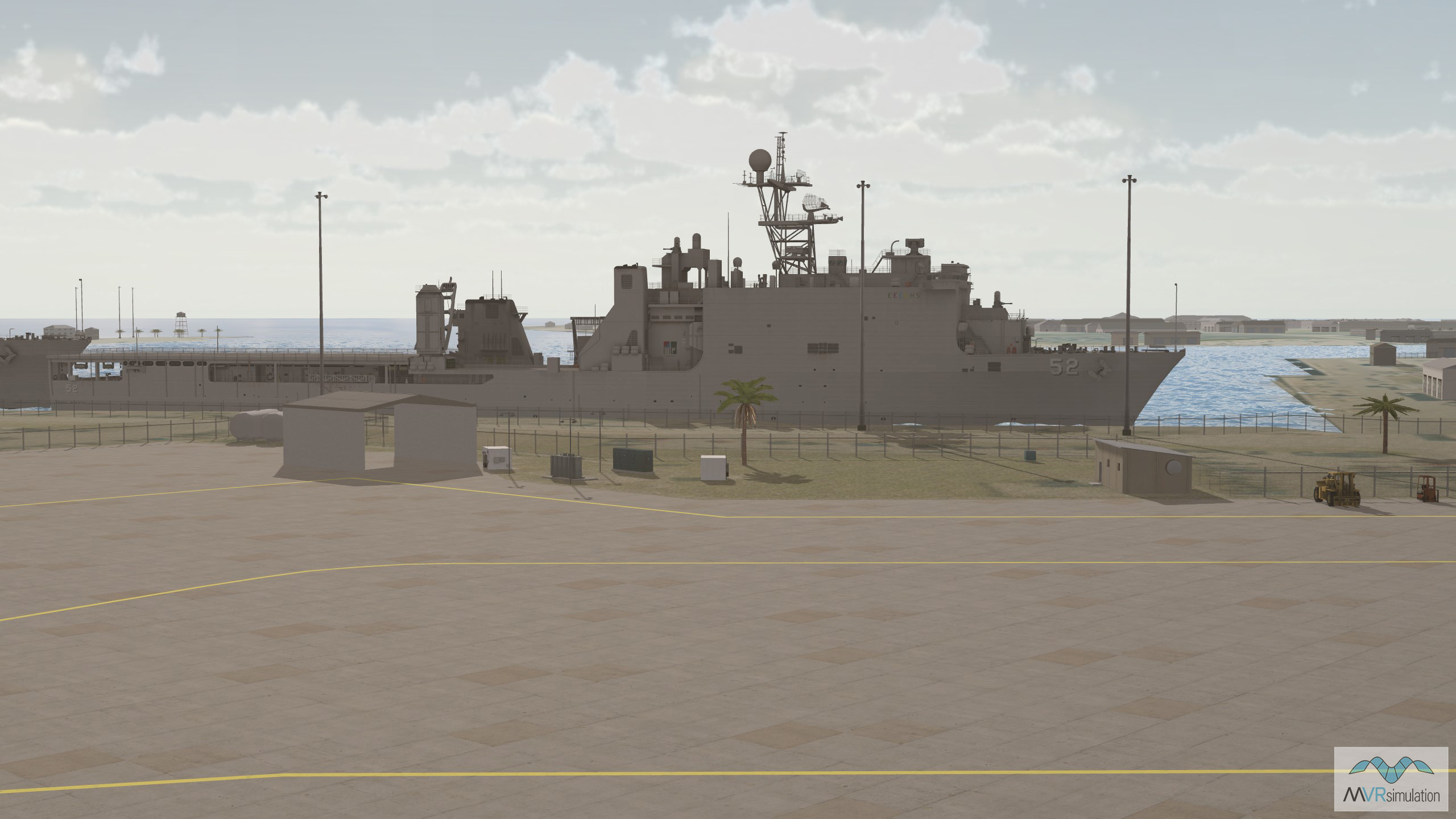
Real-time 3D models of U.S Navy dock landing ships in VRSG's terrain database of Mayport Naval Station.
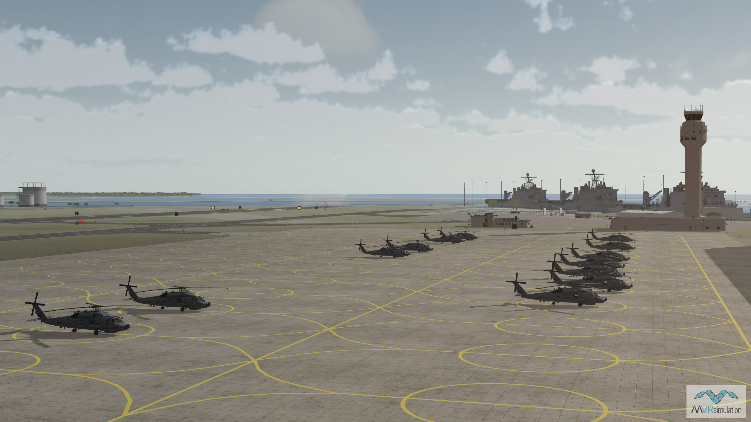
Real-time 3D models of MH-60 Seahawks in VRSG's terrain database of Mayport Naval Station.
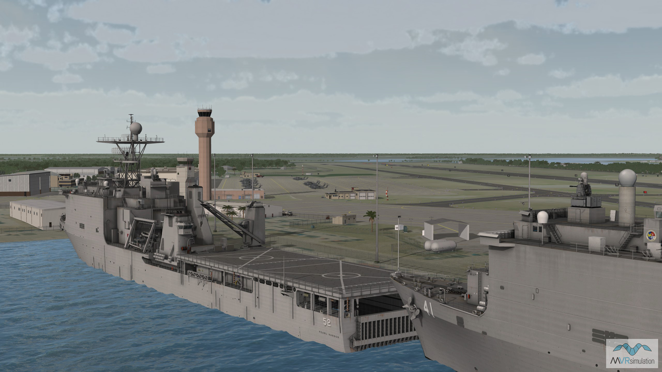
3D real-time model of USS Pearl Harbor, a Harpers Ferry-class dock landing ship, in VRSG's Mayport Naval Station terrain.
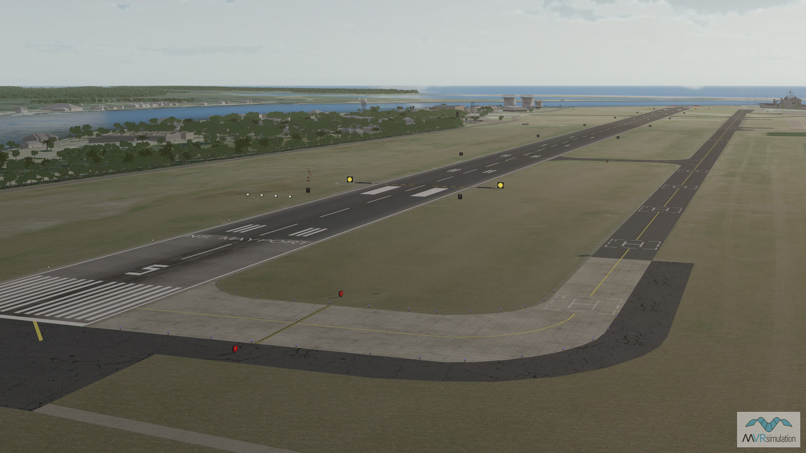
MVRsimulation's virtual Mayport Naval Station terrain includes models of runway lighting, navigational signs, taxiways, windsocks, and tarmacs.
EXTEND YOUR TERRAIN DATABASE
MVRsimulation Downloads Server
- Explore and implement terrain updates
- Download and use new 3D models
- Stay up-to-date with VRSG features
- Discover utilies for expanding VRSG
MVRsimulation Regional Terrain Drives
- External hard drive - regional terrian
- Network attached storage device - whole-world terrain
- Ready for plug and play
- Available to customers on active maintenance
MVRsimulation Produced Custom Terrain
- Custom terrain created by MVRsimulation's terrain team
- Specify your desired area of interest
- Indentify needed terrain features.
- Use your own or commercially available imagery
Create Terrain with Terrain Tools
- Build real-time 3D terrain for VRSG using GIS technology with ArcGIS Pro
- Designed to be user-friendly for users with basic ArcGIS knowledge
- Use imagery, elevation, and optional vector data to create terrain
- Compile buildings from 2D polygon footprint features using a CityEngine rule package