
Virtual Camp Pendleton MOUT Sites
MVRsimulation has built a high-resolution geospecific Marine Corps Base Camp Pendleton, CA, terrain data set with two detailed modeled MOUT sites (Combat Town 25 and Kilo 2). MVRsimulation delivered this terrain for use with VRSG in the U.S. Navy Combined Arms Virtual Environment (CAVE) simulator at the Expeditionary Warfare Training Group, Pacific (EWTGPAC) facility at Naval Amphibious Base, Coronado, CA.
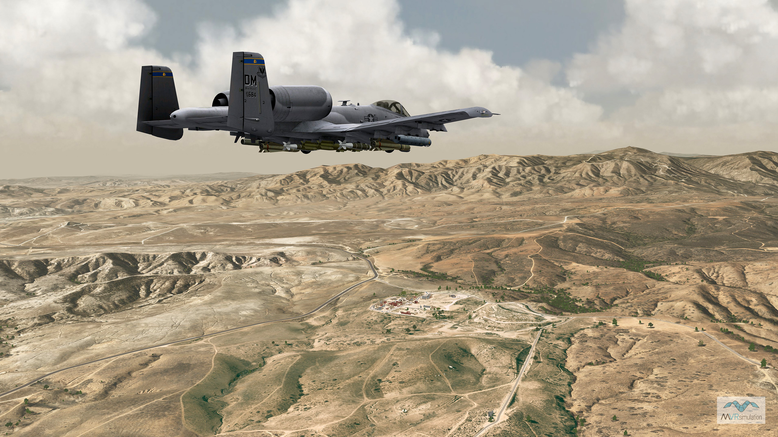
The dataset provides a high-resolution 30 cm per-pixel inset, seamlessly integrated with underlying 1-meter NAIP terrain for a comprehensive and scalable simulation environment within our whole earth terrain. The terrain was built to closely correlate to the real site using a mixture of USGS satellite imagery, DVIDS photographs, and AirSoft wargames GoPro video. The terrain also covers vast portions of CA, AZ, and NV, at 1 meter per pixel imagery and 10 meter post elevation data. In addition to the two MOUT sites, another area of interest on the terrain is the modeled Los Alamitos (KSLI) airport.
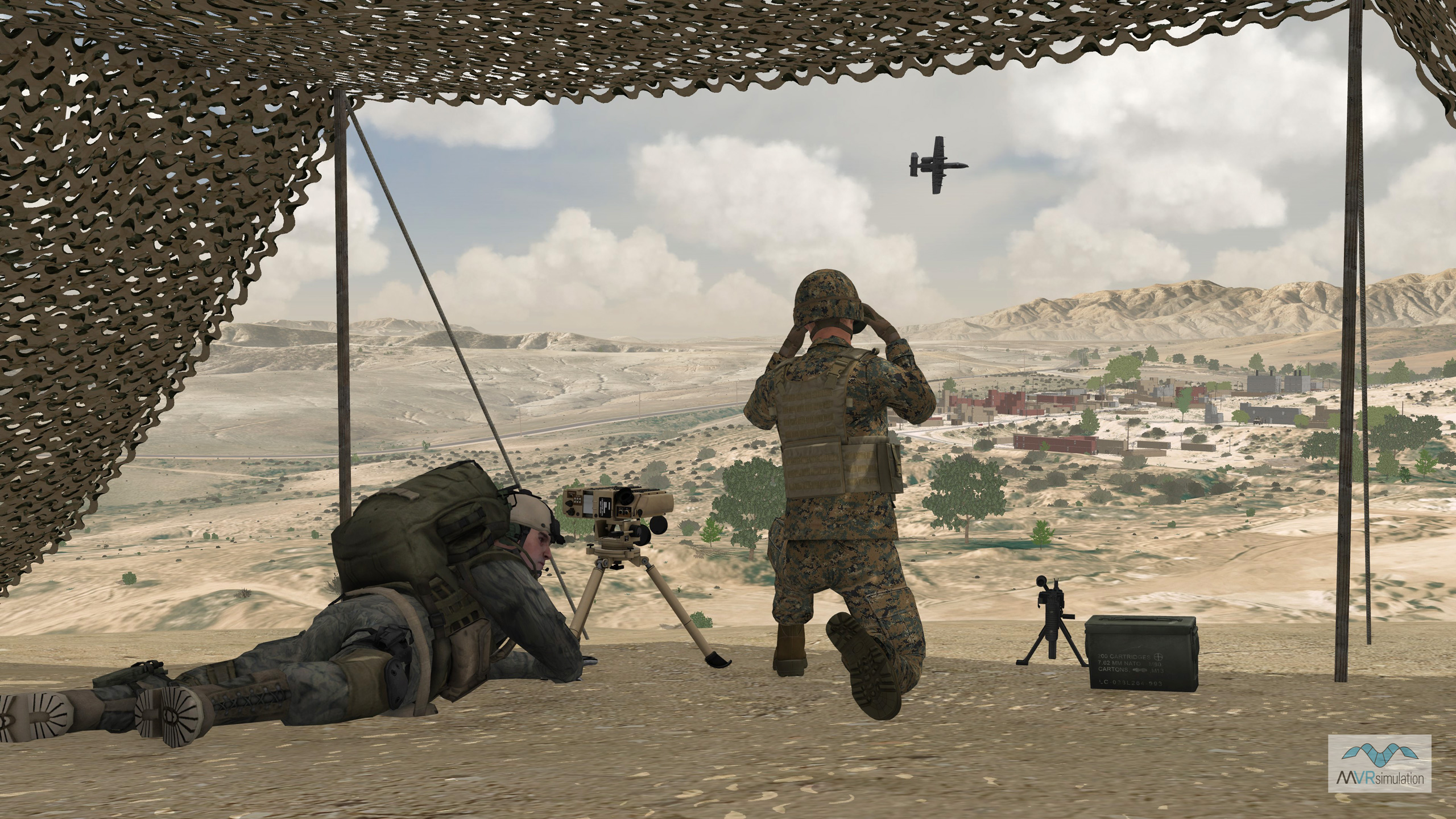
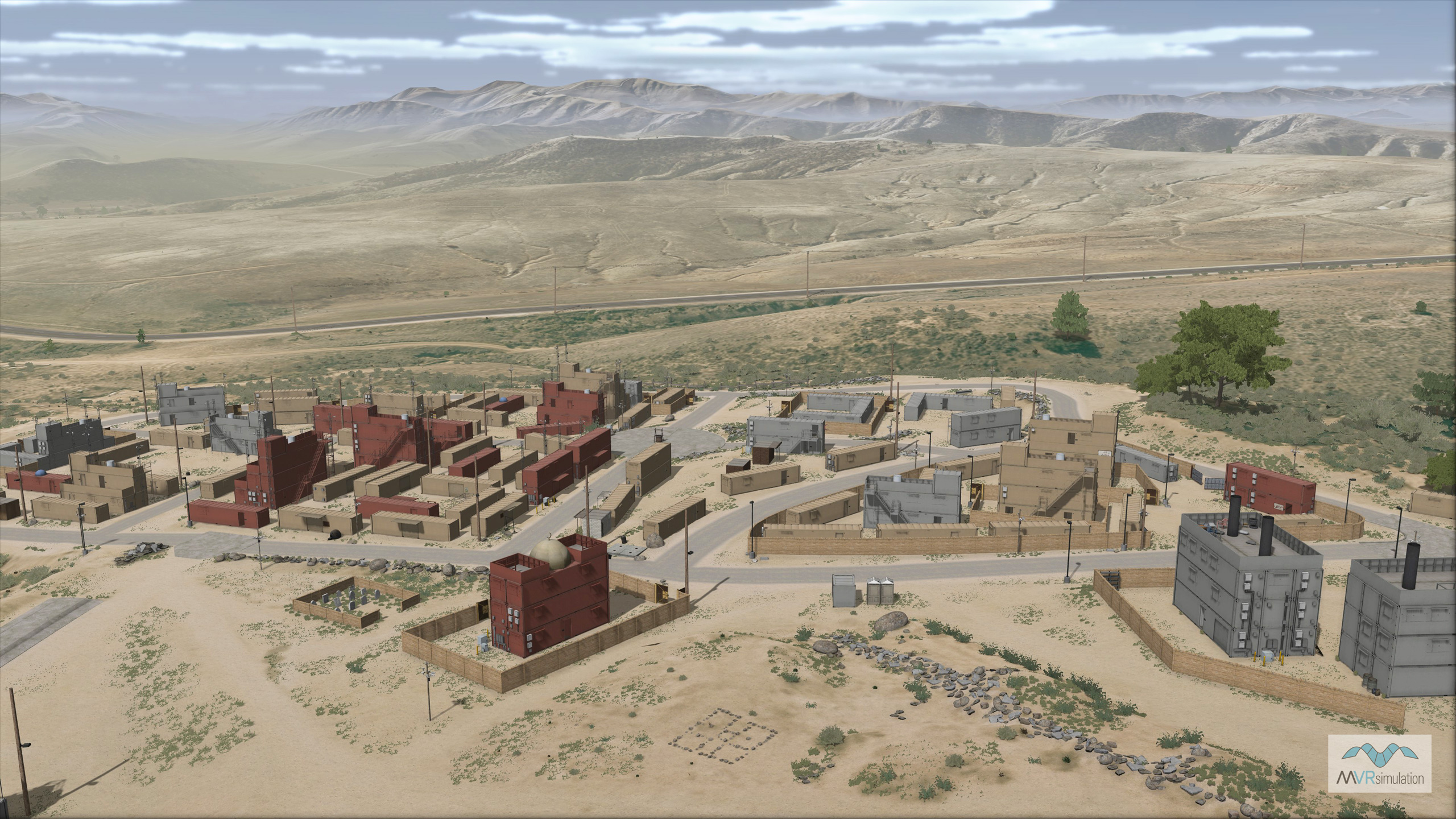
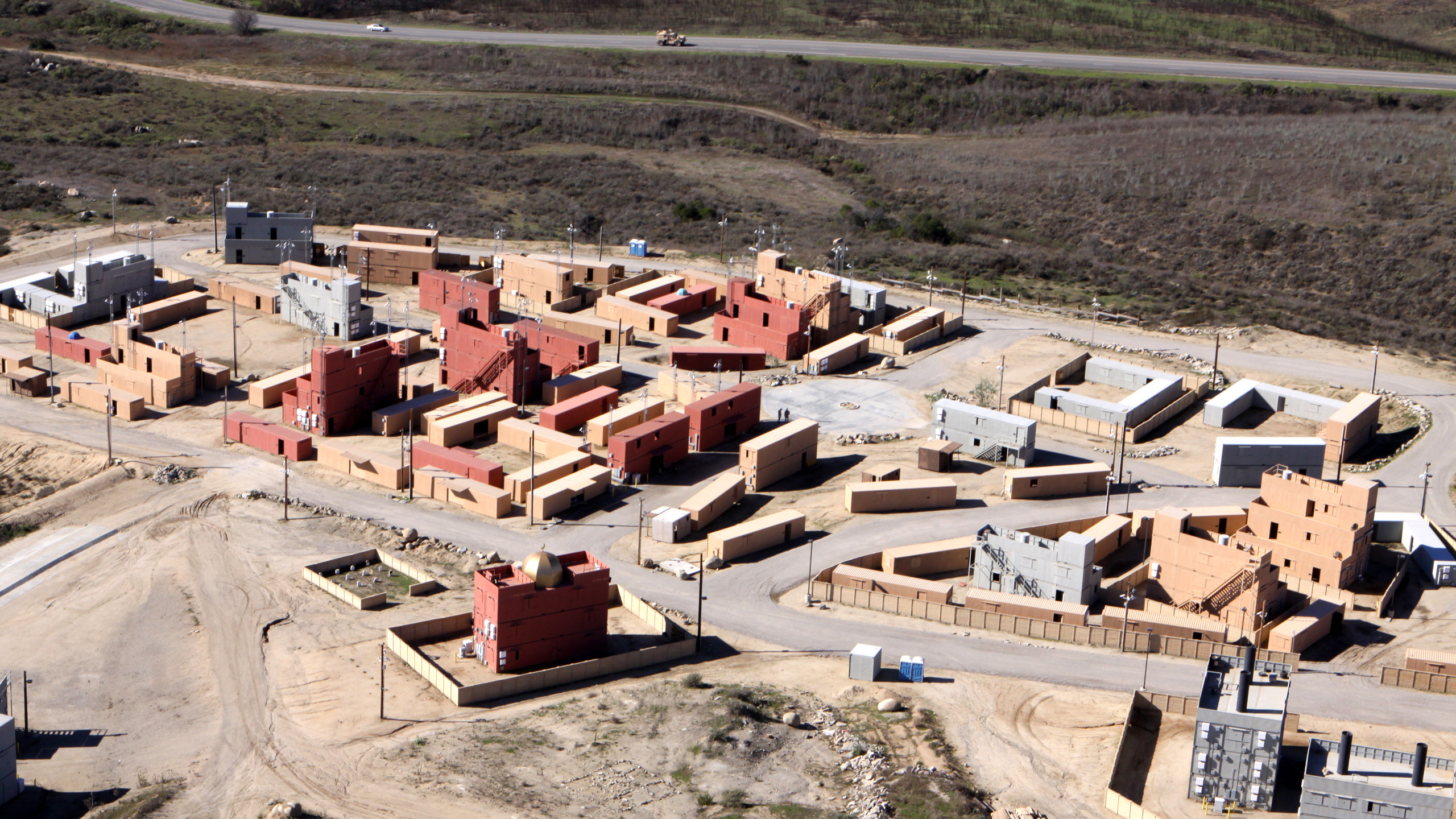
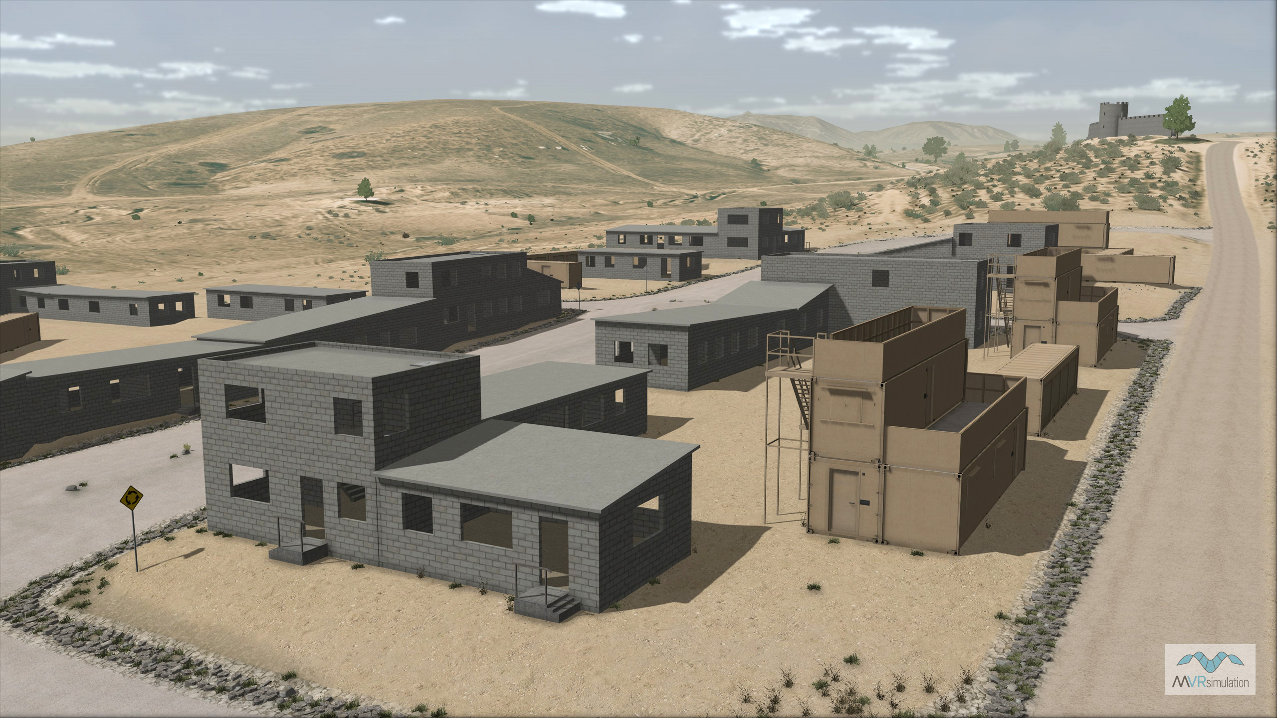
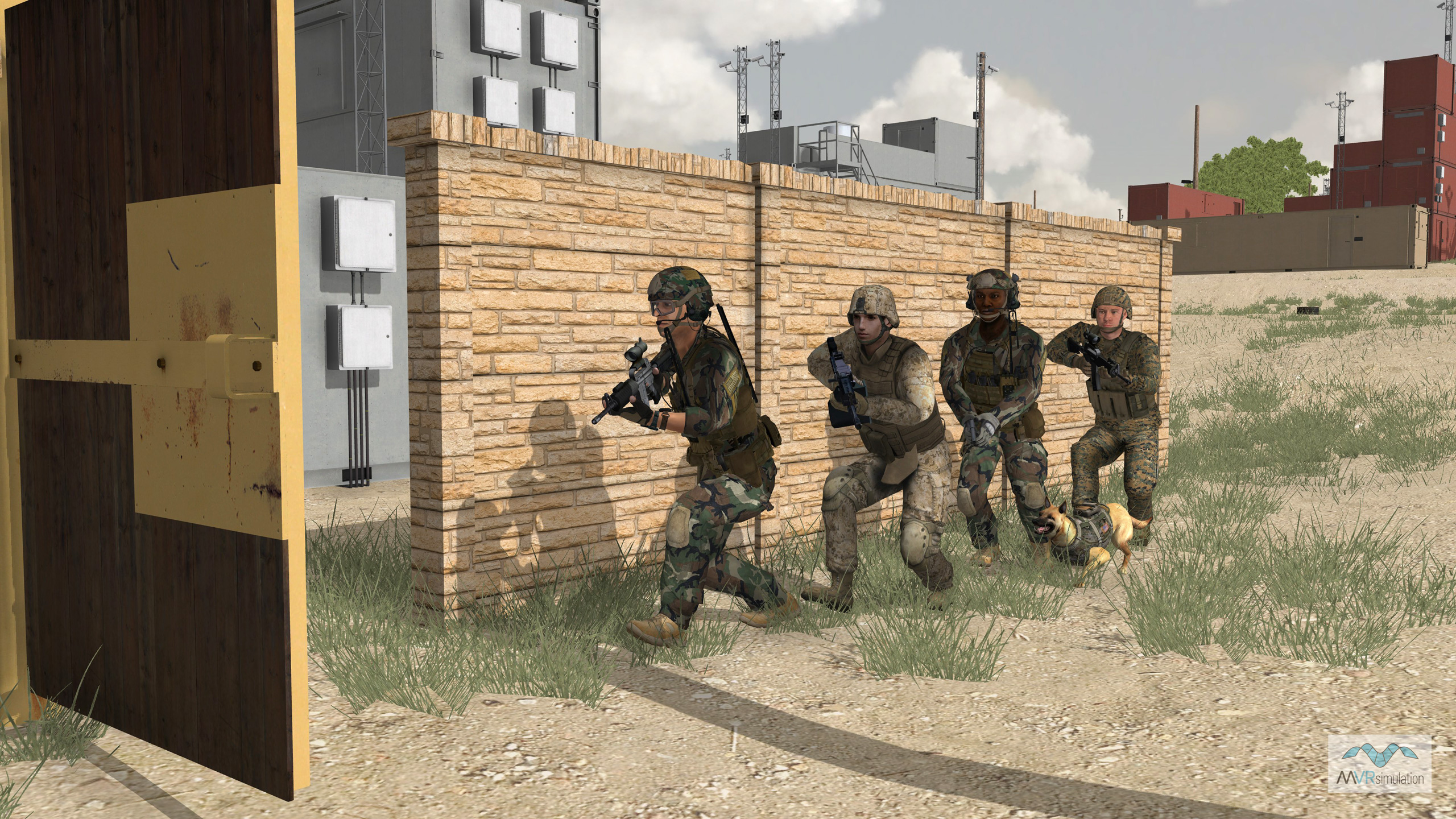
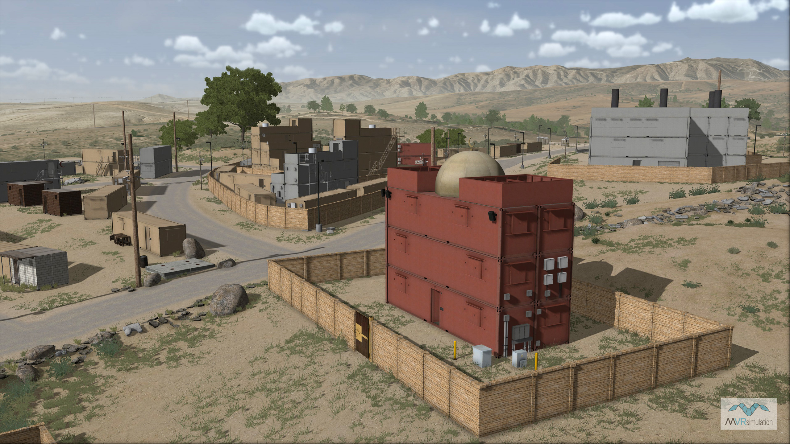
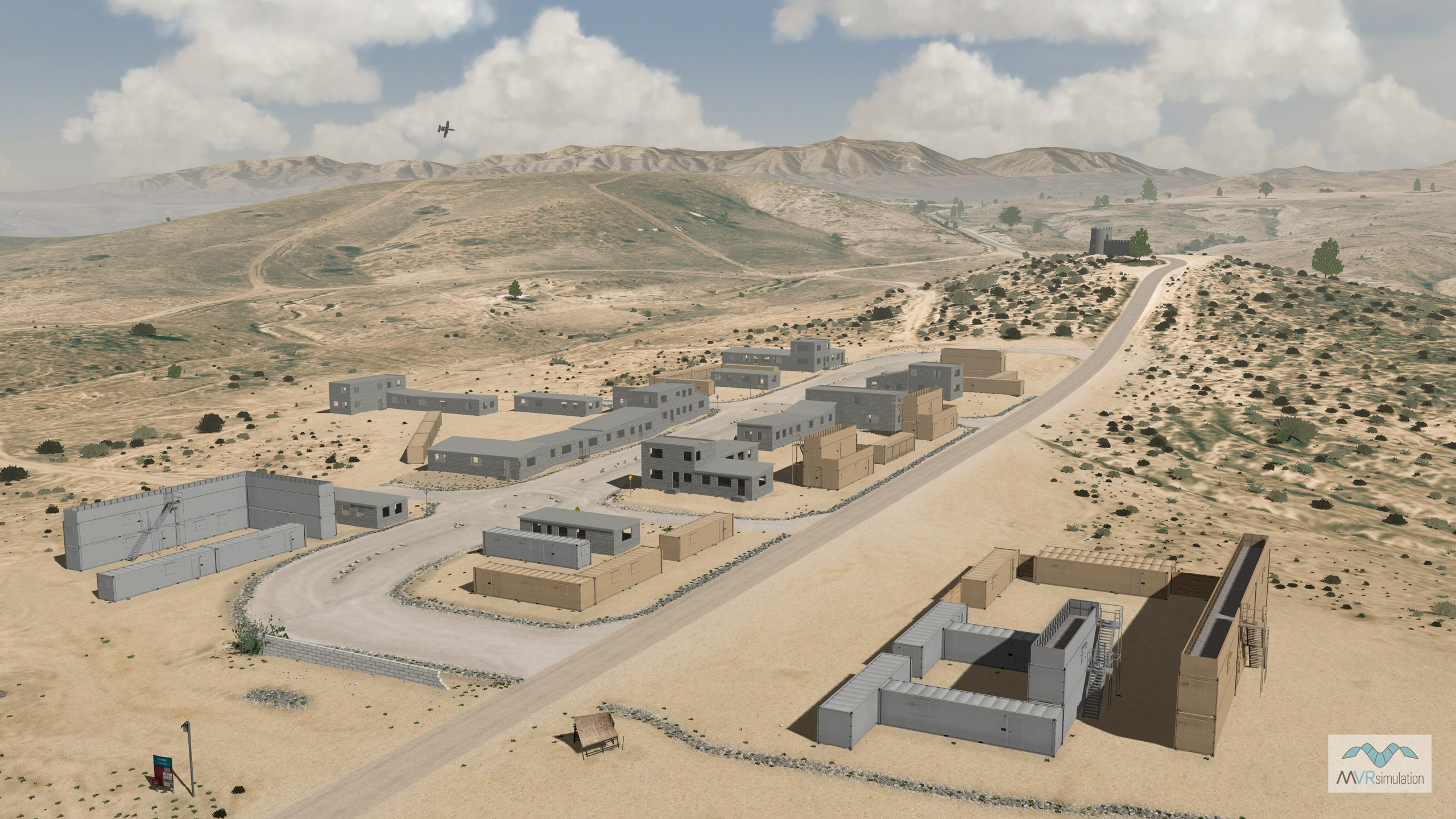
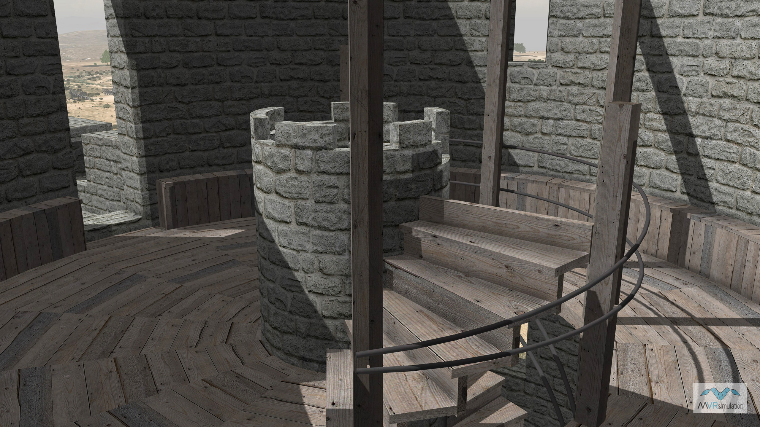
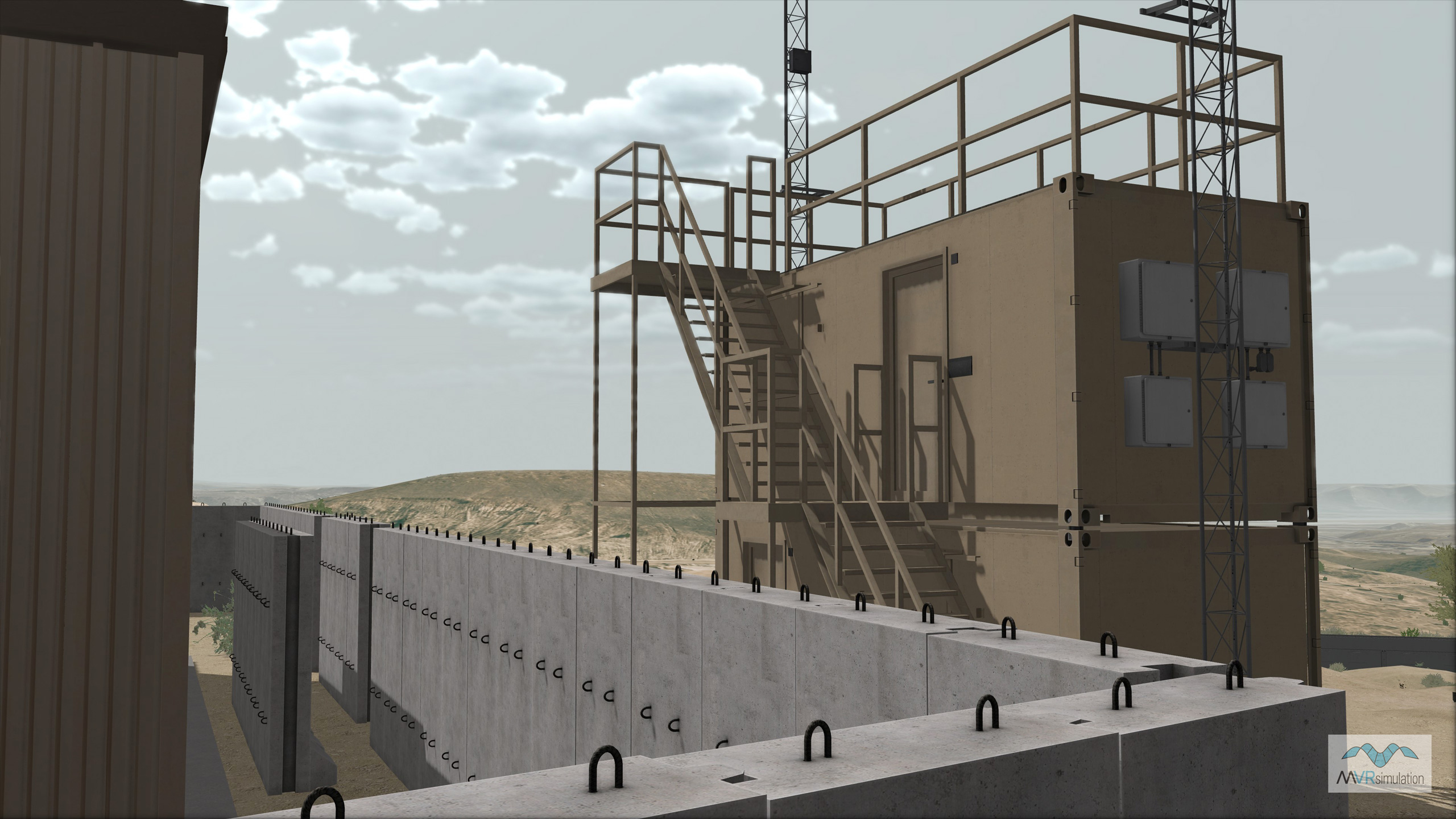
The Combat Town 25 and Kilo 2 MOUT sites feature substantial 3D content created from publicly available photos and videos. Geospecific buildings are comprised of mobile containers and concrete buildings with interiors. Other culture includes fences, stones, dumpsters, grass, vegetation, power lines, street signs, climbing structures, bleachers, trees, grave yard, mosque, observation tower, gas station, market area, and a castle.
The terrain was built in MVRsimulation Terrain Tools for Esri® ArcGIS®, which has the ability to blend multiple microtextures. For example, the terrain includes built-in roads (dirt, gravel, and paved) with blended microtextures (grass, swale, red clay soil, gravel, brown soil-grass). The georeferenced 4K microtextures are assigned to the terrain by digitizing and assigning specific land classification textures to geospecific polygons resulting in 4 mm per-pixel effective resolution.
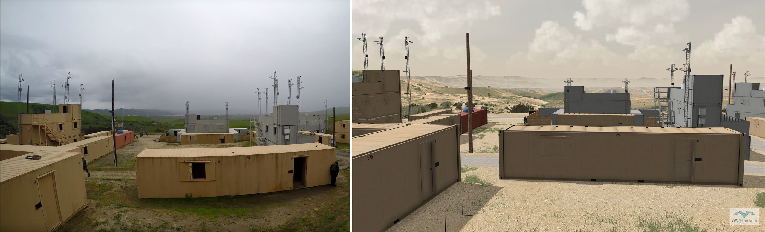
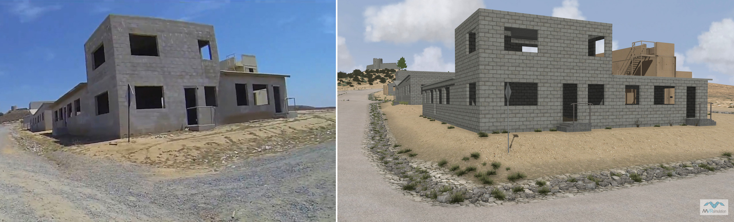
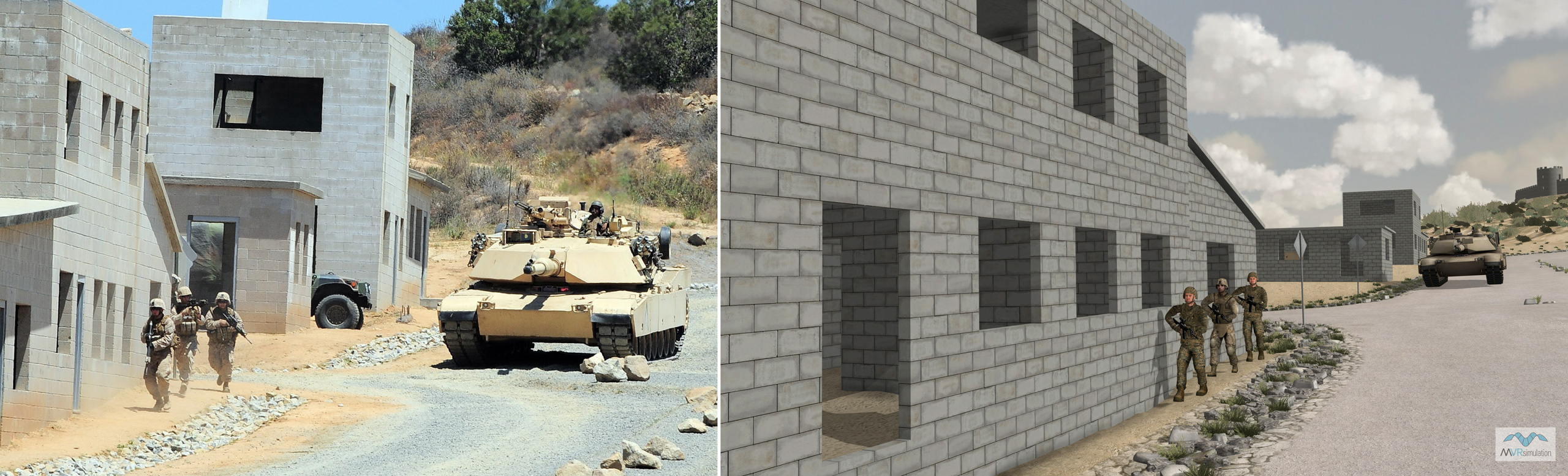
Camp Pendleton, located on the Southern California coast, in San Diego County, is the major West Coast base of the United States Marine Corps.The following set of images compares publicly available photographs of the Kilo 2 and Combat Town 25 MOUT sites with the corresponding area on the terrain rendered in VRSG.
Photos of the two MOUT sites
VRSG screen captures of the same scene
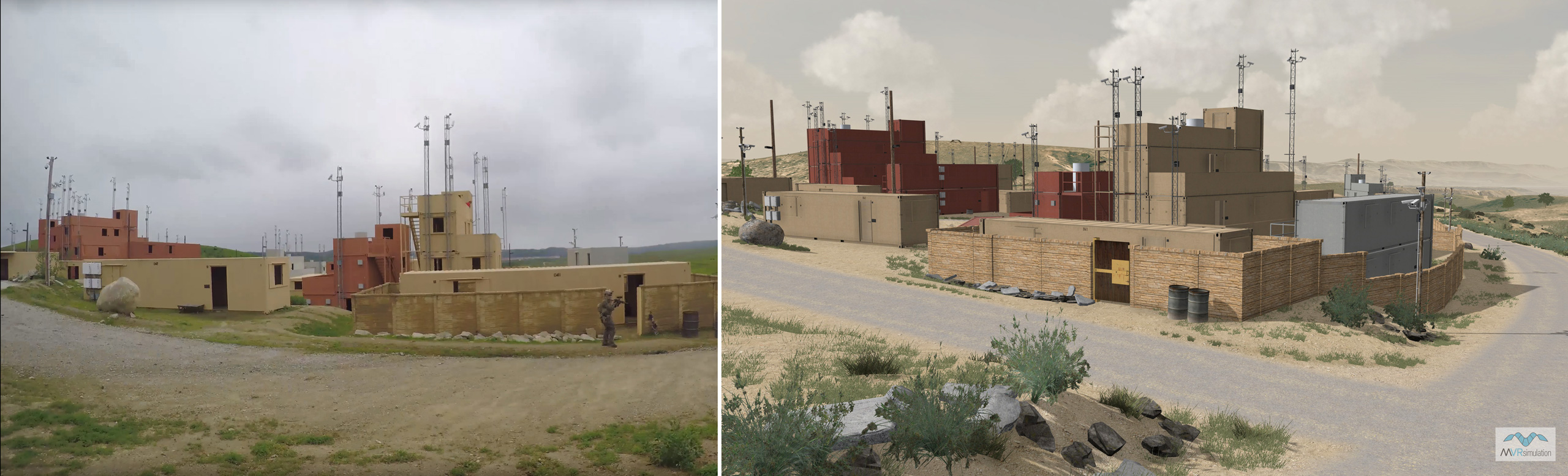
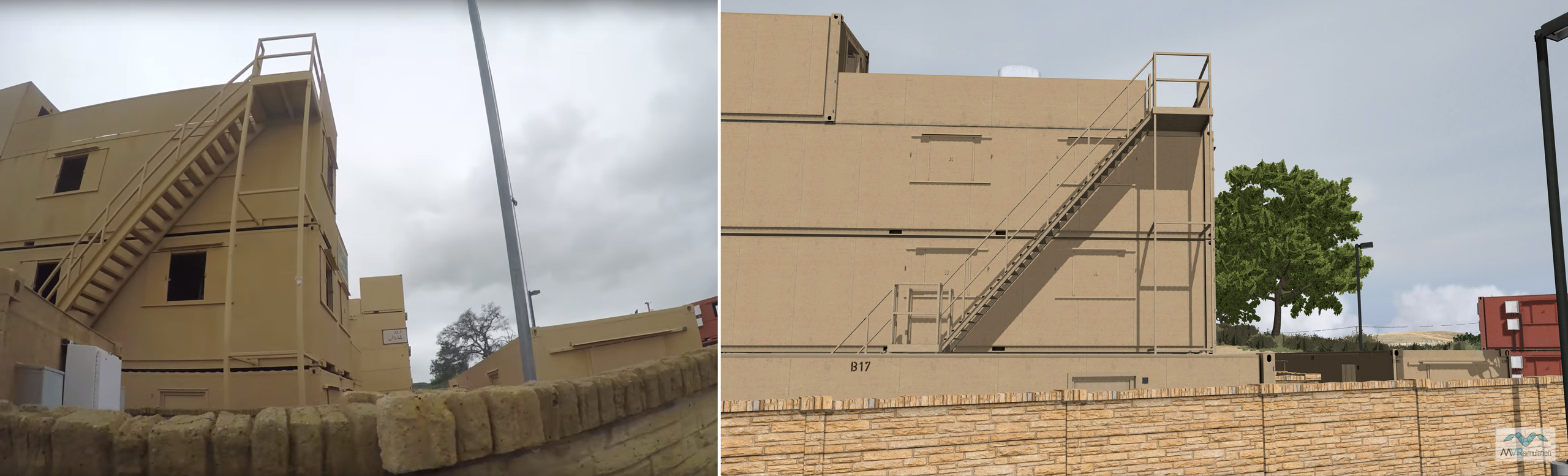
Reference photos of the Kilo 2 MOUT site were captured from a public Airsoft gameplay video: Airsoft WAR: Operation Devil Dog at Camp Pendleton K2 (MilSim) - Part 1 by Dutch The Hooligan.
The Camp Pendleton terrain dataset is available on MVRsimulation's CONUS-NAIP Southwest 3D terrain drive. The terrain, in round-earth VRSG terrain format, is available for purchase to all customers who are on active VRSG software maintenance and are US Government agencies or contractors (for official use only). For US-domestic use only, not available for export. The terrain can be viewed with a valid VRSG software license with active software maintenance.