
Fort Huachuca Terrain Database Information
- Imagery:
Black Tower training center: 25cm
Ft. Huachuca: 30cm - Elevation: NED 10 with Lidar data used for the airfield
- Terrain Drive: CONUS Southwest
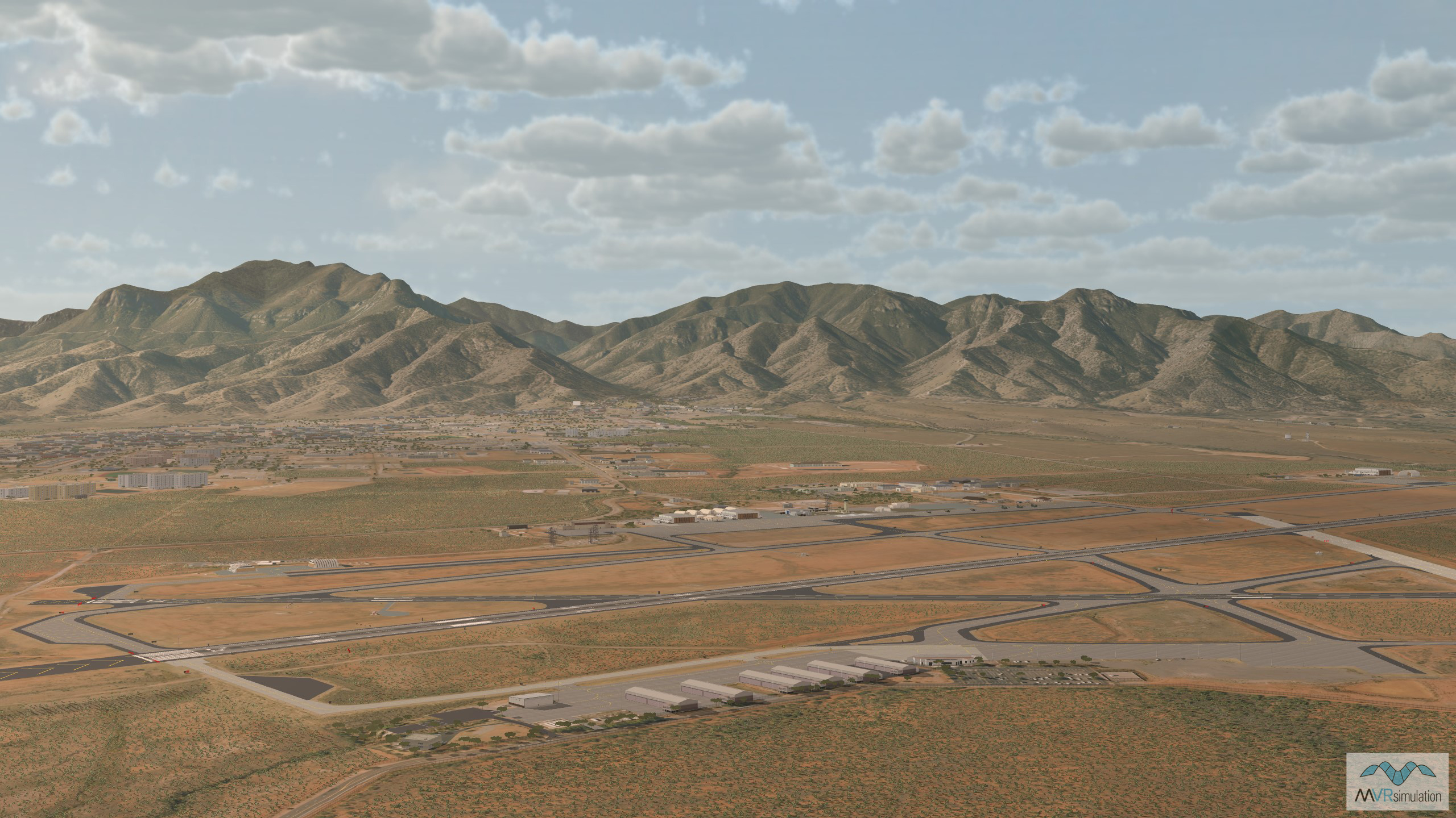
- Detailed model of Sierra Vista Airport/Libby Army Airfield (KFHU), and the surrounding area of Sierra Vista, Arizona
- Fort Huachuca is home to the U.S. Army Intelligence Center of Excellence and Black Tower military training facility.
- Cultural Features: CityEngine/Geotypical Buildings, Control Tower, Custom Models (Geospecific Buildings), Fences or Walls, Hangars, Landscape Features (Shrubs, Grass, Paved Medians, etc.), Light Poles, Lighting for Non-Runway Areas (Streetlights), Navigation Aids, Roads, Runway, Runway Lights, Signs, Taxiways and Associated Markings, Trees, Utilities (Poles, Powerlines or Transmission Lines)
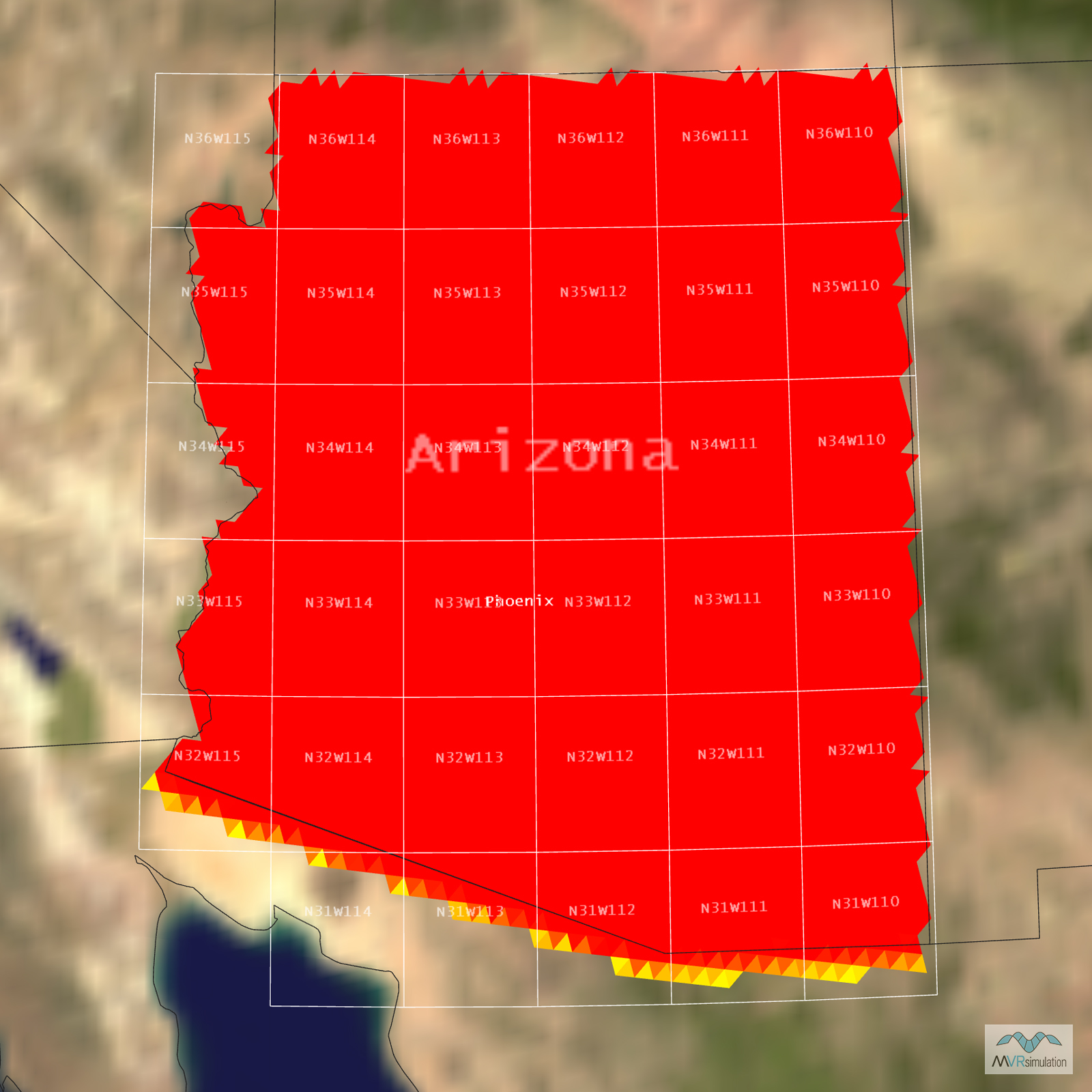
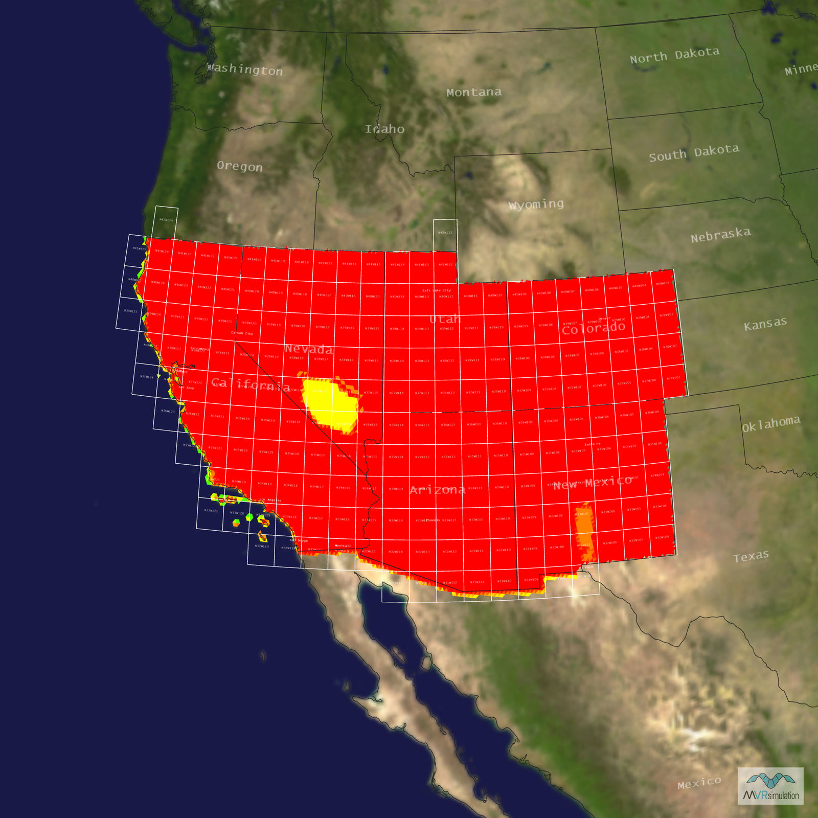
Tile Coverage Map
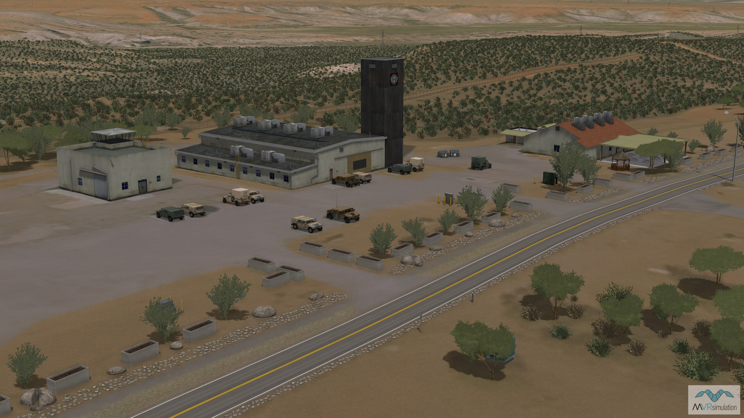
The Ft. Huachuca Black Tower comples is used for training, testing and evaluating unmanned aerial systems (UAS).
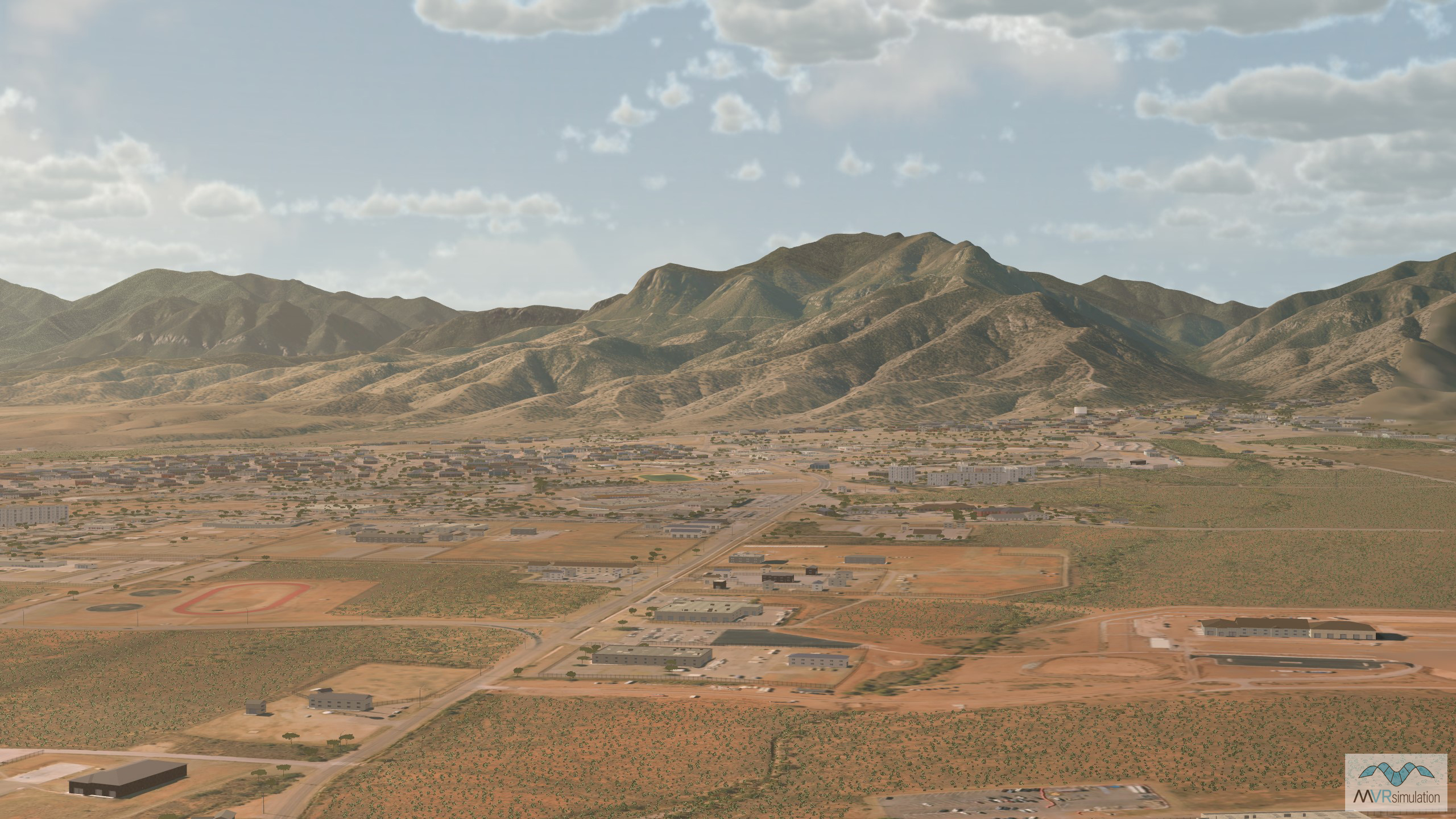
VRSG's Fort Huachuca terrain database, a U.S. Army installation located in the southeastern Arizona desert.
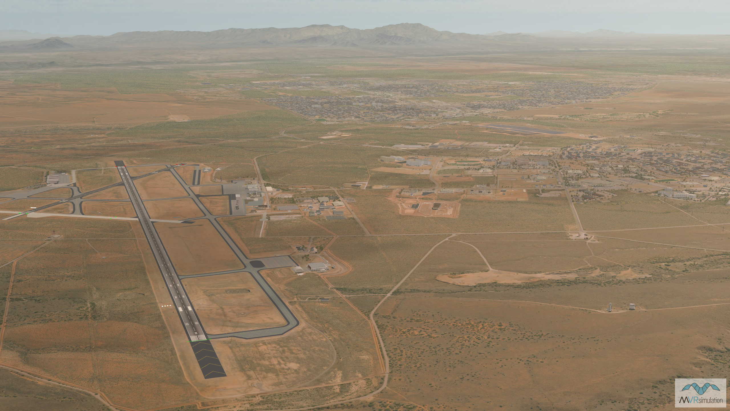
VRSG's 3D terrain model of Libby Army Airfield (KFHU) and the surrounding area of Sierra Vista, Arizona.
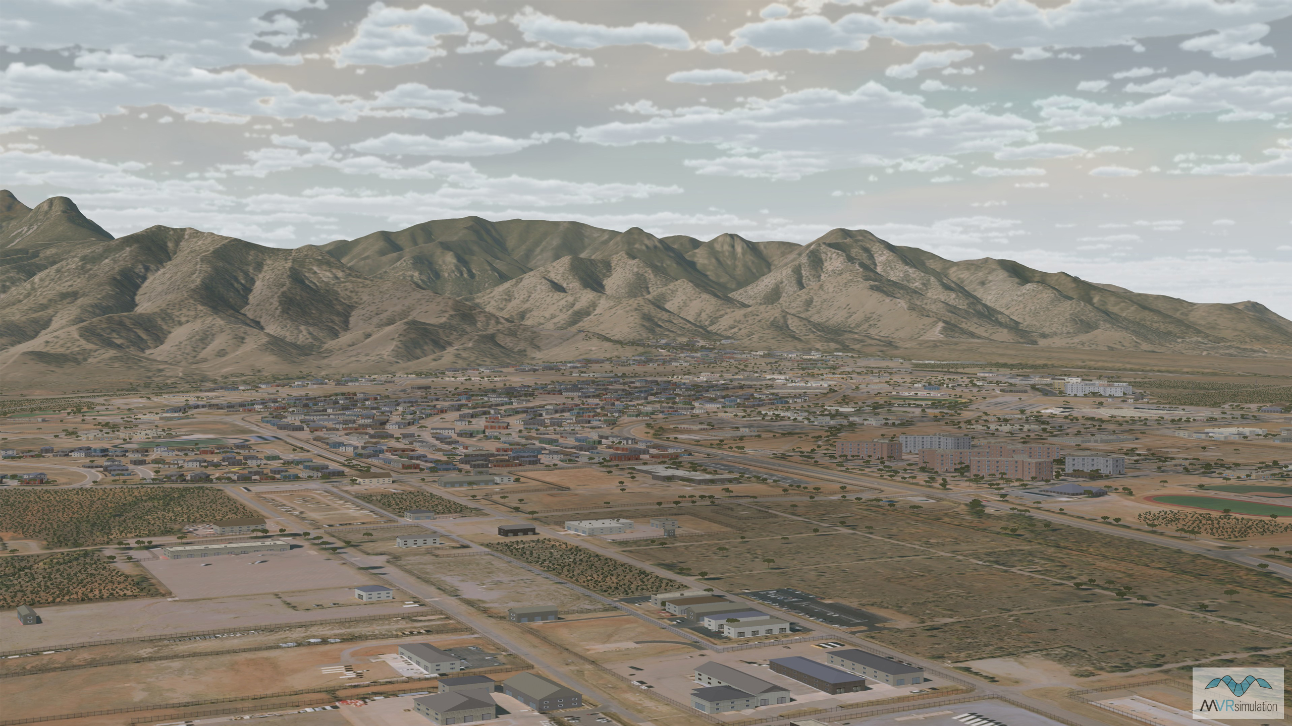
VRSG's Fort Huachuca terrain with view of the surrounding area of Sierra Vista, Arizona.
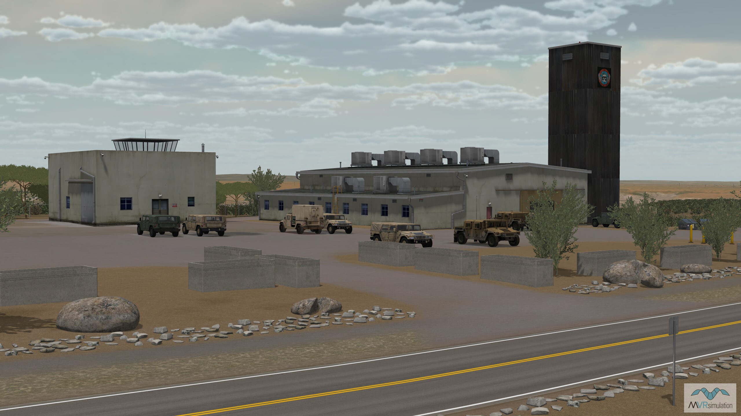
VRSG's Ft. Huachuca terrain database with geospecific model of the Black Tower training center with

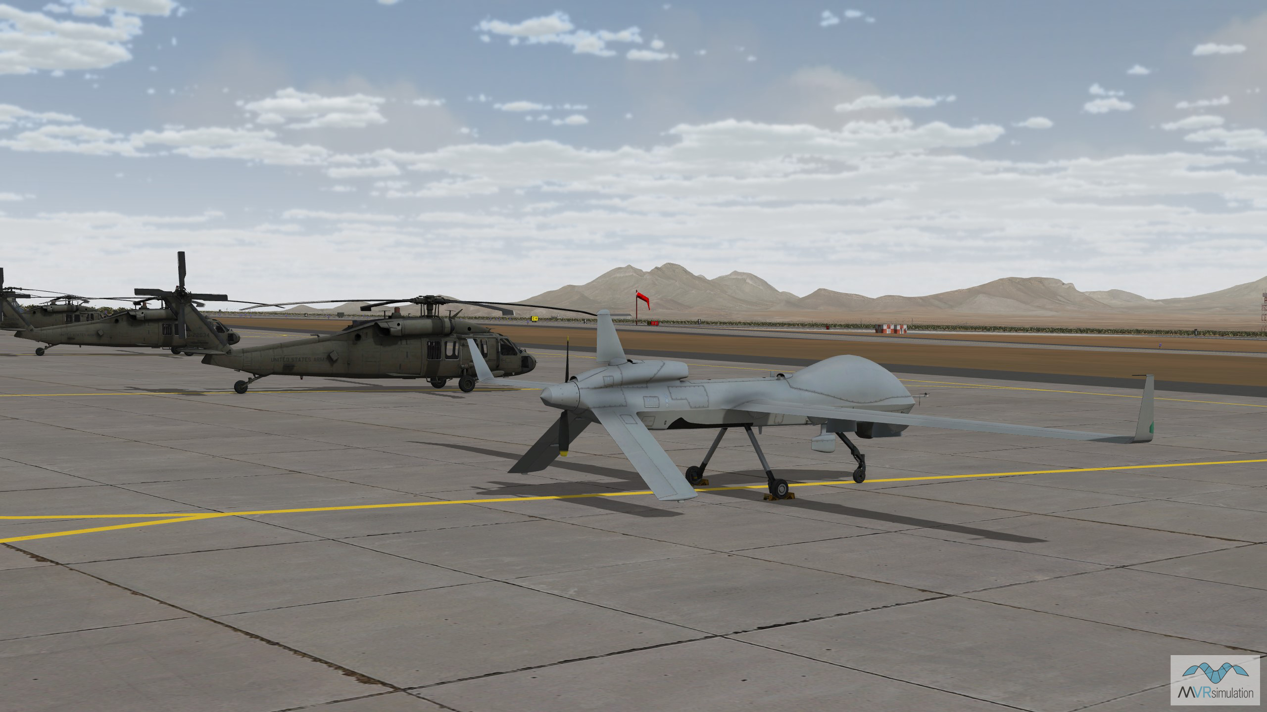
MVRsimulation's MQ-1C Gray Eagle model from the extensive VRSG 3D Model Library sitting on the tarmac in the Ft. Huachuca terrain.


EXTEND YOUR TERRAIN DATABASE
MVRsimulation Downloads Server
- Explore and implement terrain updates
- Download and use new 3D models
- Stay up-to-date with VRSG features
- Discover utilies for expanding VRSG

MVRsimulation Regional Terrain Drives
- External hard drive - regional terrian
- Network attached storage device - whole-world terrain
- Ready for plug and play
- Available to customers on active maintenance
MVRsimulation Produced Custom Terrain
- Custom terrain created by MVRsimulation's terrain team
- Specify your desired area of interest
- Indentify needed terrain features.
- Use your own or commercially available imagery
Create Terrain with Terrain Tools
- Build real-time 3D terrain for VRSG using GIS technology with ArcGIS Pro
- Designed to be user-friendly for users with basic ArcGIS knowledge
- Use imagery, elevation, and optional vector data to create terrain
- Compile buildings from 2D polygon footprint features using a CityEngine rule package