
MVRsimulation at I/ITSEC 2016
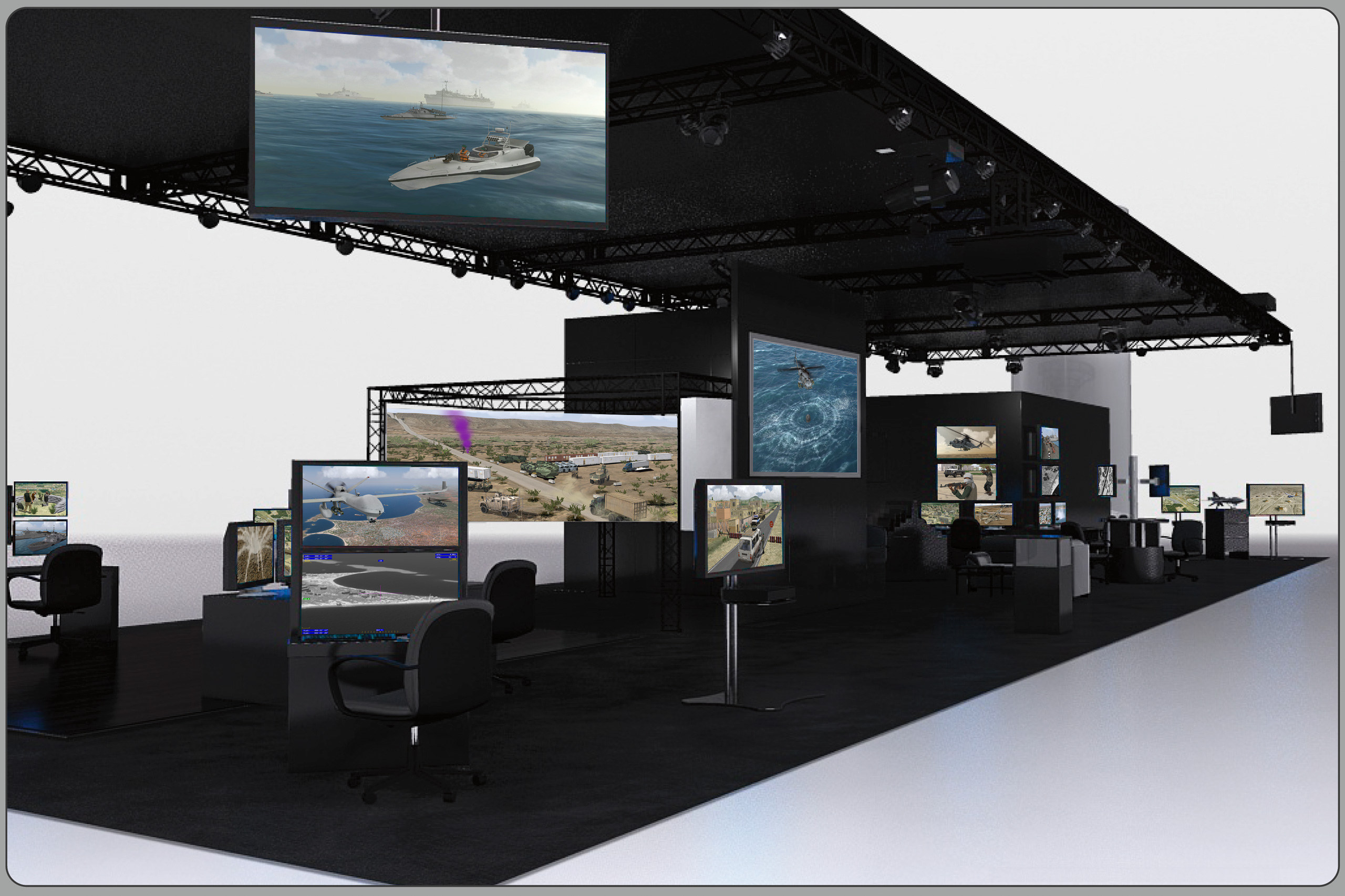
Illustration of MVRsimulation's 30' x 90' booth #1026 at I/ITSEC 2016.
MVRsimulation and its business partners exhibited their products and technology in booth #1026 at the Interservice/Industry Training, Simulation and Education Conference and Trade Show (I/ITSEC), held November 28 - December 1, 2016, at the Orange County Convention Center, Orlando, FL, USA.
I/ITSEC interview with MVRsimulation's W. Garth Smith about VRSG's new 3D sea states capabilities:
MVRsimulation hosted business partners Battlespace Simulations, Close Air Solutions, and Swift Radioplanes. A 4-meter 220⁰ cylindrical display featuring a seamless high fidelity image surface was provided by Immersive Display Solutions (IDSI).
DEMONSTRATIONS IN THE MVRsimulation BOOTH
At I/ITSEC, MVRsimulation unveiled VRSG’s new 3D ocean simulation in scenarios featuring many naval models from our military model library of 100 naval vessels on geospecific terrain/ocean body of the Strait of Hormuz and the littoral area of the port city of Kismayo, Somalia. Many of the vessels have deck details modeled to first-person level.
MVRsimulation also demonstrated two new 3D terrain datasets:
- High-resolution geospecific Marine Corps Base Camp Pendleton terrain with 2 modeled MOUT sites (Combat Town 25 and Kilo 2), which the company recently built for participants in the OBW LVC event.
- Geospecific terrain at 2 cm per-pixel resolution of the Prospect Square area of the U.S. Army Yuma Proving Ground (YPG), using 17 sq km of 2 cm per-pixel resolution imagery captured by the company’s SUAS. Demos took place on the detailed virtual SOTACC Village MOUT site.
Other demonstrations in the MVRsimulation booth included:
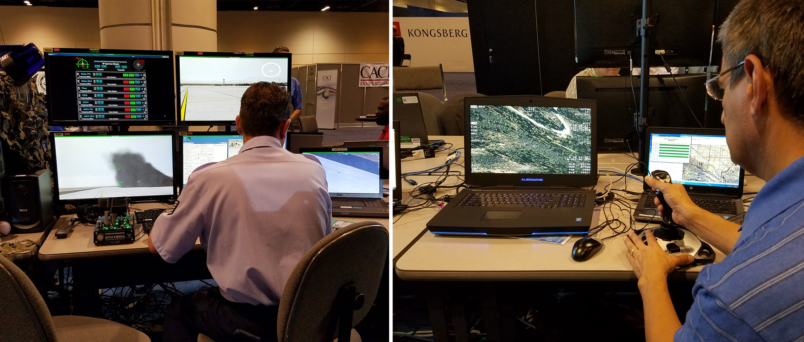
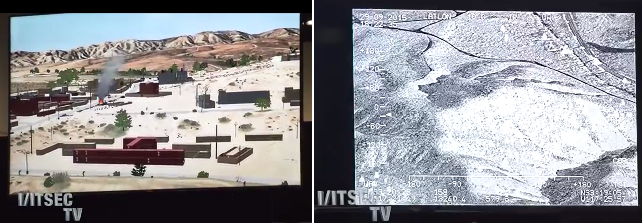
MVRsimulation and Battlespace Simulations’ (BSI’s) JTAC desktop simulation system (accredited by JFS ESC and STANAG) which was set up for conducting close-air-support training exercises with Close Air Solutions, instructors with relevant domain knowledge. The training scenario took place on MVRsimulation’s geospecific Kismayo 3D terrain and was designed to test JTAC, UAS, and close air support aircrew in a complex mission environment with 5-Line, 9-Line, and Call-for-Fire interfaces generated from BSI's Modern Air Combat Environment (MACE) software running on the instructor/role-player station. The simulator’s 4-meter 220° curved display was provided by IDSI.
High-resolution geospecific 3D terrain of a village in Kabul province, Afghanistan.
High-resolution geospecific 3D terrain and modeled airfields in Continental US plus Alaska and Hawaii (CONUS++). The CONUS++ demos included fly-through sequences on 26 modeled airports and airfields, most of which were created between 2015-2016 with high-resolution imagery and geospecific and geotypical cultural content.
MVRsimulation's SUAS for collecting sub-inch geospecific imagery for real-time 3D terrain, was on display.
All terrain was built in MVRsimulation’s round-earth VRSG terrain format with MVRsimulation Terrain Tools for Esri ArcGIS. All of the real-time demos were created with Scenario Editor, using substantial cultural feature, character, and land, sea, and air vehicle assets, and 3D character animations fromMVRsimulation’s 3D content and animation libraries.
Also in MVRsimulation's booth, BSI demonstrated its latest version of MACE, a computer generated forces (CGF)/semi-automated forces (SAF) software application, which uses VRSG for its 3D visuals and is capable of simulating an air, ground, naval and electronic warfare battlespace. In addition BSI demonstrated Viper, a low-cost PC-based DIS radio, and DIScord, a DIS recorder used for after action review.
Swift Radioplanes, the creators of MVRsimulation’s SUAS, demonstrated features of the aircraft and two examples of 2 cm terrain that MVRsimulation built from the 2 cm imagery that the aircraft collected at two target ranges at NAS Fallon and at the Prospect Square area of Yuma Proving Ground. Swift Radioplanes operated the aircraft at both sites.
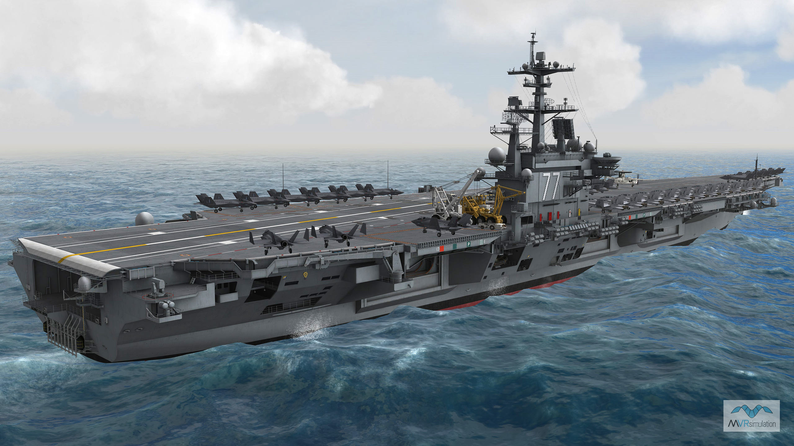
Preview of VRSG's 3D ocean sea states featuring a CVN-77 vessel on rough seas.
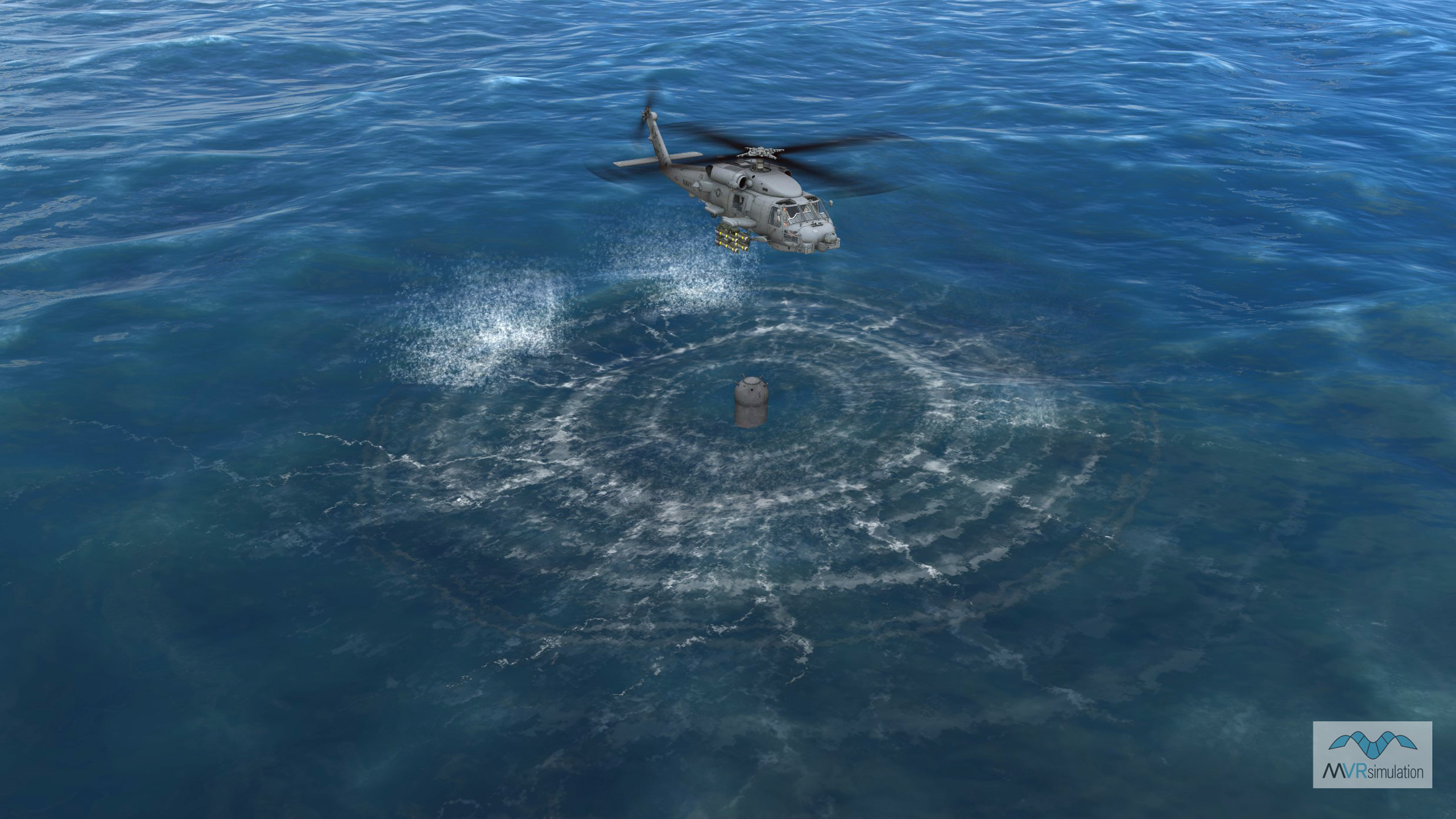
Preview of VRSG's 3D ocean sea states with rotor-wash of an MH-60R entity hovering over a drift mine.
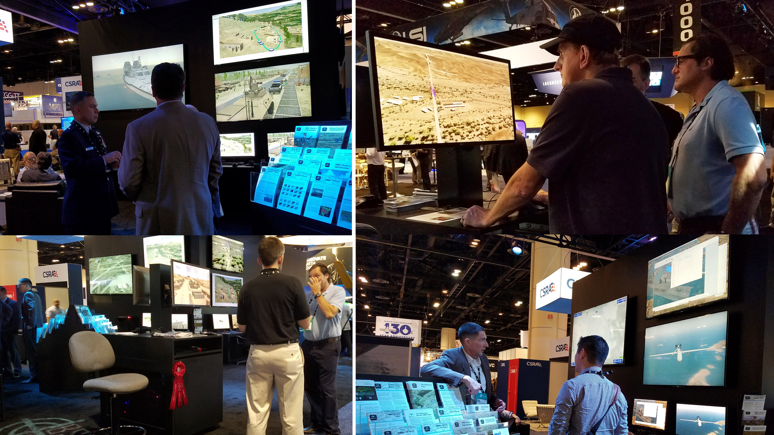
Demos and discussions in MVRsimulation's booth.
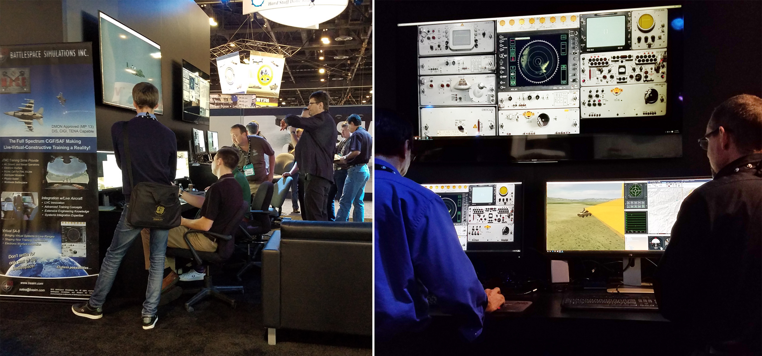
BSI demonstrating MACE.
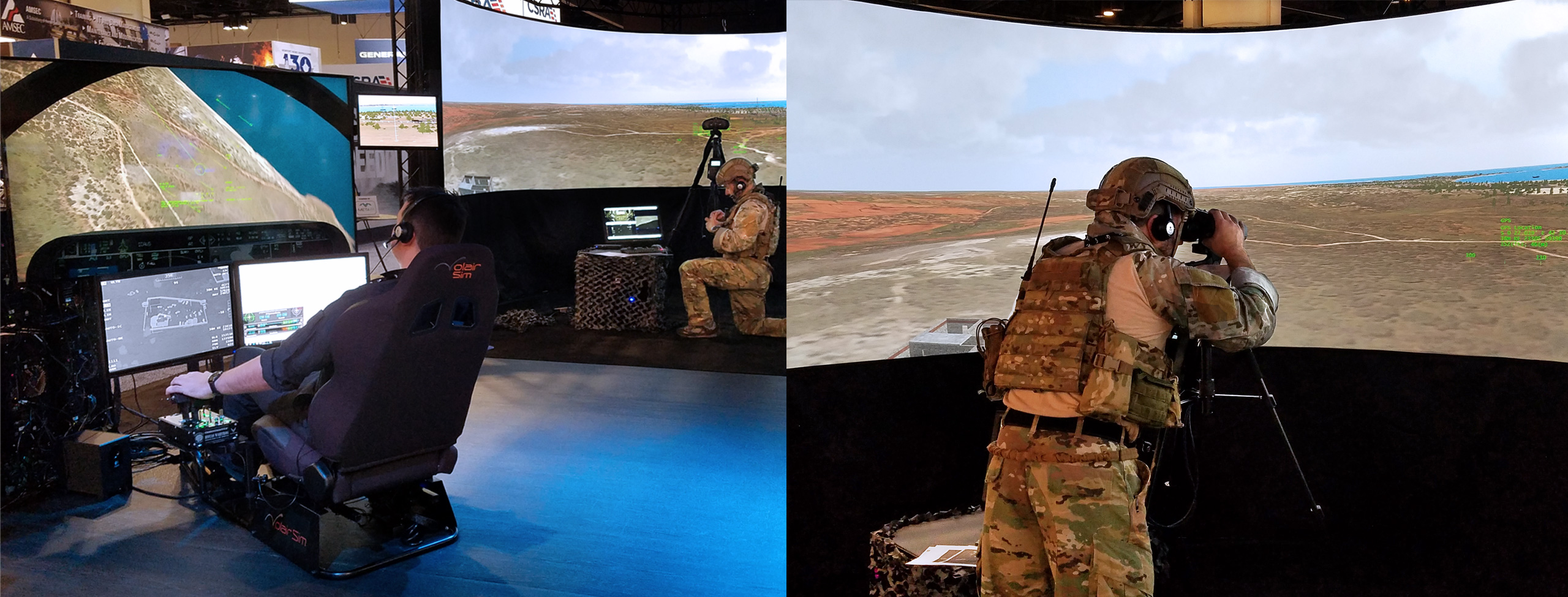
Close Air Solutions conducting JTAC training on MVRsimulation and BSI’s JTAC desktop simulator.
MVRsimulation Customers and Business Partners at I/ITSEC 2016
During the week-long "Operation Blended Warrior" (OBW) LVC event at I/ITSEC, MVRsimulation customers PLEXSYS Interface Products, TRU Simulation + Training, and ZedaSoft, used VRSG with MVRsimulation's terrain of Camp Pendleton (with modeled Kilo 2 and Combat Town 25 MOUT sites) in their respective simulators.
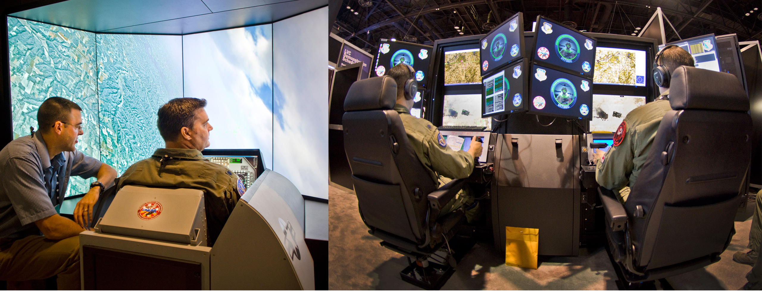
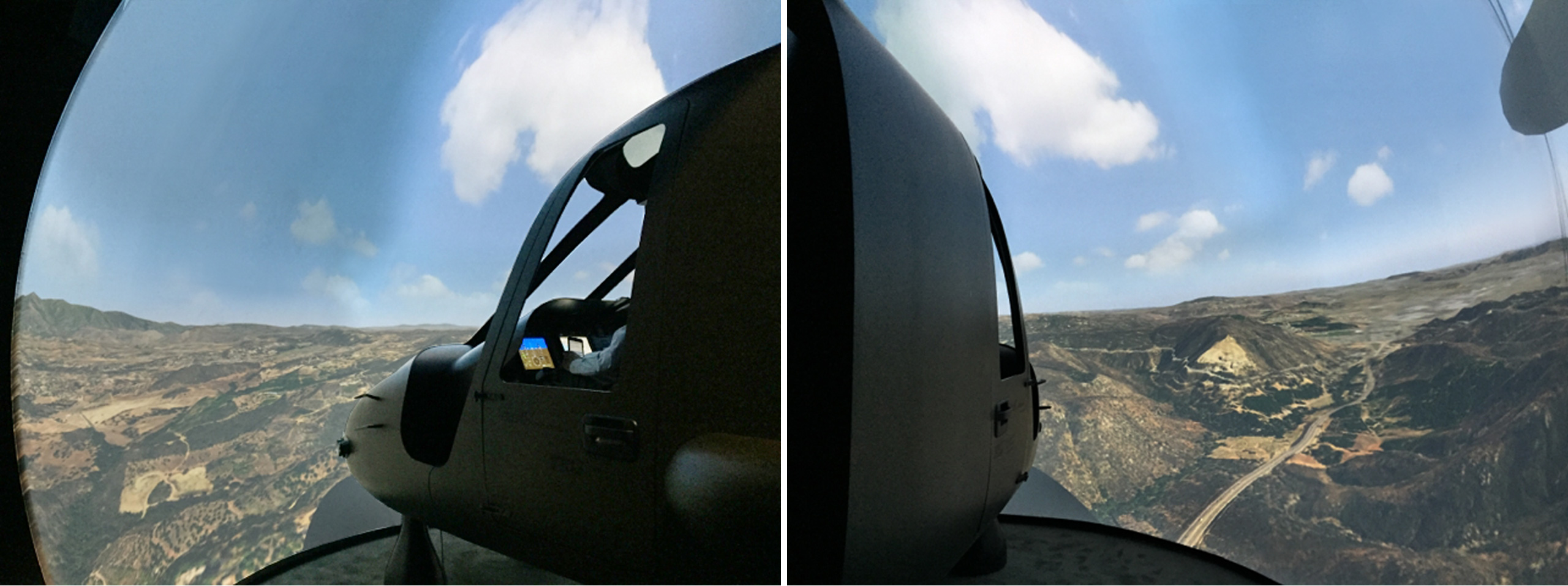
In the Air National Guard (ANG) booth, the Iowa Air National Guard Distributed Training Operations Center (DTOC) conducted demos all week, which included VRSG in its Air-to-Air and Air-to-Ground vignettes, with ZedaSoft's F-16 Reconfigurable Cockpit System (RCS) Simulator as part of a reconfigurable dome display demonstration, QuantaDyn's portable JTC TRS, and displayed on monitors above the DTOC operator workstations. The demos used the same IDSI 4-meter 240° dome for both fighter training and JTAC training.
The F-16 cockpit simulator was situated in the dome for the Air-to-Air vignettes, and then it was swapped with QuantaDyn's portable JTC TRS, which used the dome in the Air-to-Ground vignettes while the F-16 cockpit simulator continued in the vignettes using a LED display system. The IDSI dome featured 10 VRSG channels projected through Barco FS70 Ultra High Definition (3600 x 2250) projectors.
Elsewhere, VRSG was used in the following demos at I/ITSEC:
AFRL's Warfighter Readiness Division demonstrated VRSG in its deployable JTAC training dome and PRINCE MQ-9 simulator, and in its F-16 XDTT simulator. These simulators participated in the Warfighter Readiness Division’s “Cleared Hot” LVC demos throughout the week.
IDSI demonstrated VRSG in booth with QuantaDyn's JTC TRS with a 4-meter 220° dome display with multi-channel Sony GTZ280 4K Laser Projection System. IDSI also ran VRSG on its VisionStation 2 RP/Pilot Station and hosted AFRL’s 3-meter 220° MiniDome display integrated with AFRL’s F16-XDTT desktop cockpit trainer. Elsewhere, IDSI’s 4-meter 240° dome was hosted in the Air National Guard booth.
PLEXSYS Interface Products demonstrated its newest simulation solution, SimWorks, with VRSG during both OBW and non-OBW demonstrations, providing Command and Control for OBW airborne assets. PLEXSYS demonstrated its newly developed CIGI between VRSG and SimWorks using MVRsimulation's new Camp Pendleton terrain database.
Sony Electronics demonstrated a VRSG maritime-based scenario featuring VRSG’s new 3D ocean simulation. This scenario was displayed at 4K resolution on a 55” PVM-X550 OLED monitor.
TRU Simulation + Training demonstrated its V-280 cockpit simulator with VRSG for out-the-window and sensor views during both OBW and non-OBW demonstrations using MVRsimulation's new Camp Pendleton terrain database.
U.S. Air Force Training Systems Product Group demonstrated in VRSG in the MJAT MQ-9 Reaper simulator and in the BattleStaff MUSE/AFSERS system simulating an MQ-1C Gray Eagle.
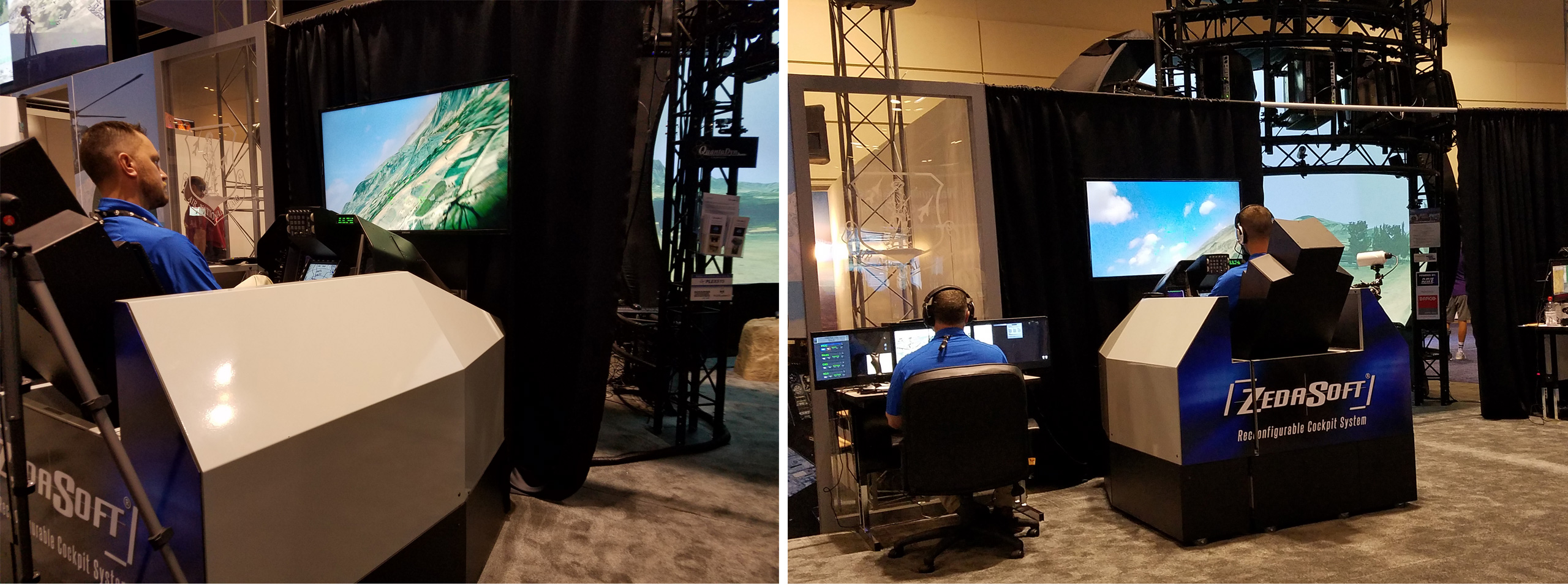
ZedaSoft demonstrated VRSG in: Reconfigurable Cockpit System (RCS) simulator, Reconfigurable Desktop System (RDS) simulator, and the Mockingbird reconfigurable UAV/RPA simulator with EO/IR and SAR payloads. ZedaSoft participated in OBW with its Mockingbird UAV/RPA simulator configured as a Scan Eagle-class UAS during OBW, and its F-16 cockpit simulator, which was located in the Air National Guard booth.
The 505 Command and Control Wing demonstrated VRSG in its JTAC-TACP/Operational Simulation Suite (J-T/OSS) v2.0 Desktop trainer and in the MJAT MQ-9 Reaper simulator with other squadron capabilities used for Distributed Mission Operation Center (DMOC) Flag event integration.
AFRL's "Cleared Hot" LVC demo with MVRsimulation visuals in F-16 XDTT simulator and PRINCE Reaper simulator. (Photos courtesy of AFRL Warfighter Readiness Division.)
Air National Guard's air-to-ground vignette with VRSG and MVRsimulation's Afghanistan terrain running in the F-16 cockpit simulator and JTAC dome trainer.
505 DMOC demonstrating J-T/OSS v2.0 Desktop trainer and MJAT MQ-9 Reaper simulator, both with MVRsimulation visuals.
Left: During OBW, view from VRSG in TRU Simulation + Training's V-280 Valor cockpit simulator of MVRsimulation's Kilo 2 MOUT site on Camp Pendleton terrain.
Right: Sensor view from VRSG in ZedaSoft's UAS/RPA simulator configured as a Scan Eagle-class UAS in OBW of MVRsimulation's Camp Pendleton terrain. (Still images taken from NTSA I/ITSEC 2016 video of OBW.)
TRU Simulation + Training's V-280 technology demonstrator in flight over MVRsimulation's Camp Pendleton terrain during OBW. (Photo courtesy of TRU Simulation + Training.)
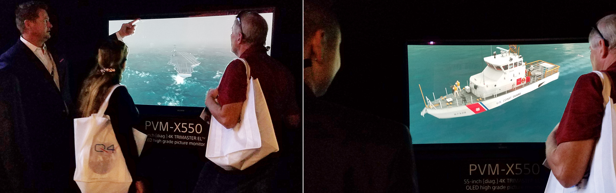
Sony Electronics running a VRSG maritime scenarios on their 55” PVM-X550 OLED monitor.
MEDIA COVERAGE
- December 1, 2016, I/ITSEC TV posted an interview with MVRsimulation's W. Garth Smith about VRSG's new 3D ocean sea states, naval vessels, and other simulation capabilities for naval training MVRsimulation demonstrated at I/ITSEC.
- December 1, 2016, the I/ITSEC 2016 Show Daily, page 22, reports on MVRsimulation's demos featuring VRSG's new 3D ocean capabilities and high-resolution ship models, new Camp Pendleton terrain with two MOUT sites that were used in the week-long OBW LVC event, and the new SOTACC Village MOUT site on Yuma Proving Ground.
- November 30, 2016, Military Technology reported from I/ITSEC 2016 on MVRsimulation's ability to build 2 cm per-pixel solution terrain for simulation training, the importance of such resolution for training, and the general lack of such high resolution terrain in the training and simulation community.
- November 30, 2016, an I/ITSEC 2016 report from Shephard Media describes MVRsimulation's Strait of Hormuz scenario at I/ITSEC and the VRSG's new 3D ocean simulation and the current-day ship models and activity demonstrated in the scenario.
The past event described on this page contains the previous name of our company. Our company name is now MVRsimulation, per our announcement of September 1, 2021.