Naval Air Station Fallon Terrain Database Information
- Imagery: 2cm imagery of two range targets from sUAS imagery collection blended into surrounding 1m imagery
- Elevation: NED 10m
- Terrain Drive: CONUS Southwest
- Cultural Features: Geotypical Buildings, Custom Models (Geospecific Buildings), Fences or Walls, Landscape Features (Shrubs, Grass, Paved Medians, etc.), Lighting for Non-Runway Areas (Streetlights), Runway, Runway Lights
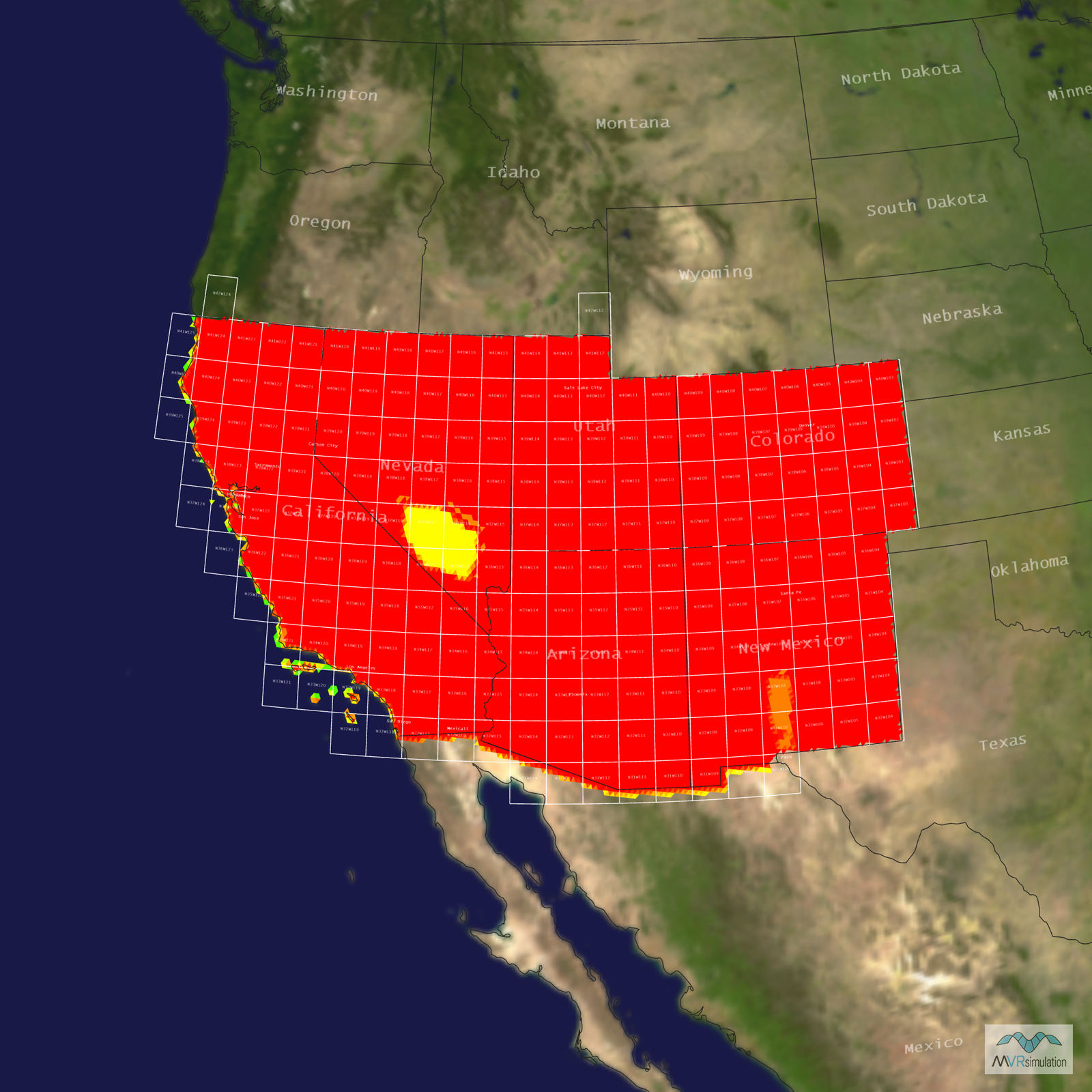
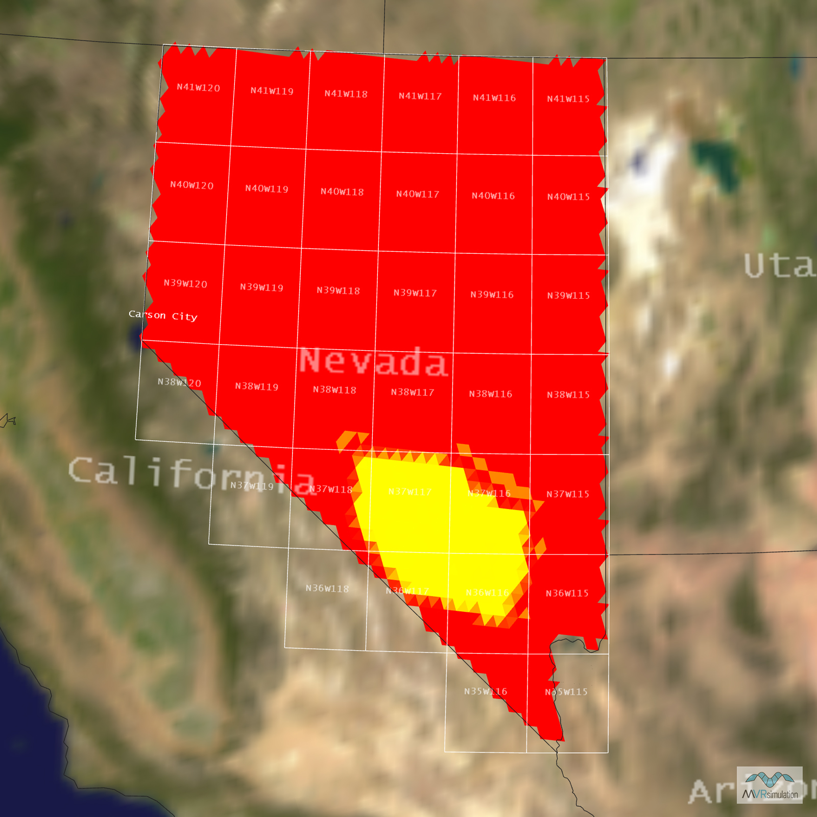
Tile Coverage Map
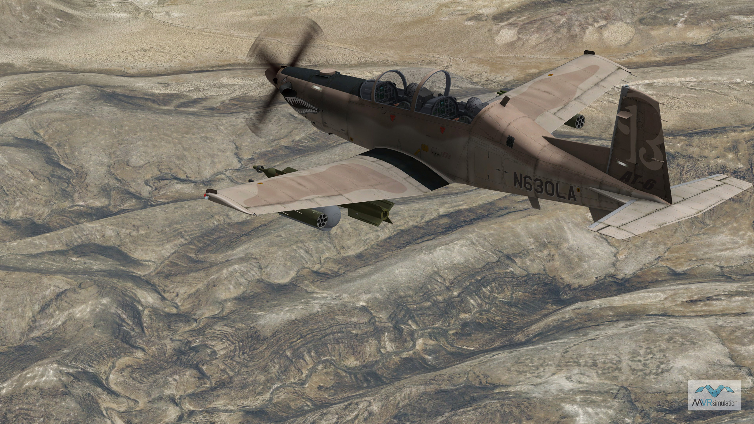
MVRsimulation VRSG real-time scene of a Textron Aviation AT-6B Light Attack Aircraft entity from MVRsimulation's 3D model libraries in flight over rugged terrain at the virtual Fallon Range Training Complex.
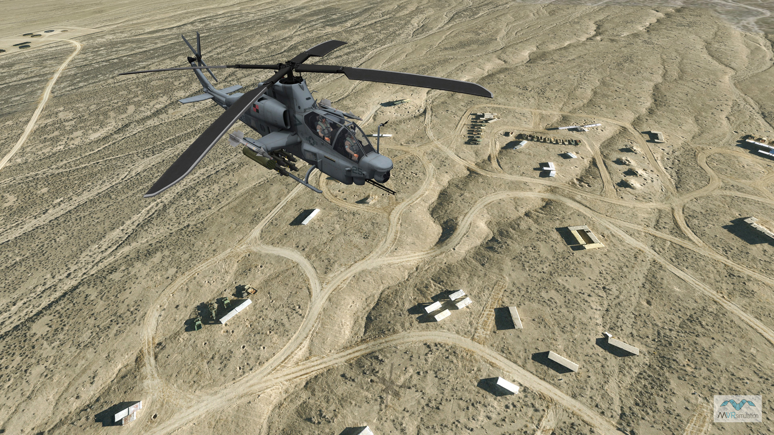
MVRsimulation VRSG real-time scene of an AH-1Z entity in flight over geospecific 2 cm per-pixel resolution 3D terrain of NAS Fallon Range Training Complex.
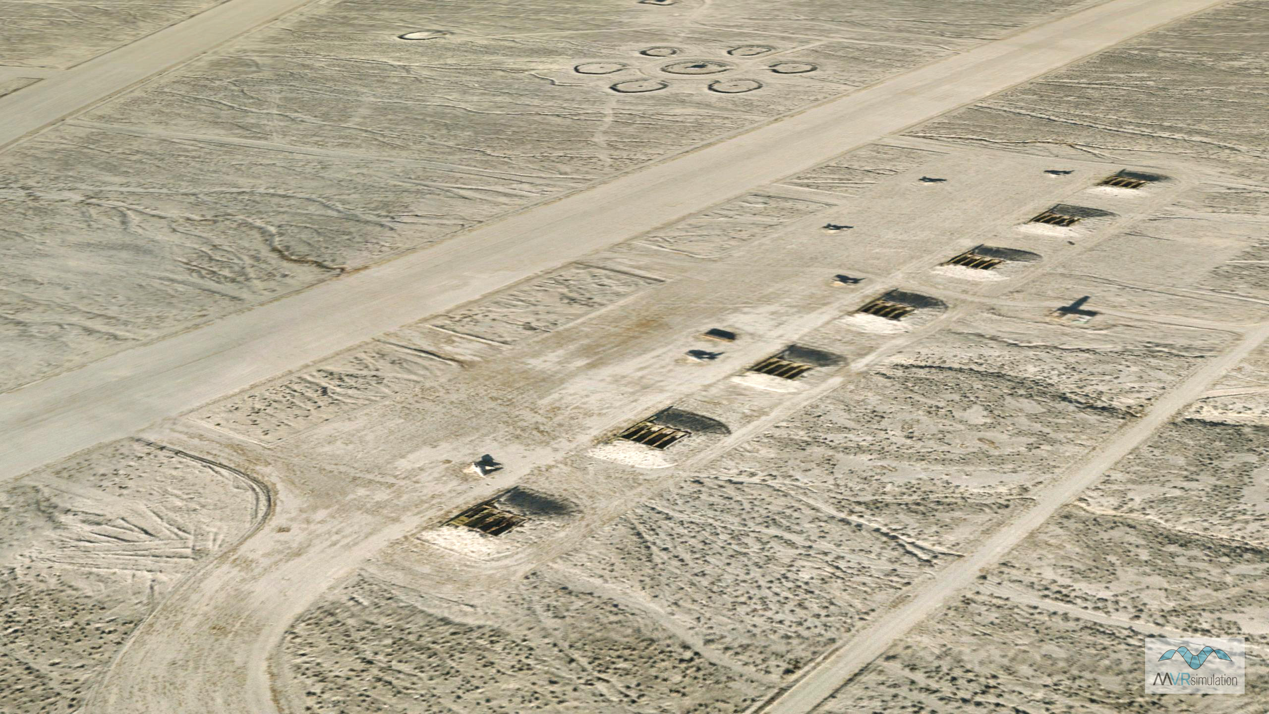
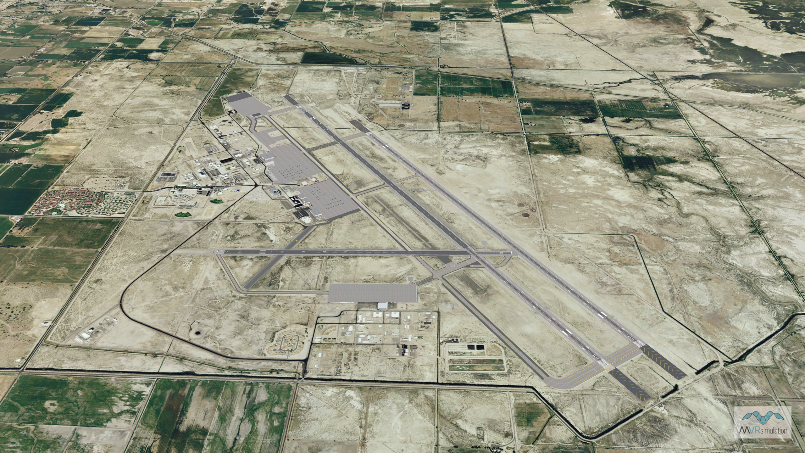
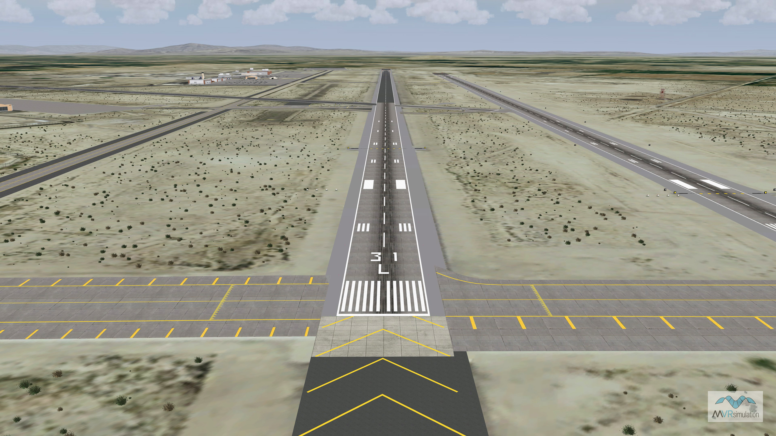
MVRsimulation VRSG real-time rendering of 2 cm per-pixel resolution virtual terrain of the NAS Fallon Range Training Complex.
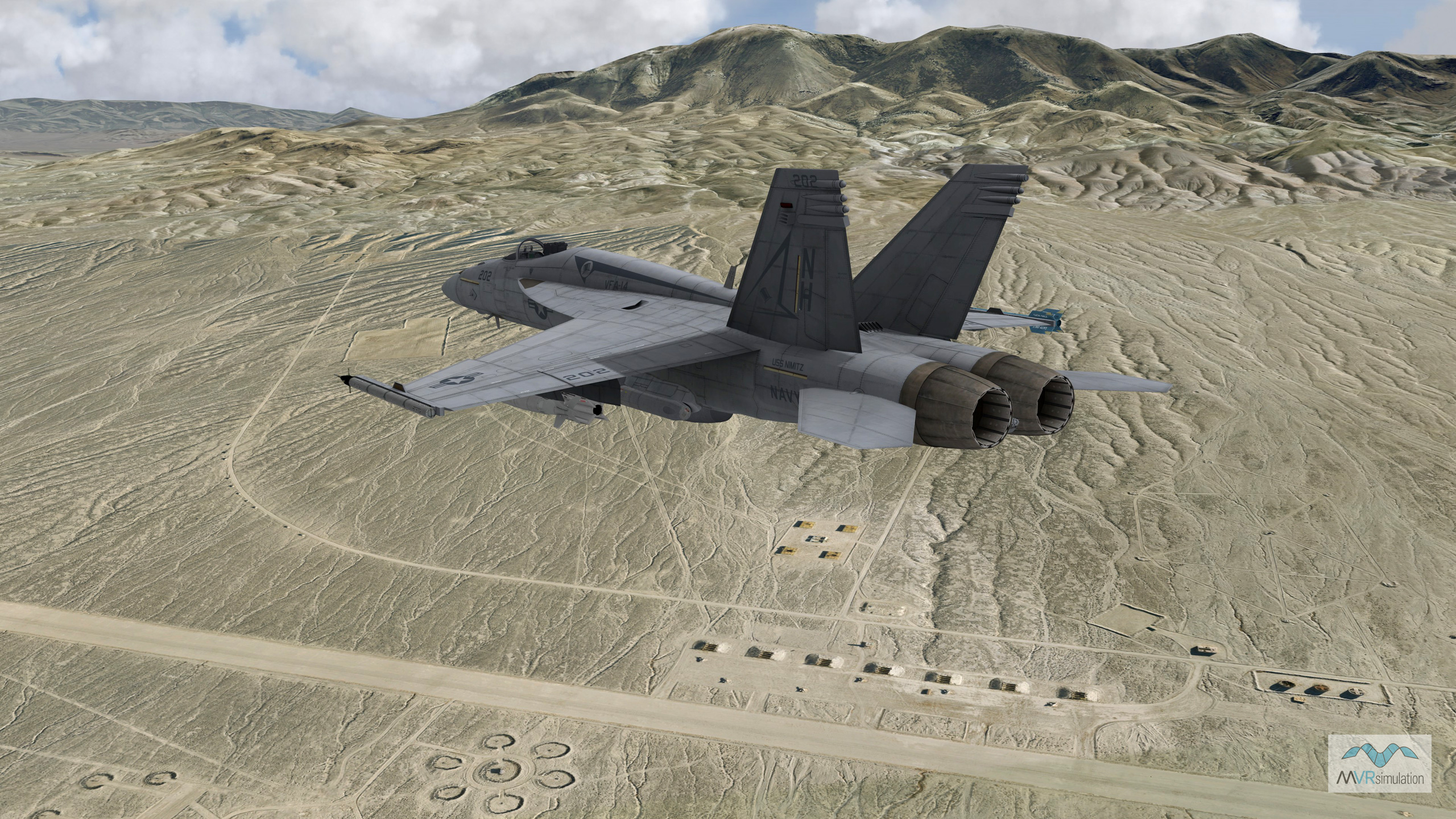
MVRsimulation VRSG real-time rendering of an F/A-18 entity over virtual NAS Fallon Training Complex. The FA-18E entity is outfitted with air combat maneuvering instrumentation (ACMI) on the wing tips for a close air support exercise.
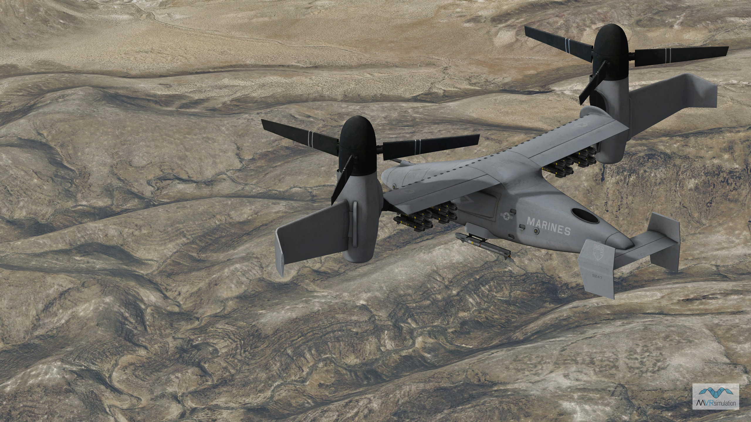
MVRsimulation VRSG real-time scene of a V-247 Vigilant unmanned entity in flight over the geospecific 2 cm per-pixel resolution 3D terrain of virtual NAS Fallon Range Training Complex.
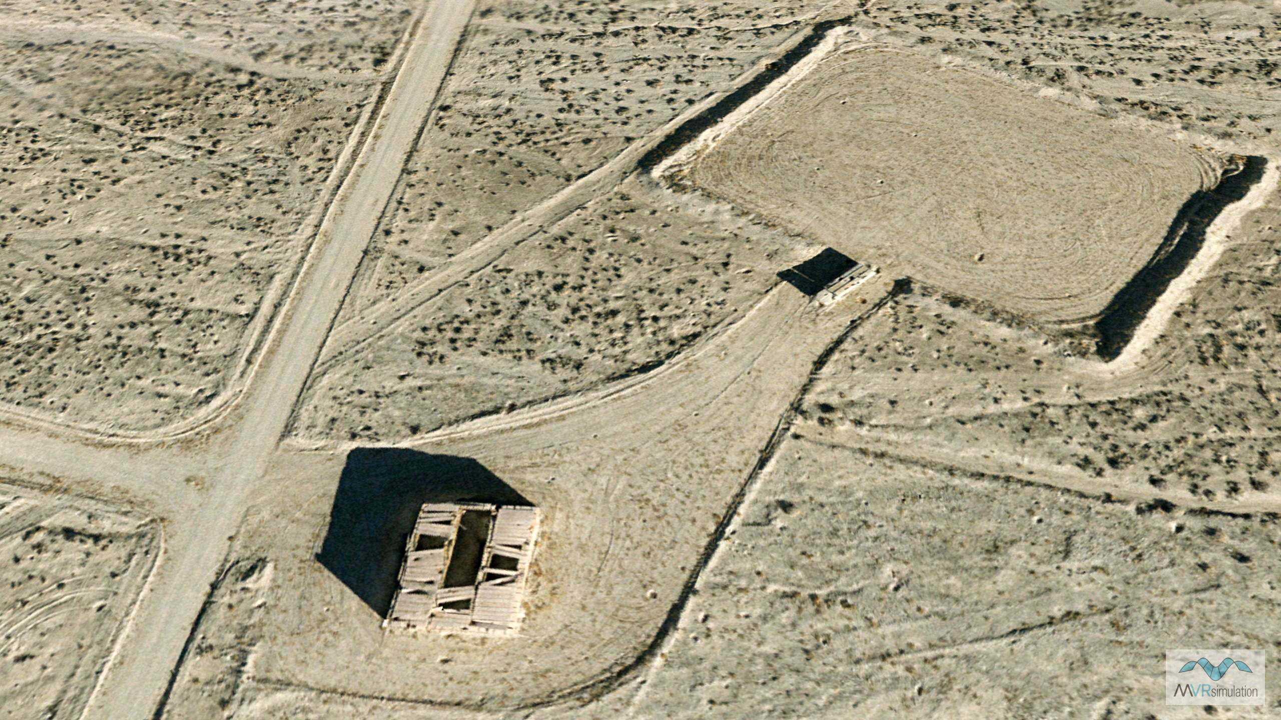
2cm UAS Imagery
MVRsimulation developed highly detailed, geospecific 2 cm per-pixel resolution 3D terrain of the B-17 and B-19 target ranges on the Fallon Range Training Complex (FRTC) at Naval Air Station (NAS) Fallon, Nevada. This terrain, covering 66 square kilometers, was captured using MVRsimulation's small UAS (SUAS) and compiled using Terrain Tools for Esri® ArcGIS®, along with 10-meter NED elevation data. The result is full-resolution terrain tiles in round-earth VRSG format, seamlessly integrated with MVRsimulation's broader CONUS terrain database.
The Naval Aviation Warfighting Development Center (NAWDC) uses this virtual terrain in its Combined Arms Virtual Environment (CAVE) simulator, powered by VRSG, to support applications such as range familiarization and close air support training. The 2 cm resolution imagery enables warfighters to train in a virtual environment that closely mirrors real-world conditions. This ultra-high resolution allows for visibility of critical battlefield details, such as vehicle targets, helicopter landing zones, bomb craters, and even bullet holes in target structures. These visual cues are essential for real-time simulation and provide enhanced realism, particularly when combined with live data feeds from aircraft such as the FA-18E outfitted with air combat maneuvering instrumentation (ACMI). The result is a blended live-virtual training capability that enhances the effectiveness of NAWDC’s simulation-based instruction.