
Virtual Afghanistan Village
To meet the needs of training NATO soldiers for coalition operations in Afghanistan, MVRsimulation built 3D geospecific terrain of the entire country of Afghanistan, covering 647,500 sq. km, featuring a high-resolution virtual village with over 650 buildings in the Afghan province of Kabul. This virtual terrain is available in MVRsimulation's round-earth terrain format for use with VRSG in simulation and training, with particular emphasis on identifying and defeating IEDs using resources from combined military branches and nations.
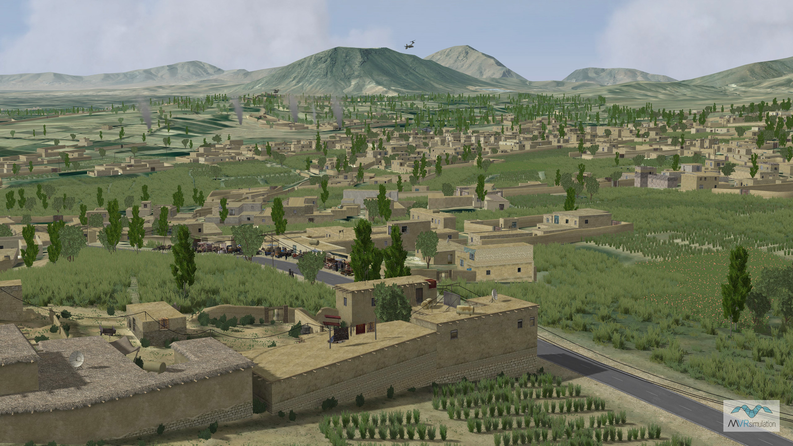
As a significant percentage of Afghanistan's population lives in mountainous terrain, training warfighters in a simulated environment that accurately represents mountainous regions with small population centers is critical. MVRsimulation’s high-resolution Afghan village is set within mountains and complex terrain of varying elevation and cave networks, enabling realistic training scenarios for mission planning and rehearsal of operations in mountainous villages.
The virtual terrain of this area of Afghanistan was built from geospecific high-resolution elevation and imagery source data; it was augmented with finer level terrain details derived from the imagery to add to the realism near ground level. This virtual terrain provides the opportunity for users to conduct challenging exercises within its tunnel and cave network. Accurately simulating typical below-ground entrances is another important part of preparing soldiers for Afghanistan and other mountainous regions. The terrain, which is delivered with VRSG, includes scenarios that were built with Scenario Editor.
The overall imagery resolution of the virtual terrain of the whole country is 2.5 meters. The terrain, built with MVRsimulation’s Terrain Tools for Esri ArcGIS, includes an area of 1,120 sq. km of 60 cm Digital Globe commercial satellite source imagery and 90 meter elevation posts. Within this area is the highly detailed 38 sq. km terrain of a 3D geospecific Afghan village. This terrain was made entirely from commercial, non-export controlled source data.
The effective terrain elevation resolution is much higher in the village areas as the construction of inferred cultural features from the geospecific imagery such as courtyards, tree line, and crops further define the elevation relief. This terrain is built entirely from commercial, non-export controlled source data. Using MVRsimulation’s terrain workflow process, additional terrain areas can be readily constructed.
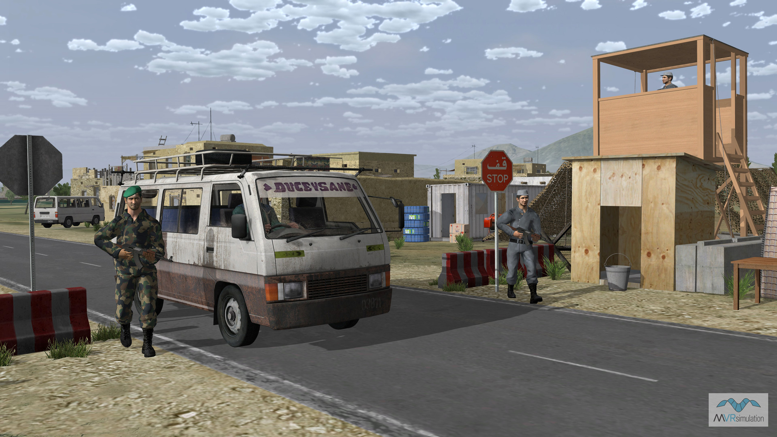
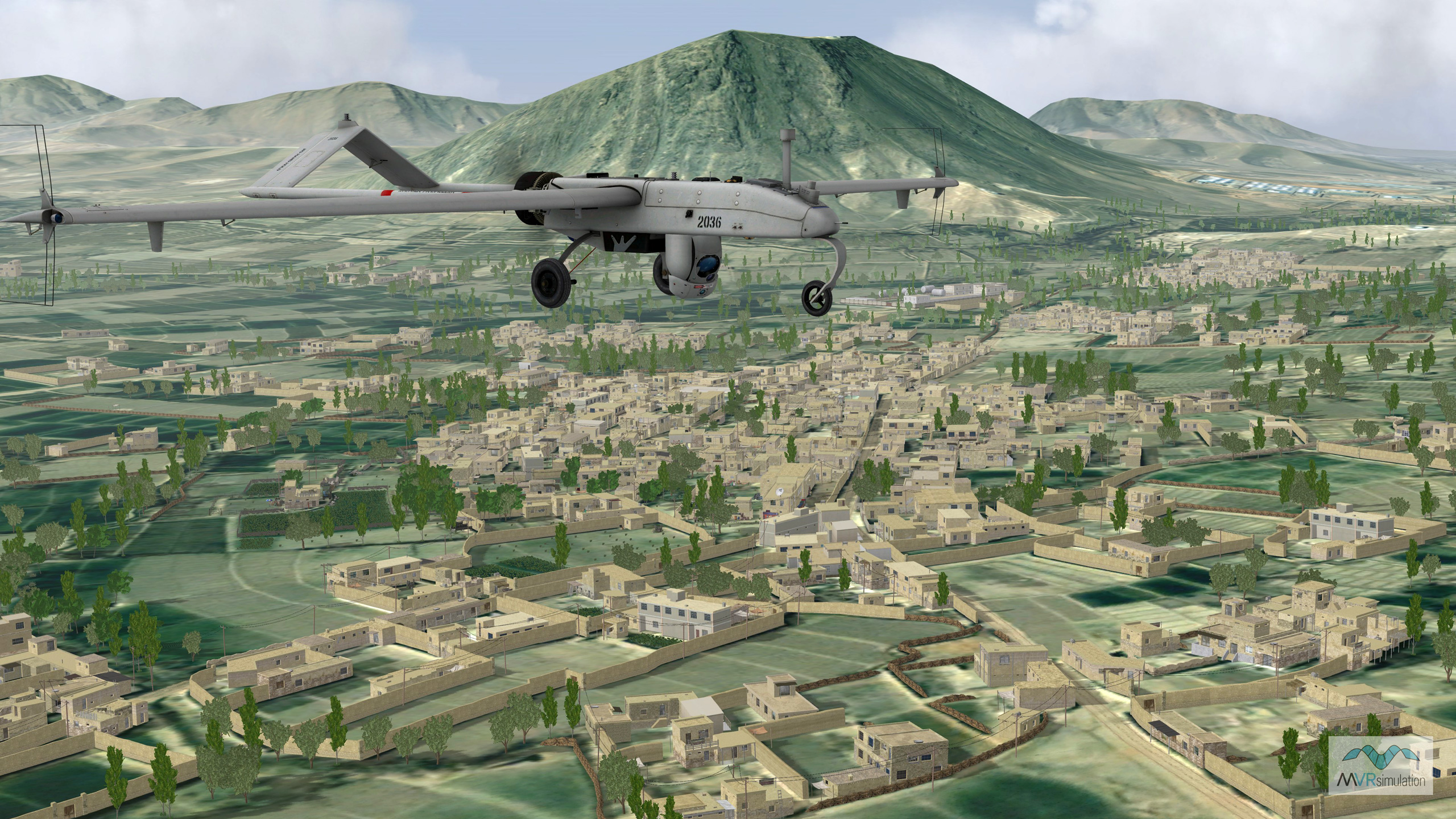
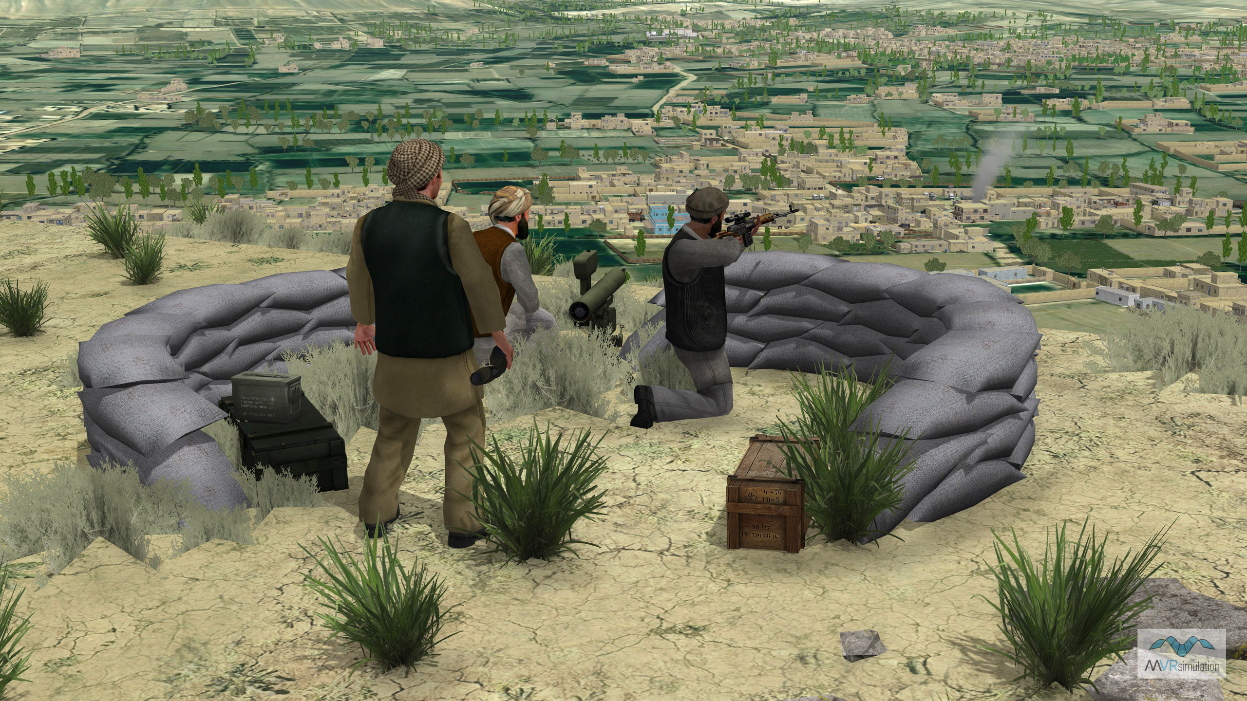
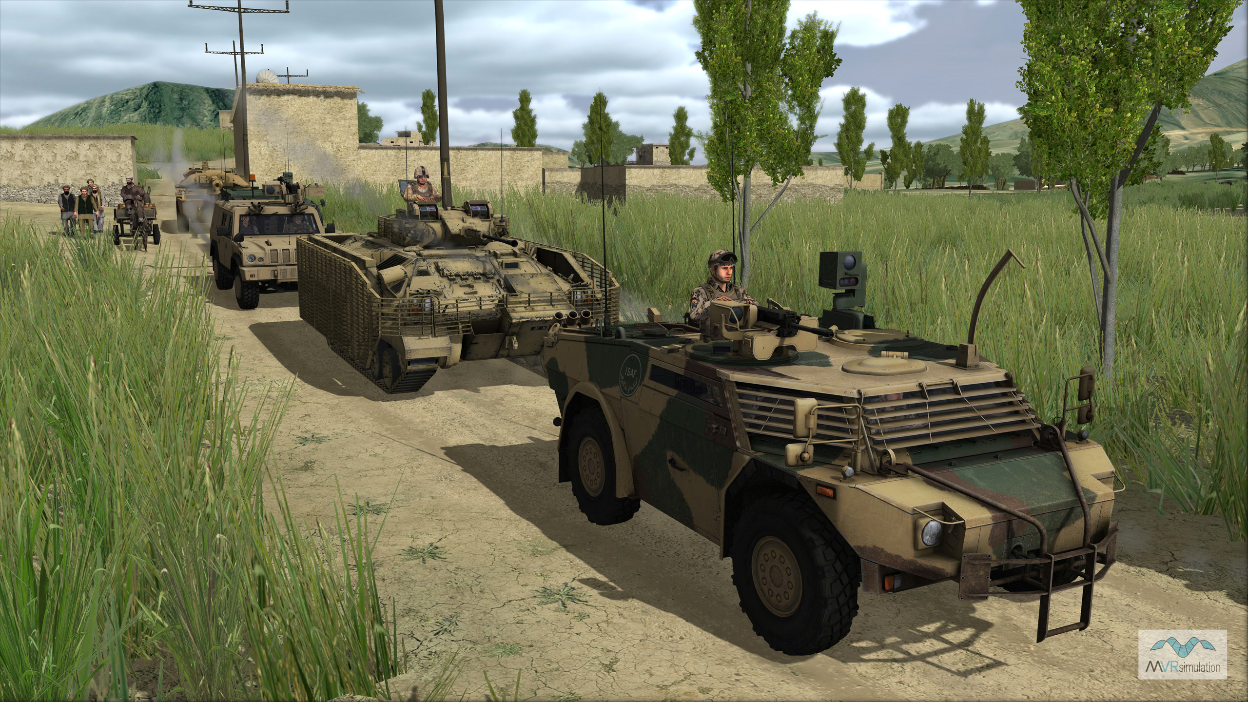
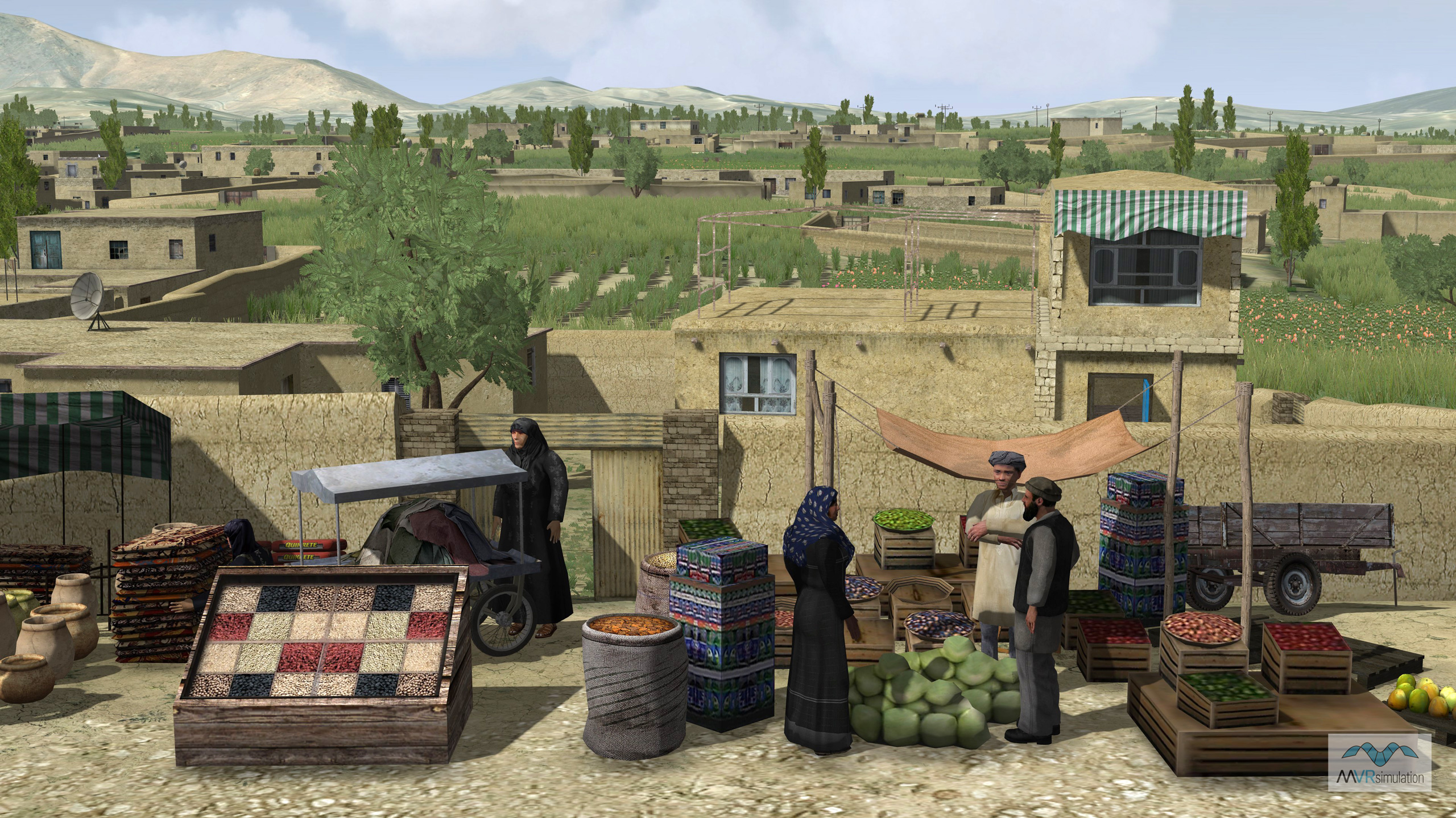
This virtual village and its surrounding mountainous terrain is optimized for conducting ground combat simulations, such as sniper, IED detection, and forward air controller or JTAC exercises such as those undertaken by A-10 missions, with a high degree of realism. For example, the high-resolution terrain and models appear accurately in simulated magnified view scopes and laser designators.
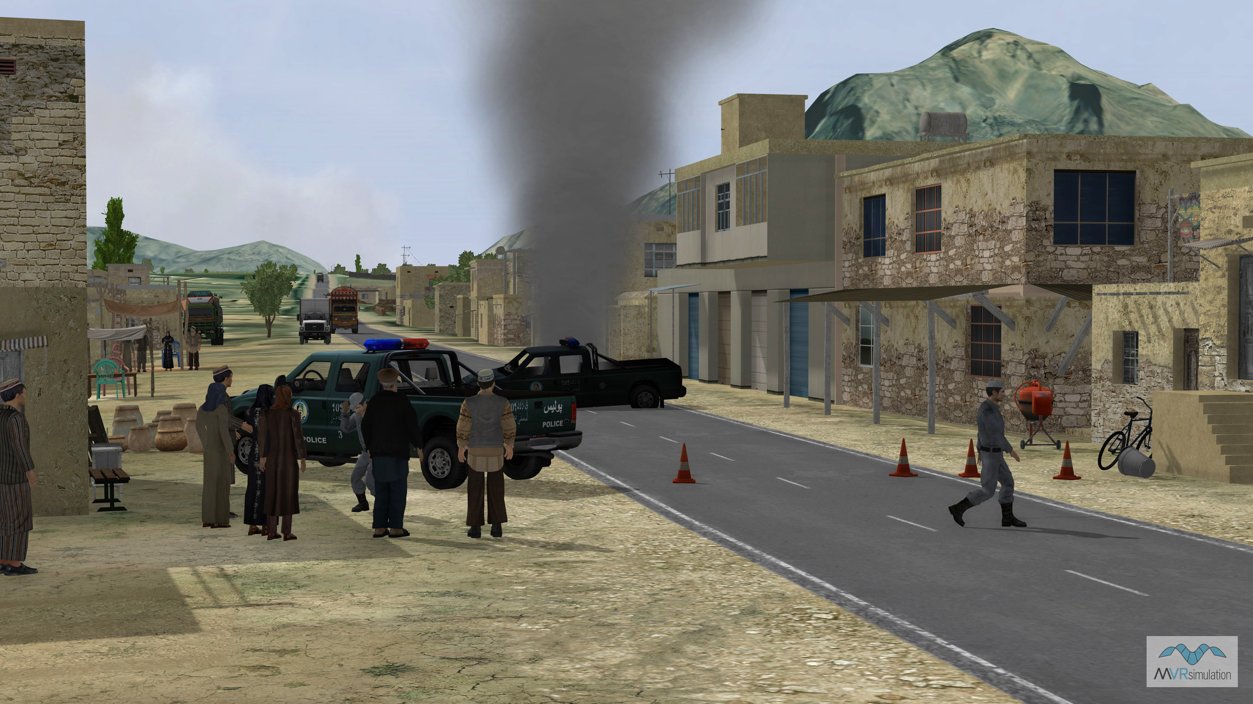
Several scenarios take place on the Afghanistan terrain delivered with VRSG. The scenarios feature a number of technical military vehicle models representative of combat vehicles used in the area. The vehicles, characters, and other models used in the scenarios are all from MVRsimulation’s 3D content libraries, which are bundled with VRSG. In Scenario Editor, which was used to create the scenarios, a significant amount of vehicular and human activity was added to the terrain to create realistic patterns of life. The JTAC scenario that is delivered with the terrain shows an overwatch position on a rooftop. The 3D vehicle entities in the convoy are representative of the types of vehicles that are actually used to transport soldiers in these mountainous regions.
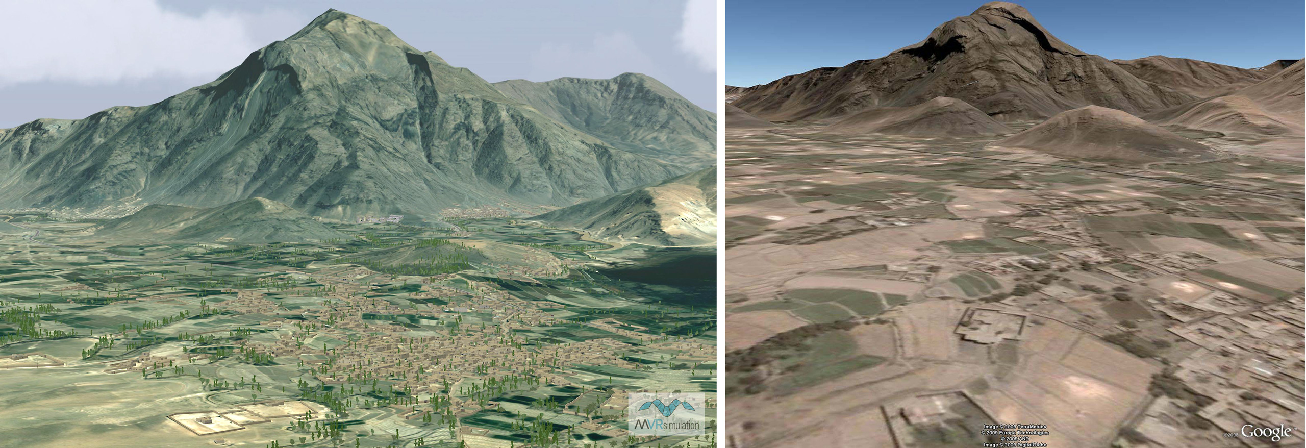
Comparison of MVRsimulation's Afghanistan terrain rendered in VRSG with Google Earth's rendering of the same area.
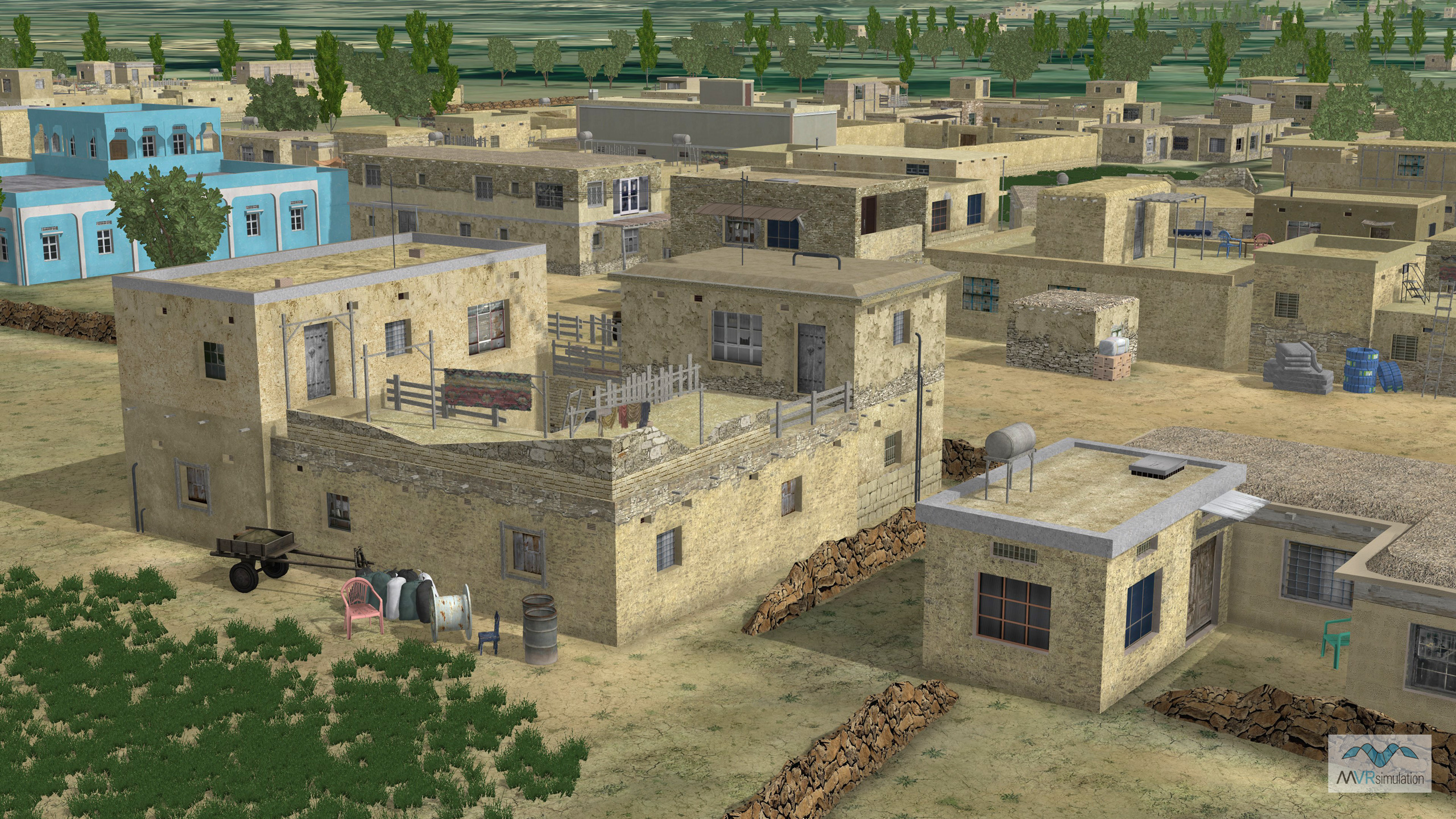
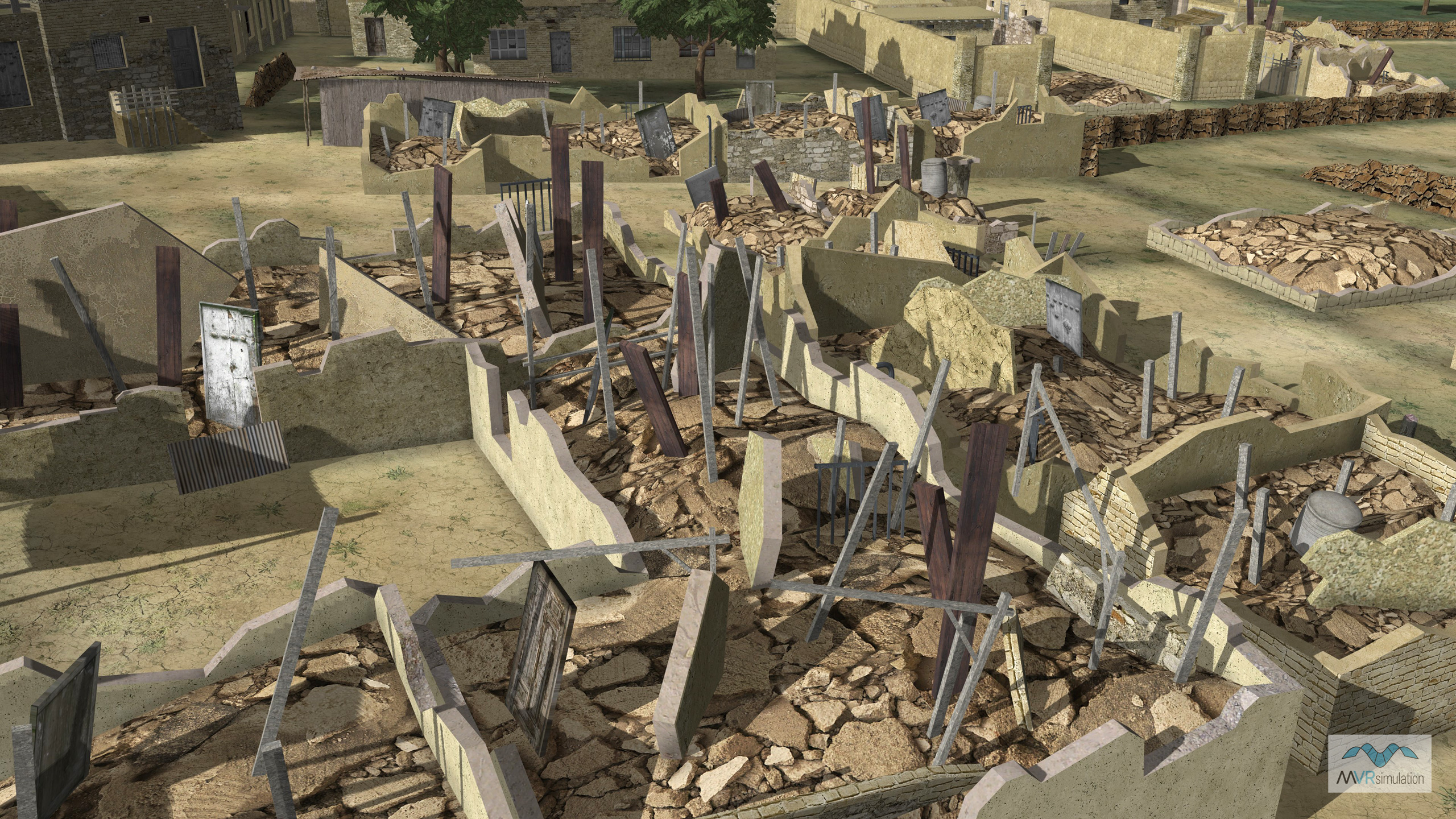
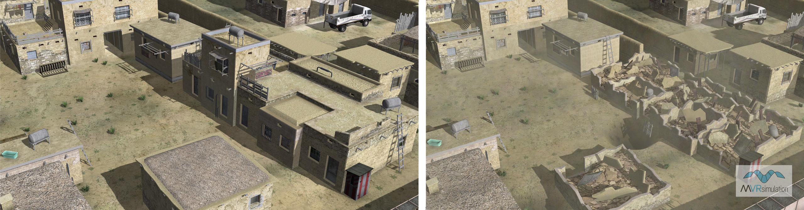
Enhancing the overall SRTM3 elevation data are higher resolution areas of the village. These high-resolution areas define features such as berms, ditches, and a tunnel network, all of which were modeled in Autodesk 3ds Max. The village area has approximately 520 custom-built 3D structures that match the building footprints visible on the source imagery. All 3D content was created in Autodesk 3ds Max, and is referenced by the terrain’s cultural feature file at run time; the content is rendered by VRSG at run-time as part of the terrain. Many of the buildings are multi-level and contain modeled interiors. Open doorways, translucent windows, and stairways, contribute to making the structures within the virtual village suitable for tactical scenarios. The textures of many cultural features are derived from publicly available photographs found on the Internet. Geospecific agricultural fields are also modeled and can be tailored to represent various crop types over different seasons.
The modeled village is based on the village of Khairabad in the southern part of the Kabul province, and includes neighborhoods along the Kabul-Gardez highway. Situated at an altitude of 1,843 meters, Khairabad is located approximately 10-15 kilometers south of Kabul city center, next to Qalai Naeem in the Char Asiab district. Among the village’s 650 models of buildings and other structures are 150 models which have multiple damage states.
A tunnel and cave complex in the virtual Afghan village has an entry point in one of the buildings that is linked to a cave and tunnel position in the courtyard, which could be used as a mortar position. The tunnel exits some distance away in a heavily wooded area behind the building complex and courtyard. The tunnel network is modeled with geometry and textures much like the above-ground terrain. It can support the underground traversal of small entities such as small unmanned ground vehicles (SUGVs) or characters.

Three VRSG views of a tunnel complex on the Afghanistan 3D terrain: the entrance and exit and a cross-section view of the tunnel from below the terrain.
MVRsimulation's Afghanistan 3D terrain is available free of charge in MVRsimulation's round-earth VRSG terrain format to customers who are on active software maintenance and are US Government or NATO agencies or contractors (for official use only). The terrain is provided in MVRsimulation's round-earth terrain format and will only run with a valid VRSG software license with active software maintenance.