Martinez CACTF at Fort Wainwright Terrain Database Information
- Imagery: 50cm
- Elevation: USGS 1 meter LIDAR blended with USGS 3 meter NED
- Terrain Drive: CONUS Northwest
- Cultural Features: Building Interiors, Custom Models (Geospecific Buildings), Fences or Walls, Landscape Features (Shrubs, Grass, Paved Medians, etc.), Light Poles, Lighting for Non-Runway Areas (Streetlights), Roads, Signs, Trees, Urban Furniture (Benches, Trash Bins, etc), Utilities (Poles, Powerlines or Transmission Lines)
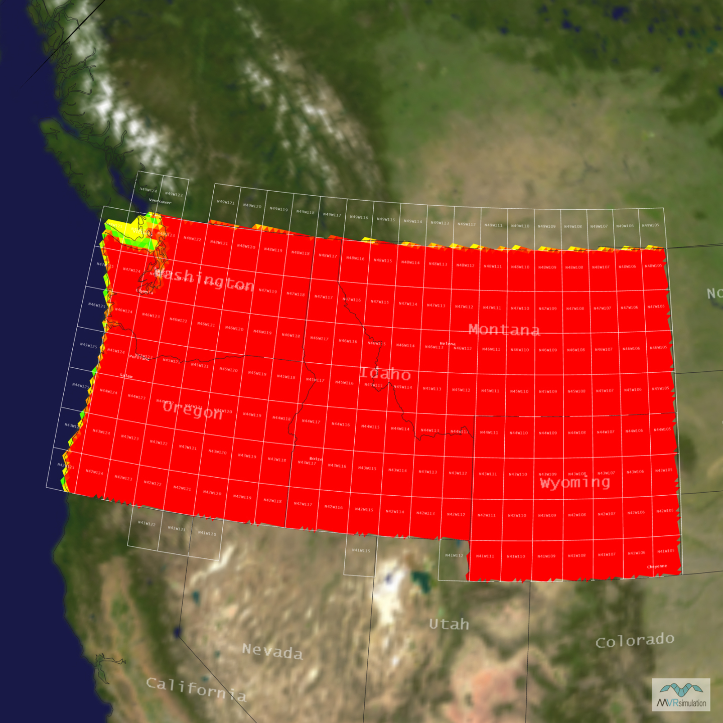
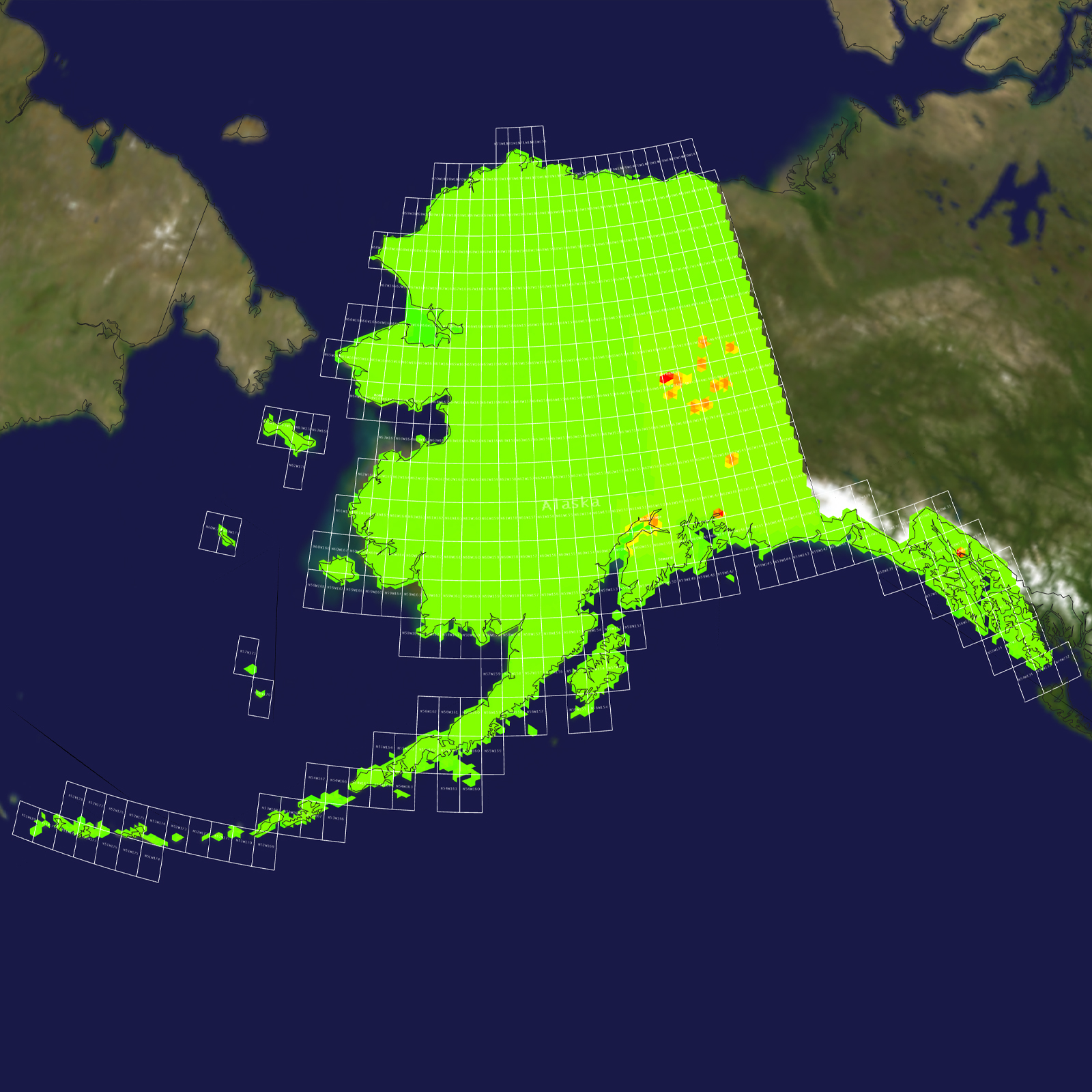
Tile Coverage Map
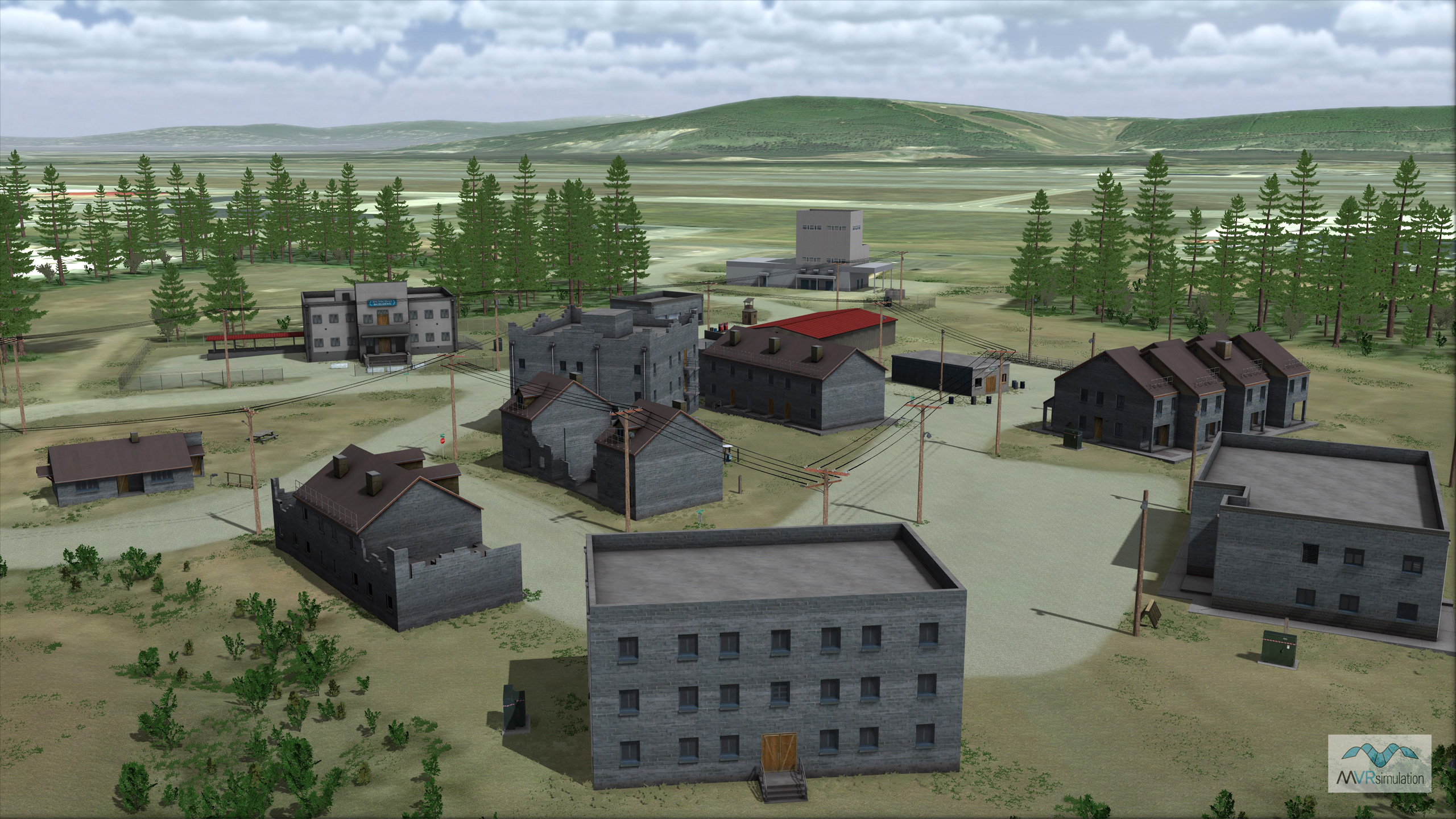
MVRsimulation VRSG real-time scene of a section of the 3D replica of the Martinez training facility at Fort Wainwright.
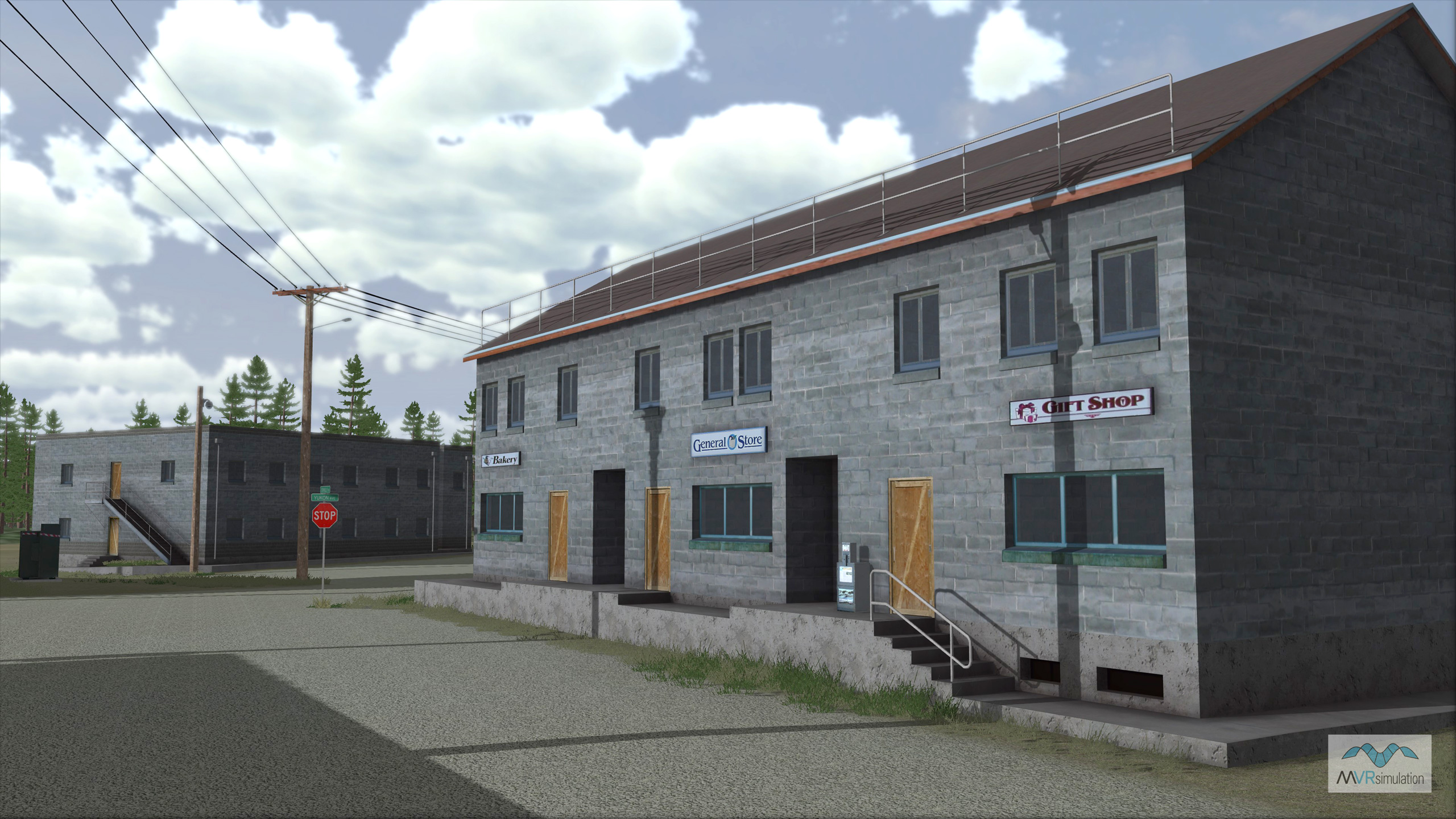
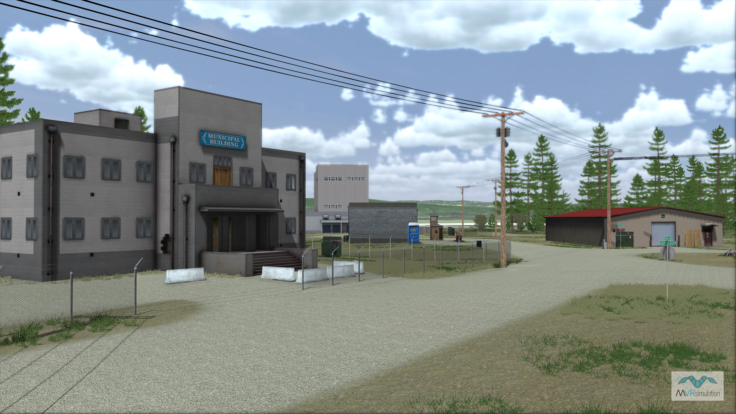
MVRsimulation VRSG real-time close-up of buildings on the 3D replica of the Martinez training facility at Fort Wainwright.
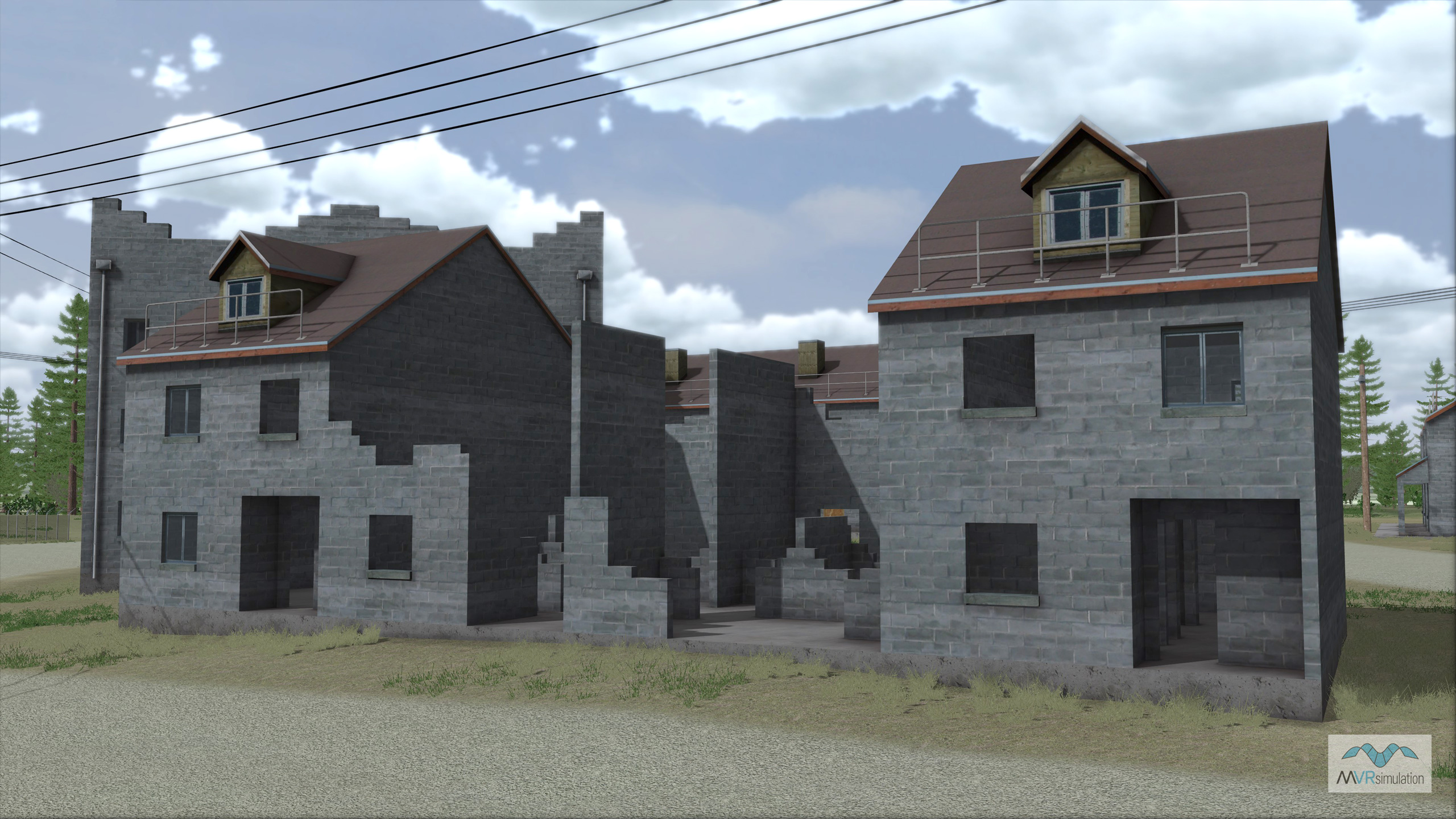
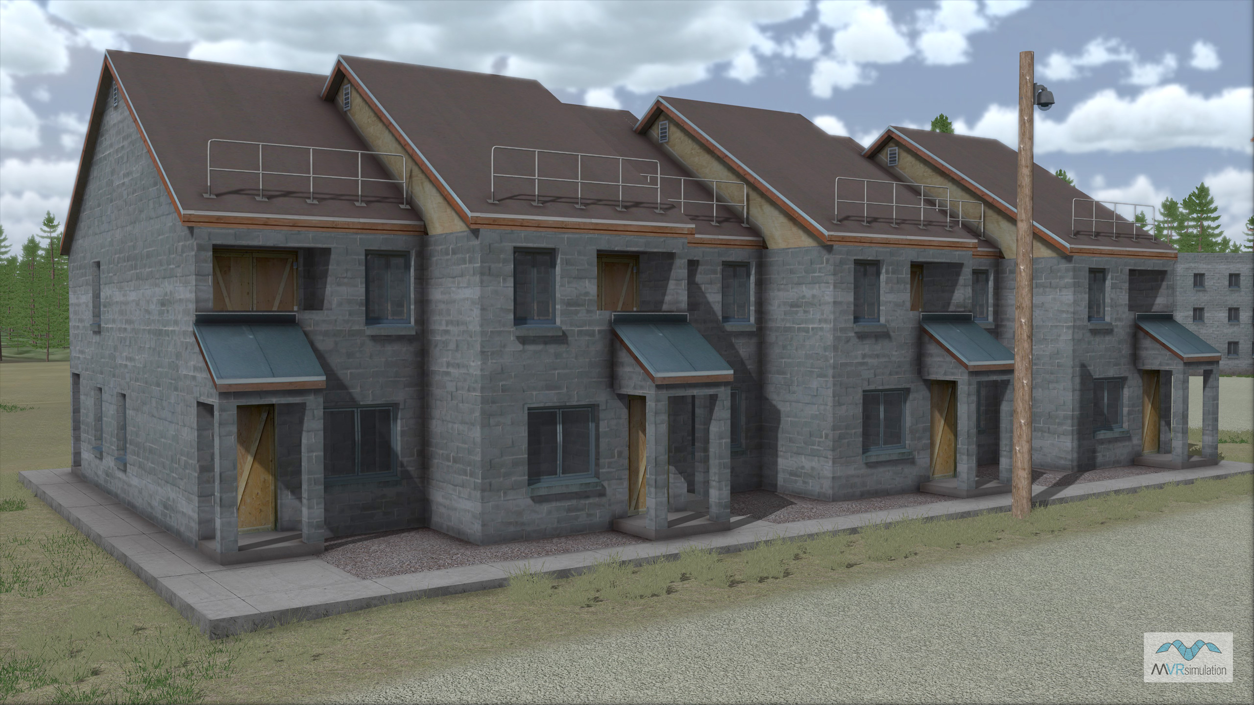
MVRsimulation VRSG real-time scene of two multi-story building models on the 3D replica of the Martinez training facility at Fort Wainwright.
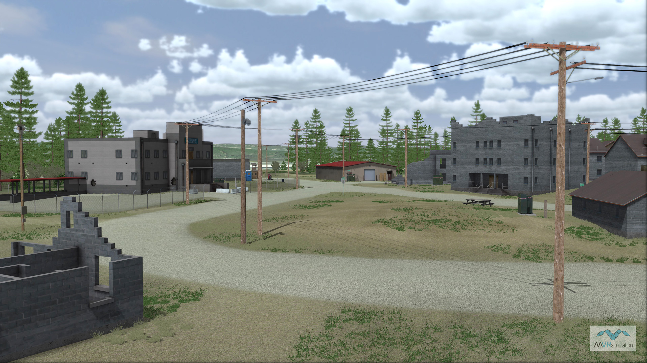
MVRsimulation VRSG real-time scene of the 3D replica of the Martinez training facility at Fort Wainwright.
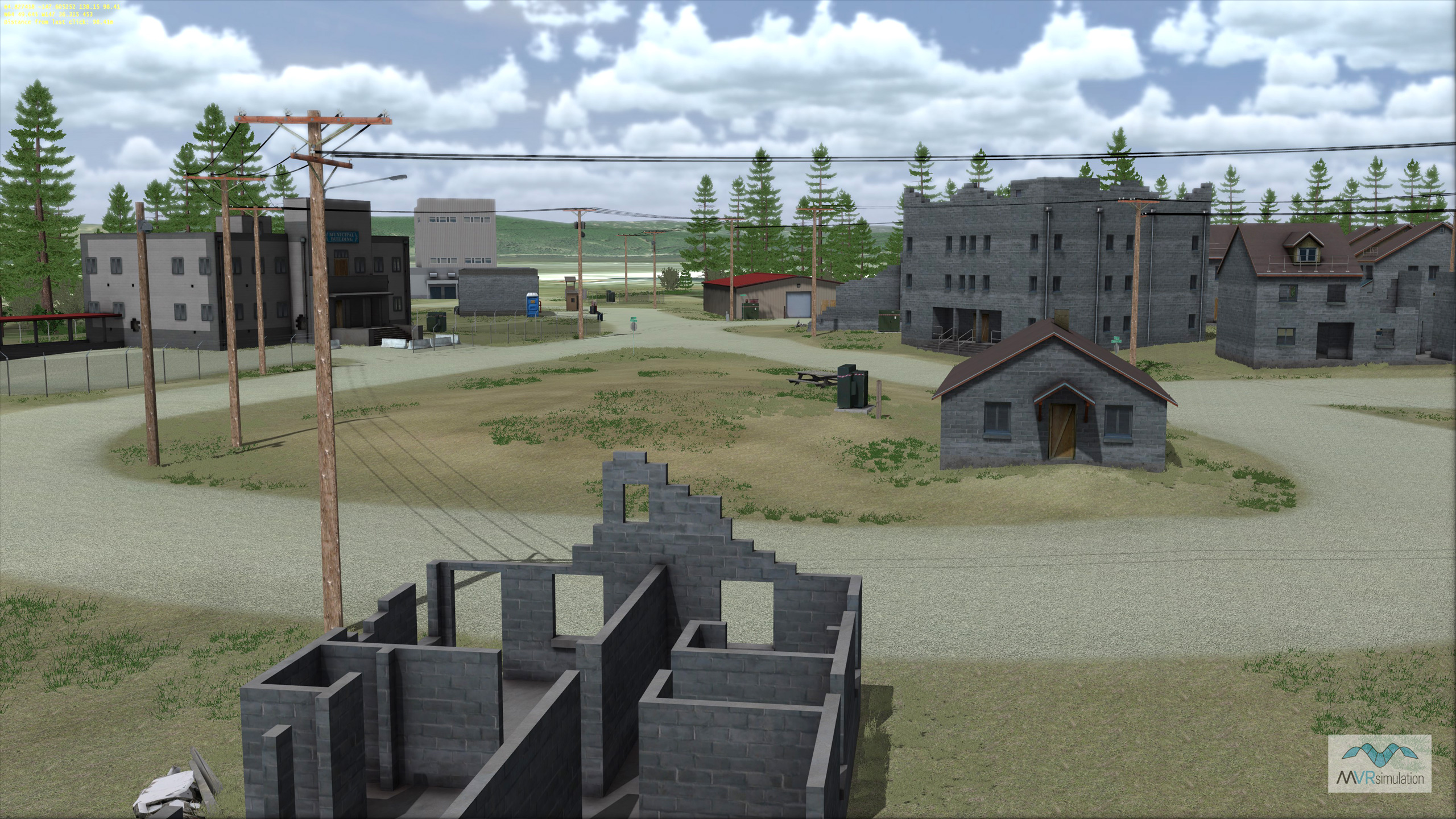
MVRsimulation VRSG real-time scene of a section of the 3D replica of the Martinez training facility at Fort Wainwright.
A Virtual Replica for Urban Maneuver Training
The Private Joseph Martinez combined arms collective training facility (CACTF) is located at Fort Wainwright near Fairbanks, Alaska. Home to US Army Alaska units, Fort Wainwright supports simulation training for dismounted infantry and UAS operator ground control. Laid out like a generic municipal center, the Martinez CACTF is designed to train soldiers how to maneuver the complexity of urban streets and multi-level structures.
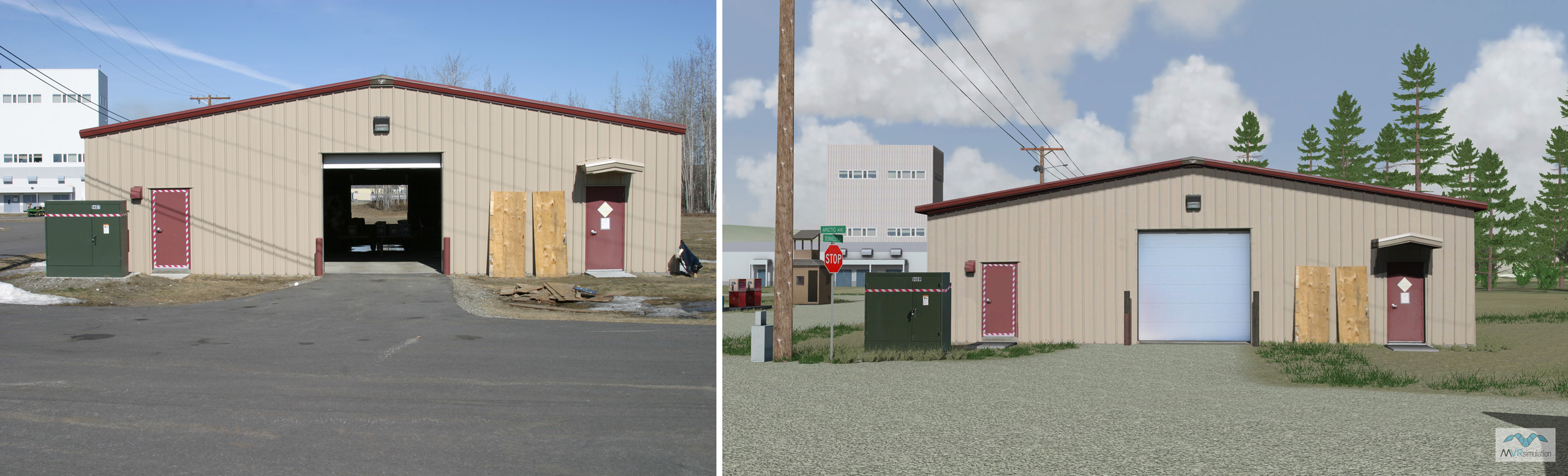
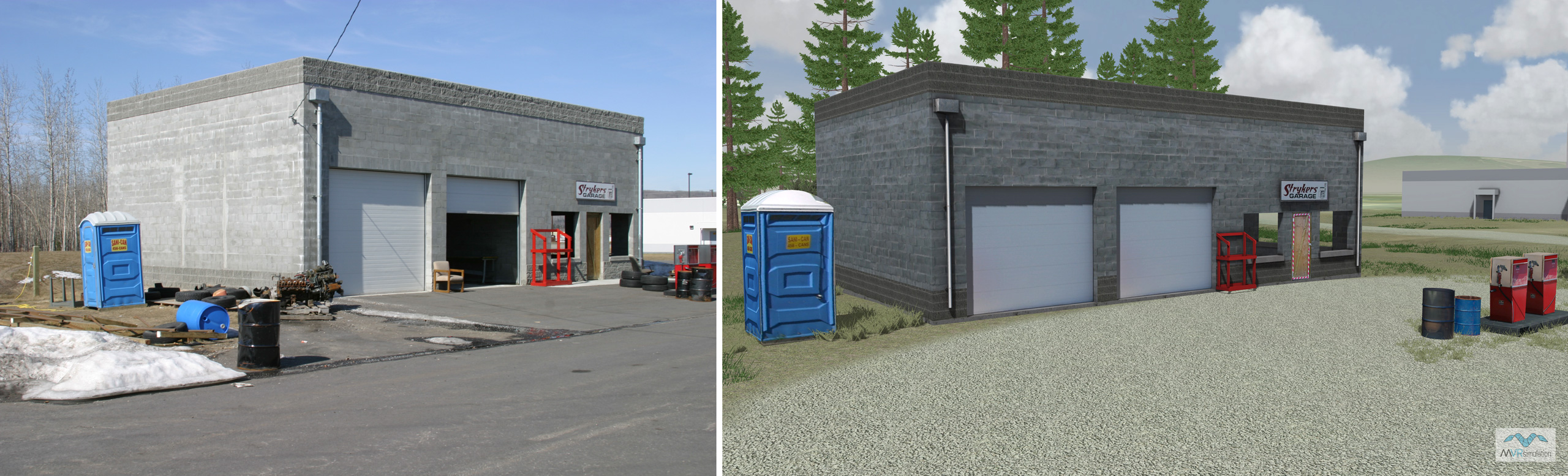
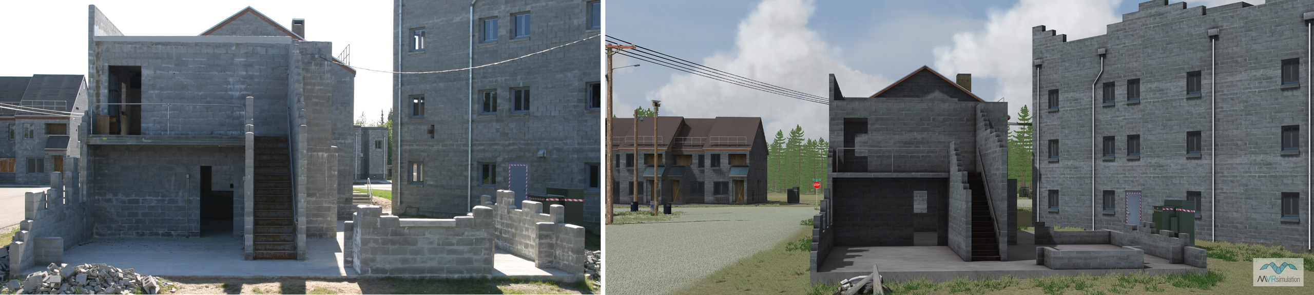
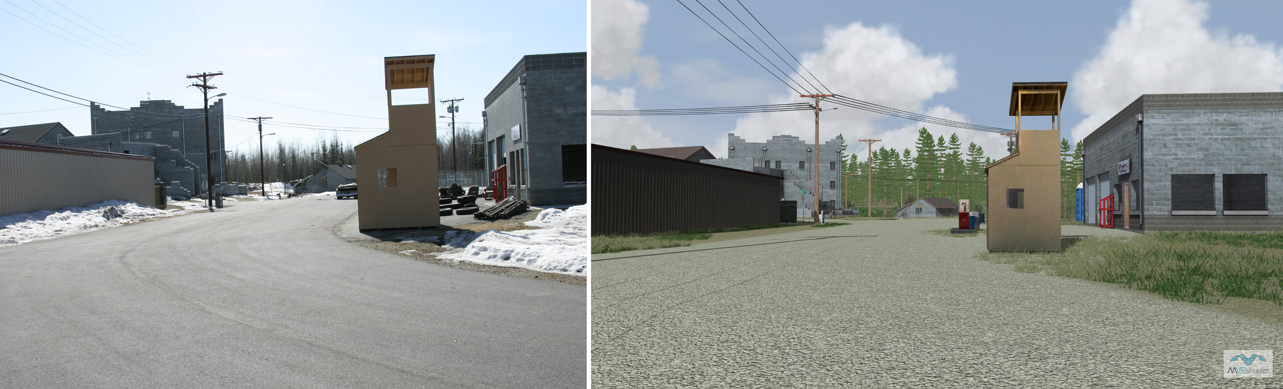
MVRsimulation's virtual replica of the facility was modeled from photographs of the actual training site. The virtual site contains substantial 3D content, including 18 geospecific building models with interiors, multiple levels, and articulated doors. The modeled site also includes street signs, power transformers, street lights, curbs, bleacher seats, gas pumps, oil drums, fences, flag poles, portable toilets, utility cables, a picnic table, and a surveillance camera. Over 5,160 tree and vegetation models round out the scene. In the images below, you can compare photographs of the actual facility with screen captures of the VRSG simulated environment.
Photos of the Martinez CACTF
VRSG screen captures of the same scene