
MVRsimulation at I/ITSEC 2017
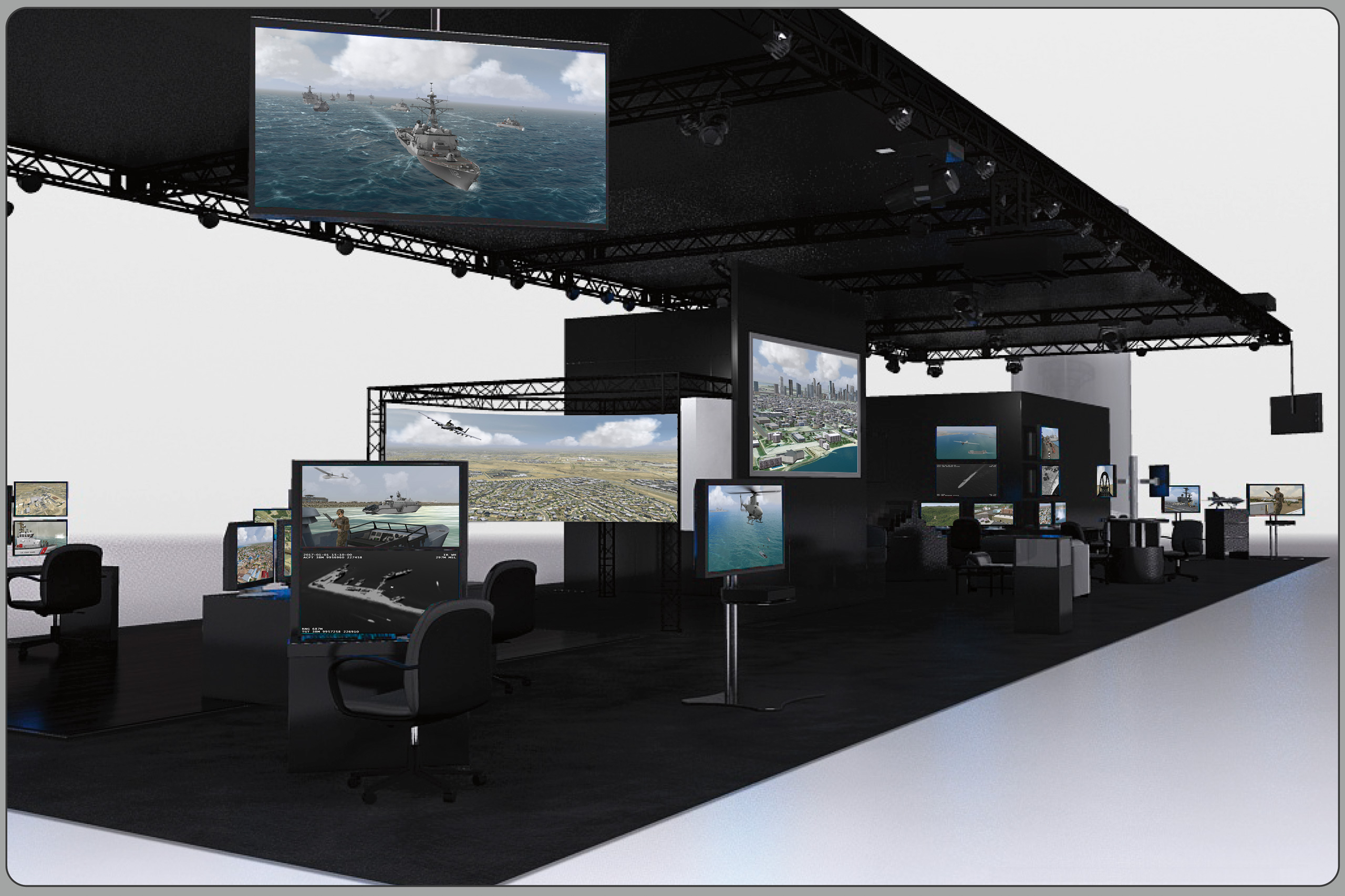
Illustration of MVRsimulation's 30' x 90' Booth #1249 at I/ITSEC 2017.
MVRsimulation and its business partners exhibited their products and technology in Booth #1249 at the Interservice/Industry Training, Simulation and Education Conference and Trade Show (I/ITSEC), held November 27 - December 1, 2017, at the Orange County Convention Center, Orlando, FL, USA.
MVRsimulation showcased its terrain and visualization products and technologies that support applications ranging from unmanned air system (UAS) operator and Joint Terminal Attack Control (JTAC) training, to high-speed fixed-wing cockpit simulators, to littoral and marine-based operations to individual/first-person ground-level urban operations. All terrain demos were rendered in the latest version of VRSG.
MVRsimulation demonstrated VRSG's newest visual fidelity features including shadows cast from static culture models, screen space ambient occlusion (SSAO), and several enhancements to 3D ocean simulation.
See I/ITSEC interview with MVRsimulation's Kristin Blier about the MVRsimulation and Esri terrain building capabilities she used to build our Buckley Air Force Base / Greater Denver 3D terrain:
MVRsimulation demonstrated two new 3D terrain datasets, built in round-earth VRSG terrain format with the latest version of MVRsimulation Terrain Tools for Esri ArcGIS:
- High-resolution geospecific Operation Blended Warrior (OBW) terrain dataset of CA, WA, and portions of NV and AZ, including modeled areas of Greater Seattle, Camp Pendleton with Kilo 2 and Combat Town 25 MOUT sites, and the Leschi Town combined arms collective training facility (CACTF) at Joint Base Lewis McChord (JBLM). MVRsimulation provided this terrain to participants in the OBW LVC event who ran VRSG in their simulators.
- Greater Seattle uses source imagery of 1 meter per-pixel resolution blended into and NED 1/3 (10 m) elevation data. The culture includes the popular Space Needle and 83,025 other buildings and 160,771 trees. Like the Denver building models, the Seattle buildings (apart from the Space Needle model) were generated with Esri CityEngine. The models were extruded and textured from OpenStreetMap (OSM) data, exported from CityEngine in FBX format, and then converted to MVRsimulation's model format.
- The virtual Leschi Town training site of .25 square kilometers was built with 15 cm per-pixel resolution USGS imagery blended with 1 meter per-pixel NAIP imagery surrounding the area up to Seattle. Elevation source is USGS 1 meter LIDAR blended with USGS NED 1/3 (10 meter). The virtual facility features 52 geospecific building models with interiors, multiple levels, and articulated windows and doors. These models, together with over 100 models of other cultural elements, were created from publicly available photos and videos and geolocated on the terrain footprints. Over 27,500 tree and vegetation models round out the scene.
- High-resolution geospecific virtual Buckley Air Force Base and the dense urban environment of Greater Denver, CO. This terrain was also on display at the Immersive Display Solutions' (IDSI's) booth #1273 on the latest Sony Crystal LED (CLED) technology, with high contrast black levels with a contrast ratio of more than 1,000,000:1 in a scalable 4.8 meter x 1.8 meter curved configuration.
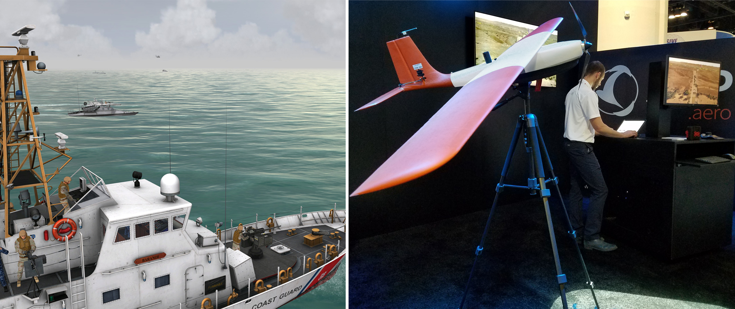
MVRsimulation demonstrated VRSG's 3D ocean simulation in scenarios featuring many naval models from our military model library of 135 naval vessels on geospecific terrain/ocean body of the Strait of Hormuz and the littoral area of the port city of Kismayo, Somalia. Many of the vessels have deck details modeled to first-person level.
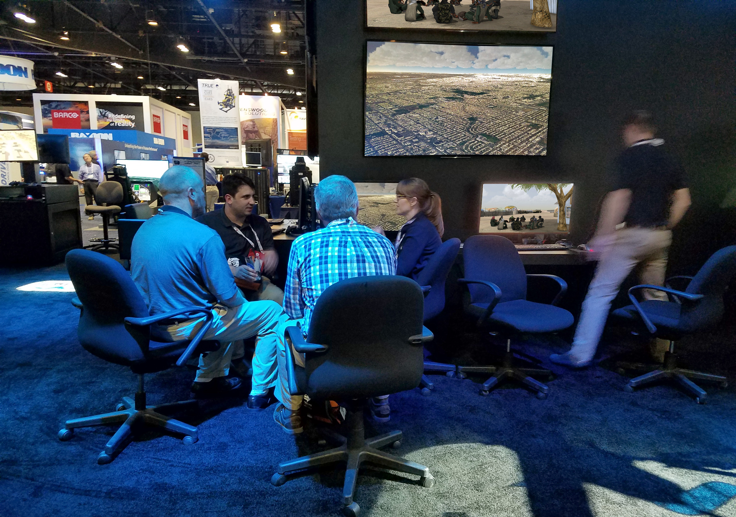
MVRsimulation 3D terrain capability discussion at IITSEC 2017.
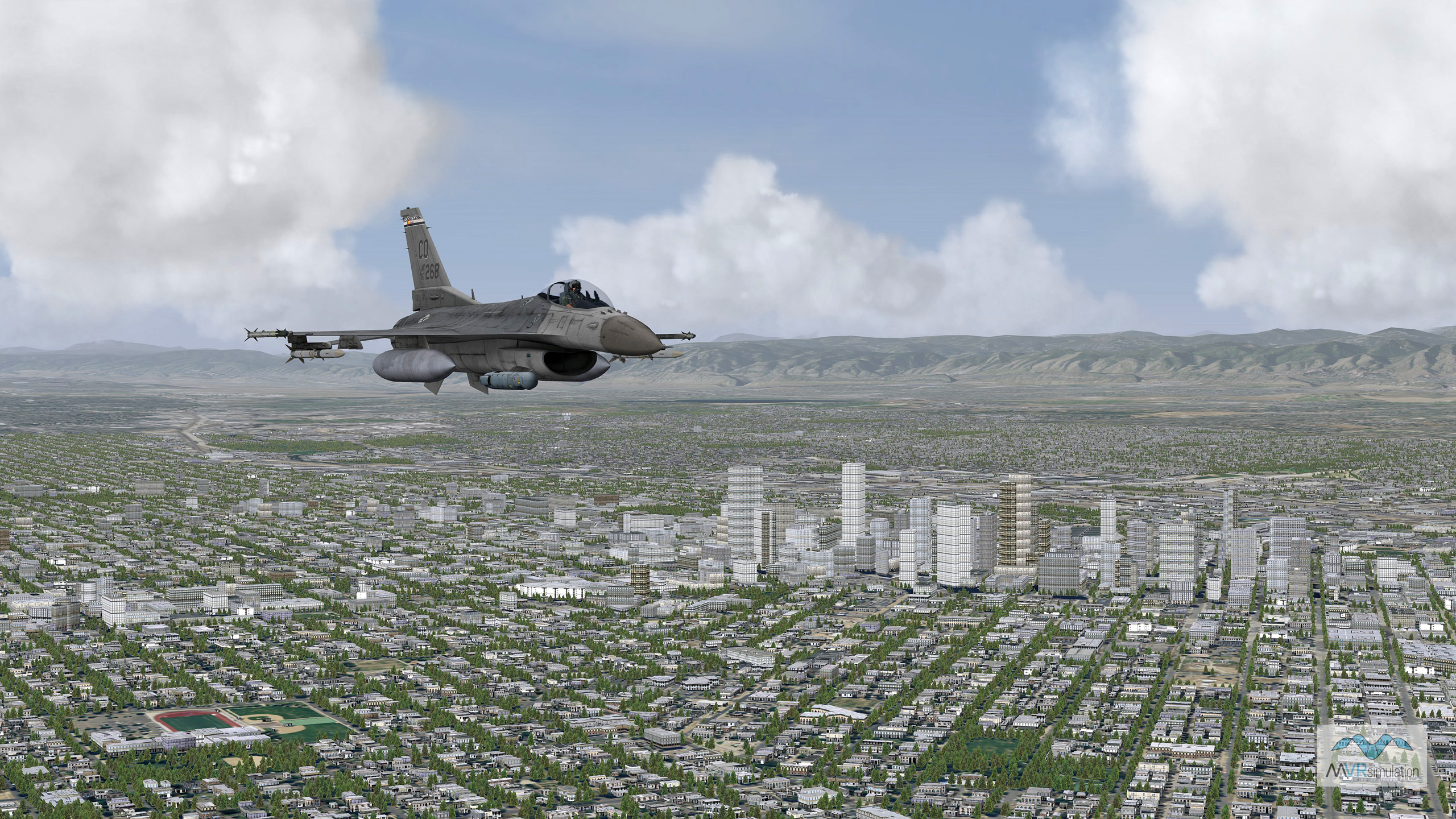
VRSG real-time rendering of an F-16C entity in flight enroute to Buckley Air Force Base over high-resolution geospecific virtual replica of Greater Denver, featuring 439,350 buildings generated in Esri CityEngine.
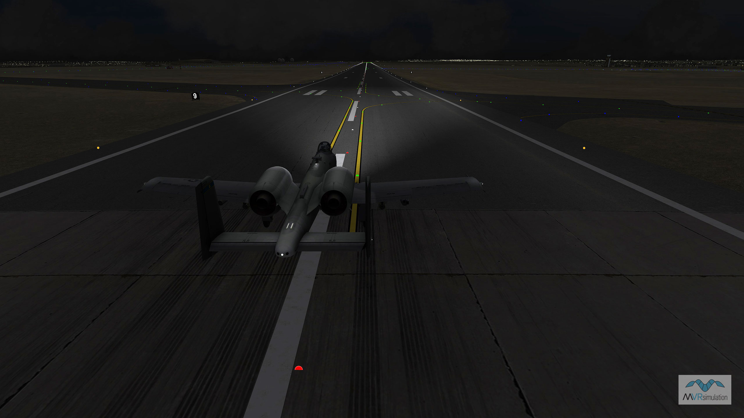
VRSG night scenario of an A-10 taking off and in flight over virtual Buckley AFB and Greater Denver.
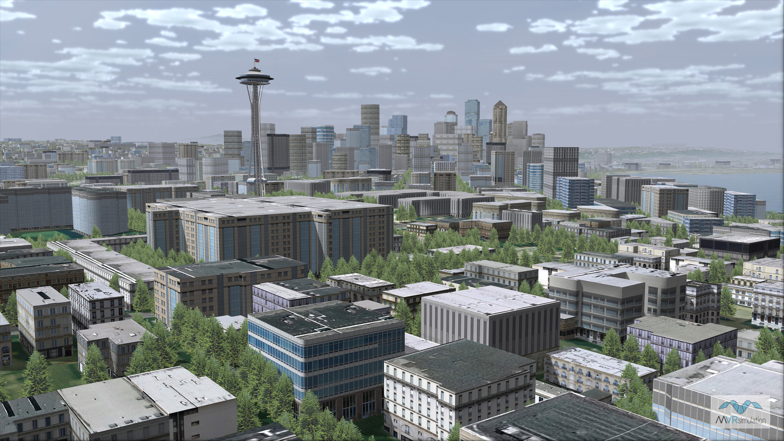
VRSG real-time rendering of virtual Seattle, WA. Terrain was built with Terrain Tools and contains an externally referenced urban model of 3D buildings extruded, textured, and exported from CityEngine.
IITSEC17 - VRSG 3D ocean sea states and SRP with MVRsimulation's SUAS.
- Other demonstrations in the booth included:
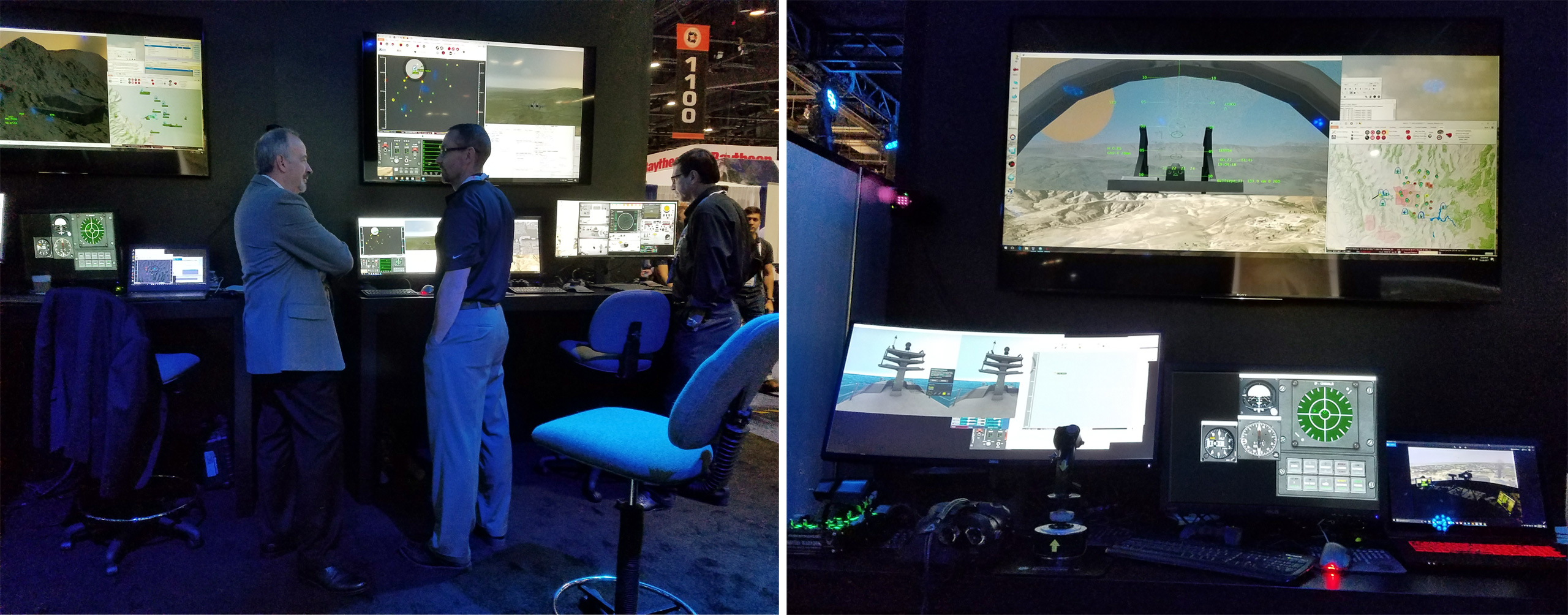
- JTAC training. MVRsimulation and Battlespace Simulations' (BSI's) JTAC desktop simulation system (accredited by JFS ESC and STANAG) was set up for conducting close-air-support training exercises with Close Air Solutions, instructors with relevant domain knowledge. In addition to providing the out-the-window views and UAS HUDs, VRSG provides the simulated thermal views, simulated UAS video feed on the JTAC's ROVER device, and emulated military equipment views. The training scenario takes place on MVRsimulation's geospecific Kismayo 3D terrain and tests JTAC, UAS, and aircrew in a complex mission environment with 5-Line, 9-Line, and Call-for-Fire interfaces generated from BSI's Modern Air Combat Environment (MACE) software. The simulator's 4 meter 220° curved display was provided by IDSI.
- High-resolution geospecific 3D terrain of the Somalia port city of Kismayo. A relevant geospecific terrain for coordinated UAS and JTAC close-air-support training, this 3D terrain is populated with hundreds of geolocated, photo-specific culture models built from ground-level photographs taken on the streets of Kismayo. Demo scenarios include amphibious and close-air-support missions. The amphibious scenario highlights VRSG's 3D ocean simulation and MVRsimulation's growing collection of U.S. naval models.
- High-resolution geospecific 3D terrain of a mountainous region in Kabul province, Afghanistan. The modeled village of Khairabad includes 650 custom-built 3D structures that match footprints on the source imagery. Many structures have multiple damage states, demonstrated in scenarios that feature close-air-support missions with UAS overwatch and strikes, and pattern of life activity. These scenarios contain many of MVRsimulation's newest military ground vehicles.
- High-resolution geospecific 3D terrain and modeled airfields in Continental US plus Alaska and Hawaii (CONUS++). The CONUS++ demos included flythrough sequences on 27 modeled airports and airfields, with high-resolution imagery and geospecific and geotypical cultural content.
- SUAS for collecting sub-inch geospecific imagery for real-time 3D terrain. MVRsimulation's SUAS for imagery data collection was on display. Built for autonomous aerial surveying, the SUAS captures 2 cm per-pixel resolution images that can be used with accurate elevation data to compile terrain at 2 cm resolution. The resulting synthetic environment can then be rendered in VRSG. Swift Radioplanes (SPR), the creators of the SUAS, demonstrated features of the SUAS and two examples of 2 cm per-pixel resolution terrain that MVRsimulation built from the 2 cm imagery the SUAS collected at two target ranges at NAS Fallon and at the Prospect Square area of Yuma Proving Ground. SPR operated the aircraft at both sites.
All terrain was built in MVRsimulation's round-earth VRSG terrain format with MVRsimulation Terrain Tools for Esri ArcGIS. All of MVRsimulation's real-time demos were created with Scenario Editor, using substantial cultural feature, character, and land, sea, and air vehicle assets, and 3D character animations from MVRsimulation's 3D content and animation libraries of over 7,000 models and over 1,400 animations.
In the booth, MVRsimulation was joined by business partners Battlespace Simulations (BSI), Close Air Solutions, and Swift Radioplanes (SRP).
BSI demonstrated their latest version of MACE, a computer generated forces (CGF)/semi-automated forces (SAF) software application, which uses VRSG for the 3D visuals and is capable of simulating an air, ground, naval and electronic warfare battlespace. In addition BSI demonstrated Viper, a low-cost PC-based DIS radio, and DIScord, a DIS recorder used for after action review.
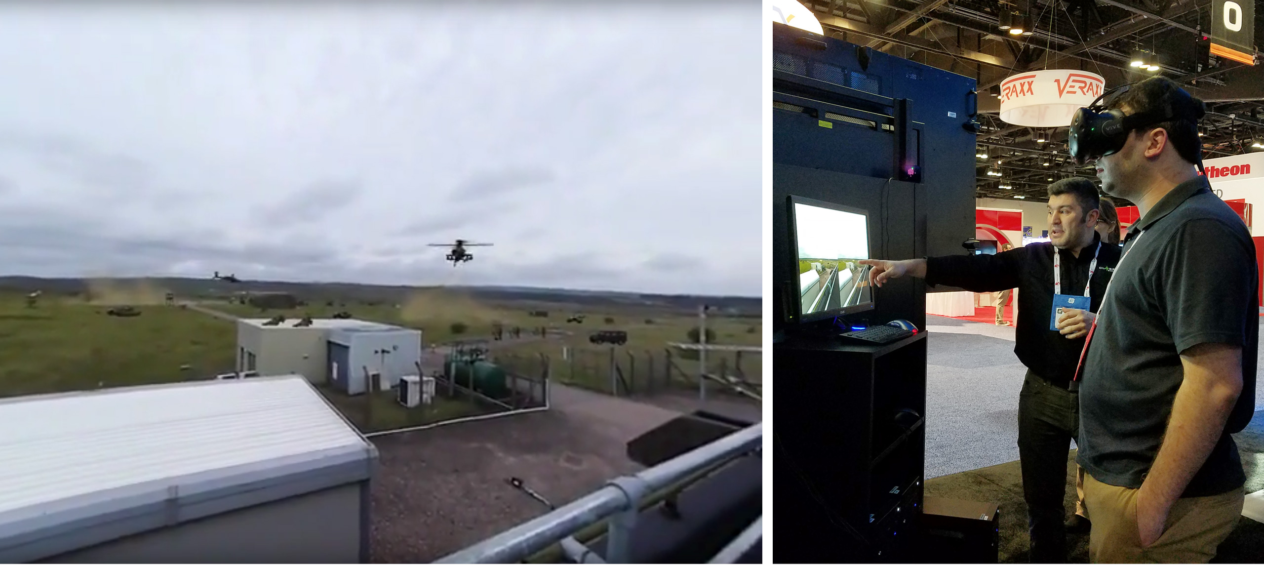
In addition to conducting demos of close-air-support training, Close Air Solutions demonstrated their new Hyper Real Immersion (HRI) concept, a project developed using MVRsimulation 3D visualization technology to deliver immersive, outdoor mixed reality training. The demo highlighted the advantages of simulation taken into the live environment by showing a 360-degree perspective from a given location combined with the HTC VIVE tracking system with blended 3D synthetic entities and effects generated by BSI MACE and rendered in real-time by VRSG. The synthetic and physical scenes are combined to provide a real-time mixed reality experience.
MVRsimulation Customers and Business Partners at I/ITSEC 2017
During the week-long "Operation Blended Warrior" (OBW) LVC event at I/ITSEC, the 505 Command and Control Wing and TRU Simulation + Training used VRSG and MVRsimulation's terrain of Washington State (to include Seattle) and portions of CA, AZ, and NV (to include MVRsimulation's virtual Camp Pendleton) in their respective simulators. The 505 Command and Control Wing (booth #529) ran VRSG in the JTAC-TACP/Operational Simulation Suite (J-T/OSS) v2.0 Desktop(J-T/OSS) trainer TRU Simulation + Training (booth #1700) ran VRSG in the V-280 cockpit simulator for out-the-window and sensor views.
Elsewhere, VRSG was used in the following demos at I/ITSEC:
- The 505 Command and Control Wing demonstrated VRSG in booth #529 in the JTAC-TACP/Operational Simulation Suite (J-T/OSS) v2.0 Desktop(J-T/OSS) trainer during both OBW and non-OBW demonstrations. The J-T/OSS demonstrated Types 1, 2, and 3 control, terminal guidance operations using a ground based laser system, as well as coordination with a wide range of virtual and constructive assets.
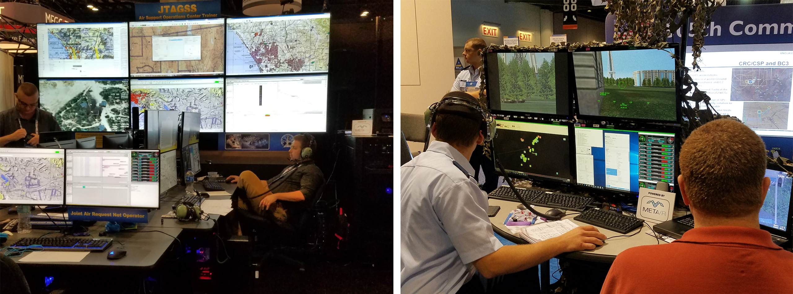
- AFRL's Warfighter Readiness Division demonstrated VRSG in booth #1533 in its Joint Theater Air Ground Simulator System (JTAGSS), The JTAGSS is a full-mission profile Air Support Operations Center (ASOC) simulator that supports the development of key knowledge, skills, and experiences across nine positions.
- Air Force Agency for Modeling and Simulation (AFAMS) booth #349 conducted JSIL's MUSE/AFSERS demo with VRSG simulating UAS streaming output.
- Air National Guard booth #1469 demonstrated VRSG in ZedaSoft's F-16 cockpit simulator and in a prototype of a new ANG Combat Operations Procedures Simulator (COPS), a security forces use-of-force proof of concept, addressing general training requirements for Security Forces Airmen.
- Fidelity Flight Simulation, Inc. (F2Si) which uses VRSG in their new UH-72A Lakota Synthetic Flight Training Systems (SFTS) for the Army National Guard (ARNG) announced at I/ITSEC that the SFTS have been delivered to the ARNG sites.
- Immersive Display Solutions (IDSI) demonstrated VRSG in booth #1273 on the latest Sony Crystal LED (CLED) technology, which features exceptional black levels and contrast in a scalable 4.8 meter x 1.8 meter curved configuration. The VRSG demo on this display featured MVRsimulation's new 3D terrain of Buckley AFB and Greater Denver. IDSI also demonstrated VRSG on its VisionStation 2 RP/Pilot Station.
- Naval Air Warfare Center Aircraft Division (NAWCAD) demonstrated VRSG in its Next Generation Threat System (NGTS) in booth #339.
- QuantaDyn, which uses VRSG in the JTC TRS, MMCT, and AAJTS, demonstrated VRSG in booth #807 in a prototype of a new ANG Combat Operations Procedures Simulator (COPS).
- TRU Simulation + Training demonstrated in booth #1700 its V-280 cockpit simulator with VRSG, during both OBW and non-OBW demonstrations.
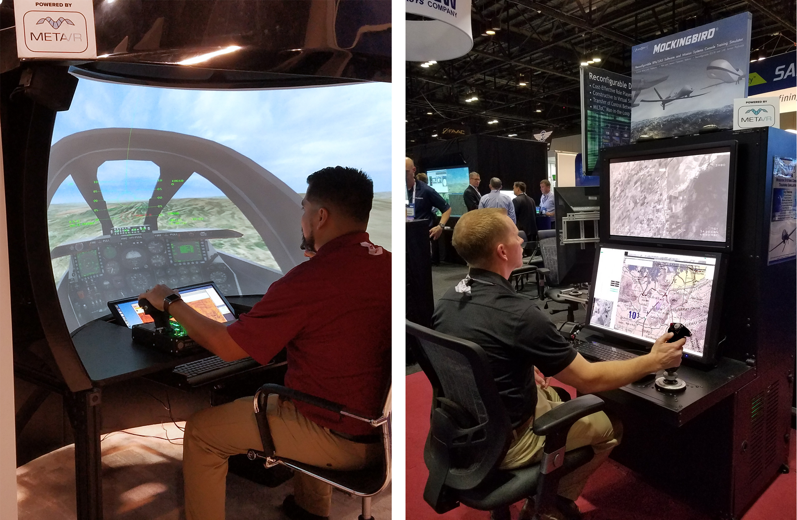
- Zedasoft demonstrated VRSG version 6.2 in booth #1873 three simulators: its partial dome F-16 Cockpit Simulator, Reconfigurable Desktop System (RDS) simulator, and the Mockingbird reconfigurable UAV/RPA simulator with EO/IR and SAR payloads.
The past event described on this page contains the previous name of our company. Our company name is now MVRsimulation, per our announcement of September 1, 2021.