3D Terrain Overview
Whole World round-earth VRSG Terrain Architecture
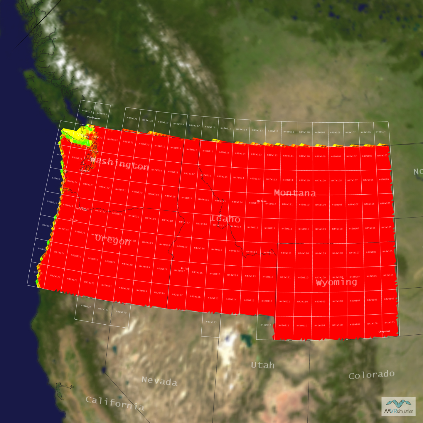
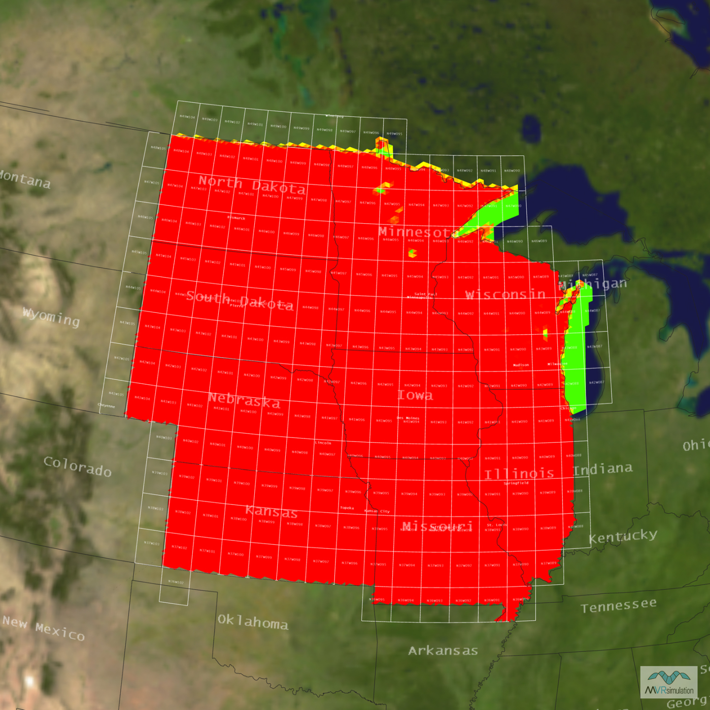
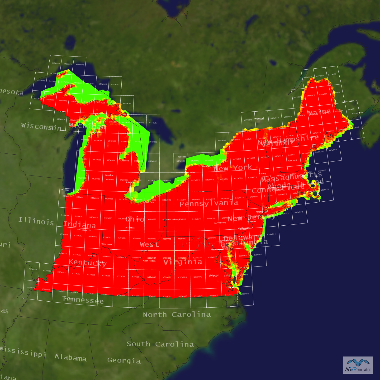
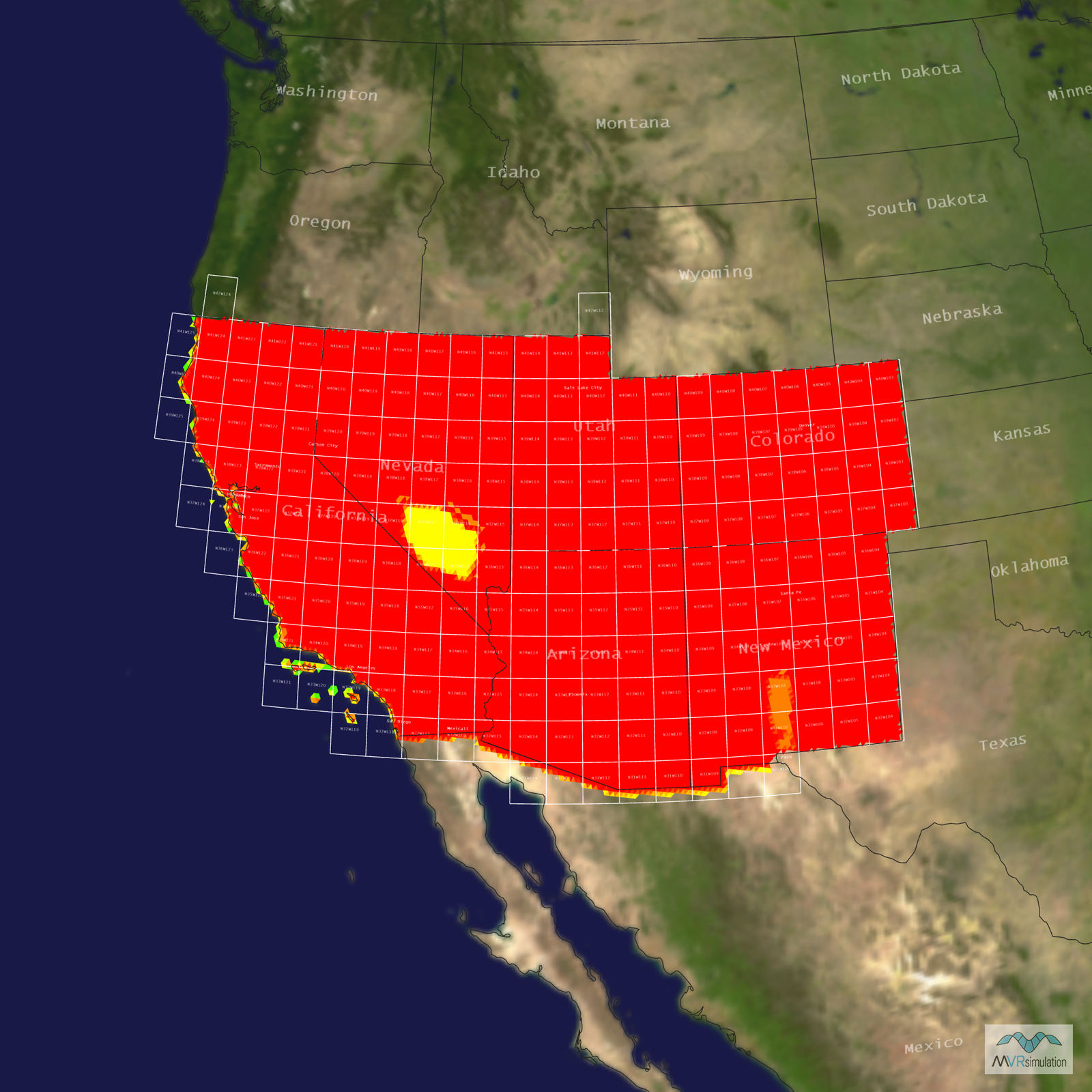
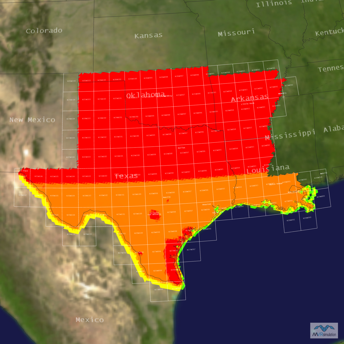
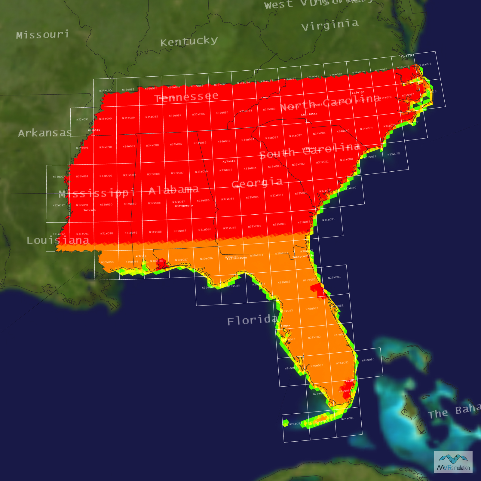
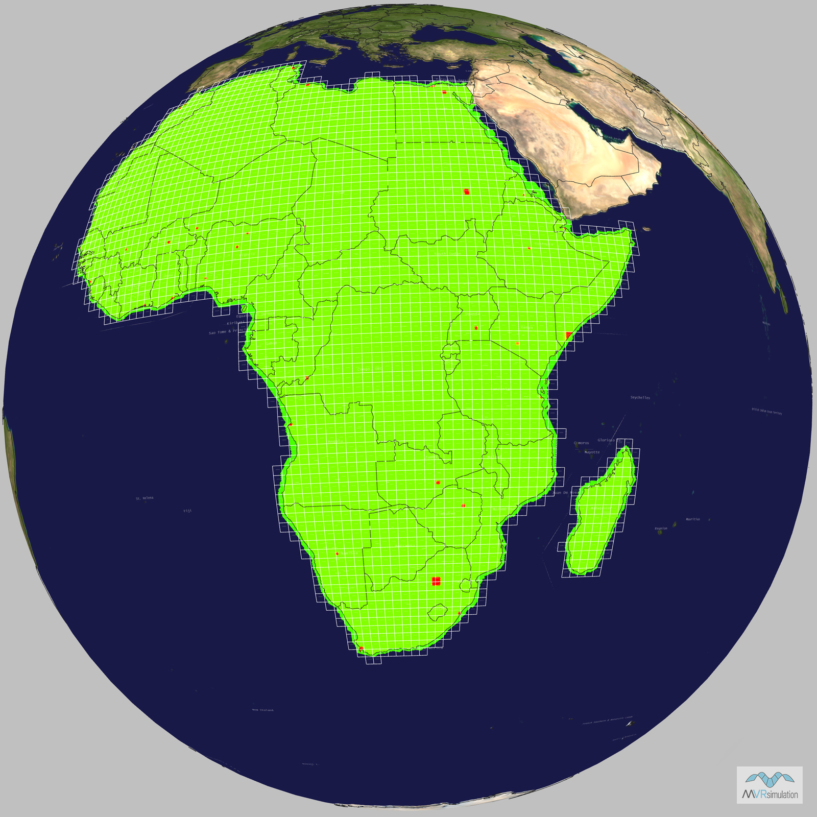
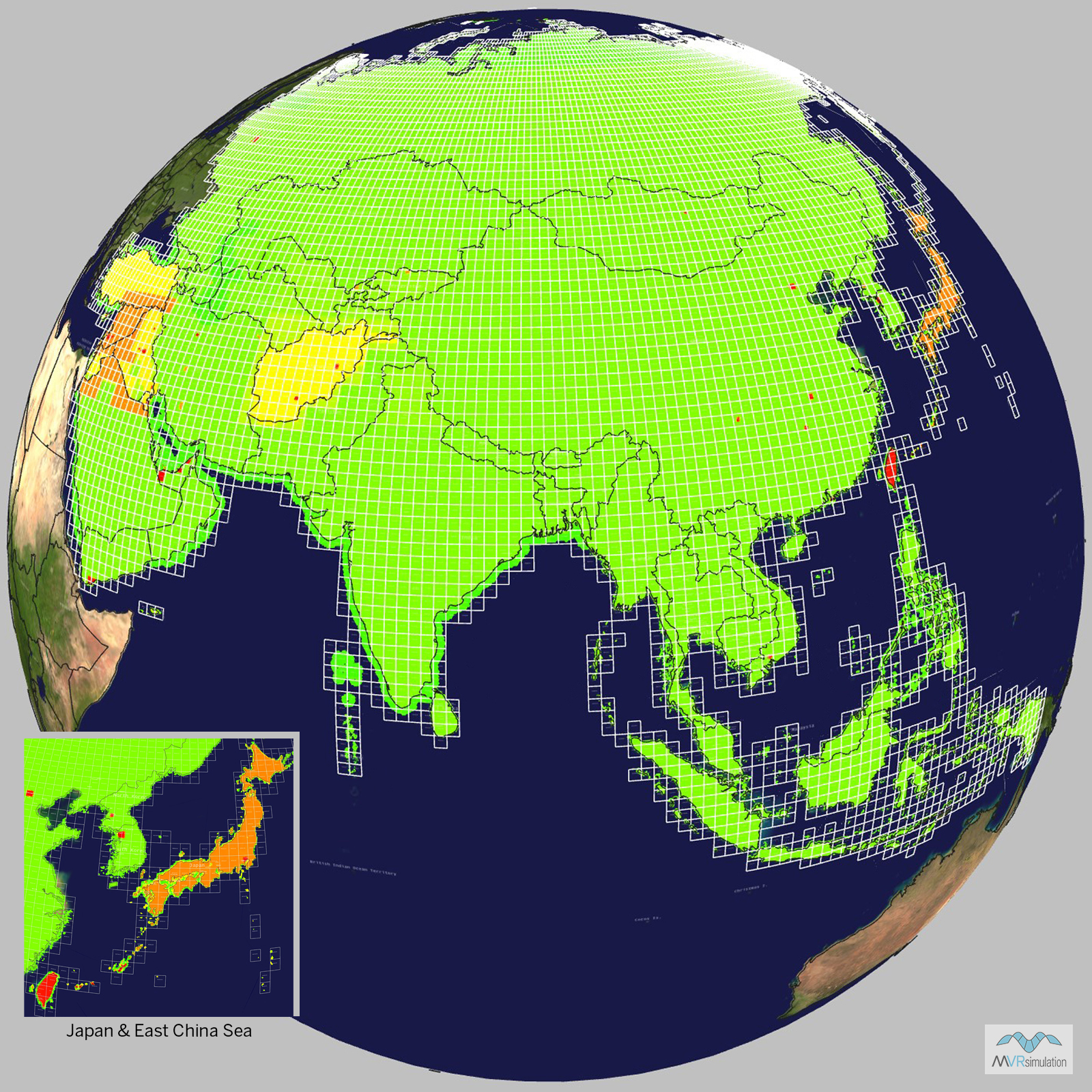
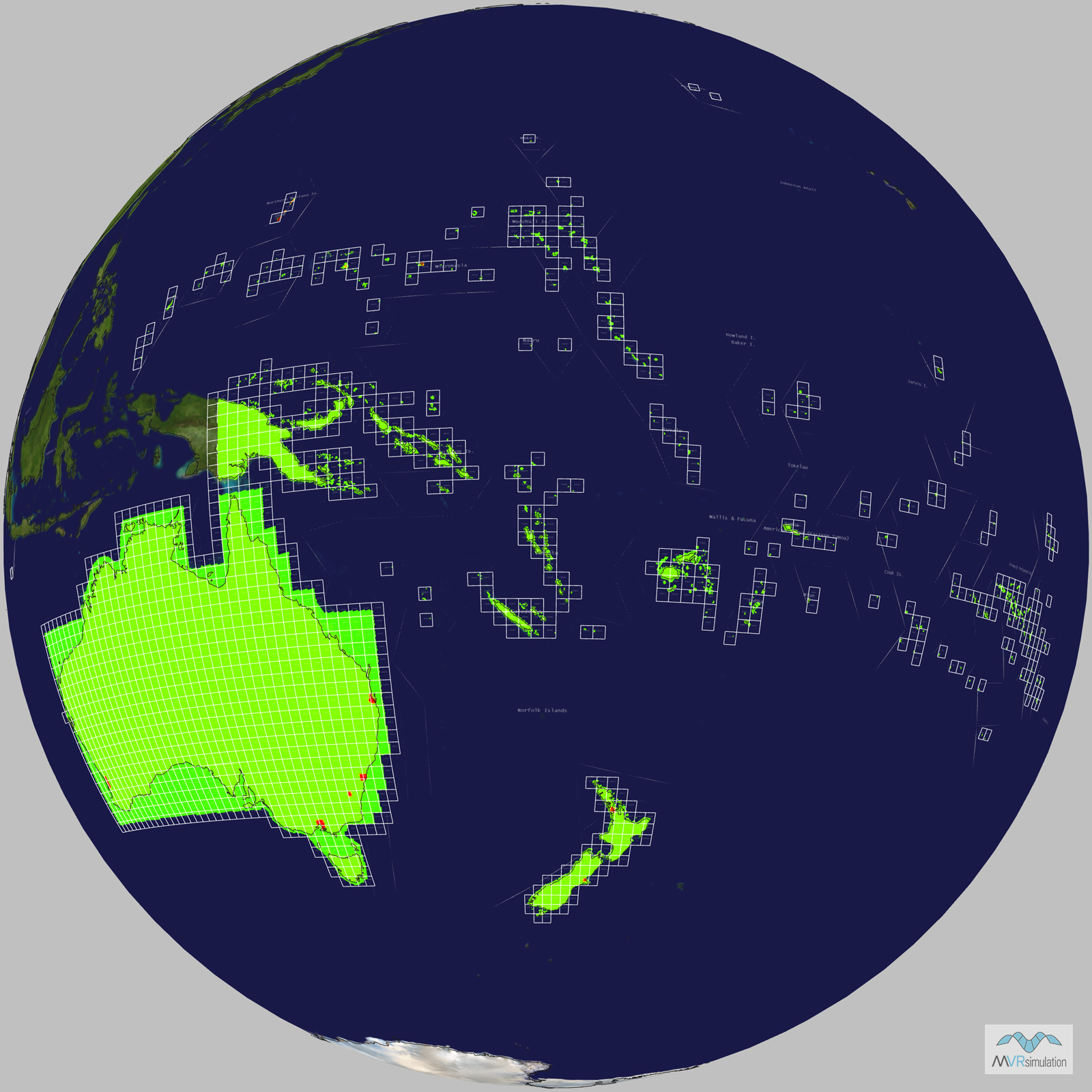
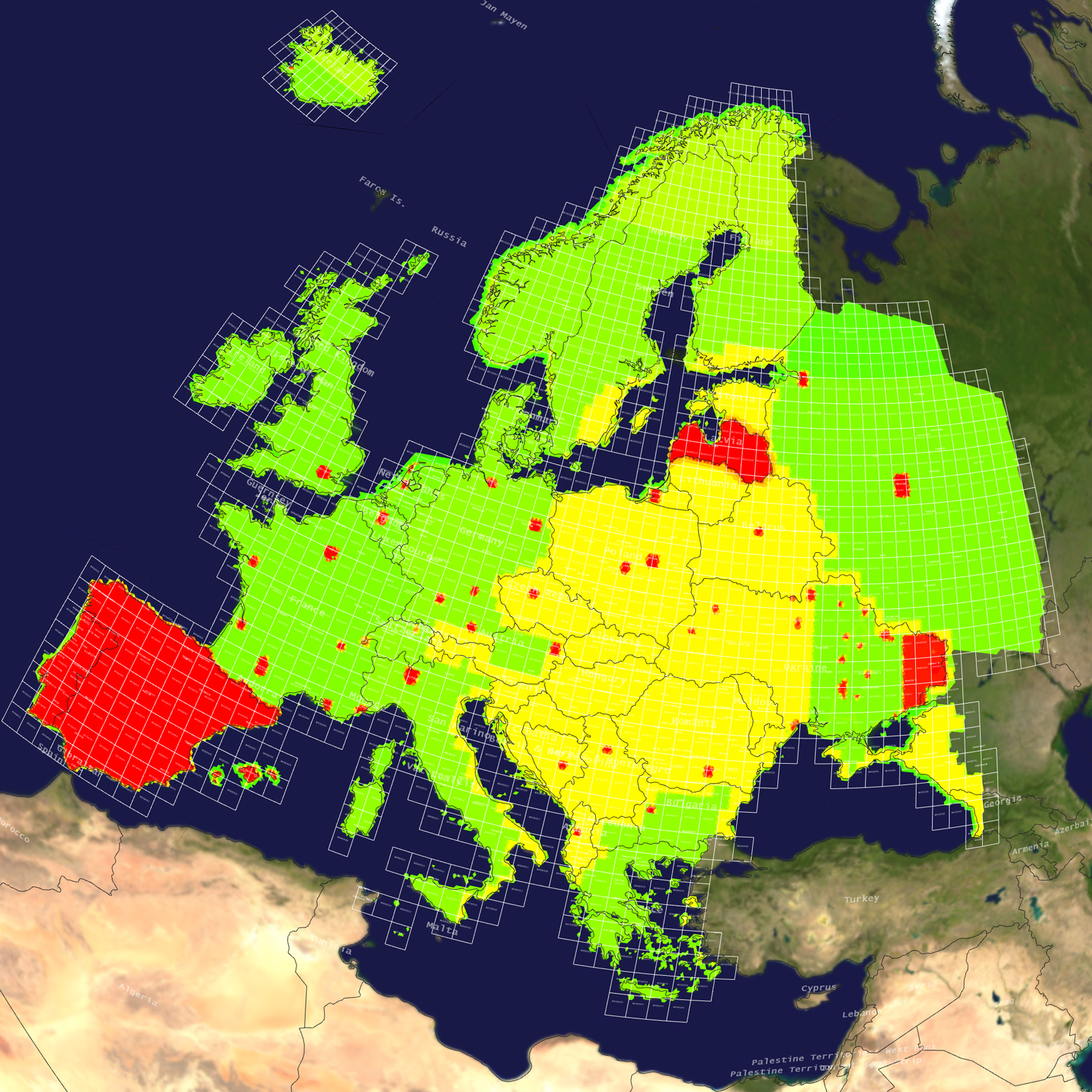
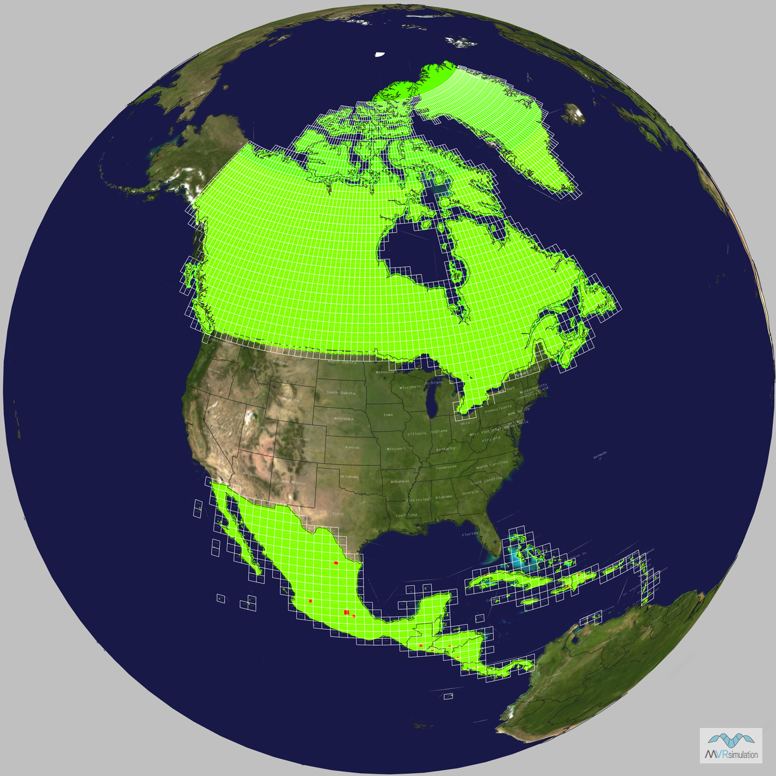
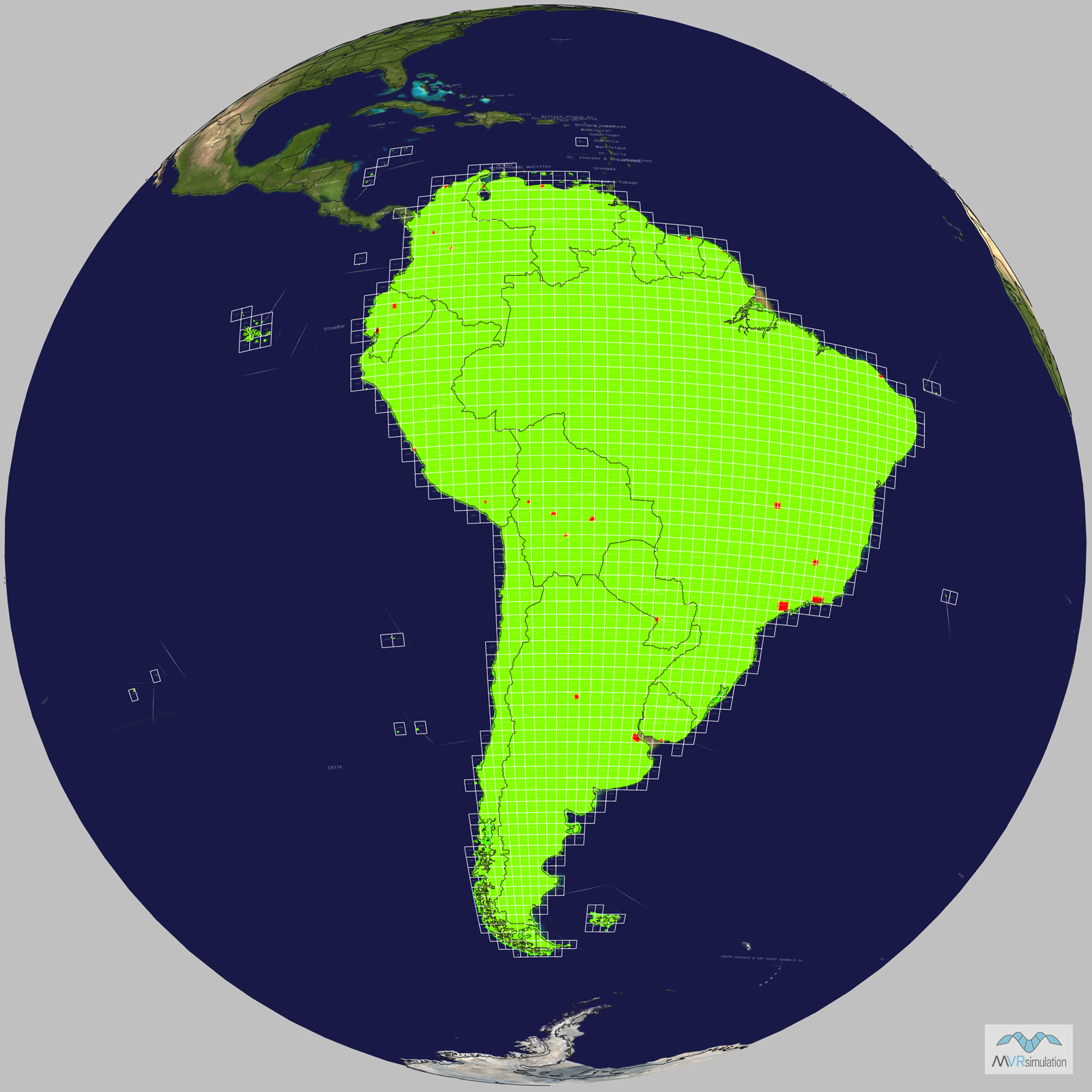
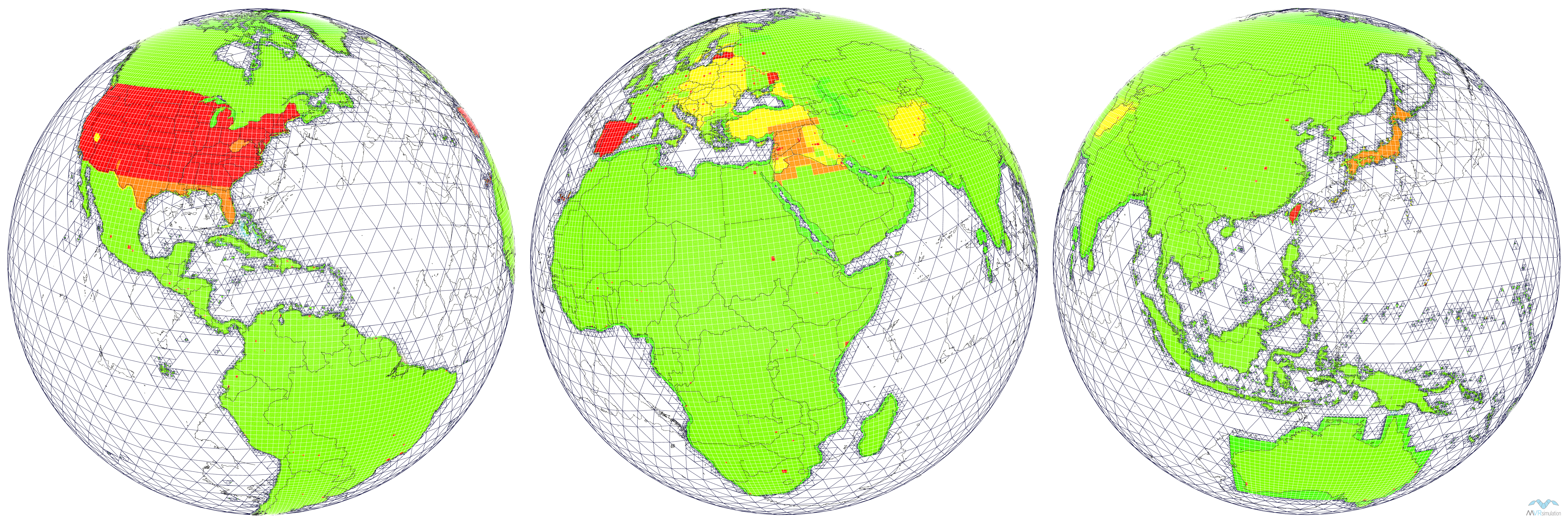
MVRsimulation offers a comprehensive library of geospecific, round-earth VRSG terrain databases that cover the vast majority of the world, including the Continental United States (CONUS) plus Alaska and Hawaii, Africa, Asia & Middle East, Australia & Oceania, Europe, North America, and South America. These 3D terrain databases are created using MVRsimulation’s Terrain Tools for ArcGIS® Pro, ensuring real-time, high-performance visualization within our Virtual Reality Scene Generator (VRSG) software. With detailed, high-resolution insets for many areas of interest (AOI), our terrain data is ideal for a wide range of military and simulation applications, including intelligence, surveillance, and reconnaissance (ISR), joint fires close-air-support (CAS) exercises, fixed- and rotary-wing cockpit training, and unmanned aerial vehicle (UAV) operation. MVRsimulation’s geospecific round-earth VRSG terrain databases are the ideal solution for customers seeking accurate, realistic, and customizable terrain data for mission-critical simulations and training.
The VRSG terrain databases can be further customized by adding cultural assets from MVRsimulation’s extensive 3D VRSG Model Library. These models can be placed on the terrain and used to construct pattern-of-life scenarios using Scenario Editor. MVRsimulation updates terrain based on new high-resolution source data, customer requests or relevant topical information. VRSG customers on active software maintenance can utilize the terrain databases and updates at no cost. VRSG terrain databases can be delivered in several formats: individual continental and CONUS regional terrain drives or a collection of the whole-world terrain. Whole-world terrain can be delivered via direct-attached large-volume (DALV) storage devices for seamless integration with notebooks or desktop computer systems or as a network device such the MVRsimulation Terrain Server.
All 3D terrain datasets are available to US Government, NATO agencies, and contractors for official use only. These datasets are delivered in MVRsimulation's proprietary round-earth VRSG terrain architecture ("Globaldesic"), requiring an active VRSG software license to run. Developed with MVRsimulation's internal funding, these terrain datasets are not part of any government program, ensuring their exclusive availability through MVRsimulation's official channels.